Velika Planina Trail
About Velika Planina Trail
Velika Planina is a big pasture plateau in the Kamnik Alps in Slovenia which is very popular for hiking due to its stunning views, pristine nature and authentic wooden huts. The huts were used by shepherds in the old times but nowadays some of them are rented to tourists, hikers and others who would like to spend more than a day at this picturesque plateau. The Velika Planina plateau lies approximately 1600 meters above the sea level and you can reach it by foot or a cable car. Now, I prefer hiking to cable cars and thus I decided to hike there. After a quick research I figured out that there are several hiking trails leading to the plateau. I decided to take the hiking trail which starts in the village of Stahovica near Kamnik.
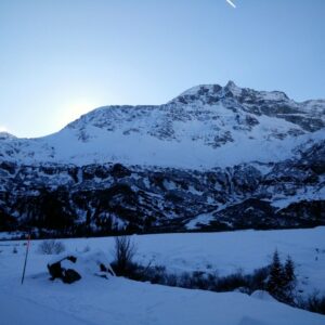
This trail seems to be the most popular, but also the most difficult in terms of distance and ascent. The total distance of the hike back and forth (Stahovica – Velika Planina – Stahovica) is no less than 21 kilometers (13 mi.) and the total ascent is 1300 meters (4265 ft.). However, this trail has a big advantage in comparison to other trails going to the plateau: You can reach its starting point from Slovenia’s capital Ljubljana quickly and easily. I did this hike already in February because there was almost no snow due to this year’s very warm winter in Europe. Nevertheless, the best seasons to do this hike are spring, summer and fall because the trail might otherwise be covered with snow and trudging through knee-deep snow is no fun when it comes to so long distances. Below is the trail description.
Velika Planina Trail Details
Physical Difficulty
Medium
Technical Difficulty
Easy
Duration
7 h 39 min
Distance
21.06 km
(13.09 mi.)
Ascent
1343 m
(4406 ft.)
Descent
1310 m
(4298 ft.)
Highest Point
1718 m
(5636 ft.)
Lowest Point
446 m
(1463 ft.)
Date of the Hike Date when we did this hike ?
February 2020
Weather On the day when we did this hike ?
Mostly Cloudy
Temperature On the day when we did this hike ?
7° C
(45° F)
Wind On the day when we did this hike ?
5 km/h
Velika Planina GPS Route and Trail Description
*Click on the chart to see the location on the map
GPX route helps you with the navigation on a hike. It can be used with a smartphone, handheld GPS device or a GPS watch.About GPX Route
Reaching the starting point
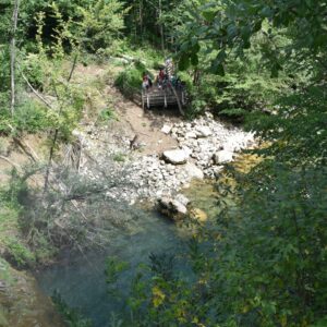
The Velika Planina trail starts in Stahovica (coordinates 46.2663234, 14.602556) which you can easily reach by car. There is also a big parking lot at the starting point of the trail where you can park your car free of charge. Nevertheless, I recommend coming early to the parking lot because it gets full quickly, especially during weekends and holidays. To reach the parking lot in Stahovica you should first drive to Kamnik, a town 22 kilometers to the north-east from the Slovenian capital Ljubljana. In Kamnik, follow the directions signs for Kamniska Bistrica and after driving for approximately 6 kilometers you will reach Stahovica. While driving through Stahovica, you will soon see a direction sign for Velika Planina on the right and the parking lot on the left.
You can also reach Stahovica by bus from Ljubljana. See the timetable on the Ljubljana Bus Station website.
Trail
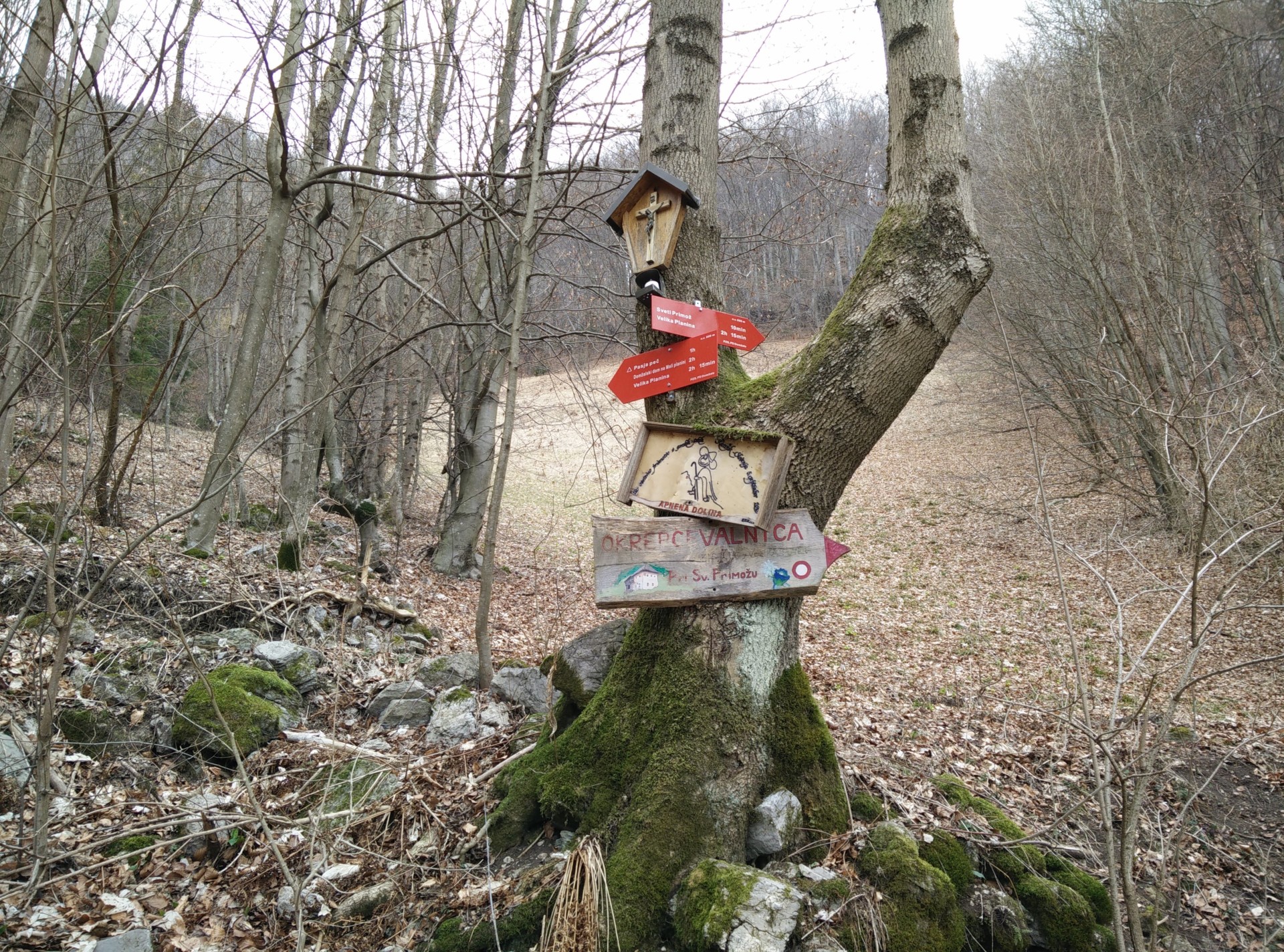
The Velika Planina trail is in general well-marked with direction signs and painted red and white circles on stones, trees etc. Therefore, you shouldn’t have any problems with navigation. However, you can always download my GPX track for free above. The trail is in the beginning very wide (gravel road) and then ascends gently in the direction of east. On this stretch I also saw several cars driving higher up. However, the gravel road is not in a great condition and thus I would recommend against doing that – at least if you cherish your car.
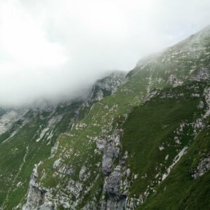
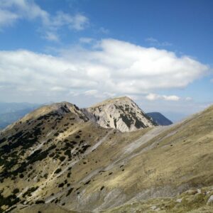
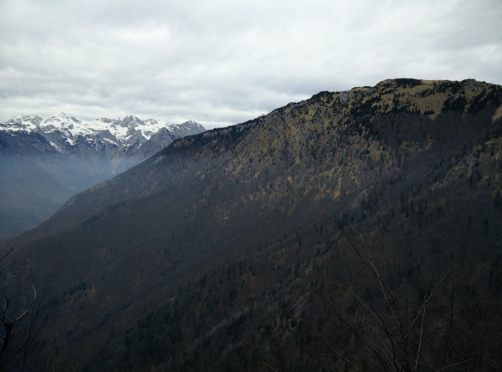
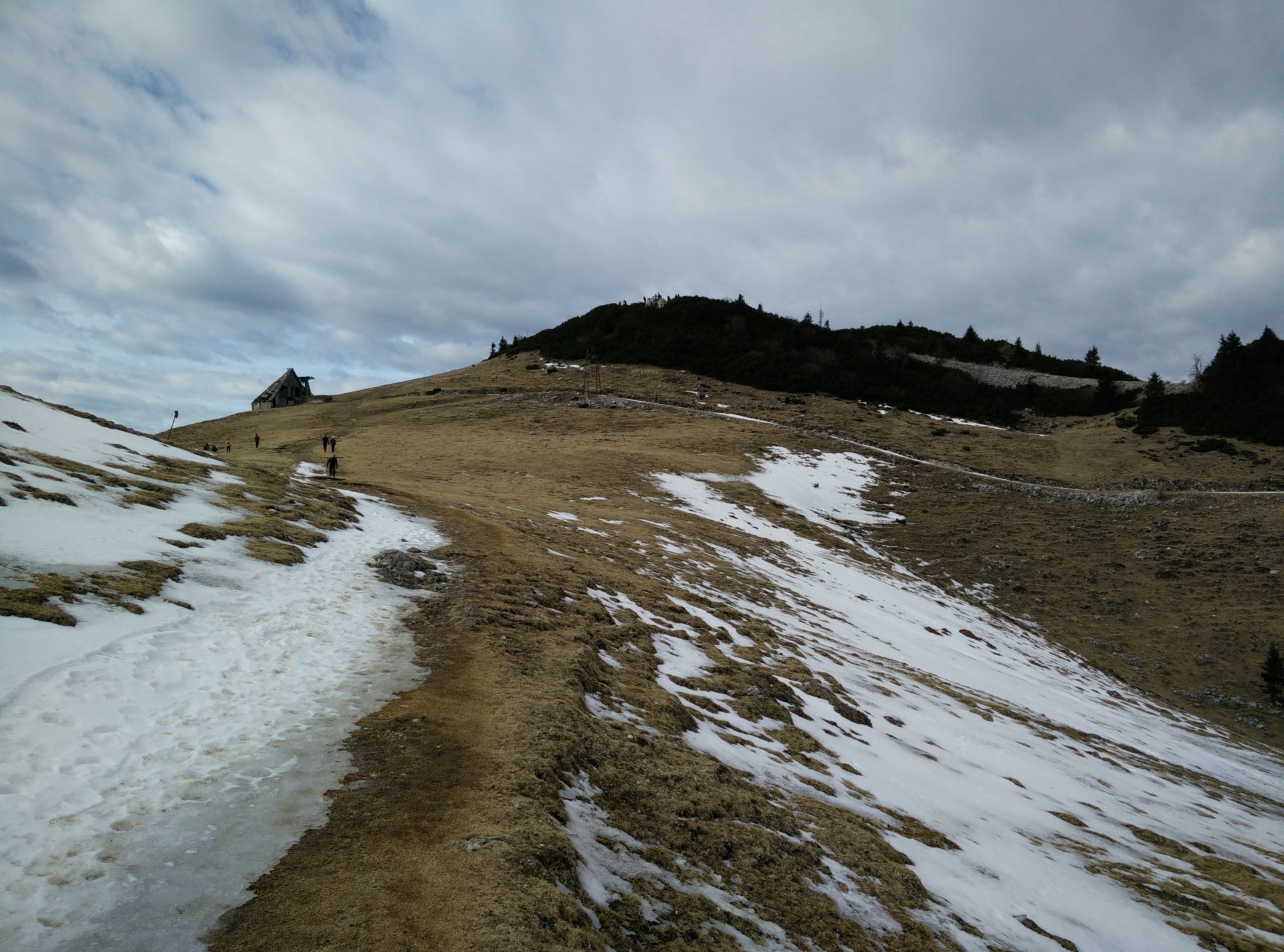
After approximately 4 kilometers a narrow path links up with the gravel road. The narrow path is a shortcut which I took for the way down but for the way up I proceeded on the gravel road. The gravel road takes you to a church where it also ends. There you should take a narrow path towards north which ascends rapidly to an unnamed ridge. After the ridge, the trail slightly descends in the direction of east but soon starts ascending again to another ridge. Between the two ridges you can already see the Velika Planina plateau in the direction of north. Note that this stretch is very narrow and relatively steep. Therefore, some caution is required, especially in wet conditions.
After 7.5 kilometers the path changes its direction towards north-west and starts ascending towards the Velika Planina plateau. The vegetation gets sparser which means that you get a great view on the valleys beneath the plateau. From here you have less than two kilometers of hiking left to reach the Velika Planina plateau.
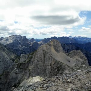
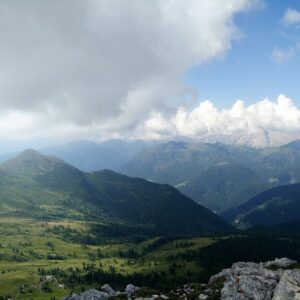
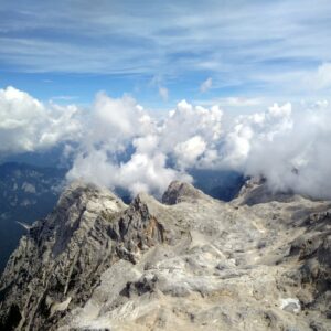
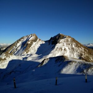
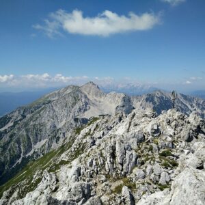
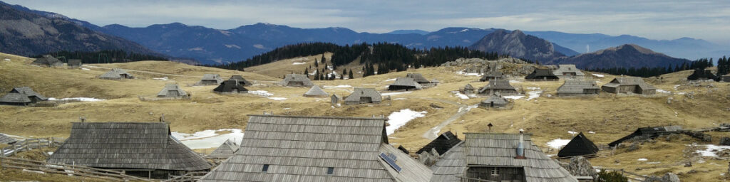
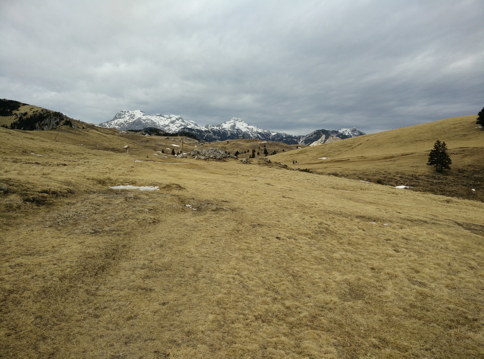
Once you reach the plateau, you should stroll around and enjoy the pristine nature. However, Velika Planina is also a heritage place with authentic wooden huts previously used by shepherds and even a wooden church. There are also many tourist information boards around the plateau which describe the history of the plateau. After I reached the plateau, I decided to also ascend Gradisce which is the highest point on the plateau. Gradisce is located on the north-western side of plateau and offers a great view on the higher peaks of Kamnik alps such as Skuta, Ojstrica and Grintovec.
Beneath the Gradisce is a cable car station as well as more huts and a restaurant. I decided to make a break in the restaurant (Zeleni Rob) where I ordered a warm meal and a beer. The prices seemed reasonable to me; I paid 3 € for the beer and 6 € for a delicious meal.
After an hour in the restaurant it was time to return to the valley. I was seriously considering taking the cable car but at the end I decided to hike down. I took the same path for the way down as for the way up, besides the shortcut mentioned above – which shortens the trip for several hundred meters.

Velika Planina Trail: Wide gravel road in the beginning
Velika Planina Trail: Between the two ridges you can already see the Velika Planina plateau
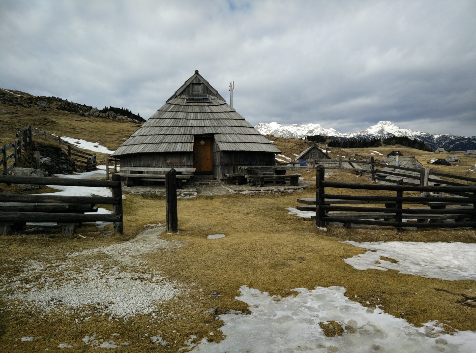
Velika Planina Trail: One of the wooden huts
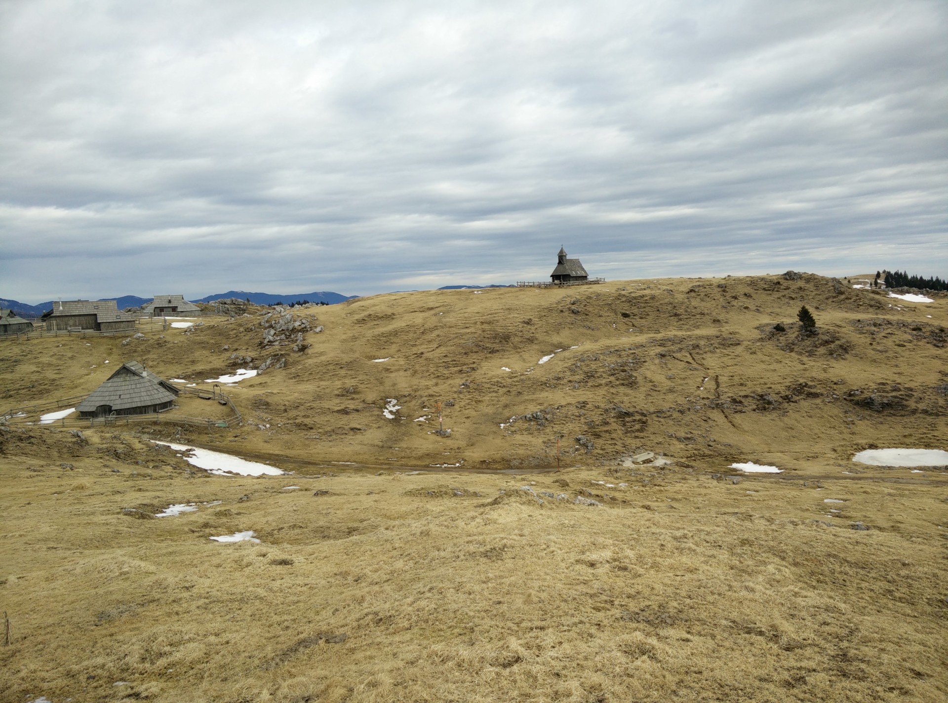
Velika Planina Trail: The wooden church is seen in distance
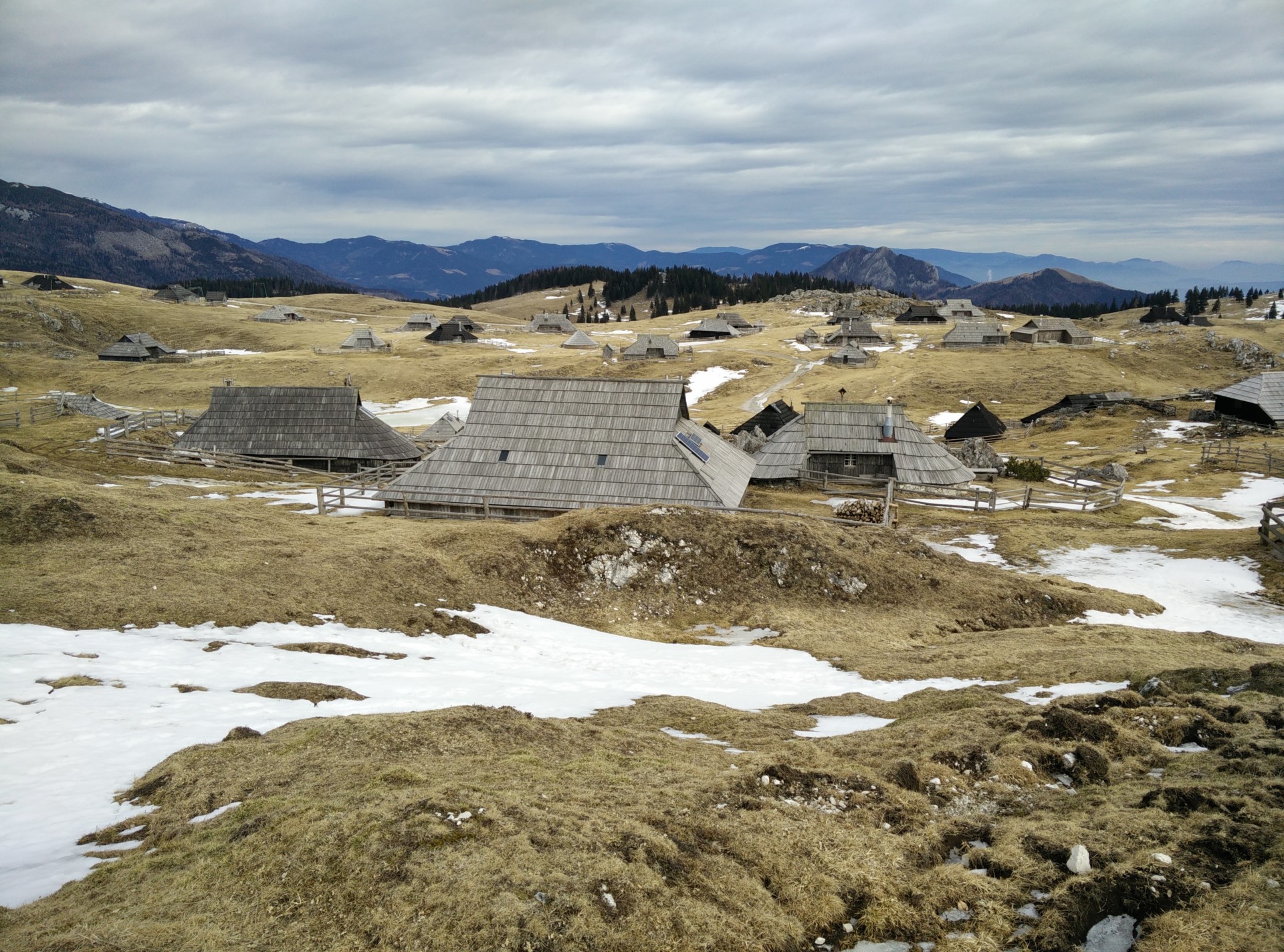
Velika Planina Trail: More wooden huts
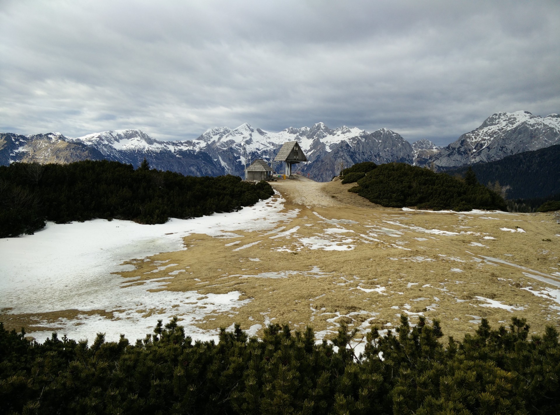
Velika Planina Trail: View on the Kamnik Alps from the plateau
Equipment
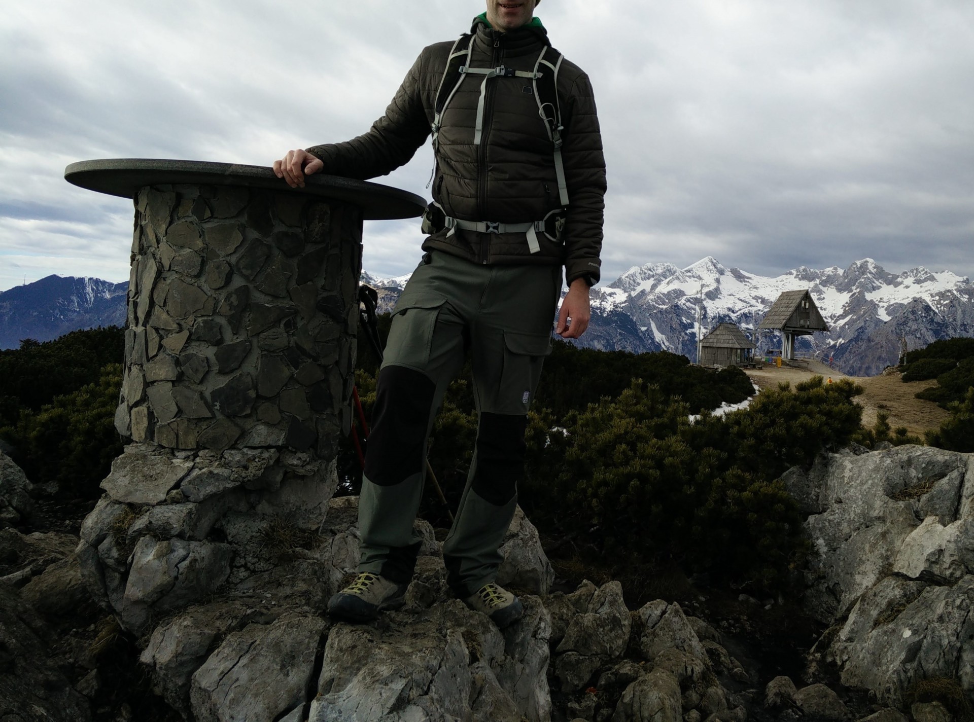
Since I knew that the temperature would be relatively high (at least for that time of year) I didn’t bring too many things with me. I was wearing the CimAlp Laos 4 pants, Isobaa Merino base layer, CimAlp PrimaLoft jacket, Isobaa Merino hat and Isobaa Merino liner gloves. In my Osprey Talon 22 daypack I was carrying 2.5 liters of water, some snacks and the brand new BioLite headlamp which I used at the end of the hike because it got dark. I also used the lightweight Montem 3K Carbon trekking poles for extra support.
Equipment under scrutiny
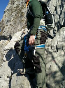
CimAlp Laos 4 Pants
CimAlp Laos Hiking Pants: On the Velika Planina Hike
I really like the CimAlp Laos 4 pants because they are very comfortable and provide great freedom of movement. The fabric is stretchy, robust and pleasant to the touch. The pants also have 5 pockets which is more than enough for storing the essentials. The only thing I don’t like is that the trouser legs are a bit too wide. Nevertheless, I was very satisfied with the CimAlp Laos 4 pants on this long hike. They kept me warm and dry throughout the day. Read the full review of CimAlp Laos 4 pants as well.
Note: In 2021 the CimAlp Laos 4 pants have been updated to the CimAlp Laos 5, which have slightly narrower legs. The link is for the CimAlp Laos 5 pants.
Conclusion and photo gallery
The Velika Planina trail is a very nice day hike which is suitable for everybody who is reasonably fit. From the plateau you get a great view on the higher peaks in the Kamnik Alps and the wooden huts there are incredibly beautiful. Furthermore, there are many tourist information boards which allow you to dive deeper into the history of the plateau. The best seasons to visit Velika Planina are summer, spring and fall. However, if there is as little snow as this year, the trail is doable also in winter without mountaineering gear. In any case do check the weather forecast before going, and postpone the hike in case of bad weather.
Velika Planina Trail: Both trails lead to Velika Planina, the left one is a shortcut
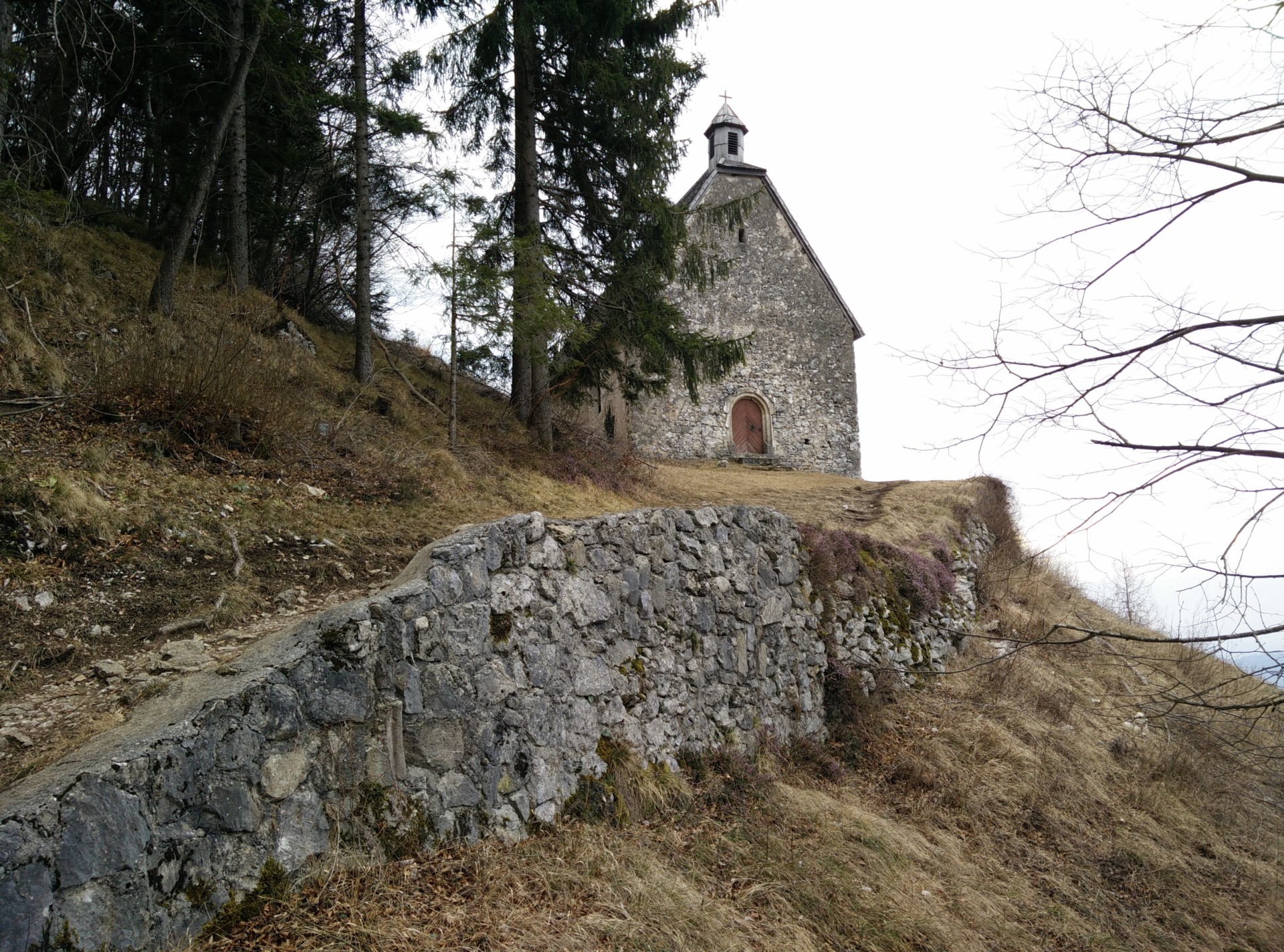
Velika Planina Trail: Church in the beginning of the trail (4km distance)
Velika Planina Trail: Hiking towards the highest point on the plateau - Gradisce
Velika Planina Trail: On the plateau
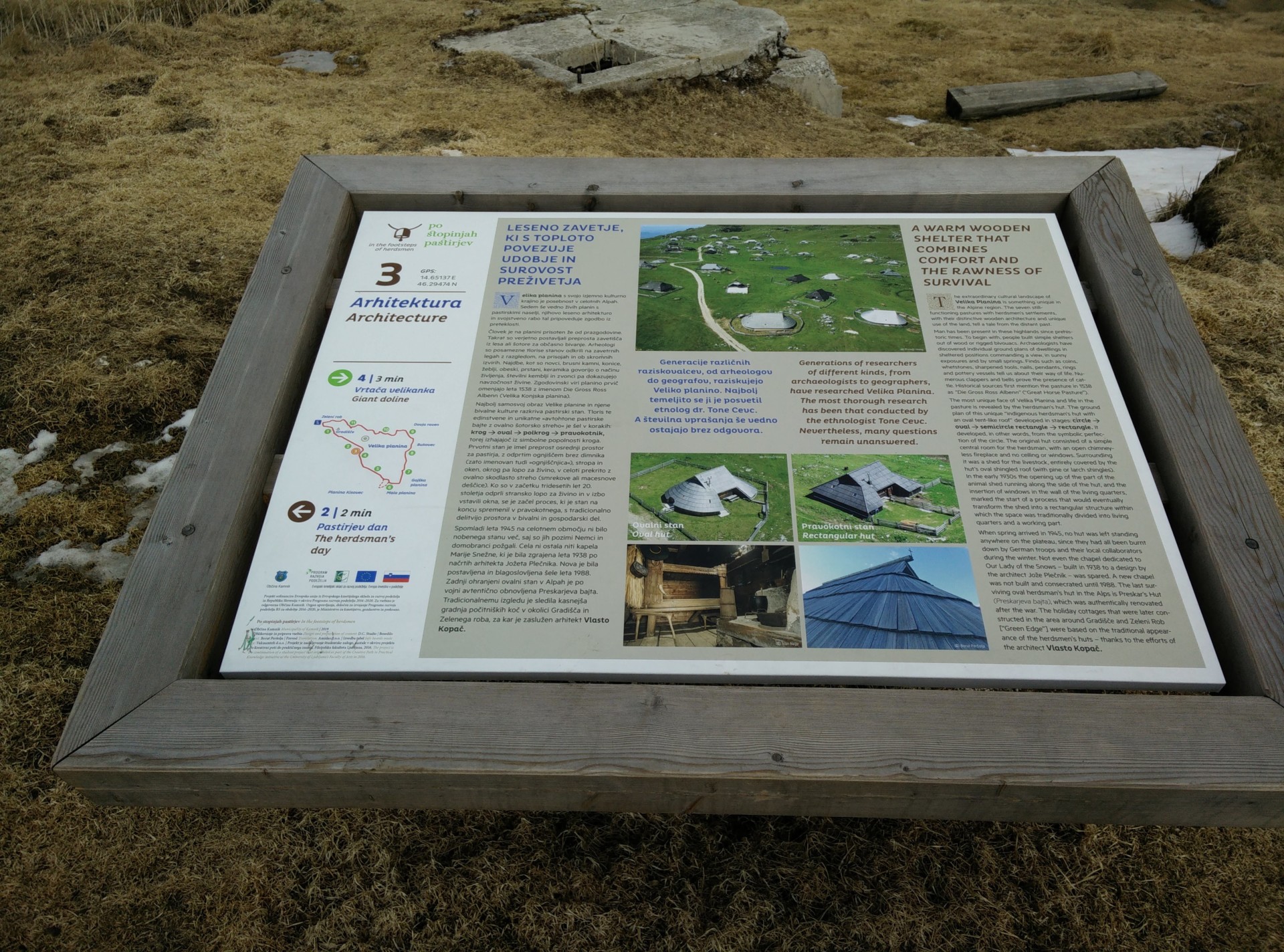
Velika Planina Trail: There are many tourist information boards which allow you to dive deep into the history of the plateau
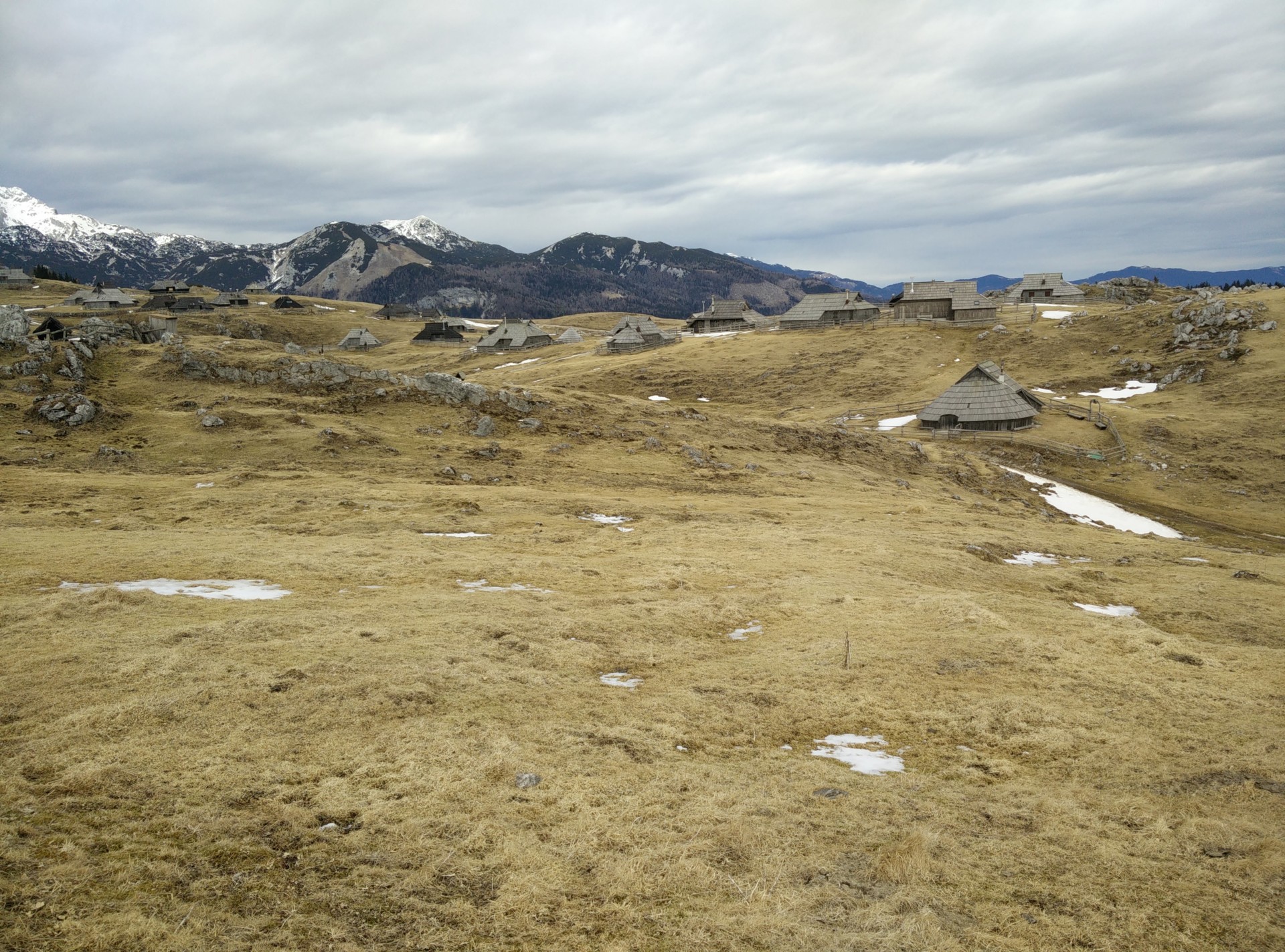
Velika Planina Trail: The shepherd huts are incredibly beautiful
If you have any questions about this hike, please drop me a line in the comments below.