Sass Ciapel Trail
About Sass Ciapel Trail
In the summer we spent several days in the Italian Dolomites. When we arrived to the beautiful town of Arabba where we had booked accommodation, I spotted a really interesting mountain which looked somewhat like a mushroom. After a brief research I figured out that the mountain is called Sass Ciapel and is 2557 meters high. I hadn’t planned to climb Sass Ciapel but when I saw it, I knew I wouldn’t be able to resist it. Therefore, I quickly readjusted my plan and early in the morning on the second day of our holidays I was making my way up to the “mushroom mountain”.
The Sass Ciapel trail is not well known and I had quite some trouble finding information about it online. Nevertheless, I did find some photos and spotted that the last stretch to the peak is fairly steep and rocky. Therefore, I also took my climbing helmet with me in addition to the ordinary hiking gear. It turned out to be a really good decision as there indeed was danger of rockfall on several stretches. Besides from that, the trail is not particularly demanding in any way – at least in summer. In winter the conditions are obviously different due to snow and ice.
I started the trail at Passo Pordoi from where I first hiked to the mountain hut Rifugio Fredarola. There, I took the ridge path towards east which brought me just under the peak. After climbing the peak, I returned to Passo Pordoi via the Rifugio Viel Del Pan mountain hut. My return route is a part of the well-known Viel Del Pan historic trail which goes from Arabba to the Fedaia Lake via Passo Pordoi. Below is a description of the trail I made.
Sass Ciapel Trail Details
Physical Difficulty
Medium
Technical Difficulty
Demanding
Duration
3 h 21 min
Distance
8.65 km
(5.37 mi.)
Ascent
542 m
(1778 ft.)
Descent
545 m
(1788 ft.)
Highest Point
2557 m
(8389 ft.)
Lowest Point
2244 m
(7362 ft.)
Date of the Hike Date when we did this hike ?
July 2019
Weather On the day when we did this hike ?
Partly cloudy
Temperature On the day when we did this hike ?
8° C
(46° F)
Wind On the day when we did this hike ?
5 km/h
Warning!
This trail is technically demanding and requires experience with alpine mountaineering and good footwear.
Sass Ciapel GPS Route and Trail Description
*Click on the chart to see the location on the map
GPX route helps you with the navigation on a hike. It can be used with a smartphone, handheld GPS device or a GPS watch.About GPX Route
Reaching the starting point
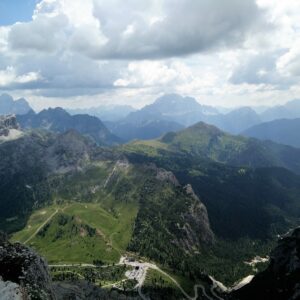
The Sass Ciapel trail starts at Passo Pordoi (coordinates 46.488969, 11.811467), like most of the hikes I did during the holidays. Passo Pordoi lies at an altitude of 2239 meters (7346 ft.) and is thus a convenient starting point for many nearby mountains. The road to Passo Pordoi is good (meaning asphalted) and there are several parking lots at the pass. The parking lot closest to cable car station is free of charge but apparently, it’s only for the cable car customers. Nevertheless, there is no systems in place to verify who is a cable car customer. So, it’s up to you whether you want to park there or not.
How to reach the Pordoi pass obviously depends from which direction you are coming. If you are arriving from the west or south-west, you can reach the pass via Canazei. The most convenient way to reach the Pordoi pass from the north (Austria) is the SS244 road that passes Brunico. Those who are coming from the east or south-east should take the Italian A27 highway towards north and in Longarone follow the directions signs for Arabba. It’s only 9 kilometers from Arabba to the Pordoi pass.
Trail
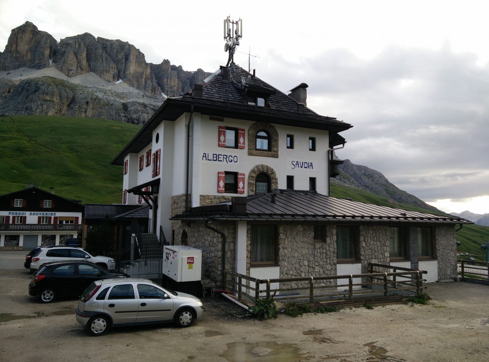
Once you are at the Pordoi Pass, locate the Albergo Savoia hotel on the southern side of the main road. The hotel lies beneath the cliffs of the beautiful Sasso Becce mountain. The trail starts just behind the hotel and there is a directions sign at the beginning of the trail. As I mentioned above, Sass Ciapel is not the most known mountain in the area, so don’t be surprised that it’s not on the directions sign. It’s actually not on any of the direction signs along the trail but because the mountain has such a unique shape, you really shouldn’t have any problems with the navigation. Nevertheless, you can always download my GPS track for free above and use it with your smartphone or any other GPS device.
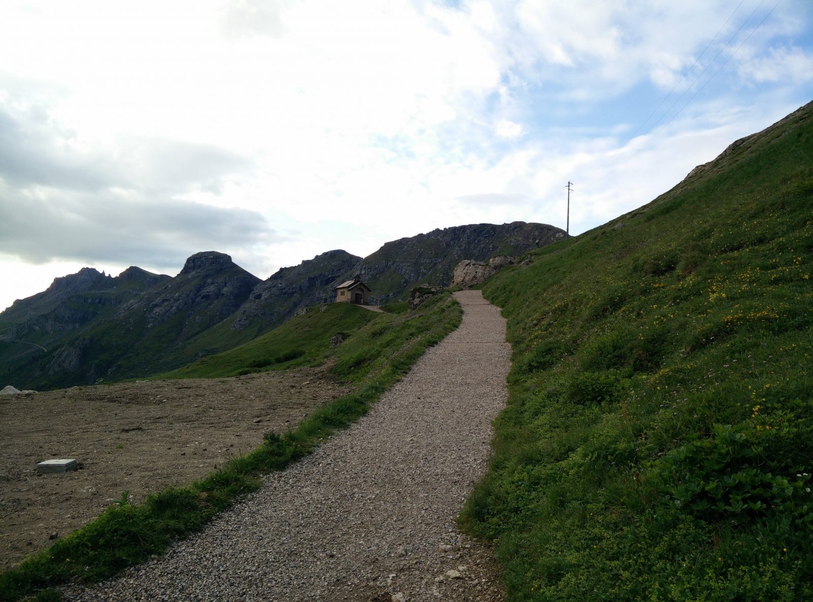
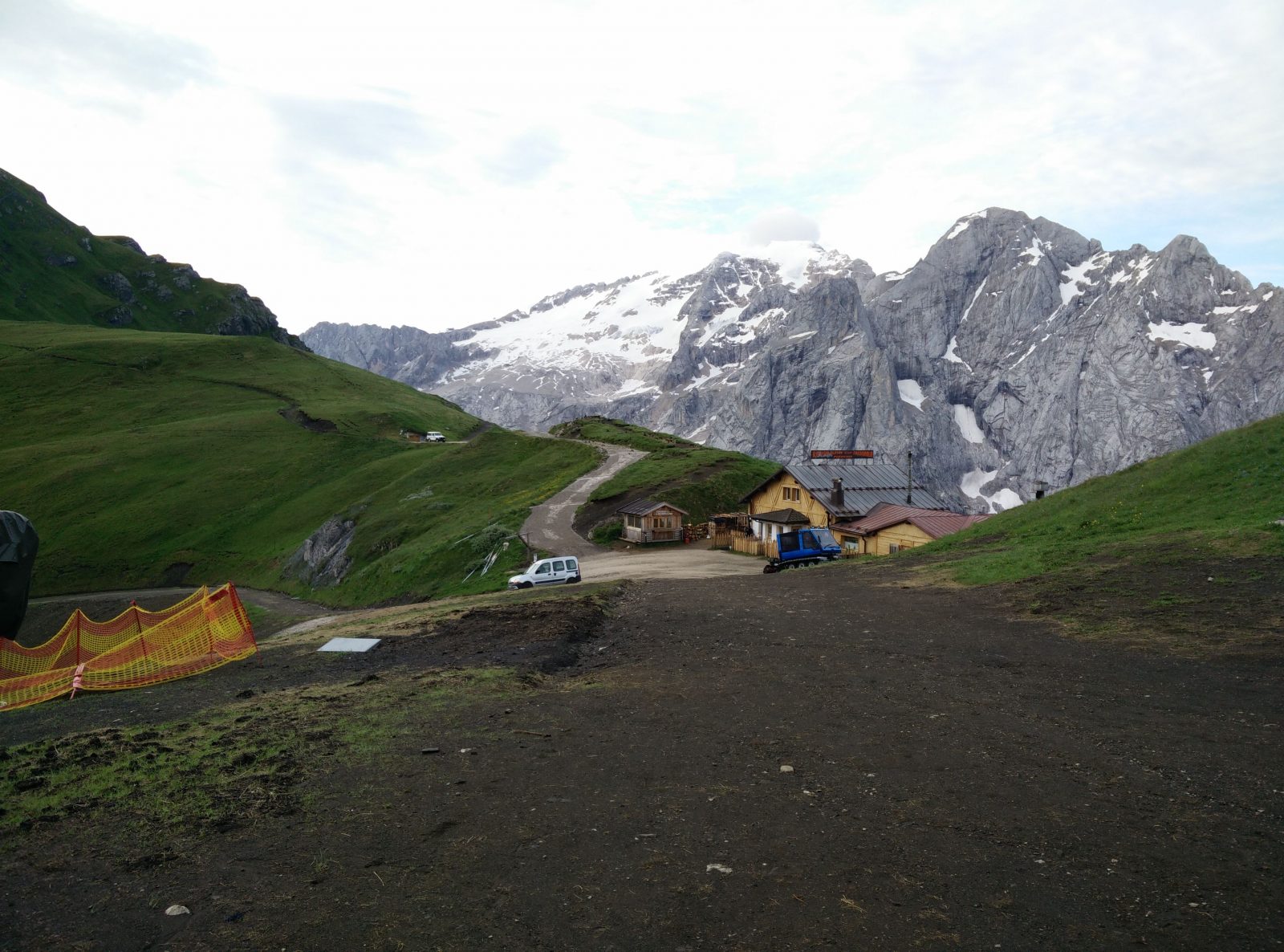
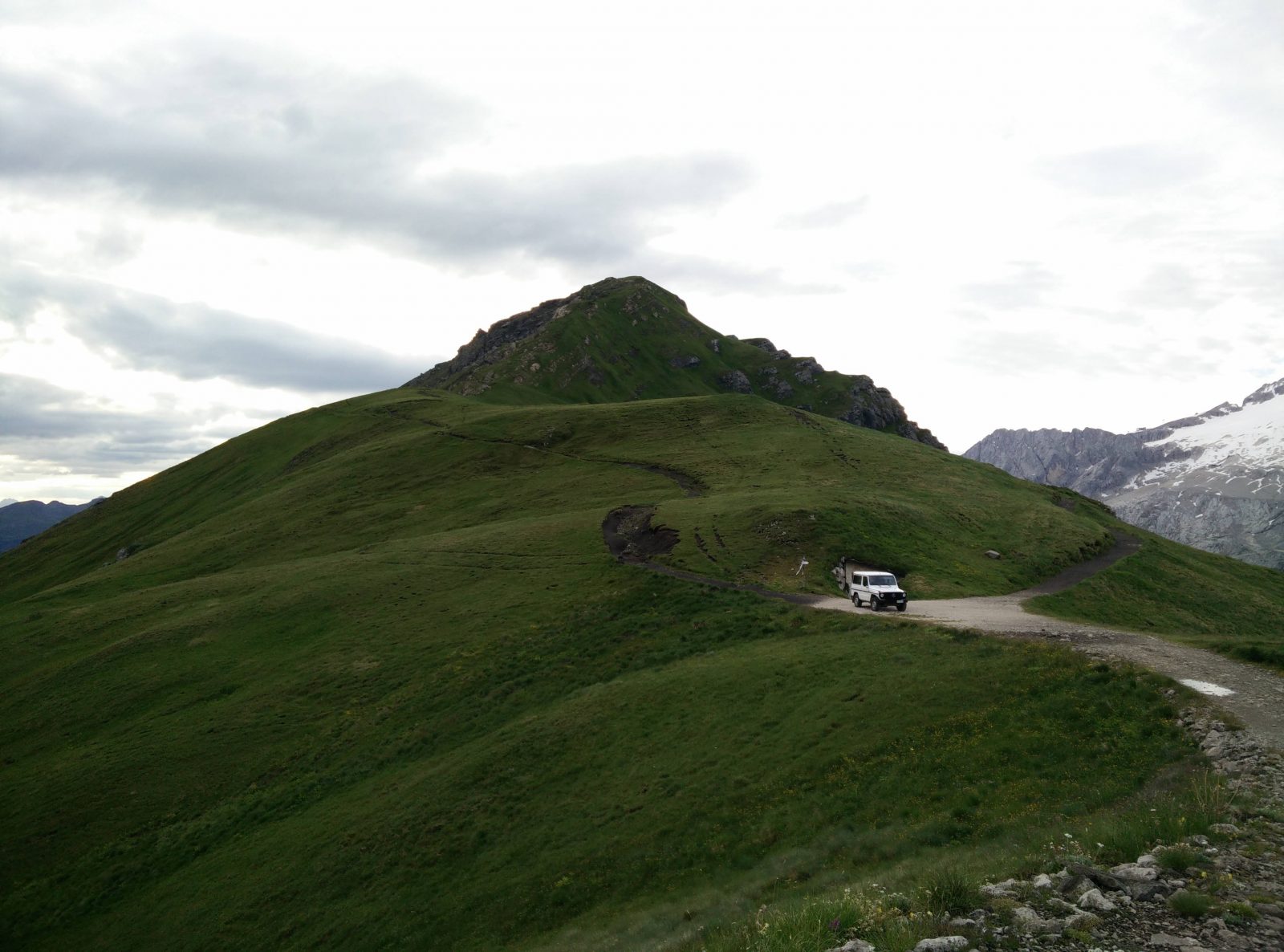
The path behind the hotel ascends rapidly towards the ridge and in only a couple of minutes you reach a cute small chapel (Chiesetta di Passo Pordoi). Behind the chapel is a bench with a great view of Arabba and the windy road from Arabba to Passo Pordoi. It’s definitely worth stopping there for a couple of minutes and enjoy the view. After the chapel, the wide path becomes even steeper as it runs up to Rifugio Fredarola mountain hut. After hiking for approximately 1.4 kilometers altogether you should reach the mountain hut. I was there early in the morning and the mountain hut was not yet opened. However, I’m quite sure it provides warm drinks and food like most other mountain huts in the Dolomites.
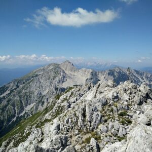
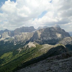
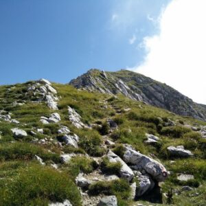
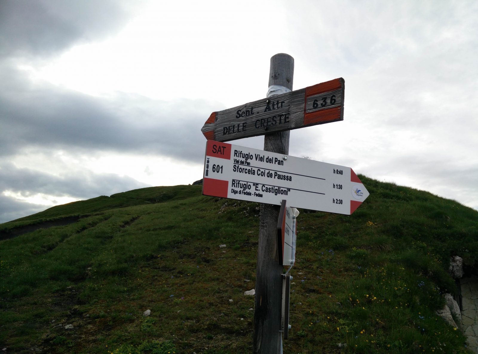
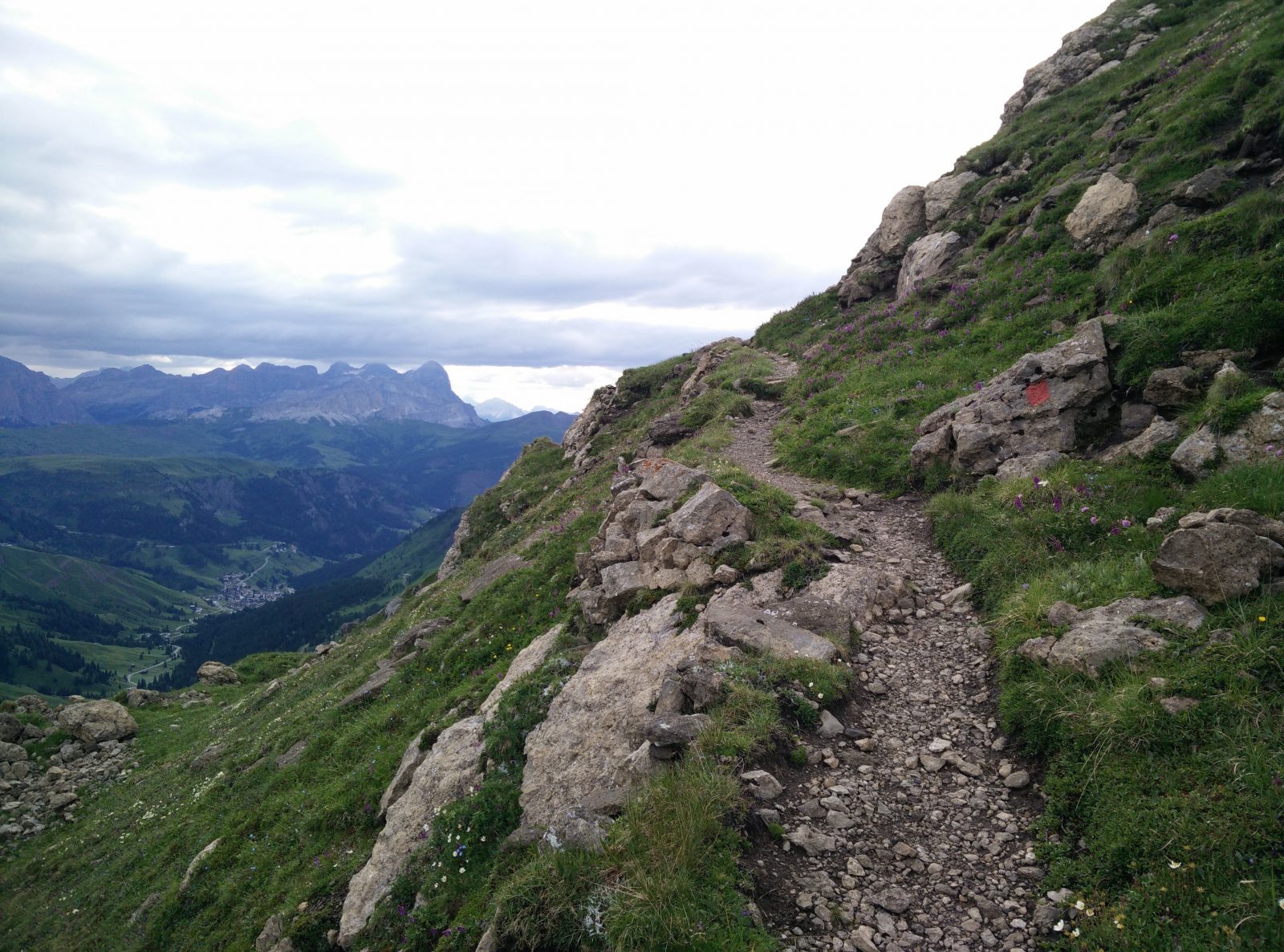
At Rifugio Fredarola you should take the path that goes towards south-east and soon you will come to a road fork. The path splits into trail 636 (left) and trail 601 (right). The trail 601 goes to Rifugio Viel del Pan while the trail 636 is marked as the ridge path (Sent. Attr. Delle Creste). I decided to take the ridge path for the way up. The ridge path is very narrow and for the first couple hundred of meters it runs just beneath the ridge. The terrain here is very steep and a bit slippery. Therefore, good hiking footwear is essential. Soon the path brings you to the top of an unnamed peak from where you can clearly see Sass Ciapel, Lake Fedaia and the Marmolada massif towards south.
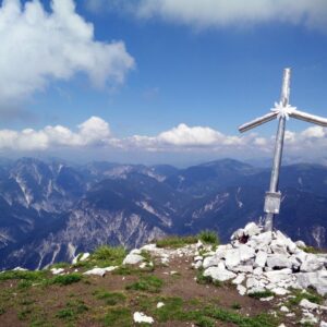
Now the trail starts descending towards the foot of Sass Ciapel. When you are at the foot of Sass Ciapel you have only a couple of minutes left to the top. The steep and slippery path ascends rapidly towards Sass Ciapel’s rocky wall. This rocky wall is just beneath the top and is 10 meters or so high. When I reached the wall, I got a bit worried because it was almost vertical, and I couldn’t find any good approach route to the peak. Nevertheless, after wandering around for a couple of minutes (see the GPS track) I found a narrow groove with good steps. Then I quickly climbed to the top. I was surprised how flat the top is. It’s more like a plateau than a regular peak.
Getting back to the starting point
First, I descended the peak and then I hiked to Rifugio Viel Dal Pan (mountain hut). There is a side path just beneath the peak that leads to the mountain hut. I stopped there for a cup of good Italian coffee which I enjoyed on the bench in front of the mountain hut while admiring the grand Marmolada massif. After the pause, I returned to Passo Pordoi on the trail 601 which is part of the Viel Del Pan historic trail.
Sass Ciapel Trail – The trails starts just behind the Albergo Savoia hotel
Sass Ciapel Trail – The Chiesetta di Passo Pordoi chapel is seen
Sass Ciapel Trail – Rifugio Fredarola
Sass Ciapel Trail – Here go left for the ridge path (trail 636)
Sass Ciapel Trail – The ridge path is quite exposed
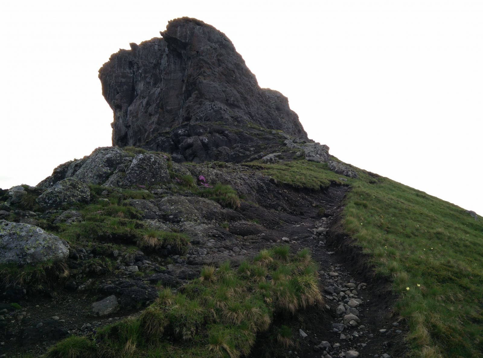
Sass Ciapel Trail – The wall beneath the peak
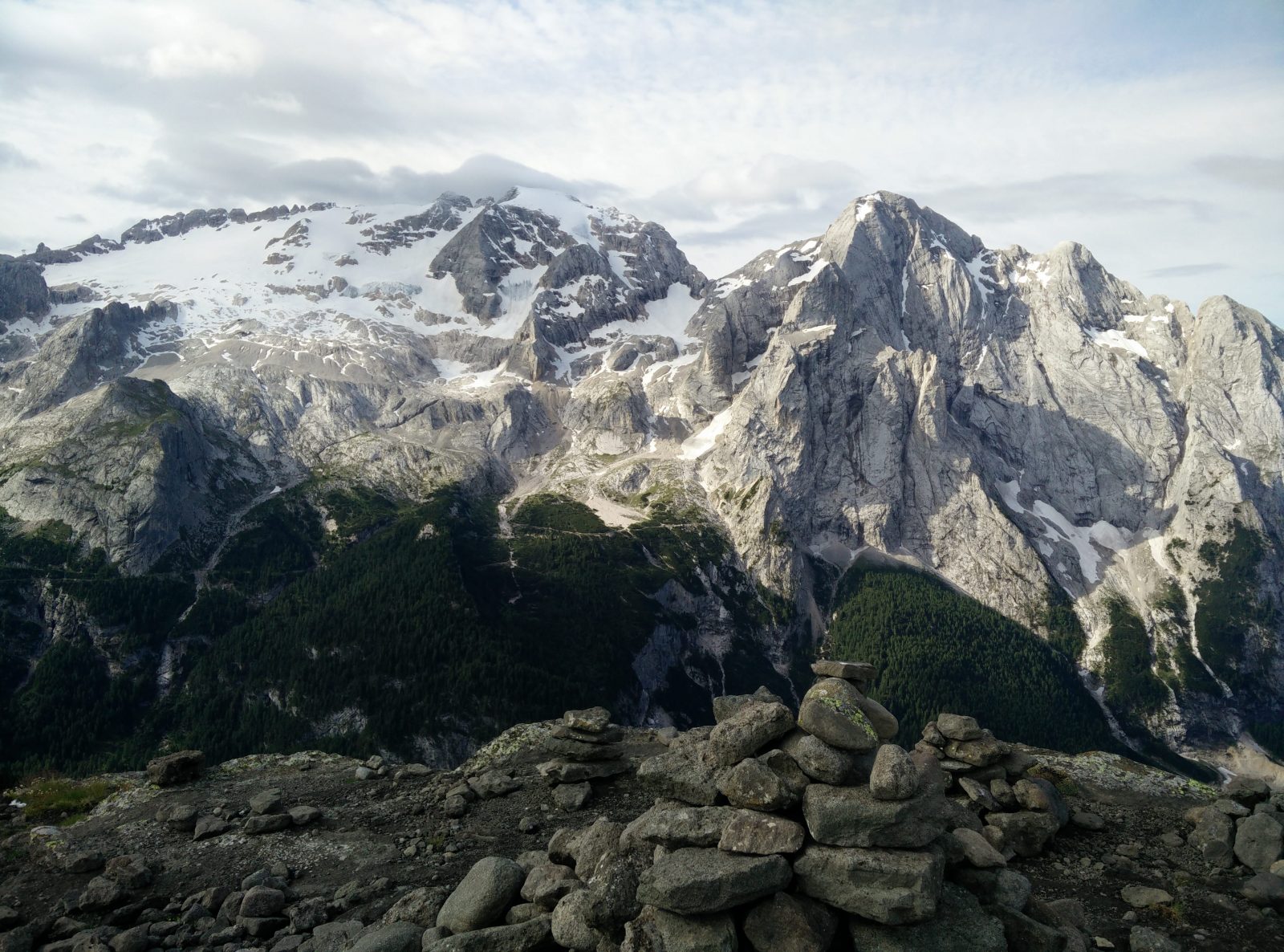
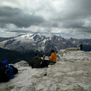
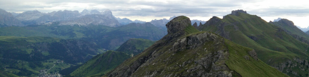
Sass Ciapel Trail – View of the Marmolada Massif from the top
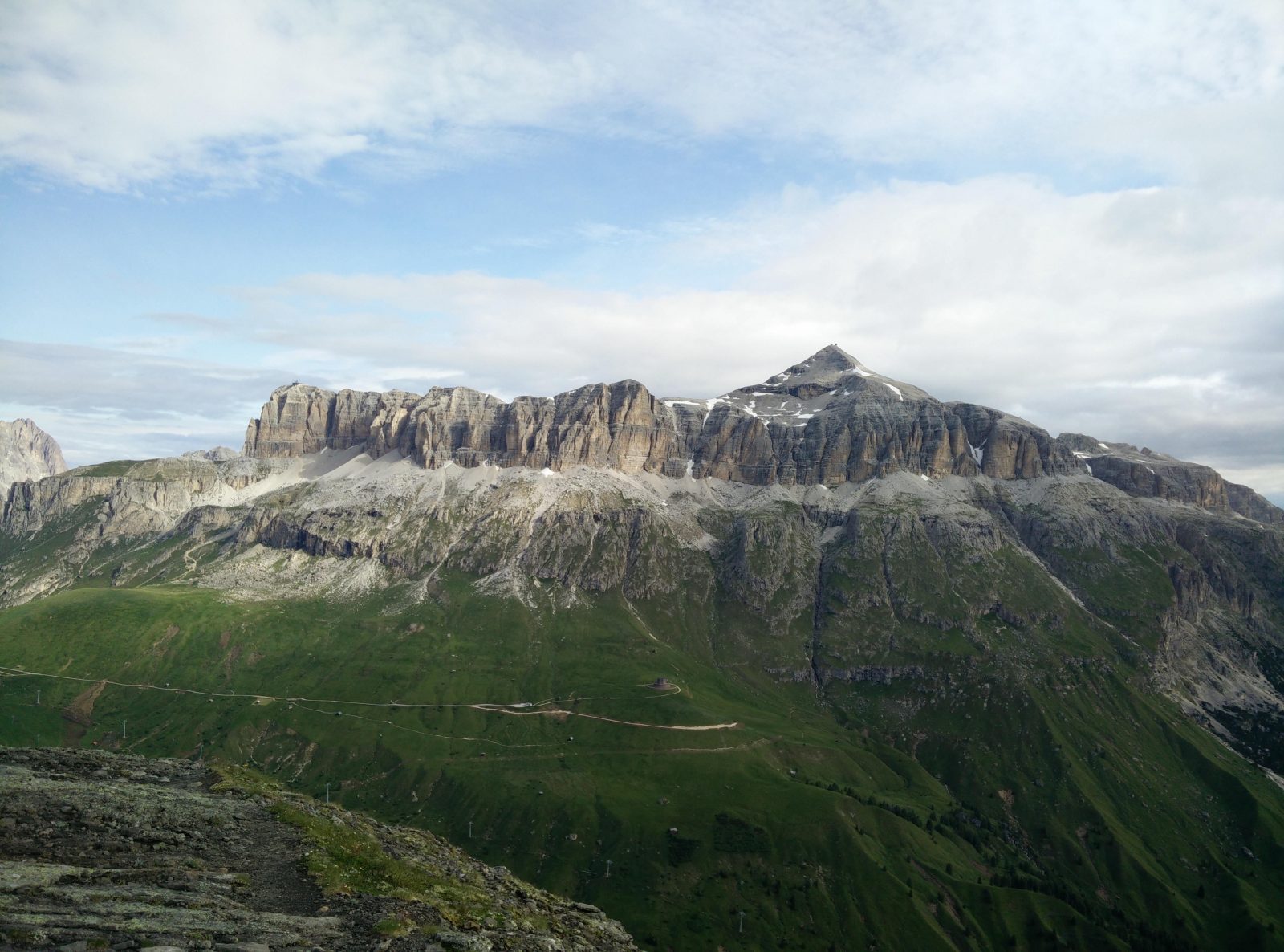
Sass Ciapel Trail – From the top you also see Piz Boe
Equipment
I went on this hike early in the morning and even though it was July, the temperatures were low. Hence, I took a little more clothing with me. I was wearing the Formal Friday Merino t-shirt, Falke Cool Boxers, Mountain Hardwear Monkey Man fleece jacket, Montane Terra Pack pants, Salewa Mountain Trainer Mid hiking boots and a sun hat. In my Osprey Talon 22 daypack I was carrying 2 liters of water, some snacks, Montane Minimus rain jacket and a climbing helmet. I also used the lightweight Montem Ultra Light 3K Carbon trekking poles.
Equipment under scrutiny
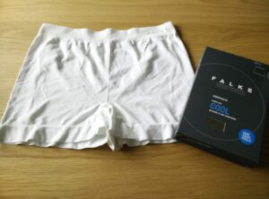
Falke Cool Boxers
Falke Cool Boxers – Logo
I wore the Falke Cool Boxers for the first time on this hike and I was very satisfied with them in general. The boxers are moisture-wicking, quick-drying and very comfortable. However, I did notice that the fabric is a bit thicker which reduces the breathability to some extent. The boxers are, nevertheless, more robust due to the thicker fabric and will thus probably have a longer life span. Read the full Falke Cool Boxers review here.
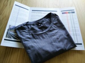
Formal Friday Merino T-Shirt
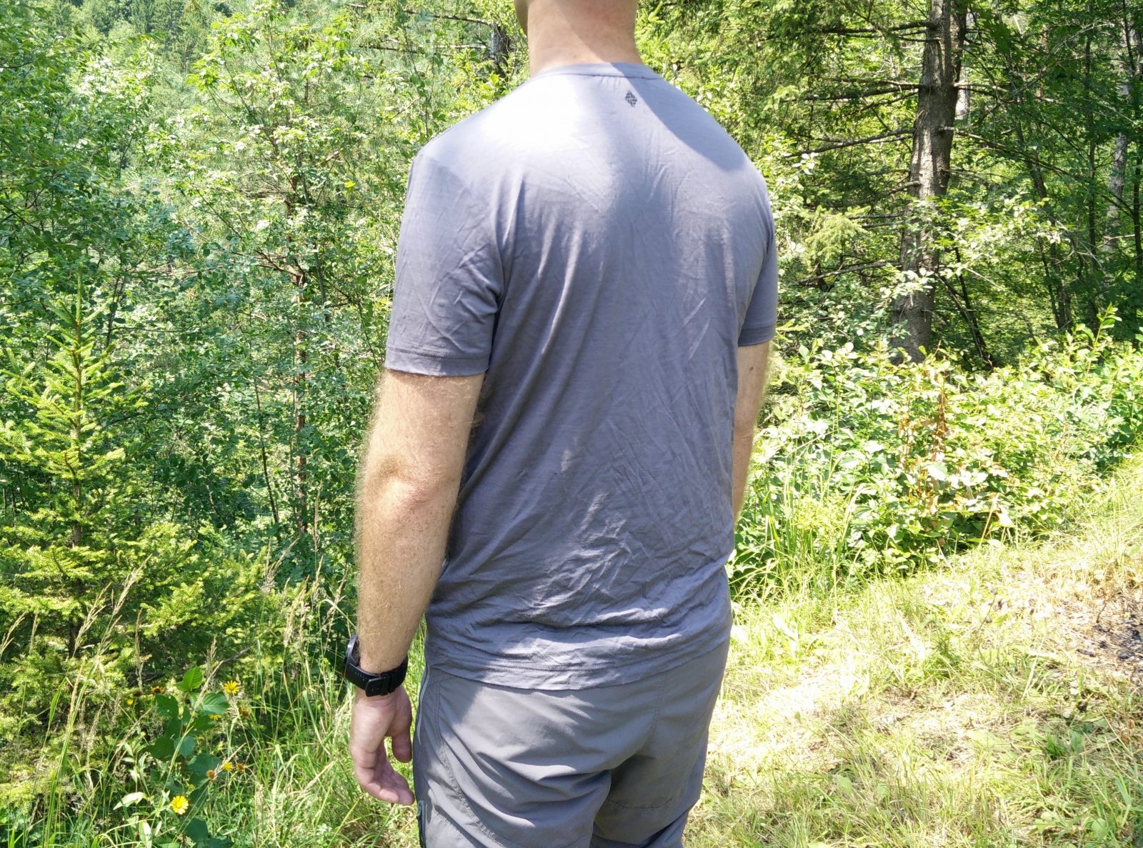
Formal Friday Merino T-Shirt – Back
I also wore the Formal Friday Merino t-shirt for the first time on this hike. The t-shirt is very comfortable, and the material feels very nice against the skin. It is also breathable, moisture-wicking and odor-resistant. The only complaint I have is that it dries slightly slower than my other Merino base layers. The material is a bit thicker and thus it absorbs more moisture. Nevertheless, Merino garments retain more heat when they are wet compared to their synthetic counterparts and thus, I didn’t find this a big problem. Read the full Formal Friday Merino T-Shirt review here.
Conclusion and photo gallery
The Sass Ciapel might not be the most popular hike/ascent in the Dolomites, but I’m really happy I climbed this weirdly shaped mountain. The best thing about this hike was that there were no crowds, at least for the first part of the trail. If you decide to do this hike, wear proper hiking footwear and a climbing helmet for the last stretch. As always, I recommend checking the weather forecast before going and postponing the hike in case of bad weather. Note that if the trail is covered with snow, a completely different set of equipment is required (crampons, ice axes etc.).
Sass Ciapel Trail - The fork; left goes the ridge path and right is the path to Rifugio Viel Dal Pan
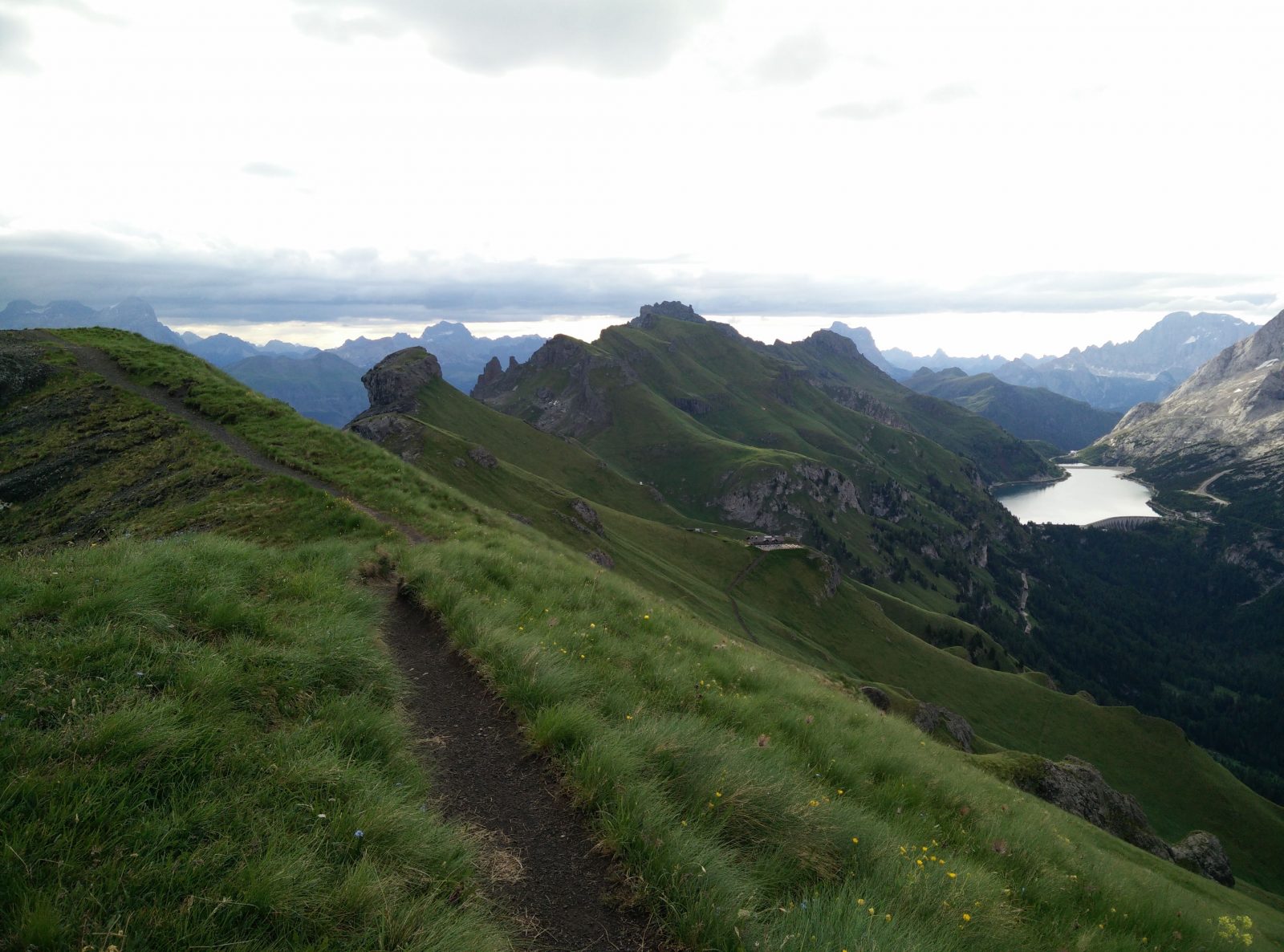
Sass Ciapel Trail - The peak, Fedaia Lake and Rifugio Viel Dal Pan
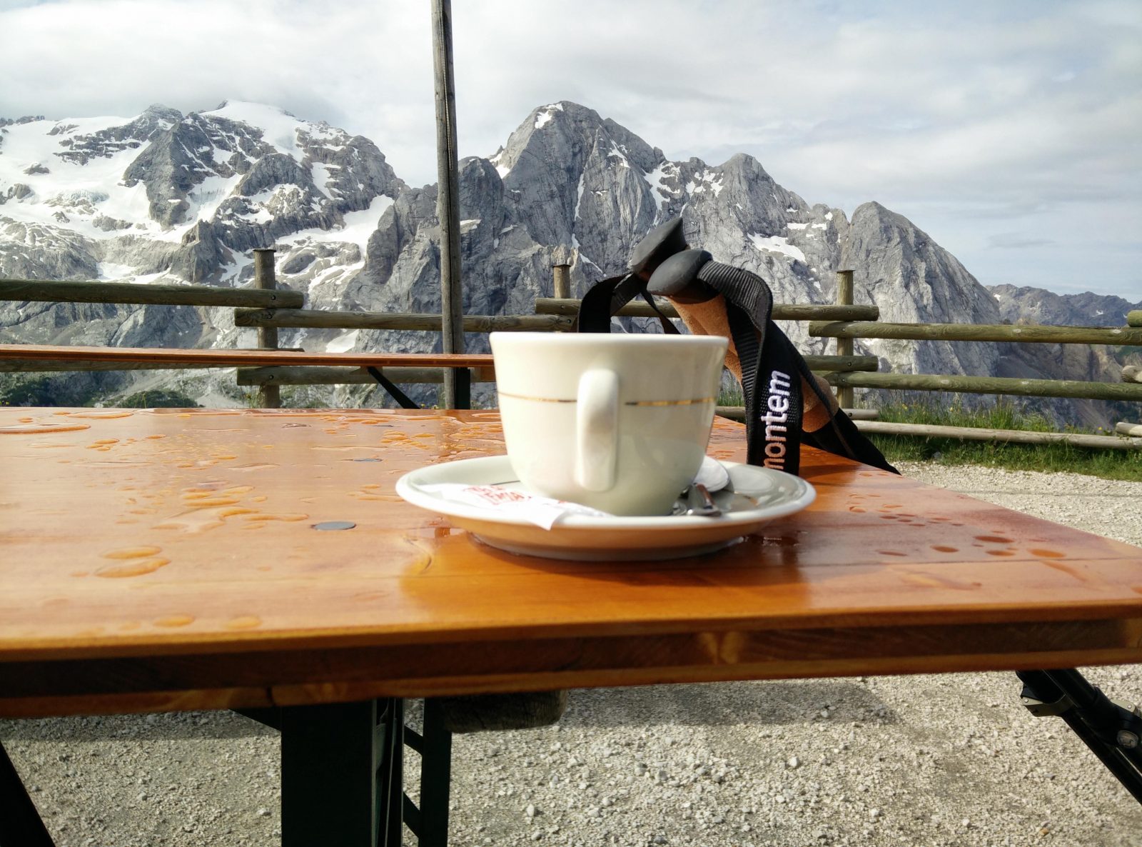
Sass Ciapel Trail - Enjoying coffee at Rifugio Viel dal Pan
If you have any questions about this hike, please drop me a line in the comments below.