Vogel Trail
About Vogel Trail
After climbing the 2539 meters high Skuta peak in the Kamnik-Savinja Alps, I decided to proceed my “Hiking the Alps” tour by ascending a relatively small, 1924 meters high mountain called Vogel in the southern Julian Alps. Vogel is very popular among hikers as the trail is not technically challenging. Nonetheless, Vogel offers a great view on the higher peaks of the Julian Alps – not least the 2864 meters high Triglav which is also the highest mountain of the Julian Alps. I decided to climb Vogel because I wanted to do a dynamic but not very demanding hike after having done the Skuta trail a few days before.
The Vogel trail is suitable for everybody who is reasonably physically prepared – even for families with kids. Reaching the peak requires an ascent of less than 1000 meters while the total distance of the trail is approximately 13 kilometers. However, the overall distance can be shortened by taking the shorter (eastern) route both up and down. I ascended the mountain taking the longer western route and only used the short route for the way down.
The route starts at Planina Kuk which lies in the proximity to the bigger towns Tolmin, Kobarid and Bovec. These three towns are becoming increasingly popular among tourists as they offer great possibilities for outdoor sports such as rafting, tubing, canyoning, paragliding, mountain biking and of course hiking.
Vogel Trail Details
Physical Difficulty
Medium
Technical Difficulty
Medium
Duration
5 h 50 min
Distance
13.2 km
(8.2 mi.)
Ascent
889 m
(2917 ft.)
Descent
891 m
(2923 ft.)
Highest Point
1924 m
(6312 ft.)
Lowest Point
1144 m
(3753 ft.)
Date of the Hike Date when we did this hike ?
August 2016
Weather On the day when we did this hike ?
Mostly Sunny
Temperature On the day when we did this hike ?
28° C
(82° F)
Wind On the day when we did this hike ?
5 km/h
Warning!
This trail has a few steep sections and requires good footwear, steady footing and no fear of heights.
Vogel GPS Route and Trail Description
*Click on the chart to see the location on the map
GPX route helps you with the navigation on a hike. It can be used with a smartphone, handheld GPS device or a GPS watch.About GPX Route
Reaching the starting point
This trail starts and Planina Kuk (mountain pasture) which lies 17 kilometers away from the town called Tolmin. Reaching Planina Kuk as well as Tolmin requires driving on local roads as there are no highways in this area. Unfortunately, you can’t reach the starting point of the trail by public transport due to its remoteness. The closest you can get is to Tolmin.
If you are approaching from the north (e.g. western Austria or northeastern Italy), you should drive along the A2 expressway (Austria)/ A23 highway (Italy) towards Tarvisio (Italy). Then take the Tarvisio exit and continue on the local road towards Cave del Predil. Soon after reaching Cave del Predil you will cross the border between Italy and Slovenia. After that continue towards south, through Bovec and Kobarid until you reach Tolmin. Drive through Tolmin and at the end of the town you will see a directions sign for Poljubinj and Ljubinj. You should turn left here and follow the road until you reach Ljubinj. At the beginning of the village Ljubinj you should turn left towards Planina Kuk and follow a relatively narrow and steep road that eventually turns into a wide dirt track until you reach a large parking place where you can park your car free of charge. The wide dirt track for cars ends here, closed off with a gate as it is forbidden to continue further by a car. If you are using a GPS device, the coordinates 46.212921, 13.785179 will lead you directly to the parking place. The wide dirt track is relatively well-maintained and thus you don’t need a 4X4 vehicle to drive on it.
Those who are approaching from the east (e.g. Italy) should first drive to Udine and then continue towards the Slovenian border by passing Cividale del Friuli and Pulfero. After crossing the border, continue towards Kobarid and then Tolmin. From Tolmin onwards continue as described above in order to reach the parking place at Planina Kuk.
You can also reach Tolmin from the east. In order to do so, you should drive along the southern stretch of the Slovenian E61 highway until you reach the Logatec exit. Then take this exit and continue on the local road for 75 kilometers until you reach Tolmin. At the beginning of the town you will see a directions sign for Poljubinj and Ljubinj. Here turn right and follow the local road that leads you to Planina Kuk as described above (coming from Austria).
Trail
From the parking place start hiking on a wide dirt track towards north and soon you will reach a farm where you can also buy homemade products such as cheese, milk and so forth. Continue past the farm and after 1.4 kilometers the wide dirt track will lead you through dense woods towards north-west. Stay on the wide dirt track which here runs over a relatively flat terrain until you reach a narrow path that splits right from the wide dirt track (after hiking for approximately 3 kilometers altogether). Here you should go right in the direction of Koca na Planini Razor. The narrow path ascends gently and after walking for only 200 meters you will reach the mountain hut at Planina Razor.
This mountain hut is very popular among tourists and hikers as it offers cooked food, drinks and accommodation. A beer there will cost you 3 € ($ 3.3) while a coffee goes for 1 € ($ 1.1). At the mountain hut you can also refill your water bottles for free as the tap water is drinkable.
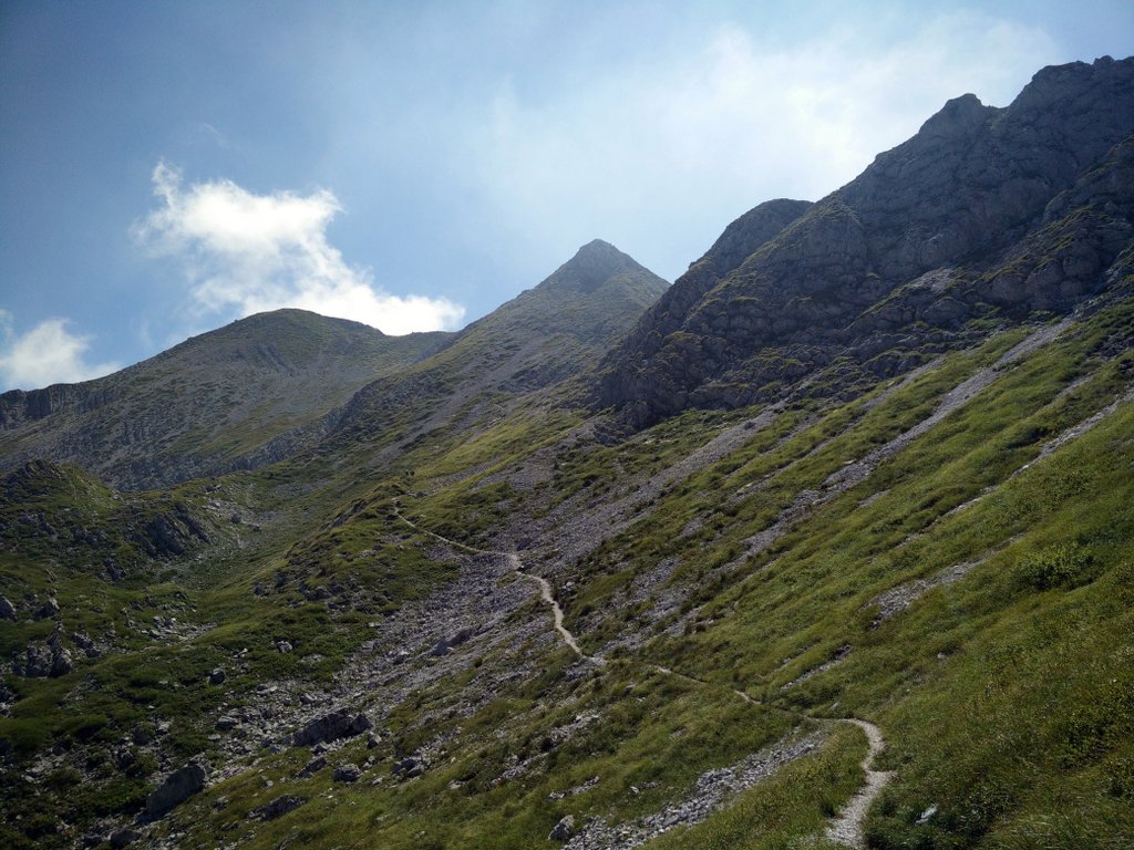
From the mountain hut continue on the narrow path towards north and after 150 meters you will reach a crossroad with a directions sign. Here you should go right, towards Globoko and Vogel. The trail is in general very well marked with direction signs and painted red and white circles on rocks and trees. Therefore, I believe that you will not have any problems with navigation. After hiking for 200 meters more you will reach another crossroad where you should go left towards Globoko if you want to do the longer western route like I did. The path that goes right leads directly to the peak and is shorter.
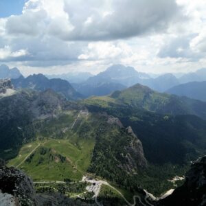
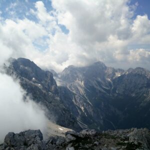
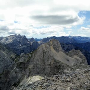
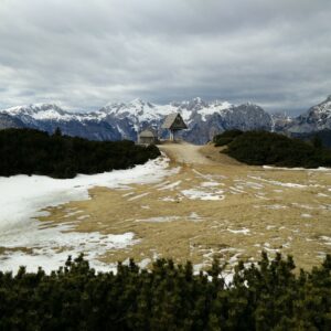
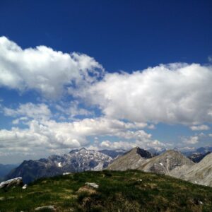
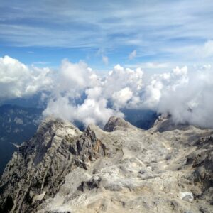
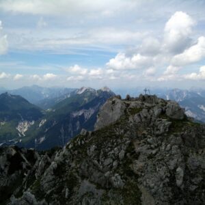
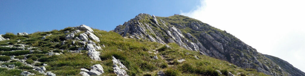
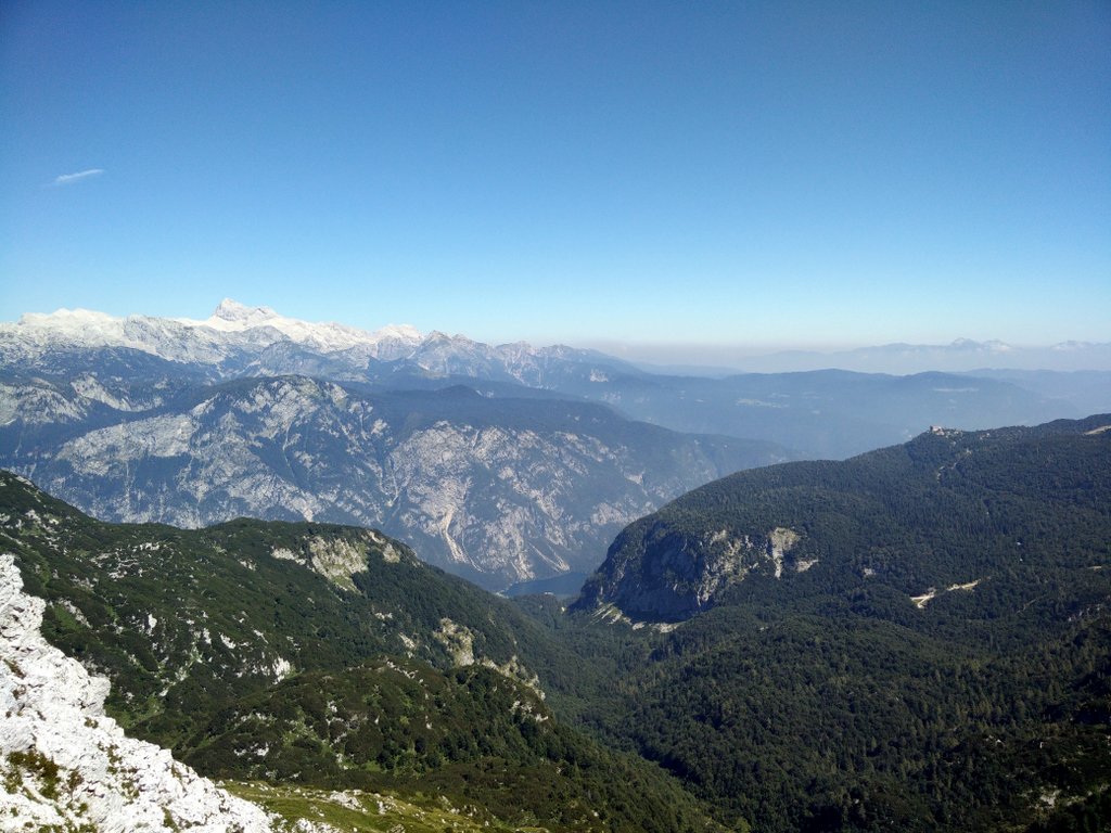
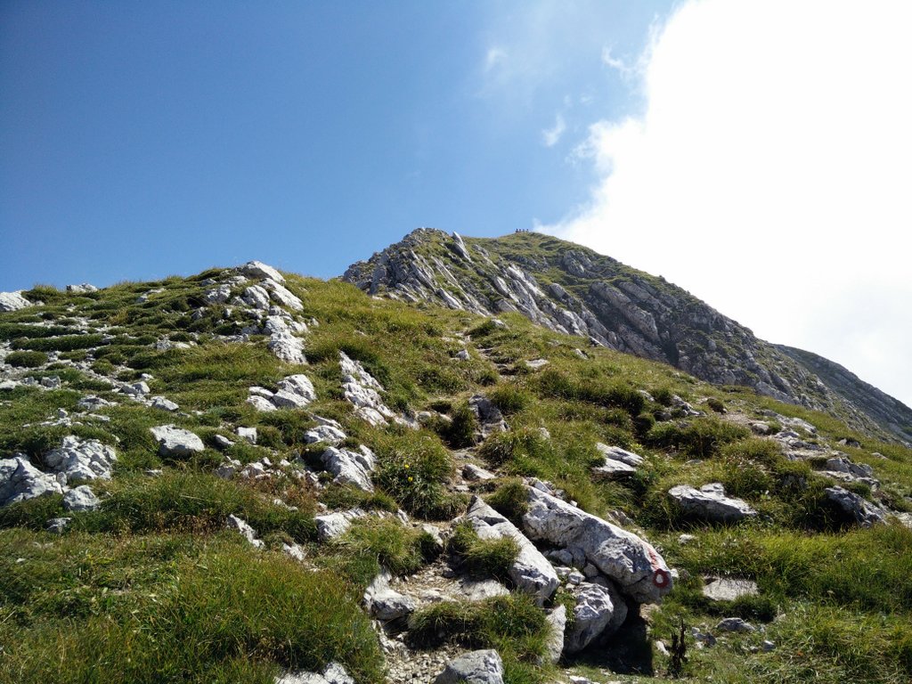
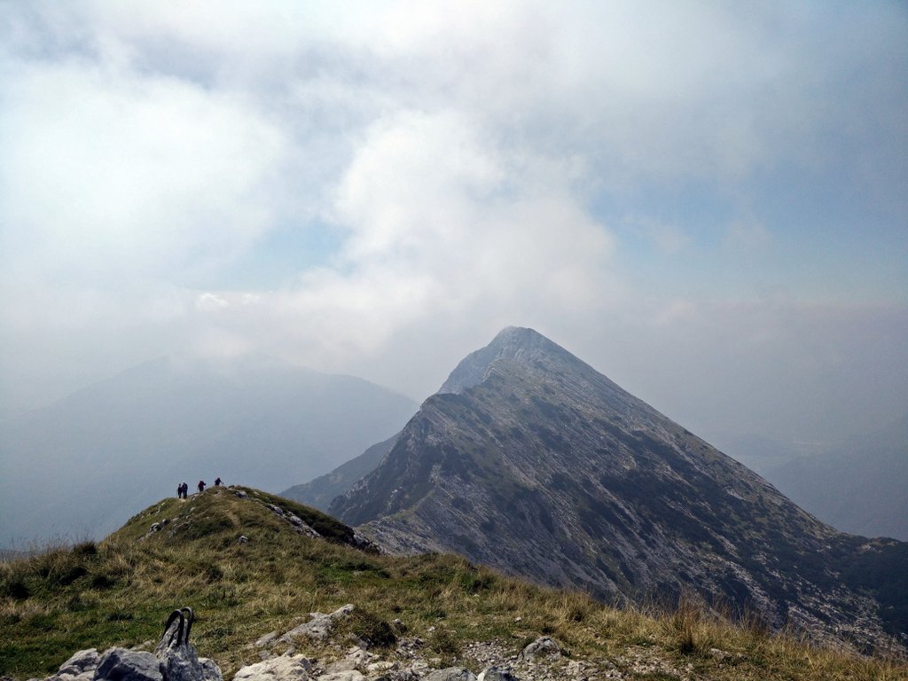
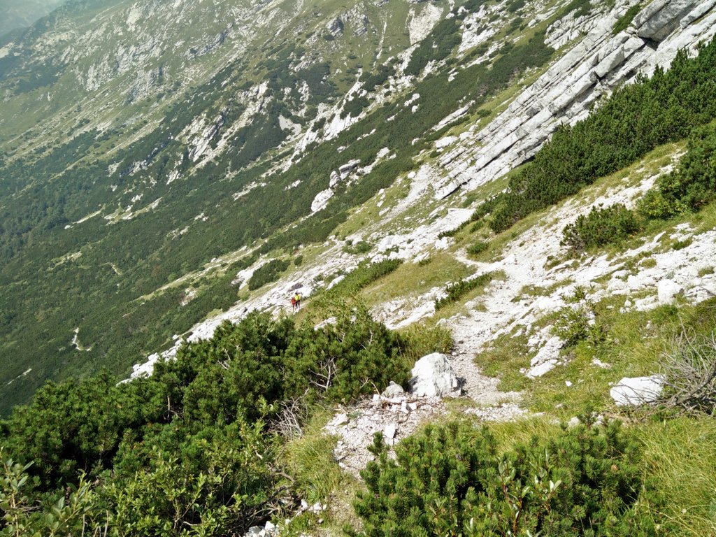
From here on the path starts ascending rapidly and the terrain becomes rockier. Even though the path is fairly steep, it is not technically challenging. After ascending for 1.7 kilometers you will arrive to an old military bunker which was built during the First World War and lies 1800 meters above the sea level. Then keep ascending for couple hundred meters more until you arrive to the top of the ridge where you will get a great view on the other peaks of the Julian Alps as well as on the famous Lake Bohinj. From here on you should continue straight ahead on the narrow rocky path which soon starts descending over the northern slopes of the ridge and then turns towards south-east and runs slightly below the ridge. After approximately 1 kilometer the path will start ascending rapidly towards the peak. From here you only have 500 meters left to the top of the mountain. On the top you will be rewarded with a great view on the surrounding peaks including the northern Julian Alps where Slovenia’s highest peaks are located.
Getting back to the starting point
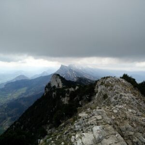
For the way back I used the shorter eastern route. From the peak you have to continue on a narrow path towards south. After a couple hundred meters the path changes its direction towards north-west and after hiking on this path for 1.7 kilometers altogether, you will arrive to the crossroad where the eastern and western route become one again. From here on I continued back to the parking place more or less on the same path as I used for the ascent.

Vogel Trail – Farm close to the parking place
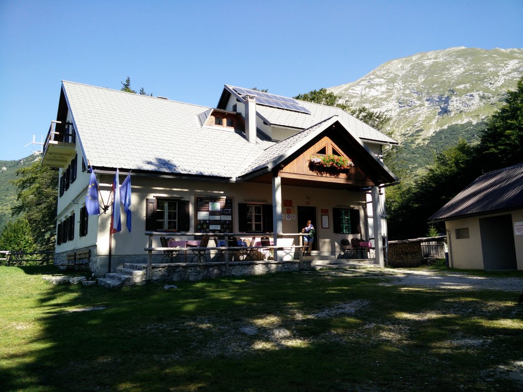
Vogel Trail – Mountain hut at Planina Razor
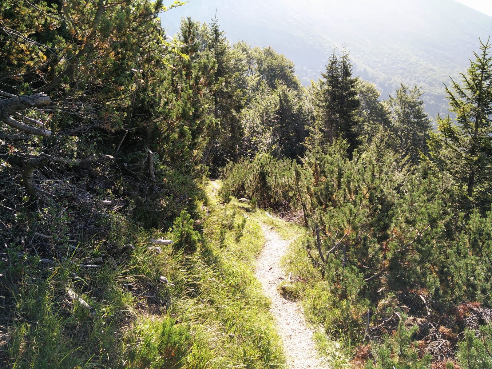
Vogel Trail – The path
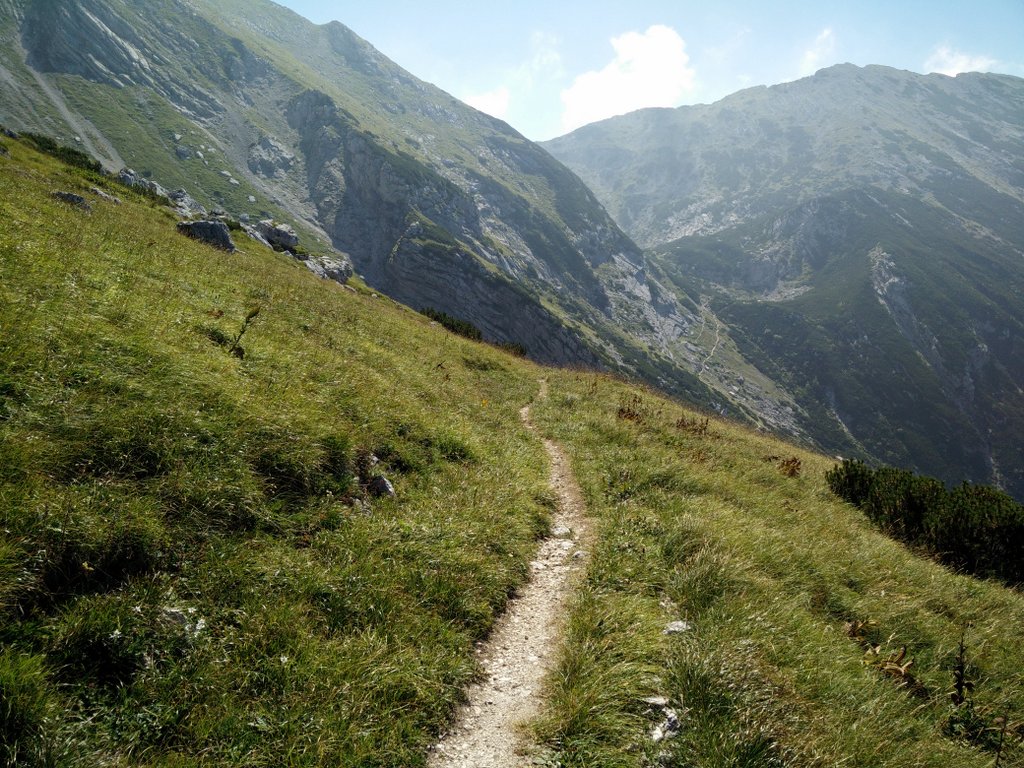
Vogel Trail – The longer western route
Vogel Trail – Old military bunker
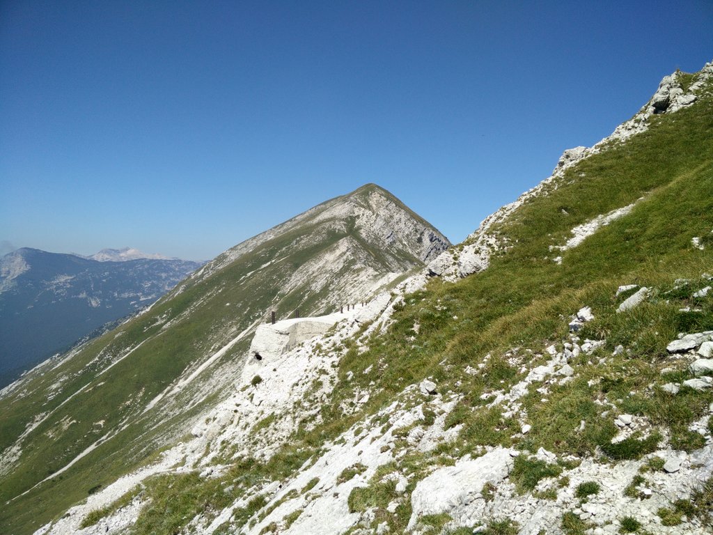
Vogel Trail – View from the ridge
Vogel Trail – The path runs below the ridge
Vogel Trail – Ascending the peak
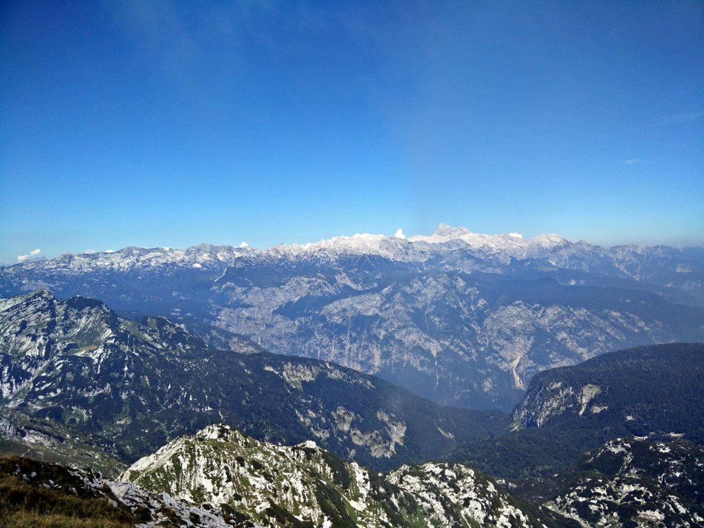
Vogel Trail – View from the peak
Equipment
As the forecast promised very nice weather and I knew that this hike is not that demanding, I only took the most basic hiking equipment with me. I was wearing an Icebreaker Tech T-Lite base layer, Woolx Merino Boxers, Montane Terra Pack pants, Salewa Mountain Trainer Mid hiking boots, baseball cap and socks made of Coolmax fibers. However, I also used hiking poles as my muscles were still sore from doing the Skuta trail a couple of days earlier. In my Osprey Talon 44 backpack I was carrying a rain jacket, food, water and some accessories. As the temperatures were very high, I drank 3 liters of water during the hike.
In summer I recommend taking sufficient amount of water on this hike. Also don’t forget to bring and frequently reapply sun cream. For more information about water requirements, read our article How much water to take on a hiking trip. In winter the trail will probably be covered with snow thus requiring additional equipment such as crampons, ice axe and gaiters.
Equipment under scrutiny
Montane Terra Pack Pants
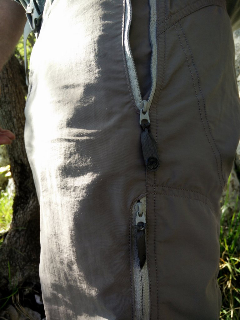
Montane Terra Pack Pants
The Montane Terra Pack pants are made of very thin material (Invista Tactel) and thus they were perfect for this hike (high temperatures). I’ve been using these pants for a couple of months now and I’m really satisfied with their performance – they are light, durable and offer some basic protection against rain and wind. Furthermore they also offer great freedom of movement. I recommend these pants to hikers who want a pair of durable and comfortable pants for 3-season hiking. You can read the full review of the Montane Terra Pack pants here. Note that the links are for a newer model of the pants with a slightly different pocket configuration.

Conclusion and photo gallery
The Vogel trail is best for those who want to do an undemanding hike in the astonishing Julian Alps. The trail is suitable for everybody – even for families with kids. The trail mainly runs over rocky terrain and offers a great view on other peaks as well as on the valley beneath. Before going on this hike check the weather forecast and pack according to expected conditions.
Vogel Trail - Ascending towards the top of the ridge
Vogel Trail - View towards the south
Vogel Trail - The shorter eastern route
If you have any questions about this hike, please drop me a line in the comments below.