Suunto Route Planning: How to do it on PC without Movescount?
Suunto offers several GPS watches such as Suunto 9, Spartan and Ambit which all support navigation, meaning that the watch can show your current location in relation to a pre-determined breadcrumb route. To create a route, you need to use some kind of route planning software on your PC or mobile device. Until a couple of weeks ago this was very simple as you could simply create routes in Suunto’s Movescount web app and import them directly to your watch via a USB cable. However, Suunto discontinued Movescount and route planning is no longer possible that way. Their alternative to Movescount, the Suunto app, is only available for mobile devices (iOS and Android) and planning routes on a small screen is indeed not optimal, especially when it comes to activities such as mountaineering or hiking, where you need a good overview of the area.
I’ve been very frustrated by Suunto’s decision and thus I decided to find an alternative to the Suunto App which would allow me to easily create routes for my Suunto 9 watch on my PC. As I’m often creating hiking and mountaineering routes, I focused on finding a route planning software that has good topographic maps, shows me information about ascent/descent and can follow paths between the created waypoints. I also wanted the software to be free of charge and capable of easily exporting the planned routes in a GPX format because these files can be imported to Suunto watches.
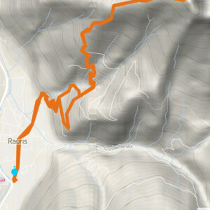
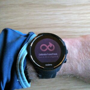
For the last couple of weeks, I’ve been testing various types of route planning software and below are the three winners. But let’s start with the basics and explain how a third-party route planning software can be utilized for creating routes and how to import these routes to a Suunto watch. While I did only test this with Suunto 9 watch, it should work with any GPS watch from Suunto. Let me know in the comments below, if you have a different experience with one of the other Suunto GPS watches.
Table of Contents:
- The Basics
- Gaia GPS Route Planner
- AllTrails Route Planner
- Outdoor Active Route Planner
- Other route planning software
- Conclusion
The Basics
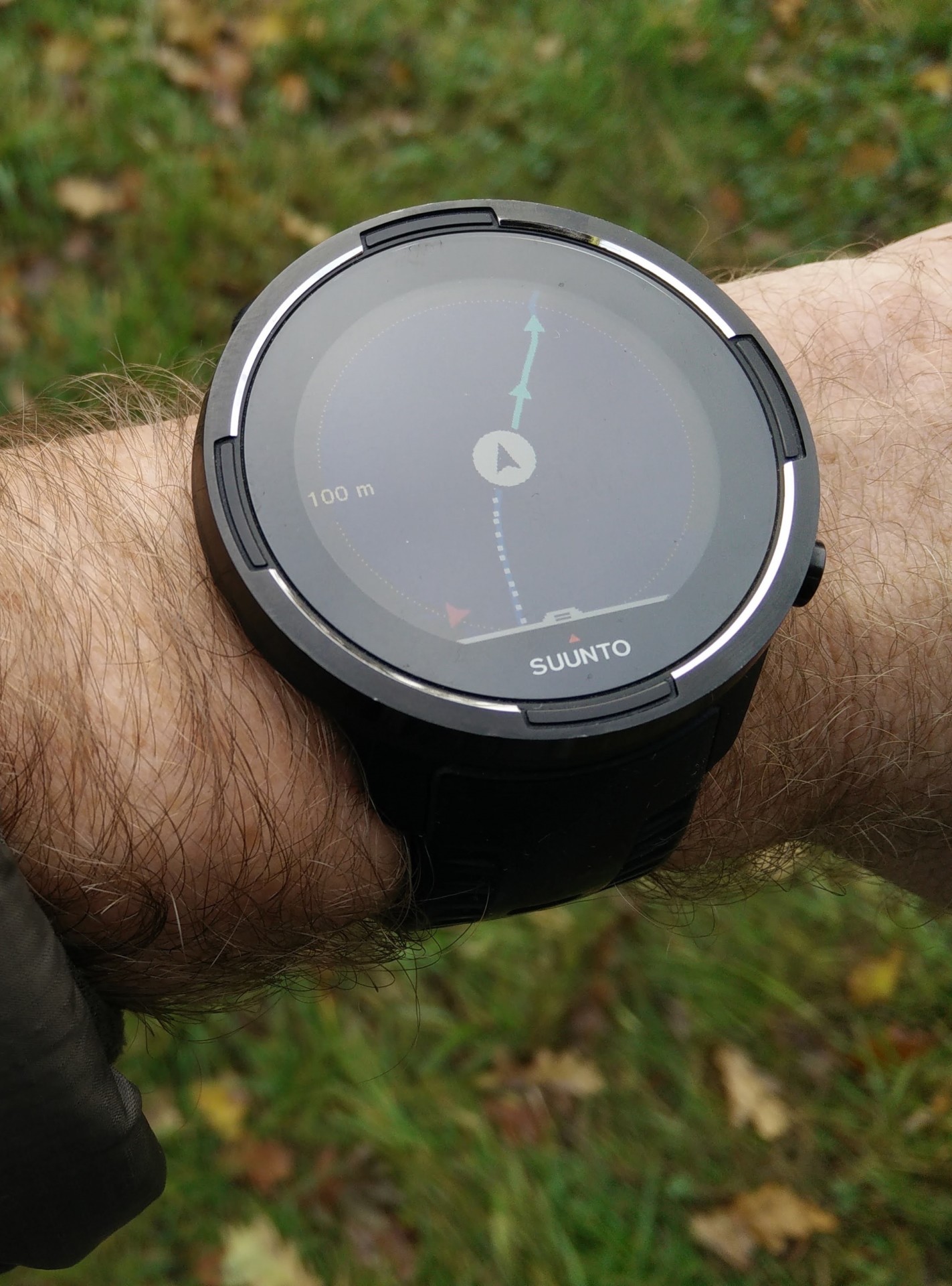
Suunto App allows you to import routes which means that you can create them with third-party route planning software
A route is simply a file with GPS data and there are many platforms which allow you to create and export routes. Therefore, you are not limited to the Suunto app when it comes to creating routes. You can create routes in your preferred software, export them as GPX files and import them to your Suunto watch. However, you will need the Suunto app to import routes; there is unfortunately no way around this at the time. Once you have the ready GPX file on your computer, you should transfer it to your smartphone via a USB cable or some kind of file sharing app such as Google Drive. Then you simply open this GPX file with the Suunto app, which will on its own figure out that you are importing a new route. To add the route to your watch you should tap on “Add to watch” in the route view in the Suunto app. While this might sound a bit complicated, it’s actually pretty easy once you get ahold of the concept.
The whole procedure is as follows:
- Create a route with third-party route planner
- Export the route as GPX file from the third-party route planner
- Transfer the GPX file to your smartphone
- Open the GPX file with Suunto App
- Save the route in Suunto App
- Tap on “Add to watch” in Suunto App
Now, let’s check out which third-party software I found the most useful for planning routes.
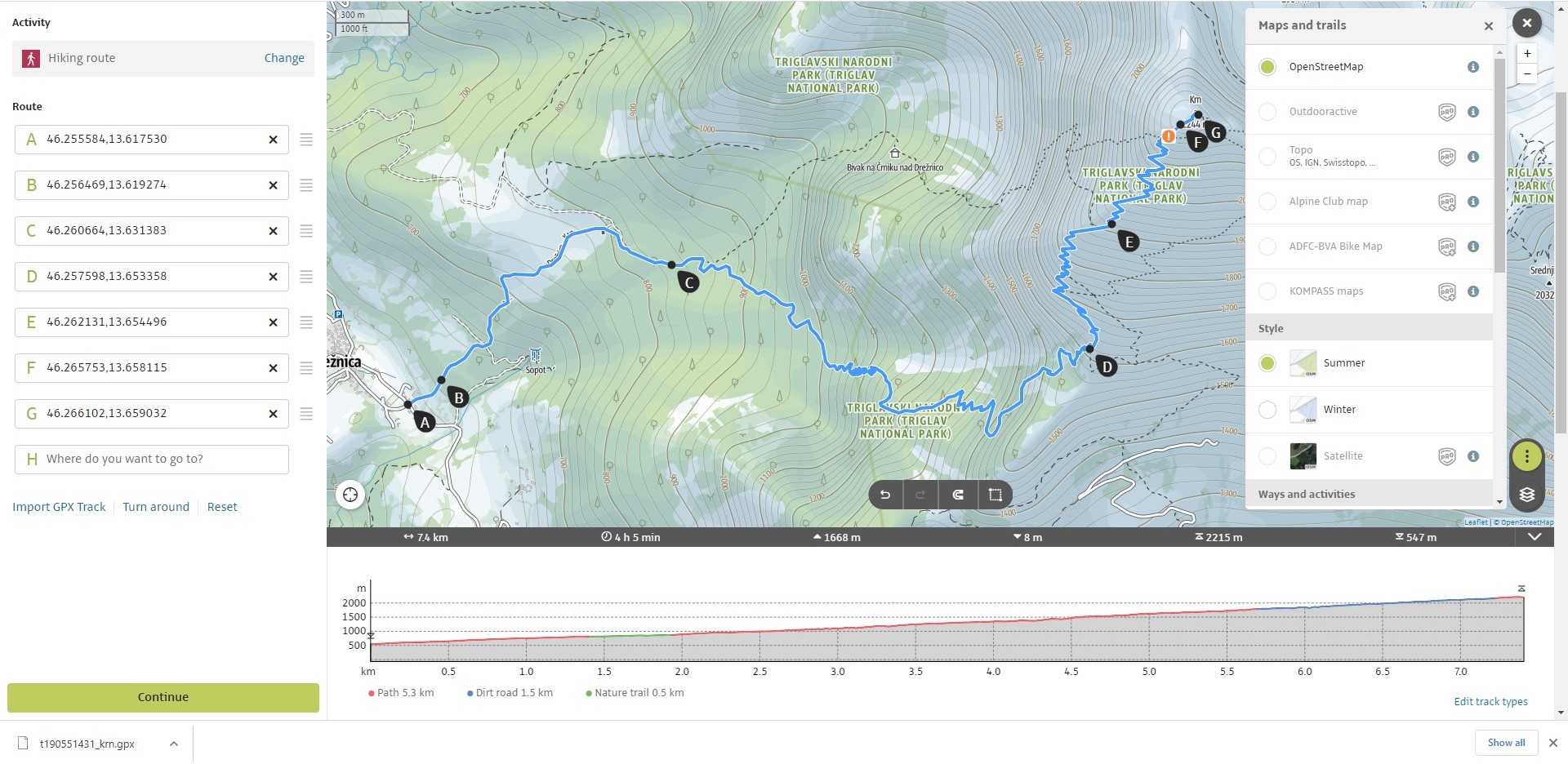
Gaia GPS Route Planner
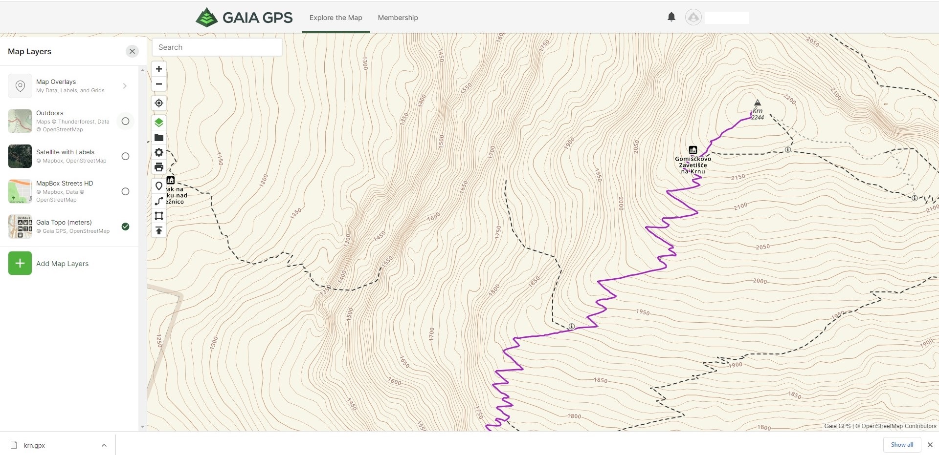
Gaia GPS Route Planner
The Gaia GPS route planner is the clear winner of all route planning software I tested because it offers a lot and can be used free of charge. It should be noted that many paid route planners don’t have as many features as the free version of Gaia GPS! It has numerous map overlays such as country-specific topographic overlays, air quality overlay and much more. I find the Gaia Topo overlay sufficient for most hikes, although when it comes to via ferrata trails I did notice that some paths are missing. Nevertheless, I found them on the OpenStreetMap overlay and thus I don’t consider this a big issue. Switching between the different layers and the satellite view is also fast and easy. The software excels at following paths between waypoints and shows information about distance, ascent, descent, maximum elevation and minimum elevation. Another great thing about the Gaia GPS, is that you can easily export the planned route as a GPX file or share it with your friends via a link. The interface is a bit cluttered and requires some time to get used to it. Nevertheless, Gaia GPS has quickly become my favorite web app for planning routes.
Try Gaia Gaia GPS Route Planner
AllTrails Route Planner
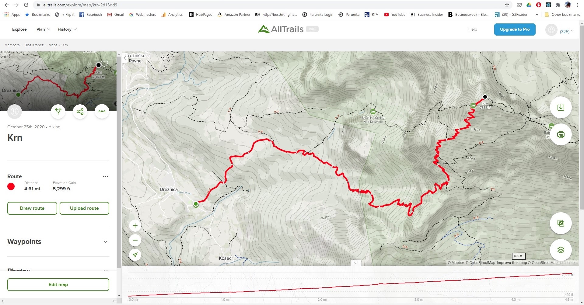
AllTrails Route Planner
I also found the AllTrails route planner extremely useful. The AllTrails Topo overlay is slightly better than Gaia GPS Topo overlay (i.e. it has more paths), but ultimately Gaia GPS does offer a bigger selection of overlays. I haven’t encountered any issues planning routes in AllTrails. The route planner nicely follows paths between waypoints and there have not been any bugs. It also provides information about distance and ascent while you are planning the route. However, there is no information about descent, maximum elevation and minimum elevation. I do, however, really like the distance markers feature which shows a label on the route for each kilometer or mile. You can easily export your planned route as a GPX file and share it with your friends.
Outdoor Active Route Planner
Outdoor Active Route Planner
Outdoor Active also offers a very good route planner. Nevertheless, in the free version you can only choose between two different OpenStreetMap overlays. I really missed the satellite view as I often use it to investigate the terrain. However, the Outdoor Active has some very neat features such as avalanche info, and other user notices through which different users can add information about various dangers on a given trail. The route planner did in rare cases have trouble following paths between waypoints but apart from that, I was satisfied with it. When you are planning a route it also displays information about ascent, descent, maximum elevation and minimum elevation. Exporting routes is simple and it also allows you to share them with your friends.
Try Outdoor Active Route Planner
Other route planning software
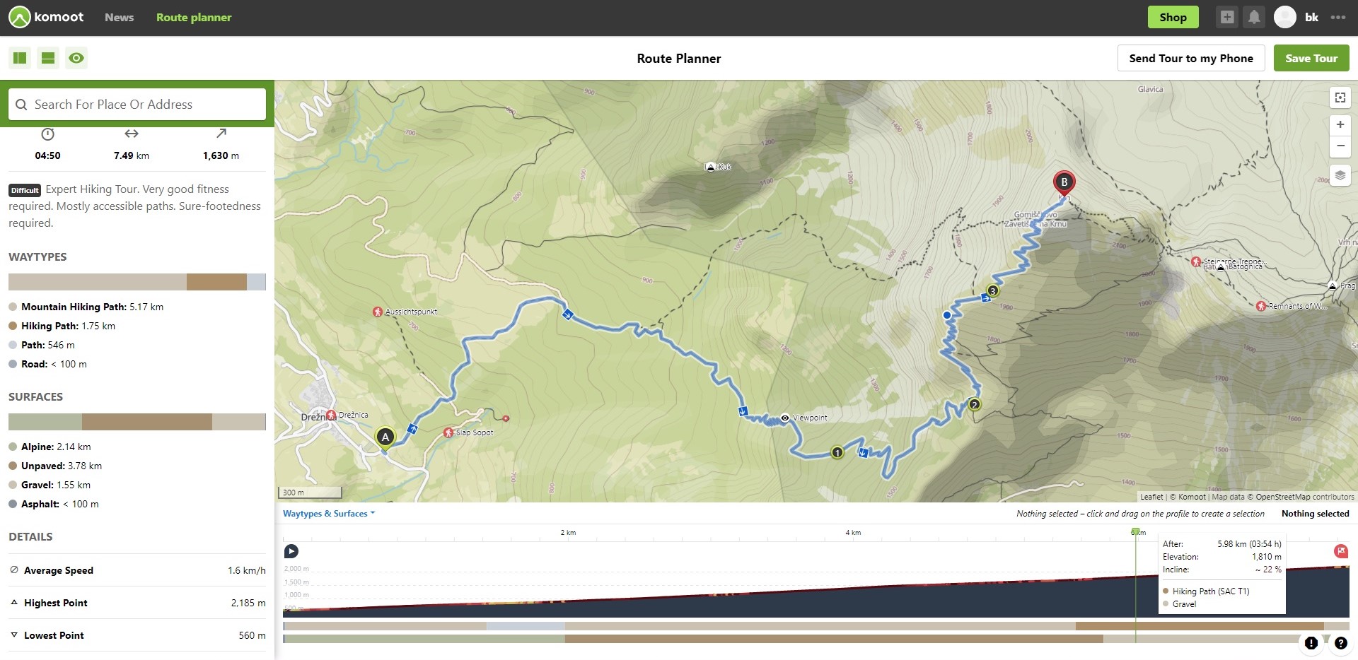
Komoot Route Planner
Besides Gaia GPS, AllTrails and Outdoor Active I also tested the following route planners: Komoot, Wandermap, Plot a Route, OS Maps and Sports Tracker.
The Komoot route planner positively surprised me, and I must say I found it the best of all route planners I tested. However, Kamoot doesn’t allow you to export routes unless you purchase the license (see pricing). Therefore, it can’t be used for importing routes to Suunto watches for free and as mentioned earlier, I was explicitly searching for free software. Otherwise, Komoot is an amazing route planner. It gives you time estimates for routes, shows terrain information (gravel, rocky etc.) and even technical difficulty of the path which is extremely useful for mountaineering. I thoroughly tested this feature and was positively surprised over the accuracy. So, if you don’t mind spending 30 € for a good route planner, you should indeed go with Komoot.
Other route planners didn’t really impress me. Sports Tracker is good because it uses the same infrastructure as Suunto App and thus the routes get automatically synced to the Suunto App. You don’t have to first transfer them to your smartphone. Note that this only works if you log into the Sports Tracker with your Suunto App credentials. Nevertheless, Sports Tracker doesn’t support topographic maps and there is no satellite view. So, for mountaineering and hiking it’s pretty useless. It does, however, come in handy for planning routes for running, cycling etc.
Conclusion
I must say that I’m surprised that there are so few good options of route planning software on the web. Nevertheless, Gaia GPS, AllTrails, Outdoor Active and Kamoot all have very good route planners which are suitable for all types of activities. I’ll stick with Gaia GPS, but if you have some extra money to spend and are searching for something that can handle mountain routes well, I do recommend going for Komoot. Hopefully Suunto will make a web app soon so we’ll be able to plan routes without the whole export/import procedure.
I’d love to hear your thoughts on this topic. Share them in the comments section below.


With a Traverse, as at 21 December 2020, two things are different.
1. SuuntoApp will NOT send your route from your phone to Traverse, at least not on Android.
2. On the other hand Movescount and the cable both work fine.
So the process is slightly different and takes place entirely on your PC:
1. Export from the 3rd party map maker to your PC. With AllTrails, the only one I’ve tried, use GPX Route rather than GPX Track.
2. Import into Movescount and save.
3. Connect Traverse to PC with the cable and sync using SuuntoLink.
However, since Movescount still works I only use this process when I find a route on another site that I want to use myself.
I’ve got a Traverse Alpha and use AllTrails. honestly, I’ve been planning my routes in AllTrails, uploading to Movescout, then syncing to the Traverse up until now with no issues, but what happens when Movescout is gone? I can’t seem to find a decent answer to that. I’ve imported a route manually to the SuuntoApp (Android), and did a sync with the Traverse. Nothing went over to the Traverse.
I’m a bit pissed at Suunto for this.
Hi there,
I don’t have any problems importing routes created with 3rd party software to Suunto 9 via the Suunto app. In this case I think you should contact Suunto support. I hope they get back to you soon! 🙂
@Wafi, For Traverse watches, Movescount will still work to transfer routes to the watch. You use Suuntolink and your charging cable. It is a bit more cumbersome than using the app but not so bad.
There is no “Add to watch” option in Suunto App that I can see. Maybe a screenshot of this could be added to the article.
My guess is it only works for watches with direct (Bluetooth) connection. Ambit2, etc. connect to the PC running Suuntolink via USB, then via the internet ‘cloud’ with Suunto app running on the android device.
What we really need is a simple PC app to download/upload GPX data via USB directly with the watch. That would involve reverse engineering a working example, but with Moveslink no longer available (it seems) to use as a reference this boat may have sailed unfortunately.
Hi Bernard,
If you have Ambit 2 watch, you should create (or import) GPS route in the Movescount. Ambit 2 pulls settings and routes from there. I tested this a couple of weeks ago and Suunto Link does prompt you for Movescount credentials when it detects Ambit 2 watch. I guess the same applies for other non-bluetooth watches from Suunto. The whole software situation is indeed confusing at the moment 🙂
Regards,
Blaz
I used Sports Tracker application before getting the watch and Suunto app. Sports Tracker is application from Suunto and it has web interface too and the routes can be planned on PC and then they get synchronized to Suunto app and can be synced with the watch also. So you can use Sports Tracker for planning the routes as well.
I find Sports Tracker good for planning running routes and such but for hiking and mountaineering it’s not so great. It lacks topographic maps and satellite view. I was also a bit annoyed that you can’t import GPX tracks. I guess it really depends what kind of activity you are planning.
Regards,
Blaz
Have you had any luck with getting waypoints to transfer across into the suunto app? I like to have summits labelled as waypoints, and these remained when files were imported into movescount (and so went onto the watch), but the waypoints seem to disappear in suunto app?
Hi there,
I haven’t tried transferring the waypoints. I’m planning to test this shortly. I’ll update the article with my findings.
Regards,
Blaz
Hi, just found this and was wondering if anyone can help, please? I had no problems downloading gpx files of routes to my Suunto Ambit 3 Sport, when using Movescount. Now that’s gone I can’t do the same with the Suuntolink App. Doesn’t seem to recognise my watch at all. It is synced with the phone but won’t accept the routes. Does anyone have an idea how I can get a gpx route onto my watch, please?
Many thanks,
Gerry
I have the same problem with my Ambit 3 Peak. The app and the watch are synced but the routes I create/import won’t get imported to my watch (and I have chosen “add to watch”).. Very frustrating..! 🙁
Hello. This is my first time posting a comment on NAIL THE TRAIL.
I’d like to introduce my method for transferring a GPX file created on a PC to a Suunto watch.
Preparation:
You will need both a Windows PC and an Android device. The PC requires the installation of SuuntoLink and connecting the provided USB cable. The Android device needs SuuntoApp as described in this article in this web page.
Connect your Suunto watch to the PC using the USB cable and execute SuuntoLink.
Following the steps in “The Basics” section of this article, manipulate the SuuntoApp on your Android device. The GPX file will be transferred to your Suunto watch through SuuntoLink.
I’ve tested this on Windows 11 and Suunto Traverse.
Good luck!
Hi
Do you also have a solution to send waypoint to the Suunto?
I try to plan a 15 day tracking on my mac. White garmin explorer I can send tracks and waypoints to the Fenix watch. I think about buy a new fenix 7 Pro or the new suunto. But the point is, i like to send waypoints like (sleeping, water, point of no return, etc) to to watch and to the garmin gpsmap 67i
Hi Tobias,
Once you import your route to Suunto app you can add waypoint there. You choose the route from the library and then you tap three dots in the top right corner. You tap “edit route” and then you add waypoints by holding your finger on the desired location on the map for three seconds. The dialog box will appear and there you tap add waypoint. Alternatively you should also be able to add waypoints with GPX studio on desktop. You load your GPX file and then add waypoints. I haven’t tested this but it should work.
Best regards,
Blaz