Sass Pordoi Trail
About Sass Pordoi Trail
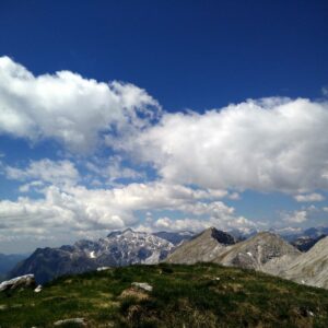
In July 2019 we went to the Italian Dolomites for several days where we hiked, climbed mountains and tested hiking gear. We stayed in a small town called Arabba which is known to be a top-tier skiing destination. Nevertheless, Arabba is also a great destination for active summer holidays because it’s surrounded by high mountains and only 9 kilometers away from the popular Pordoi pass. The Pordoi pass lies at an altitude of 2239 meters (7346 ft.) and many hiking/mountaineering trails start there. So, it was relatively easy for us to climb a mountain every day because we didn’t lose time driving to remote places. Staying in Arabba was also good to get adjusted to the altitude. Arabba lies at an altitude of 1600 meters (5250 ft.) which indeed helped us to get accustomed to the thin air.
For our first hike, we decided to climb the 2950 meters high Sass Pordoi from the Pordoi pass. We arrived to Arabba relatively late (around noon) and the weather was very unstable with a chance of thunderstorms. Therefore, this relatively short and not too demanding ascent seemed like a great option. The Sass Pordoi peak is otherwise a very popular destination, not least because you can take the cable car to the top. We decided to hike to the top, but we did take the cable car down because it started thundering and raining. The trail is not technically difficult and besides from good footwear it doesn’t require any special mountaineering gear in summer. You should be, however, reasonably fit for this trail because it’s quite steep. Below is the trail review.
Sass Pordoi Trail Details
Physical Difficulty
Medium
Technical Difficulty
Demanding
Duration
1 h 30 min
Distance
3 km
(1.86 mi.)
Ascent
706 m
(2316 ft.)
Descent
56 m
(184 ft.)
Highest Point
2945 m
(9662 ft.)
Lowest Point
2237 m
(7339 ft.)
Date of the Hike Date when we did this hike ?
July 2019
Weather On the day when we did this hike ?
Cloudy/Thunderstorm
Temperature On the day when we did this hike ?
15° C
(59° F)
Wind On the day when we did this hike ?
5 km/h
Warning!
This trail is technically demanding and requires experience with alpine mountaineering and good footwear.
Sass Pordoi GPS Route and Trail Description
*Click on the chart to see the location on the map
GPX route helps you with the navigation on a hike. It can be used with a smartphone, handheld GPS device or a GPS watch.About GPX Route
Reaching the starting point
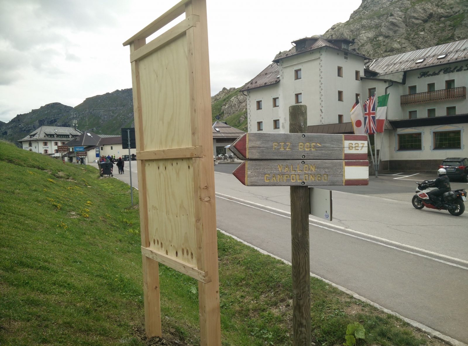
The trail starts at the Pordoi pass (coordinates 46.488969, 11.811467) which lies between the famous ski resort Canazei and the popular town of Cortina d’Ampezzo. If you are arriving from the west or south-west, you should first drive to Canazei and then take the Strada Dolomites to the pass. In case you are arriving from the north, it’s probably best to first drive to Arabba via Brunico on road SS244. From Arabba it’s only a fifteen-minute drive uphill to the pass.
If you are arriving from the east or south-east, I recommend taking the Italian A27 highway towards north which will eventually turn into state road SS51. Just before reaching Longarone, you should turn left and follow the direction signs for Arabba. The road will take you through the villages of Forno di Zoldo, Pescul and Piave di Livinallongo to Arabba. The road is relatively narrow but in a good condition. You will also come past some amazing viewpoints. When you reach Arabba, continue through the town towards Passo Pordoi. After driving for 9 kilometers or so, you will reach the pass.
There are several parking lots at the pass. We parked our car on the parking lot closest to the cable car station, free of charge. However, we did notice a sign there that says: “Only for cable car customers”. Nevertheless, it seemed that there was no system in place to verify who indeed is a cable car customer. Since we did take the cable car down, we kept a clear conscience!
Trail
If you park on the parking lot closest to the cable car station, you should first walk over the main road, and on the right side of the cable car station you will see a directions sign. Now, ironically the trail towards Sass Pordoi is not listed on this directions sign, but if you go towards Piz Boe you are on the right way. Higher up, you should follow the direction signs for Rifugio Forcella Pordoi which is a mountain hut just beneath the peak. The trail is in general well-marked with direction signs and because it’s pretty busy, navigation shouldn’t be a problem. Nevertheless, you can also download our GPS track above for free and use it with your smartphone, handheld GPS device or a GPS watch.
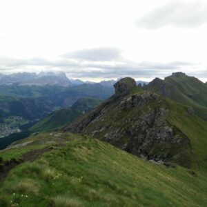
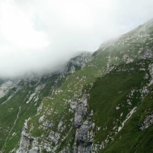
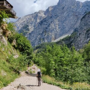
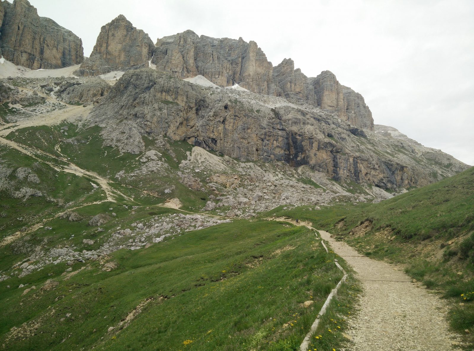
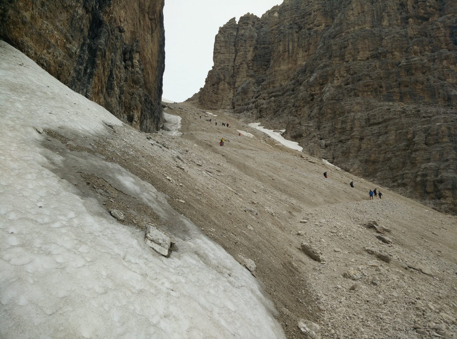
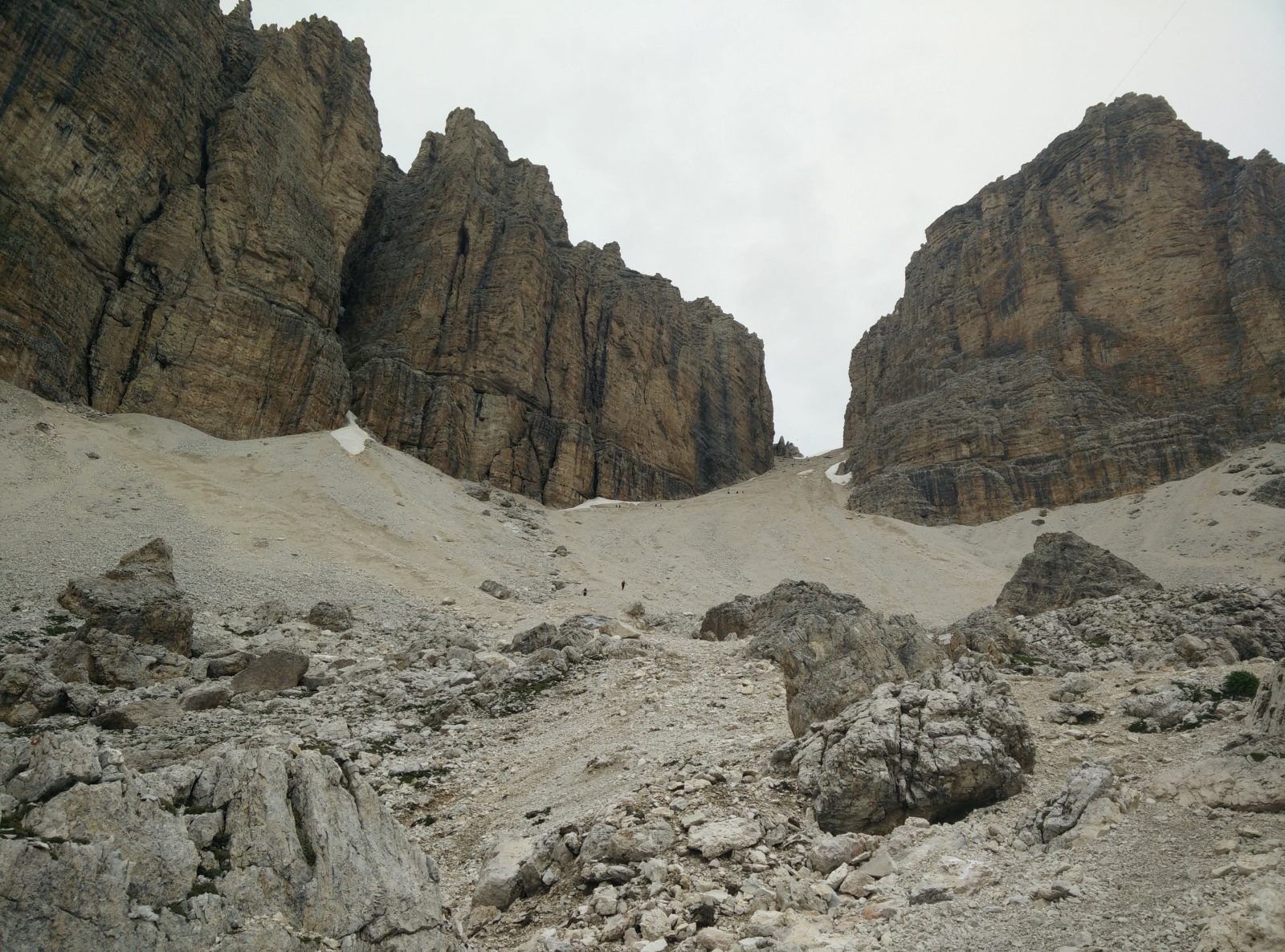
On the right side of the cable car station, the wide path ascends gently over grassy terrain and leads you towards north. After 800 meters or so, the trail becomes rockier, steeper and soon turns towards the cliffs in the direction of west. Eventually you will end up on a scree beneath the southern wall of Sass Pordoi. Good footwear is essential for this stretch as the surface gets quite slippery, especially in wet weather. From here, the trail starts ascending towards the pass between the southern wall of Sass Pordoi (west) and the southern wall of the unnamed peak to the east. Here the trail gets particularly steep and just beneath the pass there was still some snow in mid-July. However, the authorities have attached a rope there so the climbers can ascend/descend safely. I believe that this is a standard practice in case that there is still snow in the summer season.
Nevertheless, we got a bit impatient with the queue at the rope, so we scrambled our way past the other hikers. The snow was anyway melting and thus we had enough grip to do so safely. A couple of minutes later, we reached the Rifugio Forcella Pordoi mountain hut on the top of the pass. Here you can buy warm drinks and probably also food. We didn’t, however, pause at this mountain hut because we knew that there is also a restaurant on top of Sass Pordoi.
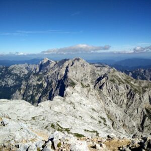
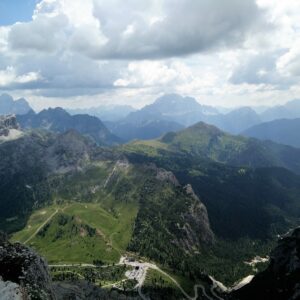
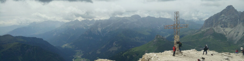
From the mountain hut, you should continue towards north-east on a rocky path. The path will soon turn towards south-west and bring you to the top of Sass Pordoi. We needed approximately 10 minutes to reach Sass Pordoi from the Rifugio Forcella Pordoi mountain hut. The view at the top is just amazing. You can see many beautiful peaks, including the famous Marmolada massif.
We stopped at the restaurant, which is also the end station for the cable car, for a cup of good Italian coffee. To our surprise the prices seemed very reasonable.
Getting back to the starting point
While we were enjoying the last sips of coffee, it started raining and thundering. Therefore, we decided to take the lift back to the Pordoi pass. Thunderstorms are no joke in the Alps. Going down with the cable car was a great but a bit pricey experience. We paid 9 € per person for the way down. Note that going up is more expensive (12 €) while the return ticket costs 19.5 €.
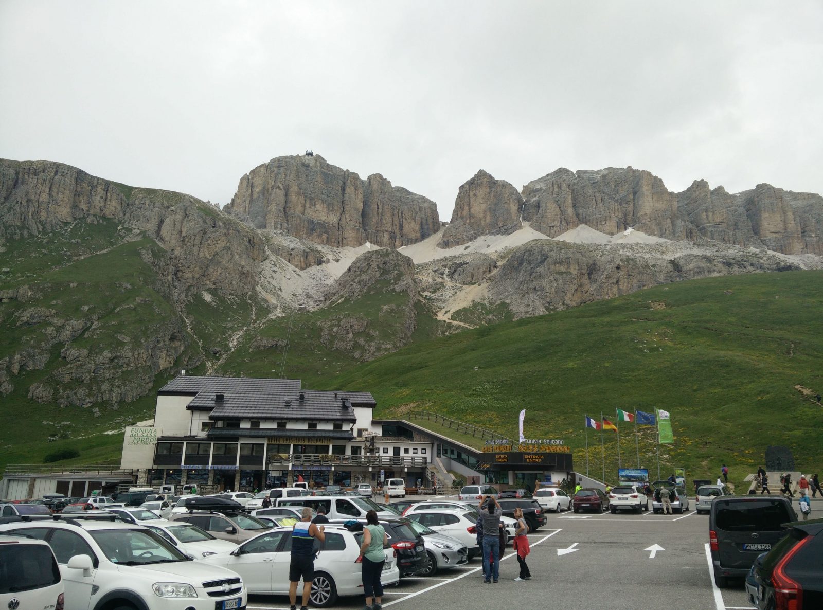
Sass Pordoi – Passo Pordoi is the starting point
Sass Pordoi – The wide path in the beginning
Sass Pordoi – The pass between the southern wall of Sass Pordoi (left) and the southern wall of the unnamed peak to the right
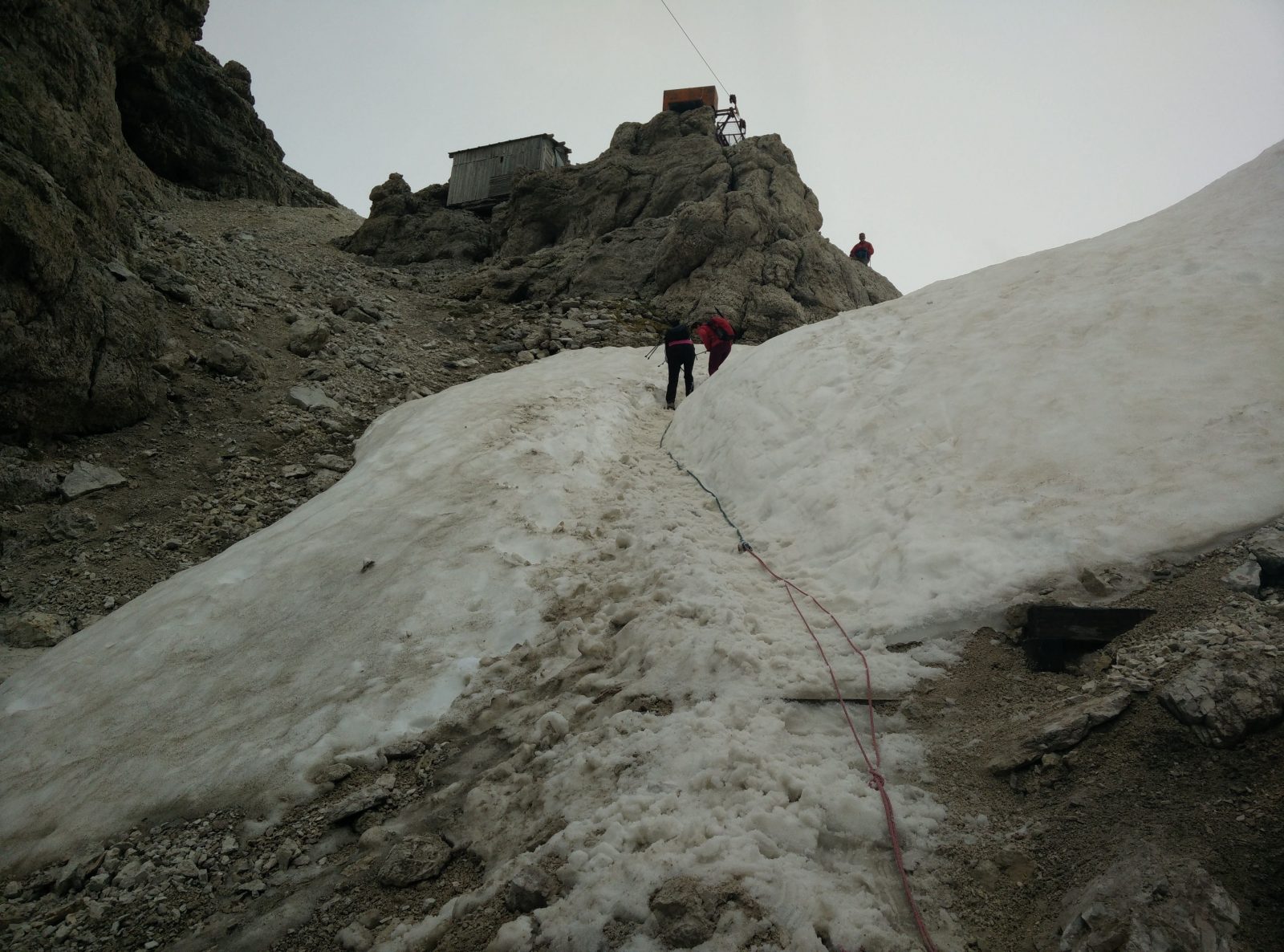
Sass Pordoi – Authorities have attached the rope as there was still some snow on this steep stretch
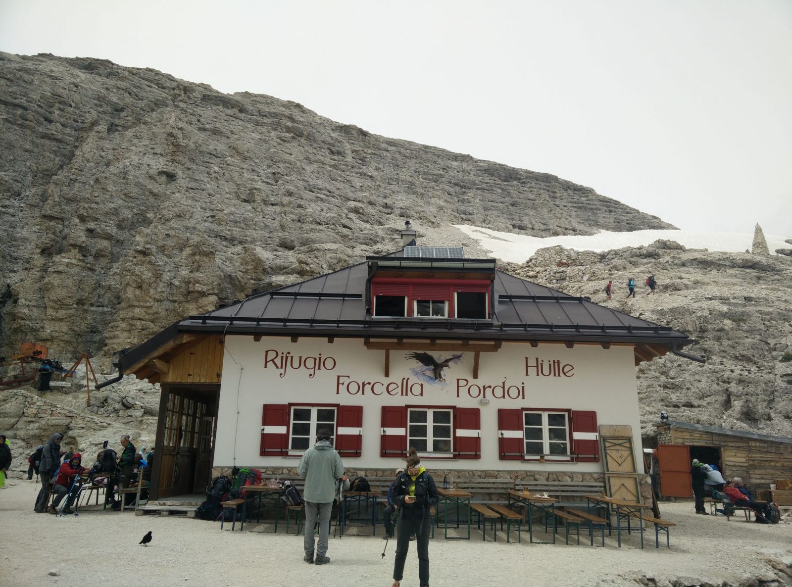
Sass Pordoi – The Forcella Pordoi mountain hut is just beneath the peak
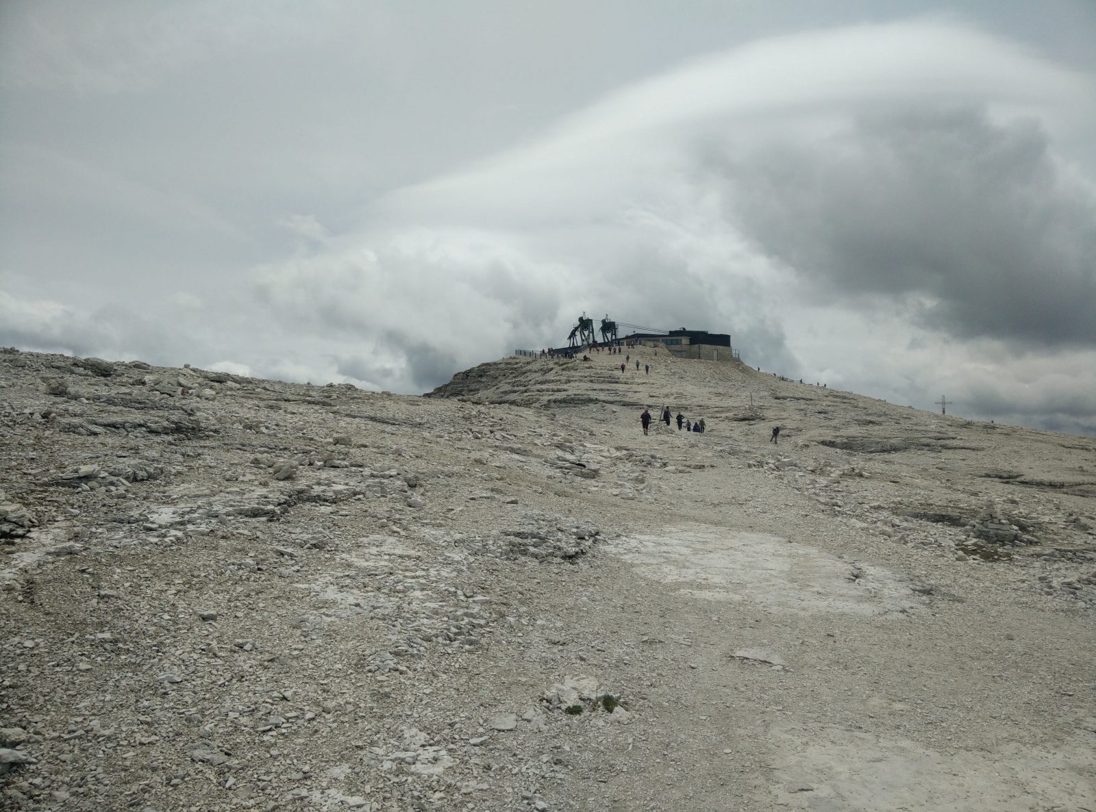
Sass Pordoi – Approaching the top
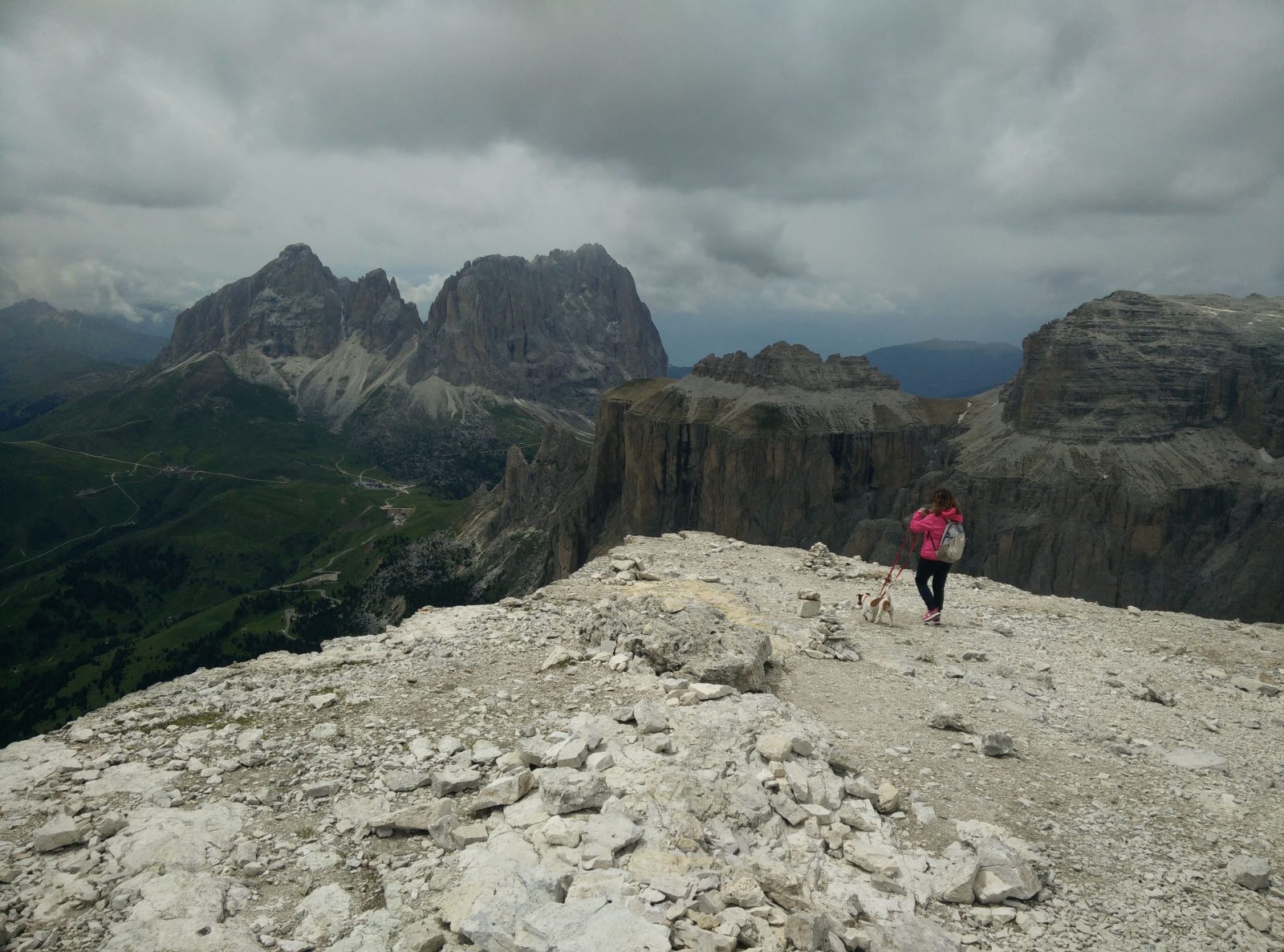
Sass Pordoi – View from the top is amazing
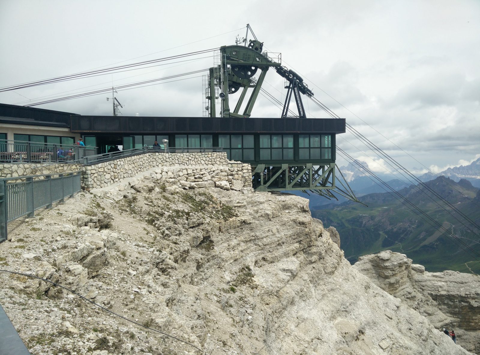
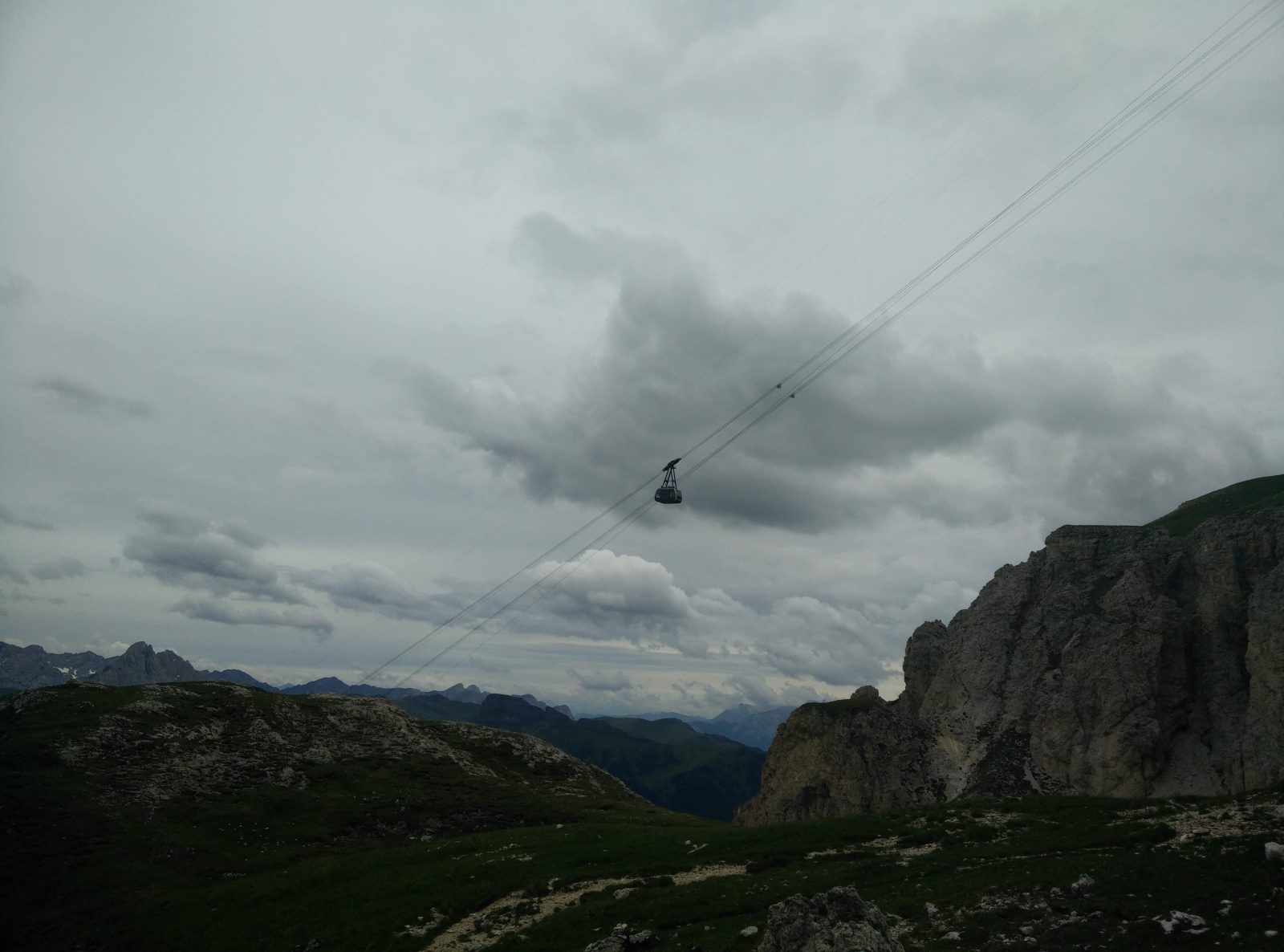
Sass Pordoi – The cable car station and restaurant at the top
Equipment
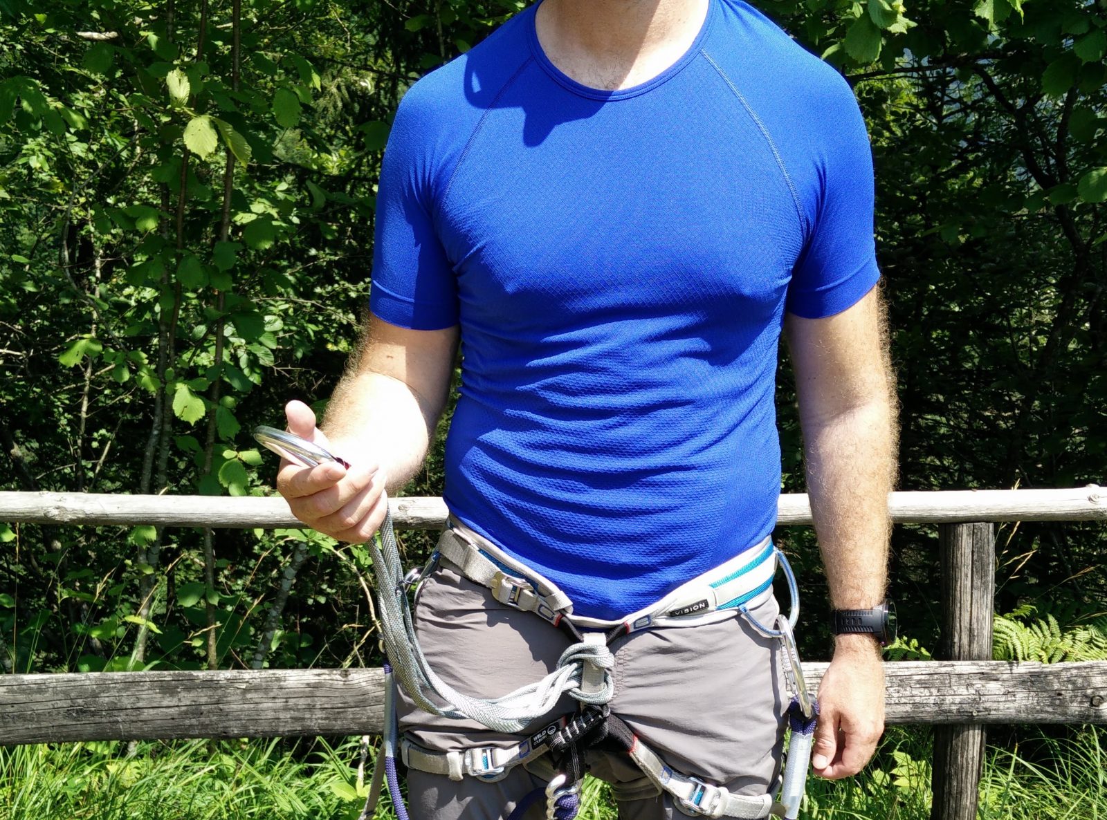
I knew that this would be a short hike, but since the weather was very unstable, I took a little more clothing with me than usually. I was wearing the Falke Cool T-Shirt, Montane Terra Pack pants, Salewa Mountain Trainer Mid hiking boots and a sun hat. In my Osprey Talon 22 daypack I was carrying 2 liters of water, Mountain Hardwear Monkeyman fleece jacket and the Montane Minimus rain jacket. At the first mountain hut I had to put on the fleece jacket because it got quite cold up there. When it started raining, I also put on the Montane Minimus rain jacket. During the hike I used the lightweight Montem Ultra Light 3K Carbon trekking poles for extra support and traction.
Equipment under scrutiny
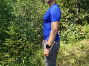
Falke Cool T-Shirt
Falke Cool T-Shirt – From the front
I wore the Falke Cool T-Shirt for the first time on this ascent and I was very satisfied with it. The t-shirt is made of super porous nylon fabric and thus it’s very breathable. I was also surprised over its moisture-wicking properties. You can literally feel how it pulls the moisture from your skin. However, I did notice that the t-shirt dries slightly slower than my other synthetic base layers while on the body. Nevertheless, I wouldn’t say that the drying time is problematic. On this hike it got soaked with sweat but it was already completely dry when I came back to the starting point. You can read the full Falke Cool T-Shirt review here.
Conclusion and photo gallery
The Sass Pordoi trail is a great day hike, which is suitable in the summer time for anybody who is reasonably fit. Nevertheless, do check the conditions on the trail and weather forecast before going. In case that the trail is covered with snow (can also happen in summer, although rarely), I recommend postponing this hike unless you have experience with winter mountaineering and appropriate gear such as ice axes and crampons. The same goes for bad weather. Thunderstorms can be very dangerous in the Alps.
Sass Pordoi - The directions sign at Passo Pordoi
Sass Pordoi - The path becomes rockier and steeper
Sass Pordoi - Some take the easy way up
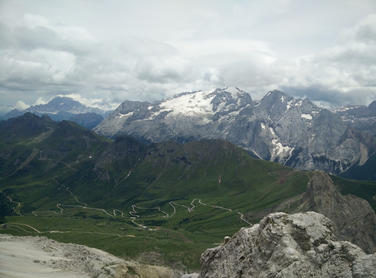
Sass Pordoi - View on the Marmolada massif
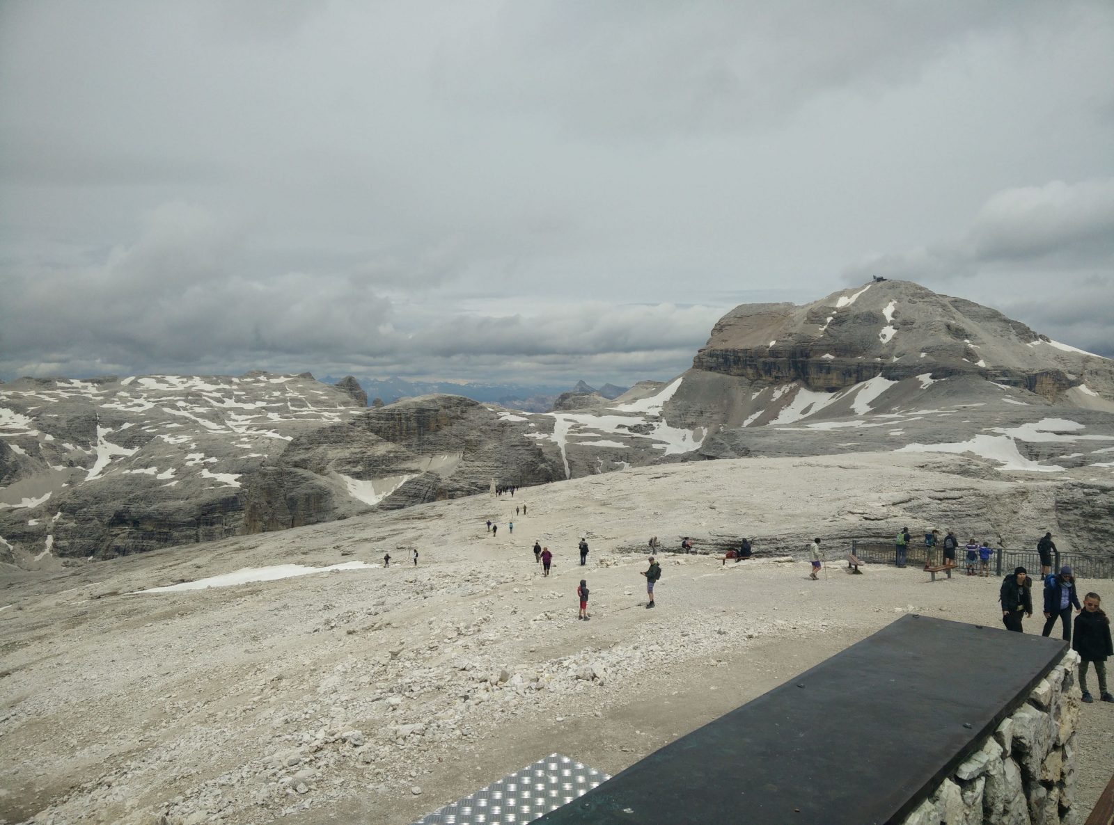
Sass Pordoi - View on the higher Piz Boe
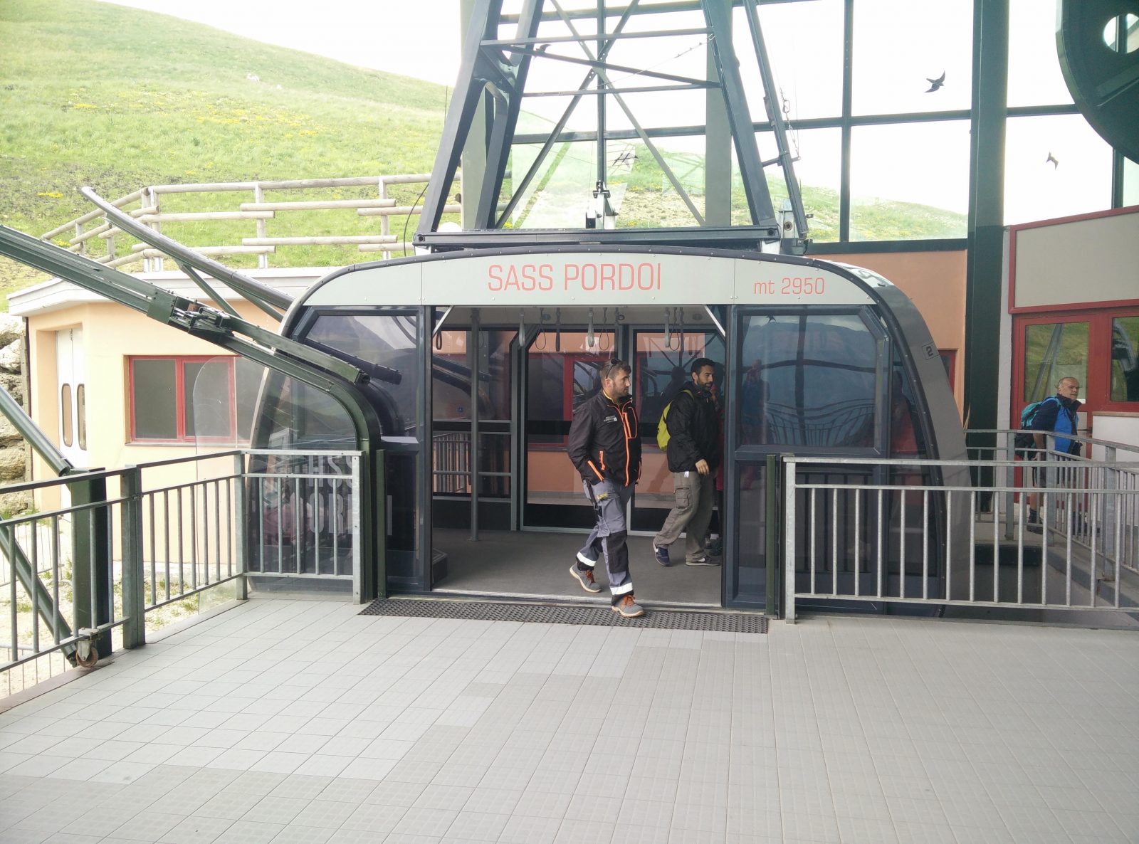
Sass Pordoi - The cable car at the bottom
If you have any questions about this hike, please drop me a line in the comments below.