How to print topographic maps for free
When you go out hiking, it’s good to bring a map, especially if you’re hiking in areas with little people or terrain that’s tricky navigation-wise. Electronic devices such as smartphones and handheld GPS devices are indeed great, but they don’t replace a map and a compass because they’re not as reliable. They can run out of battery or signal might be weak in some areas. Now, that’s all clear and fine but where do you get a topographic map? I’ve been always wondering that. Since I hiked a lot in the Alps, I did buy some maps of the areas in the Alps where I hiked the most. However, buying a map for every hike would make hiking quite an expensive and inconvenient sport. So, I started digging where I could find good topographic maps online for free in a format that can be easily printed.
I quickly figured out that getting printable topographic maps for United States is very simple. However, that’s not the case for Europe and the rest of the world. Nevertheless, it is also possible to get good topographic maps for printing for other countries with software utilizing OpenStreetMap. Below you’ll learn how to print topographic maps for free for any location in the world.
Table of Contents:
- How to print topographic maps for United States?
- How to print topographic maps for Europe and the rest of the world?
- What paper to use?
- Conclusion
How to print topographic maps for United States?
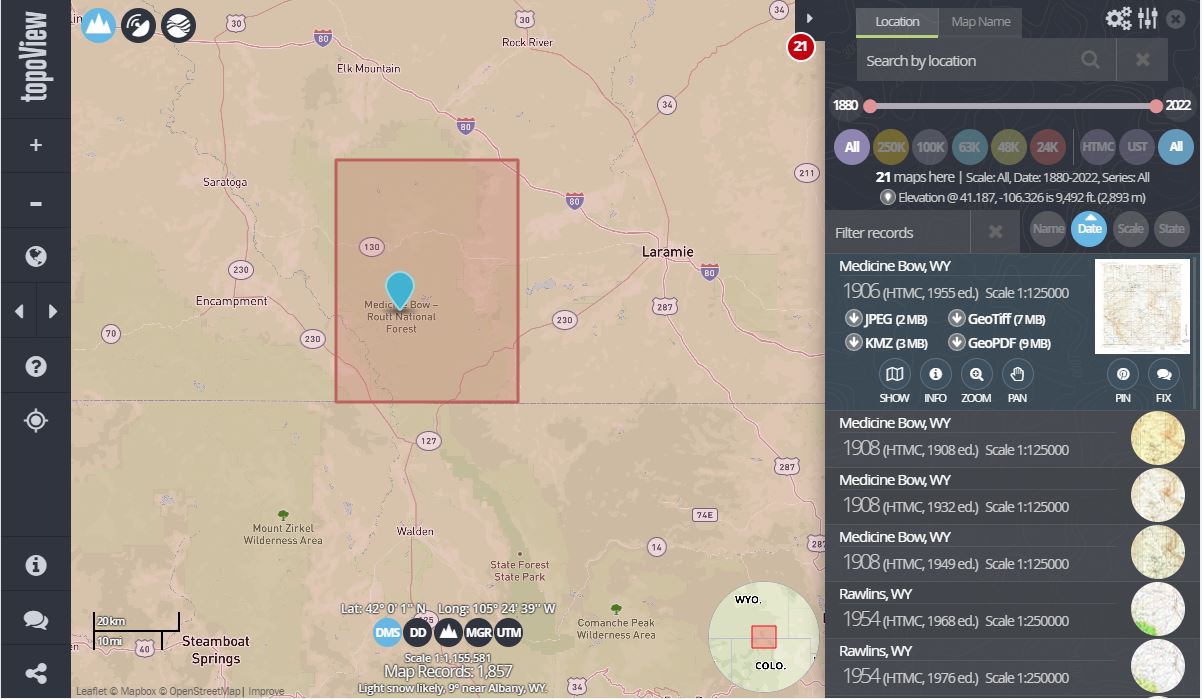
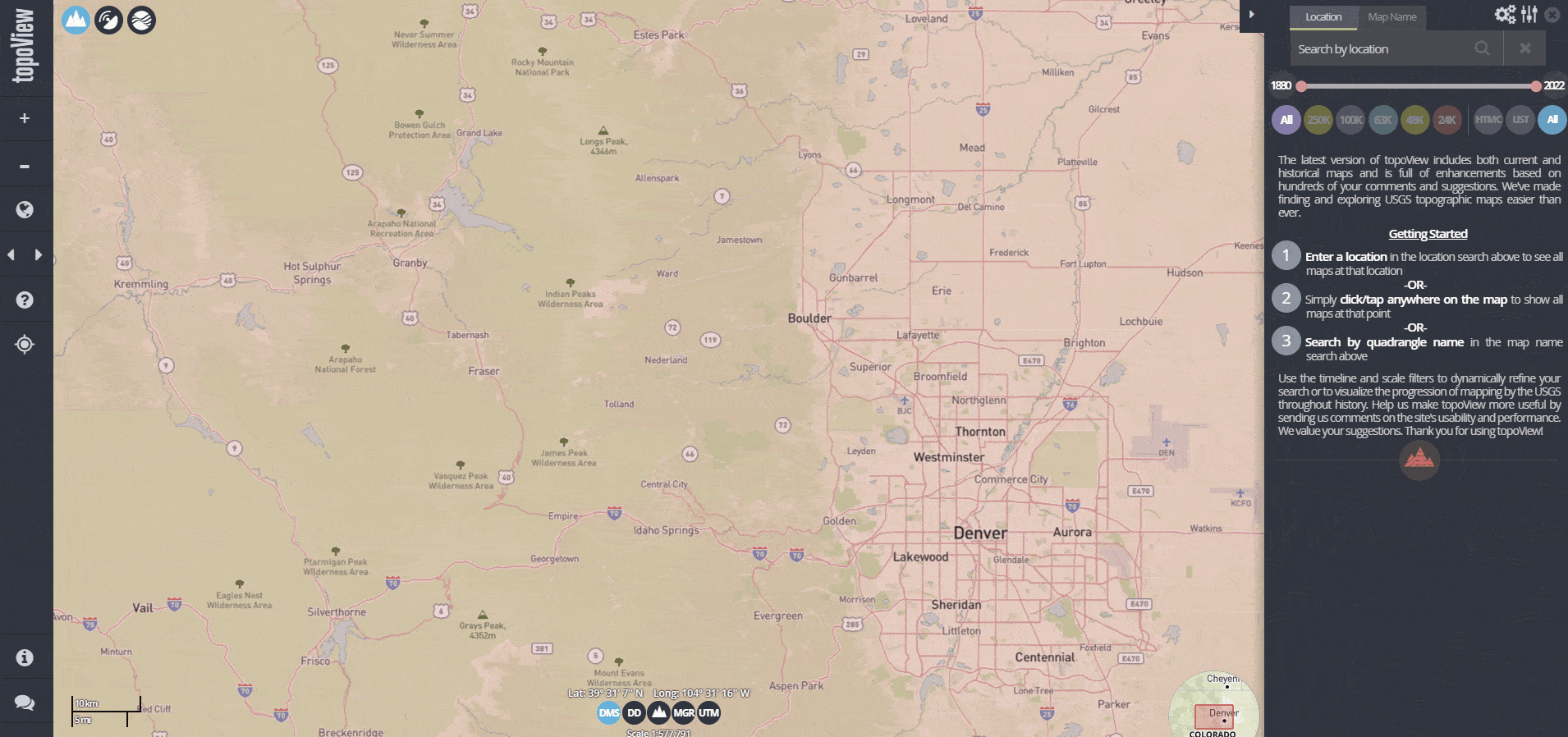
National Geologic Map Database: It enables you to print topo maps for free
Option 1: National Geologic Map Database
Website: https://ngmdb.usgs.gov/topoview/viewer/
Best for: Those who have a printer for printing very large documents
The National Geologic Map Database enables you to download maps at various scales for the whole United States. You simply head here, click on the location and click download as GeoPDF.
The good thing about the National Geologic Map Database is that it offers maps at different scales, from 1:24.000 to 1:250.000. Furthermore, you can also download historical topographic maps. Each map comes with legend, title, scale, grid, orientation indicators and source notes.
Printing maps from National Geologic Map Database is a bit trickier. The maps are in sizes 630 x 891 mm. A4 paper size is 210 x 297 mm and most of us only have printers that support printing on A4 paper. However, if you open the downloaded map in Adobe PDF viewer and click on printer icon in the top bar you can choose to print the document as poster. That will split the map into multiple A4 papers. Nevertheless, getting maps from National Geologic Map Database is best if you have an option to print very large documents. Otherwise, I recommend checking the National Geographic Maps instead (see below).
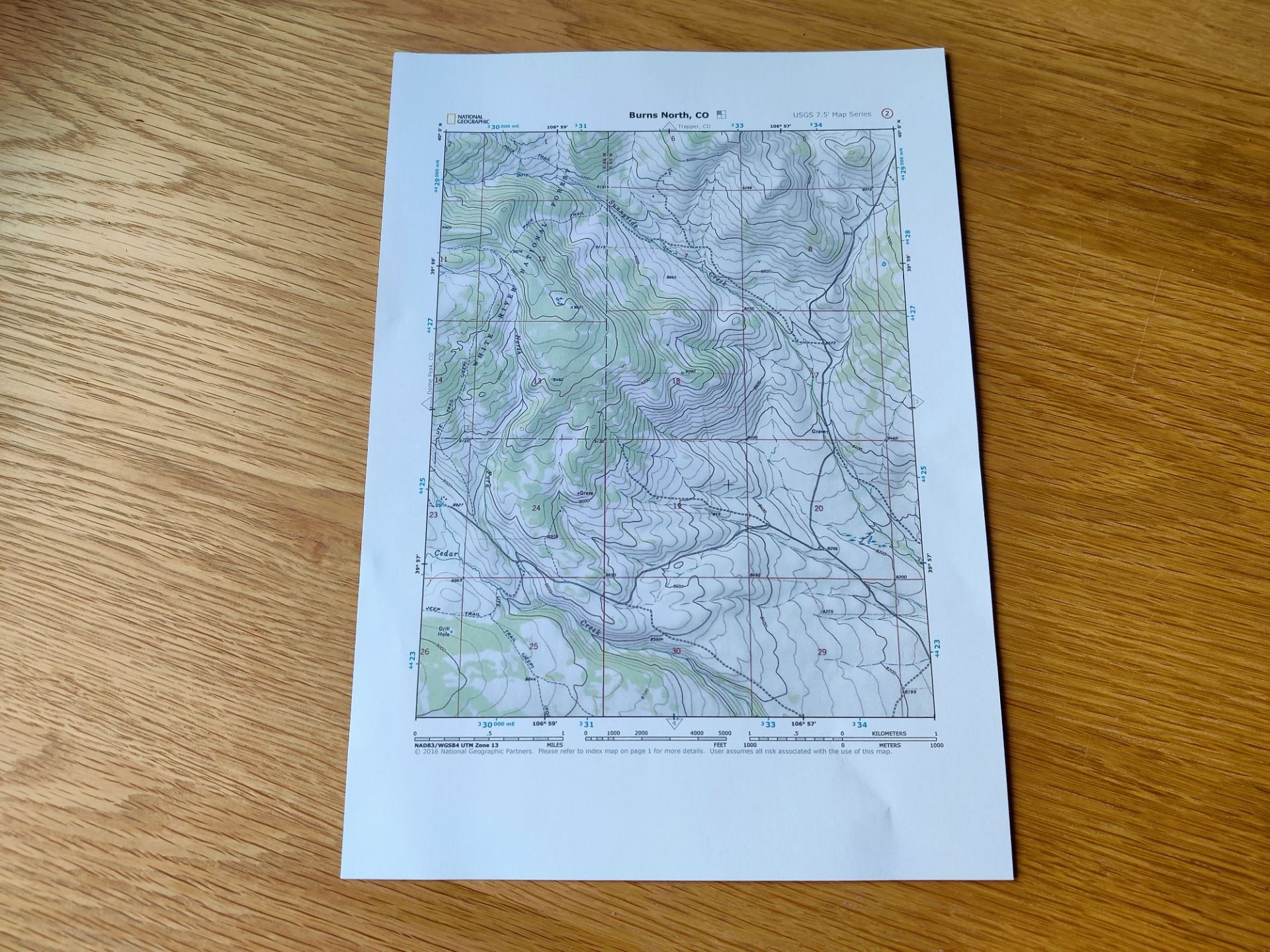
National Geographic Maps: The easiest way to print topo maps for US for free
Option 2: National Geographic Maps
Website: https://www.natgeomaps.com/trail-maps/pdf-quads
Best for: Those who only have access to A4 printer
The National Geographic Maps portal works very similar to National Geologic Map Database, but the exported maps are in A4 format which means that you can easily print them at home. To download the map, you zoom in and choose the area by clicking on a red dot on the map. The selected area will open as a map in PDF format. It will be in five pages. The first page shows the area that the other four pages capture. This first page is at 1:100.000 scale. The other four pages are more detailed maps at 1:24.000 scale.
How to print topographic maps for Europe and the rest of the world?
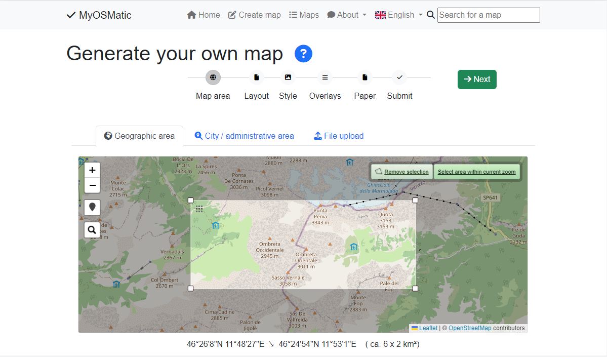
get-map software enables you to print topo maps for free for anywhere in the world
Website: https://print.get-map.org/new/
But what if you need a map for outside the United States. Well, then it gets a bit trickier. Many countries have their own equivalent system which works like the American National Geologic Map Database. However, writing about map databases for each country in the world would be a bit too extensive for this article. Therefore, I’ll instead introduce you to a free software which enables you to print topographic maps for anywhere in the world.
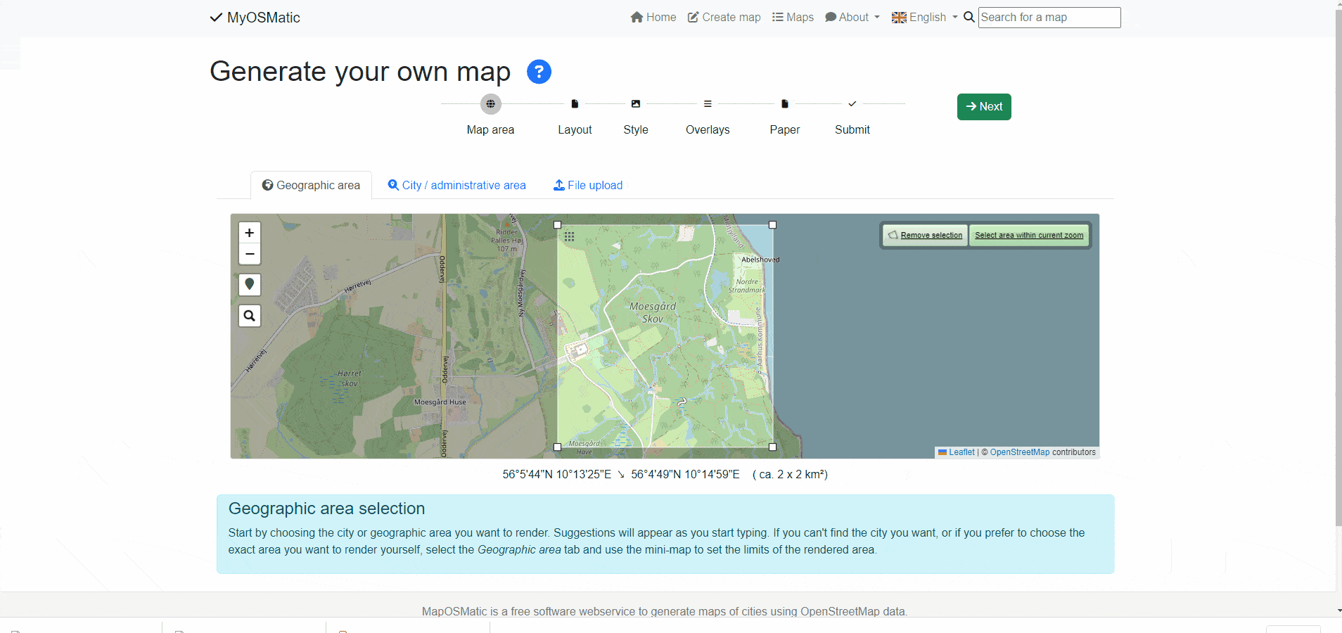
The get-map.org is an open-source project that makes printing topographic maps easy. To print a topographic map head here and select geographic area by clicking on “select area”. Adjust the area to capture what you want to see on the map. Then click next and select “Full-page layout without index” for layout and OSM Notes index for Indexer. In the next step you choose the map type. I found the OpenTopoMap to be the best for hiking. After that you choose the overlays. I recommend selecting “Compass rose”, “Scale bar”, and “UTM Grid”. In the last step you choose paper size and orientation. After that you just click on generate and the map will download to your device in PDF format, ready to be printed. Note that generating the map might take a few minutes.
The get-map.org software has a lot of options. After testing it for a while, I figured out that the settings I mention above work best for my needs. If you figure out that other settings work better for you, please let me know by adding a comment below. The downside of this software is that that you can’t choose the scale of the map. Instead, you select the area you want to capture and then the map has a corresponding scale to fit selected paper size (A4, A3 etc.). I always end up with some weird scale that makes measuring distances hard.
What paper to use?
For printing maps it’s better to use glossier and more durable paper because such a paper will last longer out on trails. Alternatively, you can laminate maps printed on regular paper. You will need a laminating machine but those are actually quite inexpensive. You can get a decent laminator for $25. The advantage of laminating your maps is also that you’ll be able to draw on them with a marker. After use you can clean the ink off with alcohol.
Conclusion
If you want to print topographic maps for free for United States use National Geologic Map Database or National Geographic Maps. The advantage of National Geographic Maps is that the maps come in A4 format and are thus easy to print. For other countries you can use get-map.org which enables you to print topographic maps for any area in the world. The tool is a bit harder to use because it has many options but it’s manageable.
I’d love to hear about your thoughts on printing topographic maps for free. Write them in the comments below.


