Burfell Mountain
About Burfell Crater Trail
The Burfell Crater is an old volcano near Reykjavik, around 170 meters high. As you might already know I started my “Hiking Iceland” tour in May 2015 by climbing small mountains as I didn’t have sufficient equipment (crampons and an ice axe) to ascend the more significant ones. In summer the snow had more or less melted and I was able to conduct more demanding hikes such as Kjolur and the Mount Esja Trail. Now, in November, the snow is back and I’m again stuck with small mountains due to insufficient equipment. Furthermore, the day length is reduced to less than 7 hours making hiking even more difficult. Recently, I decided to ascend the Burfell Crater because I assessed that the crampons and ice axe wouldn’t be required. Additionally, the starting point is easy accessible by public transport from Reykjavik and the landscape seemed fascinating on the images that I found on the internet – the trail runs over a lava field and you ascend the crater through the old lava pathway.
Burfell Crater Trail Details
Physical Difficulty
Easy
Technical Difficulty
Easy
Duration
3 h 19 min
Distance
14.96 km
(9.3 mi.)
Ascent
211 m
(692 ft.)
Descent
211 m
(692 ft.)
Highest Point
169 m
(554 ft.)
Lowest Point
41 m
(135 ft.)
Date of the Hike Date when we did this hike ?
November 2015
Weather On the day when we did this hike ?
Mostly Sunny
Temperature On the day when we did this hike ?
1° C
(34° F)
Wind On the day when we did this hike ?
11 km/h
Burfell Crater GPS Route and Trail Description
*Click on the chart to see the location on the map
GPX route helps you with the navigation on a hike. It can be used with a smartphone, handheld GPS device or a GPS watch.About GPX Route
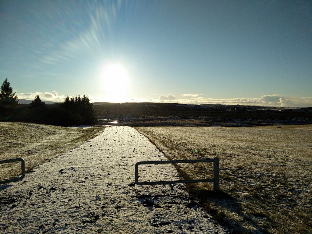
Reaching the starting point
The crater itself is quite far away from any public transport routes and so this trail starts at the nearest bus stop called Reykjanesbraut/Vifilsstadavegur. As this bus stop is primarily meant for children at the nearby Barnaskóli Hjallastefnunnar, the buses don’t drive here very often. Therefore, I would strongly advise you to check the timetable – especially for returning back to Reykjavik. To reach the Reykjanesbraut/Vifilsstadavegur bus stop first take bus number 3 from Hlemmur main station to Mjodd. The bus drive will take you approximately 18 minutes. If you are not departing from Hlemmur, find the route from your nearest bus stop to Mjodd on the Straeto website. At Mjodd take bus number 21 towards Fjordur/IKEA and after approximately 6 minutes you will reach the trail’s starting point – the above attached GPX route starts exactly at the bus stop.
Trail
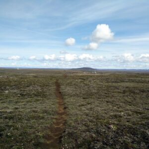
Even though the distance is great, the hike is not demanding because the path is pleasant and relatively flat. From the bus stop continue on a wide dirt track towards south – the dirt track starts just behind the bus stop sign. The surrounding area is quite swampy and at the time when I was doing the hike the path was flooded. Although the water was frozen I didn’t dare to cross it as the ice layer was thin and cracked at some places. Therefore I made a detour and bypassed the swampy area – the detour is obviously seen on the GPS track.
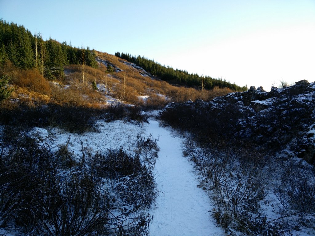
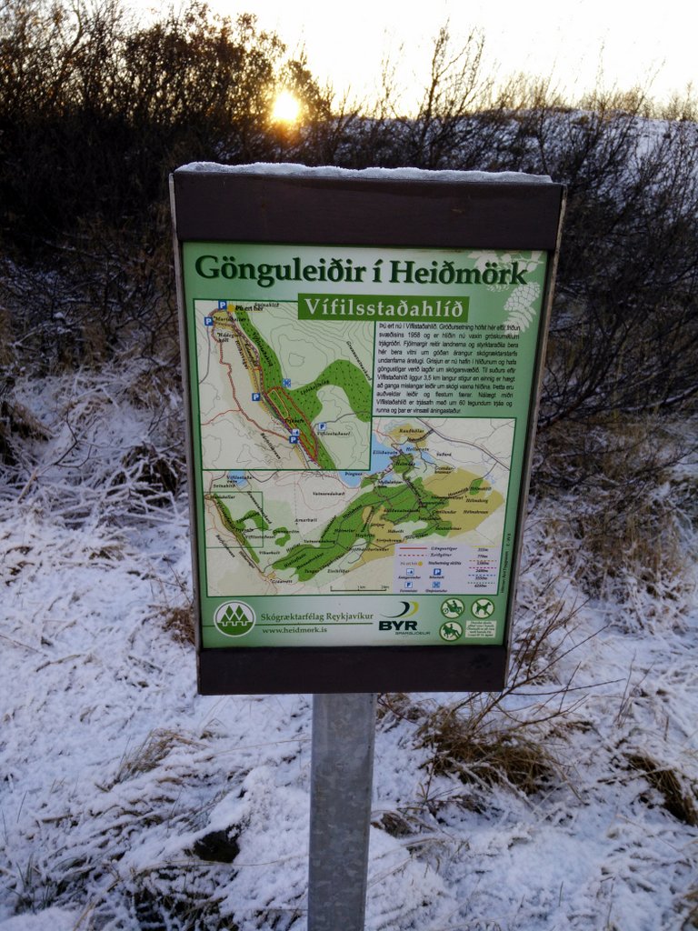
After traversing the swampy area you will reach a paved road. You have to cross it and then go on a wide dirt track that runs parallel to it – turn right when you arrive on the track. This dirt track initially runs towards southwest but soon changes the direction towards southeast and starts ascending gently. Here you are entering the Heidmork nature park which is very popular among Icelanders as it is covered in trees (a rarity in Iceland). Additionally, the Heidmork nature park is home to around 60 species of wild birds. After walking on the wide dirt track for approximately 4 kilometers you will reach the southeastern border of Heidmork.
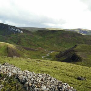
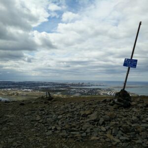
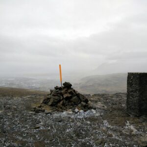
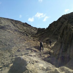
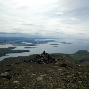
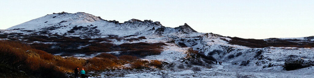
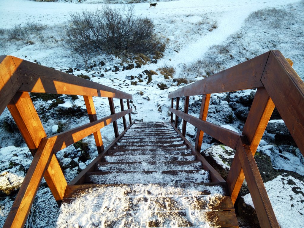
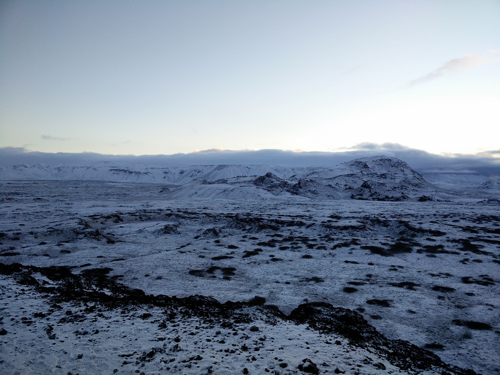
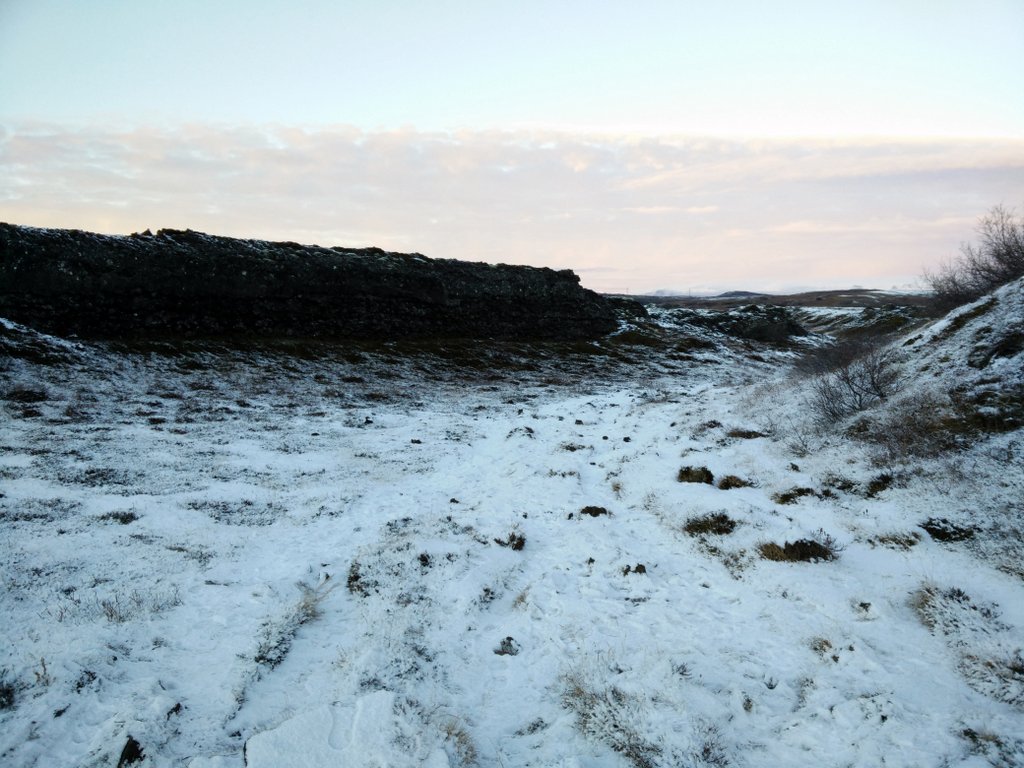
Here you will find a big parking place and in case that you are not planning to use the public transports you can drive to there and thus reduce the total distance of the hike to approximately 7 kilometers. Near the parking place you will see a wooden staircase by which you descend to the lava field. Then you continue following a path that runs over the lava field towards the Burfell crater. As the path is narrow and rocky I would recommend you to use footwear that provides decent stability, e.g. hiking boots or shoes with stiffer soles. While walking through the lava field I saw several chasms and thus I would suggest you to stick to the path or at least be careful if you wander off it – especially if you are with kids – the chasms can be deep. After a kilometer or so it will become obvious that you are walking through the old pathway of the lava as the walls around the route will become higher. Soon you will start ascending the crater itself – the climb is quite steep but it only lasts for 500 meters. On the top of the crater you will get a great view on the higher mountains that lie west of the crater as well as the Heidmork park and Reykjavik towards east. There is also a narrow path which leads around the crater. If you are planning to take a walk around the crater, be careful not to slip because the path is quite exposed at some places. I skipped the walk around the crater as the sun was already down behind the horizon and so I headed back to the starting point.
Getting back to the starting point
As I anticipated that it would get dark quick I decided to use the same route for the way back in order to avoid the navigation troubles.
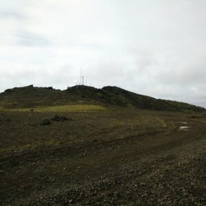
Burfell Crater Trail – Starting Point
Burfell – Path
Burfell – Descend to the Lava Field
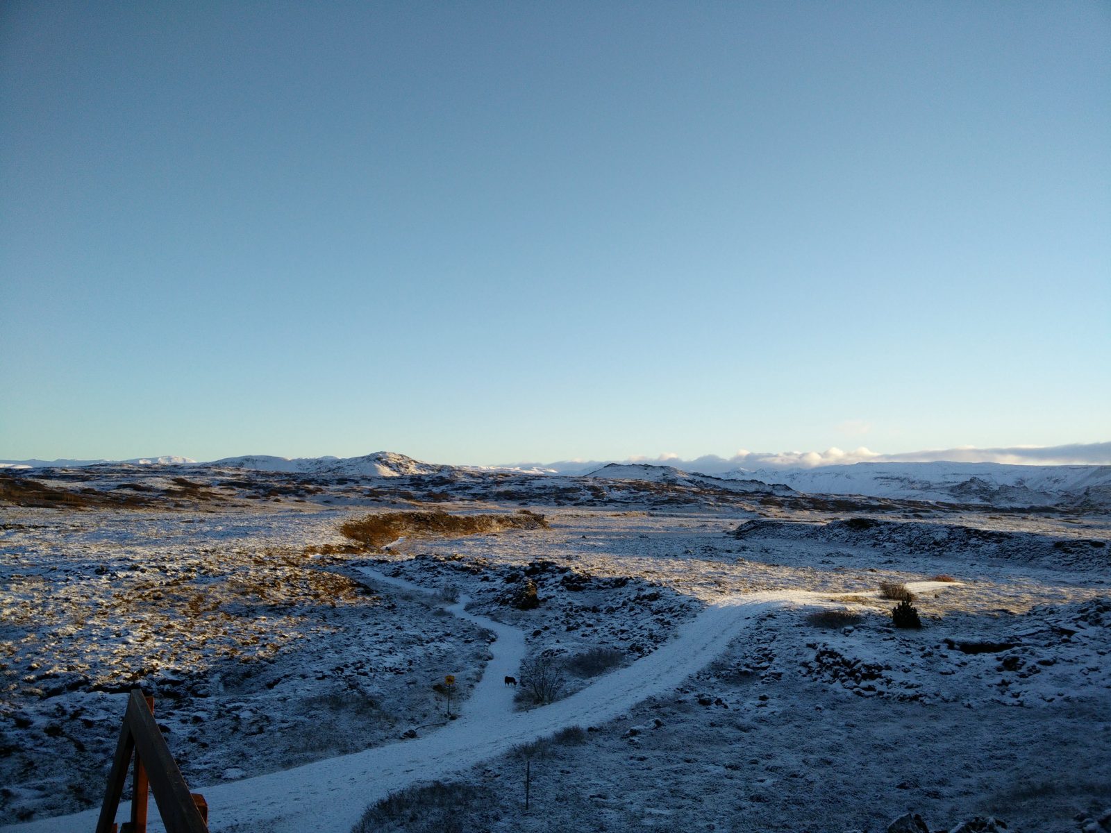
Burfell Crater Trail – View from the path
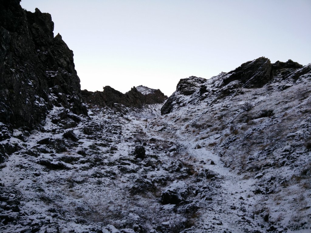
Burfell – Lava Pathway
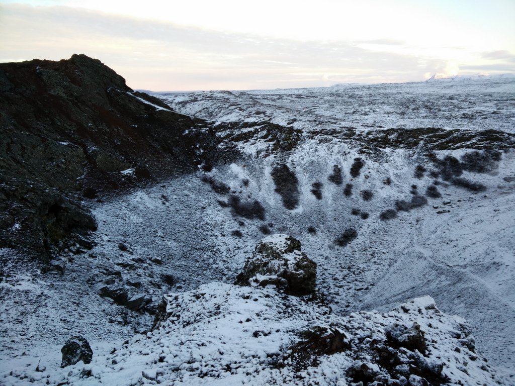
Burfell – Crater
Equipment
On this hike the weather surprised me positively – it was sunny. However, whenever the weather is sunny in Iceland (which doesn’t happen that often), it is usually also very cold and so I had to use warm insulated clothing. I was wearing a synthetic Under Armour t-shirt, Polartec fleece jacket, Carinthia HIG G-Loft jacket, windproof Schoeller AB400 pants, mid-length Salewa hiking boots, synthetic gloves and a Woolx hat. In the backpack I was carrying additional thermal clothing, water, food and some accessories.
I would recommend you to dress warmly and pack waterproof/windproof clothing in your backpack because the weather can change very quickly in Iceland. If the terrain is covered with snow and the weather is sunny also don’t forget to bring your sunglasses as the snow powerfully reflects the sunlight and can harm your eyes.
Equipment under scrutiny
Foxelli Rechargeable Headlamp
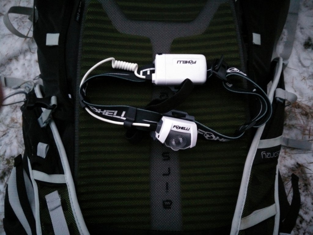
Foxelli Rechargeable Headlamp
When it got dark I used the Foxelli Rechargeable Headlamp for illuminating the track. I was very satisfied with the illumination provided as well as with the comfort that the headlamp offered. The headlamp is equipped with an adjustable headband and top strap and thus stays firmly on your head while hiking. Additionally it offers great battery life, 5 different modes and IPX7 standard. I would recommend it to hikers, mountaineers and trekkers who need a reliable headlamp for a reasonable price. You can read the full review here.

Conclusion and photo gallery
The Burfell crater trail is best for those who are staying in Reykjavik and want to climb a small mountain while observing an astonishing and characteristic Icelandic landscape. As the trail is relatively flat I believe that everybody can do this hike – even families with kids. However, I would recommend you to wear warm clothing and at least mid-length hiking boots in order to be comfortable. The unique thing about the Burfell trail is that you are actually ascending an 8000 years old volcano through the old pathway of the lava that the volcano used to burst with. This is definitely a special experience. Furthermore when you reach the top, you are rewarded with an amazing view.
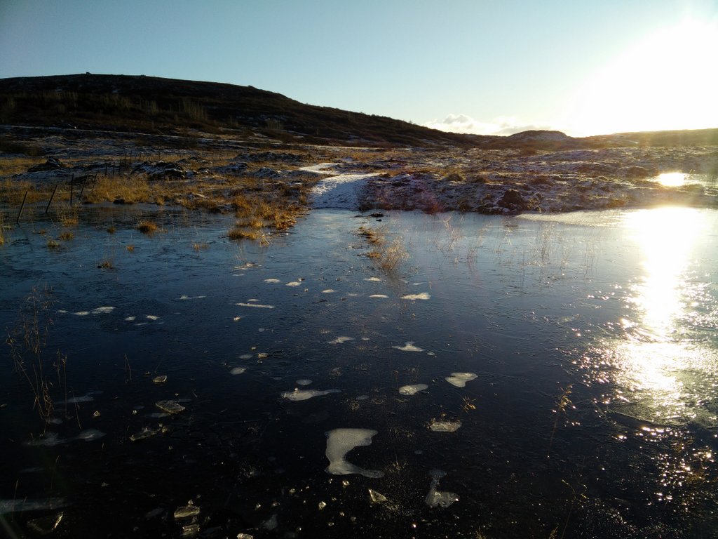
Burfell Crater Trail - Swampy Area
Burfell - Heidmork
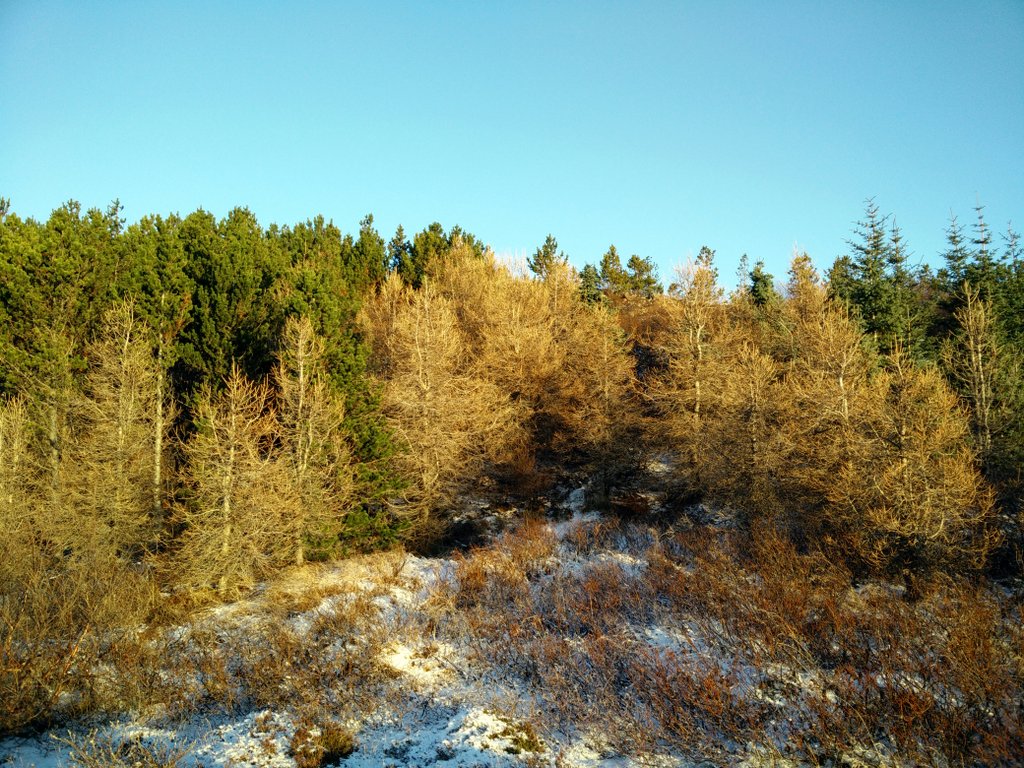
Trees in Heidmork Nature Park
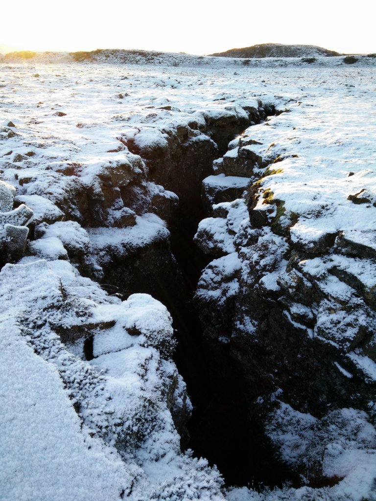
Burfell - Chasms
Burfell - View
Burfell - Lava Pathway
If you have any questions about this hike, please drop me a line in the comments below.