Garmin Montana 700i
A handheld GPS device is very useful for hiking, trekking and mountaineering because it enables you to easily find your way even if the visibility is poor or the landscape has little or no distinct features. We’ve found handheld GPS devices to have several advantages over smartphones which are often used for navigation on hiking trails. They’re more durable and have a much longer battery life. Additionally, the convenience of rechargeable batteries that can be swapped with disposable ones in remote and sparsely inhabited areas is a significant plus.
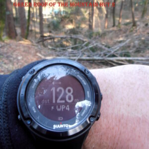
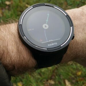
While GPS watches are gaining popularity and are undoubtedly useful for navigation, we lean towards handheld GPS devices for their superior terrain overview. These devices show detailed maps and, in some cases, even satellite imagery. In contrast, most GPS watches can only display your location and direction concerning waypoints and routes (breadcrumb trail). The ability to easily insert new waypoints and plan routes directly on the device is another plust of handheld GPS devices. To achieve this on a GPS watch, you’d typically need a computer or a smartphone with a working internet connection. Thus, when it comes to hiking and mountaineering, handheld GPS devices are our preferred navigation tool.
Nevertheless, we emphasize the importance of never relying solely on any electronic GPS device, be it a watch, phone, or handheld device. All these tools are limited by their battery life and the availability of GPS signals. As a precautionary measure, we recommend always bringing a compass and map as a backup. It’s a simple yet crucial step to ensure you stay safe on your outdoor pursuits.
Updated Content
We regularly update our reviews and selections to always recommend you the best products on the market.
Expert Selections
We only list top-tier products. Read how our selections of best hiking products differ from others here.
Links
We use affiliate links and may receive a small commission on purchases at no extra cost to you.
1. Our Hiking GPS Picks
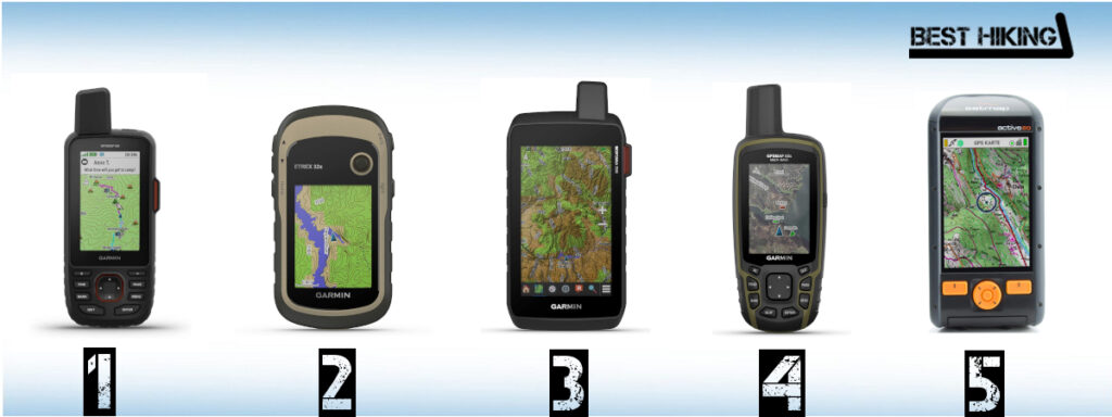
Best Hiking GPS Devices
2. Comparison of Hiking GPS Devices
| Feature/Product | Garmin GPSMAP 66i | Garmin eTrex 32 | Garmin Montana 700i | Garmin GPSMAP 65s | Satmap Active 20 |
|---|---|---|---|---|---|
| Weight | 8.11 oz. | 4.9 oz. | 14.5 oz. | 7.7 oz. | 11 oz. |
| Weight (Metric) | 230 g | 141 g | 410 g | 217 g | 310 g |
| Size | 2.4 x 6.4 x 1.4 in. | 2.1 x 4.1 x 1.3 in. | 3.6 x 7.2 x 1.3 in. | 2.4 x 6.3 x 1.4 in. | 2.4 x 5.8 x 1.4 in. |
| Size (Metric) | 6.2 x 16.3 x 3.5 cm | 5.4 x 10.3 x 3.3 cm | 9.2 x 18.3 x 3.3 cm | 6.1 x 16 x 3.6 cm | 6.1 x 14.7 x 3.5 cm |
| Display | 3'' | 2.2" | 5" | 2.6" | 3.5" |
| Touchscreen | No | No | Yes | No | Yes (but also buttons) |
| Battery Life | 35 h (10 min tracking interval) | 25 h | 18 h (10 min tracking interval) | 16 h | 16 h |
| Battery | Rechargeable lithium-ion | 2 AA batteries (not included) | Rechargeable lithium-ion | 2 AA batteries | Rechargeable lithium-ion |
| Technology | GPS + GALILEO | GPS + GLONASS | GPS + Galileo | GPS + GLONASS + Galileo | GPS + GLONASS + GALILEO |
| Electronic Compass | Yes | Yes | Yes | Yes | Yes |
| Barometric Altimeter | Yes | Yes | Yes | Yes | Yes |
| Waterproof | Yes (IPX7) | Yes (IPX7) | Yes (IPX7) | Yes (IPX7) | Yes (IP68) |
| Memory Card Support | Yes | Yes | Yes | Yes | Yes |
| Routes Memory | 250 | 200 | 250 | 200 | Unlimited |
| POIs Memory | 20000 | 10000 | 20000 | 10000 | Unlimited |
| Supports Standard Batteries | No | Yes (2 AA batteries) | No | Yes (2 AA batteries) | Yes (3 AA batteries) |
| Wireless Connectivity | Bluetooth, Wi-Fi and ANT+ | ANT+ | Bluetooth, Wi-Fi and ANT+ | Wi-Fi and ANT+ | Bluetooth and Wi-Fi |
| Camera | No | No | No | No | No |
| Geocaching-friendly | Yes | Yes | Yes | Yes | No |
| Trip Planning Software | Yes (BaseCamp, Garmin Explore) | Yes (BaseCamp) | Yes (BaseCamp) | Yes (BaseCamp, Garmin Explore) | Yes (Xpedition) |
3. The Selection
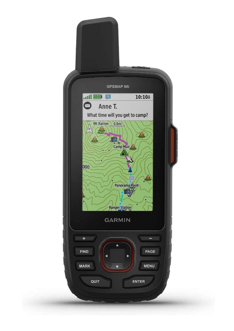
Garmin GPSMAP 66i
1. Garmin GPSMAP 66i
Suitable for:
- Hiking
- Mountaineering
- Trekking
- Hunting
- Geocaching
- Backpacking
The Garmin GPSMAP 66i is the device we like the most. The helix antenna, capable of tracking both GPS and Galileo satellites simultaneously, ensures a swift satellite lock and precise positioning. What truly sets it apart is the inReach technology, turning it into a reliable satellite communication device via the Iridium satellite network. This feature is very valuable because it enables you to send and receive messages in areas with no cell phone signala as well as trigger an SOS when needed (subscription required). Beyond its navigation excellence, the GPSMAP 66i has an electronic 3-axis compass, barometric altimeter, and Bluetooth chipset. The Bluetooth connectivity lets us wirelessly link the device to our smartphones, facilitating seamless communication. We appreciate how notifications, including missed calls and text messages, can be displayed directly on the GPS device through the Garmin Connect app. Equipped with TOPO U.S. 100K maps and a 1-year BirdsEye Satellite Imagery subscription, it offers comprehensive mapping solutions for our journeys. However, it also has a downside – reliance on rechargeable batteries, because it doesn’t support AA batteries. This means we need access to electricity for recharging, which is something we keep in mind for longer outdoor expeditions.
Pros:
- Durability
- Buttons
- Galileo support
- inReach technology
- Pairs with a smartphone
- Robust design
Cons:
- Size
- Doesn’t support standard batteries
Where to buy?

Also available at:
Video

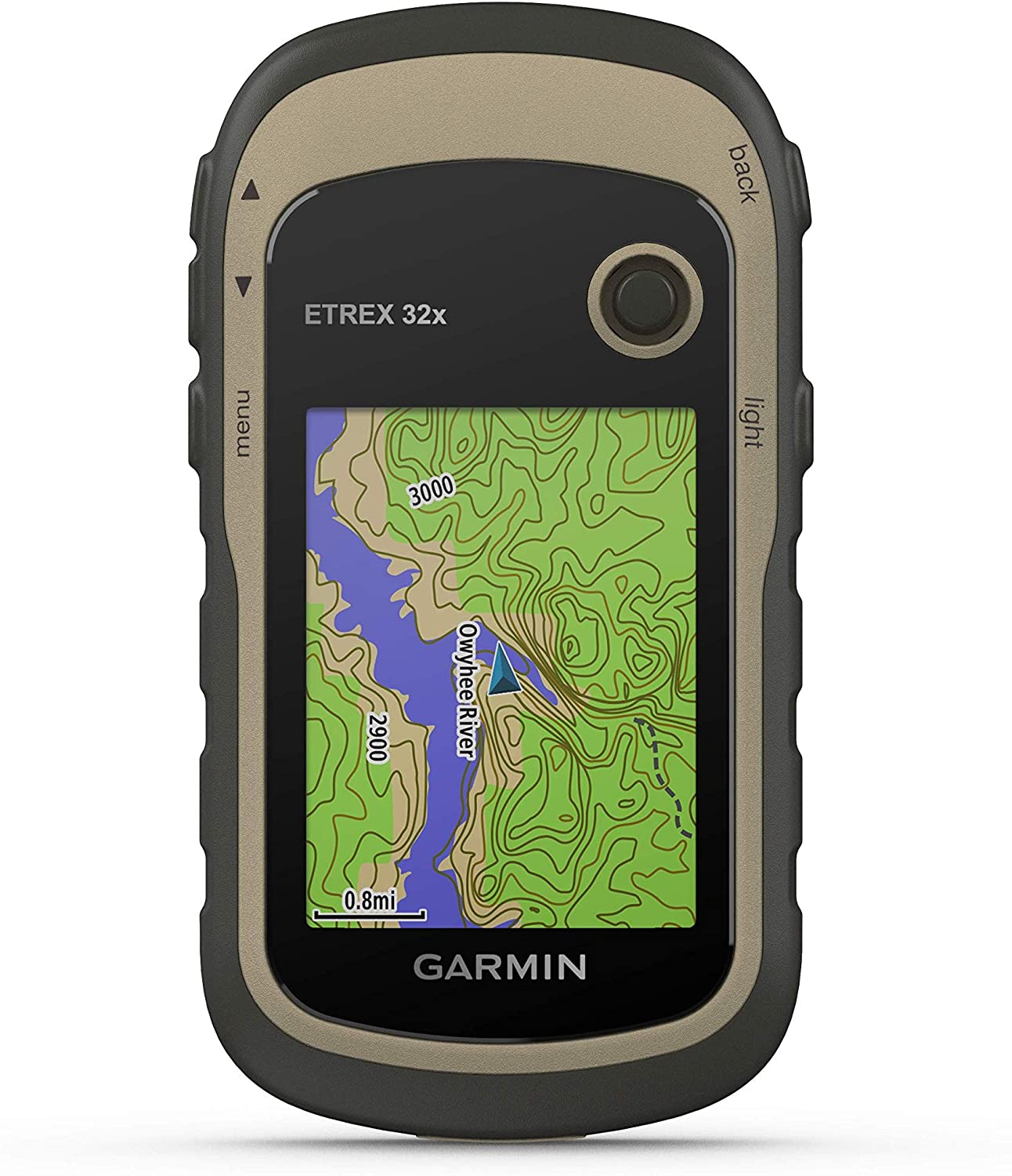
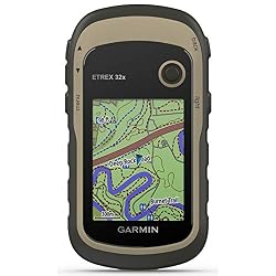
Garmin eTrex 32
2. Garmin eTrex 32x
Suitable for:
- Hiking
- Mountaineering
- Climbing
- Trekking
- Hunting
- Geocaching
- Backpacking
The Garmin eTrex 32x has become our go-to companion for hiking, mountaineering, trekking, and our other outdoor pursuits. Its standout feature is its lightweight and compact design, fitting perfectly into backpack’s hip belt pocket and snugly into a hand. The device’s small size doesn’t compromise its durability, offering excellent water and shock resistance for rugged adventures. While the display is modest in size, its readability is more than sufficient, having a resolution of 240 x 320 pixels and the ability to display 65,000 colors. Equipped with WAAS and HotFix features, along with a 3-axis electronic compass and barometric altimeter, the eTrex 32x ensures precise and fast positioning. The electronic compass remains reliable even when the device isn’t completely leveled. We’ve found its support for satellite images, where it can display them instead of a map, particularly useful, though a subscription (BirdsEye) is required for this feature. Running on two AA batteries enables easy on-the-go replacements. While the Garmin eTrex 32x impresses with its small size and robust hardware, it’s worth noting that it doesn’t support Bluetooth or Wi-Fi, a minor drawback in the era of wireless connectivity.
Pros:
- Battery life
- Weight
- Buttons
- GLONASS support
- Supports AA batteries
Cons:
- Screen size
- Lacks Bluetooth or Wi-Fi connectivity.
Where to buy?
Also available at:
Video

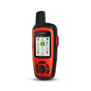
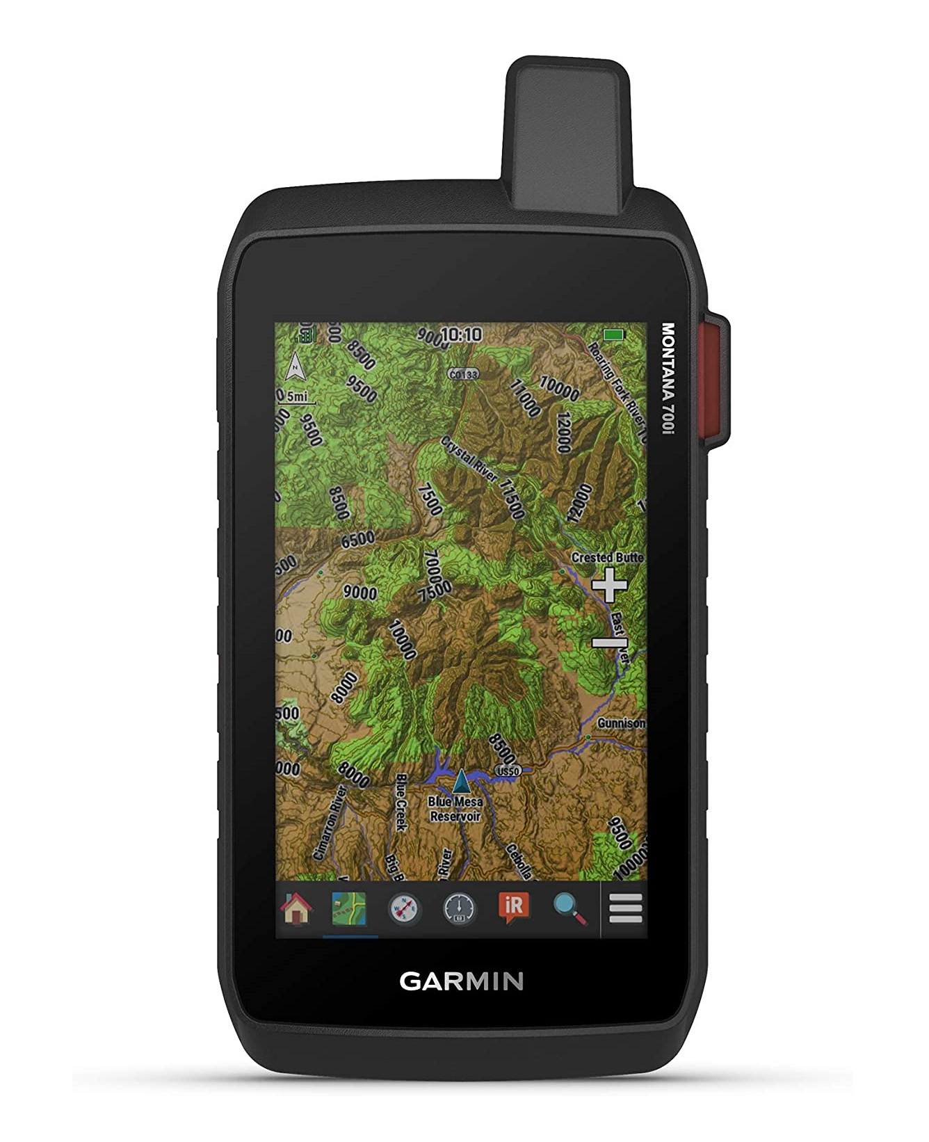
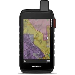
Garmin Montana 700i
3. Garmin Montana 700i
Suitable for:
- Hiking
- Mountaineering
- Trekking
- Hunting
- Geocaching
- Backpacking
The Garmin Montana 700i has elevated our hiking experiences with its advanced features. It is slightly bigger and heavier than its counterparts, but this device also offers a larger display with higher resoltuon. The touchscreen, supporting double orientation, is more “glove-friendly” than standard screens, though the challenge of precise touch with thick gloves still persists.Packed with functionalities, the Montana 700i includes a barometric altimeter, digital compass, sun and moon information, hunting/fishing calendar, tide tables, and turn-by-turn navigation. Tracking both GPS and Galileo satellites ensures rapid signal retrieval and precise location tracking. Fueled by a rechargeable lithium-ion battery, it has an approximate 18-hour battery life. Just like the GPSMAP 66i, the Montana 700i features inReach technology, allowing seamless satellite communication. Despite being a powerful navigation tool, it comes with two significant downsides – weight and size. These considerations are essential factors, especially for those who prioritize a lighter and more compact device for their outdoor adventures.
Pros:
- Screen readability
- Galileo
- User-friendly
- inReach technology
- Pairs with a smartphone
Cons:
- Heavier weight
- Large size
- Hard to use with gloves
Where to buy?
Also available at:
Video

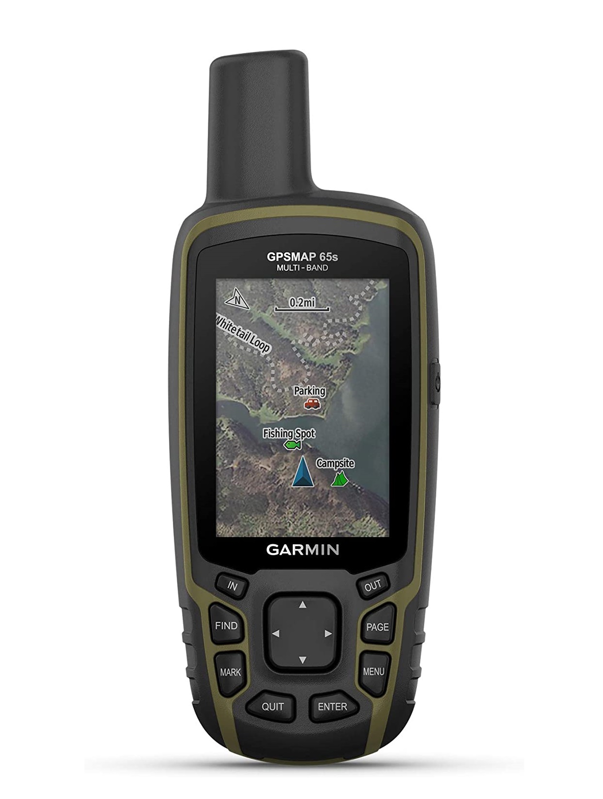
Garmin GPSMAP 65s
4. Garmin GPSMAP 65s
Suitable for:
- Hiking
- Mountaineering
- Trekking
- Backpacking
- Hunting
- Geocaching
- Backpacking
The Garmin GPSMAP 65s looks almost the same as the Garmin GPSMAP 66i mentioned above. However, the devices differ in features and price. diverge in features and pricing. The GPSMAP 65s, being more budget-friendly, comes with fewer features and more economical components. Notably, it lacks support for inReach technology and sports a smaller screen with lower resolution compared to the GPSMAP 66i. However, the GPSMAP 65s still proves to be an excellent hiking GPS device. It includes a barometric altimeter, digital compass, and supports Bluetooth and ANT+. We appreciate its compatibility with GPS, GLONASS, and Galileo satellite systems, ensuring accurate location data and a swift satellite fix. Pairing with our smartphones is a breeze, allowing us to receive notifications directly on the device. Running on 2 AA batteries adds to its practicality, making battery replacement straightforward. This feature proves invaluable during extended backpacking trips where access to electricity might be limited. In conclusion, the Garmin GPSMAP 65s offers great value for its price, delivering essential features for an enriching outdoor navigation experience.
Pros:
- Durability
- Buttons
- Galileo support
- GLONASS support
- Pairs with a smartphone
- Robust design
Cons:
- No Wi-Fi
- Size

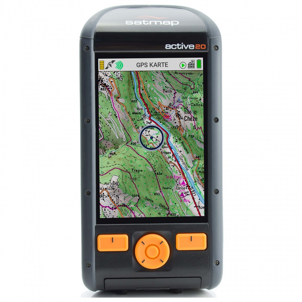
Satmap Active 20
5. Satmap Active 20
Suitable for:
- Hiking
- Mountaineering
- Trekking
- Hunting
- Geocaching
- Backpacking
The Satmap Active 20 is the only “non-Garmin” device in this selection. We found the Satmap Active 20 a simple but effective device. Weighing in at 11 ounces, its 3.5-inch high-resolution display provides clear visuals, while the large, user-friendly buttons make handling easy – even with gloves or numb fingers in cold conditions. The robust construction ensures excellent shock and water protection, with an IP68 water-resistance rating allowing submersion up to 1.5 meters. Adding to its durability, it boasts an IK7 impact rating and features Gorilla glass. Equipped with Bluetooth Smart, the Satmap Active 20 facilitates wireless route sharing and connectivity with additional equipment like heart rate belts. The inclusion of a barometric altimeter ensures precise altitude readings, even when the GPS signal is lost. A variety of maps is readily available for purchase directly from Satmap’s website, catering to diverse needs. The rechargeable battery, included with the device, offers a substantial 16-hour lifespan but can be conveniently replaced with 3 AA batteries when needed. With its combination of user-friendly buttons and a large high-resolution display, the Satmap Active 20 stands out among the competition, making it an excellent choice for hikers and mountaineers alike.
Pros:
- User-friendly with large buttons and a high-resolution display.
- Solid construction with IP68 water resistance and IK7 impact rating.
- Bluetooth Smart for wireless connectivity.
- Rechargeable battery with a 16-hour lifespan, replaceable with AA batteries
Cons:
- Limited support – produced by a smaller company
Where to buy?

Video

4. Hiking GPS Buying Advice – What is important?
Positioning Technology:
In addition to GPS, some devices also support GLONASS, Galileo and other positioning systems. These positioning systems are alternatives to GPS but can also work together with it. Devices that support multiple positioning systems locate your position faster and more precisely. Furthermore, they are also more likely to locate your position in difficult terrain (narrow valleys, dense woods etc.).
Garmin GPS devices often feature WAAS technology which increases the positioning accuracy. WAAS stands for Wide Area Augmentation System and provides GPS signal corrections (clock drift, delays caused by atmosphere etc.) thus increasing the positioning accuracy. WAAS is only available in America. Another useful feature from Garmin is Hotfix which decreases satellite acquisition time. Hotfix calculates and saves the positions of satellites for the next three days for area where you last used the device. This feature is useful if you’re using the device regularly in the same area.
Extra Features – Altimeter, Barometer, Compass etc.
Modern GPS devices do not only show your location on a map but also have other useful features such as an electronic compass and barometric altimeter. Such a compass and altimeter work even if the GPS signal is not available and are thus useful for hiking in narrow valleys or dense woods, where it might be hard to get the signal. Some GPS devices can also be connected to other devices such as Smartphones, cameras (for example the Garmin Virb action camera), heart rate monitors and temperature sensors. These devices can then be controlled directly from the GPS unit, which can also show different information from each device (for example notifications from a Smartphone, the heart rate from a heart rate monitor etc.).
Mapping and Memory:
Most GPS devices come with preloaded maps. For example, Garmin devices typically come with TopoActive mapping for the country where you bought the device. You can buy TopoActive mapping for other areas on Garmin website. TopoActive maps are very detailed and regularly updated. Backpackers and hikers are very satisfied with them in general. However, if you find them too pricy you can always use open-source mapping like OpenTopoMap. You can download open-source maps for free and then transfer them to your device. GPS device will typically have a memory card where maps are stored. The memory card also stores information about routes and POIs.
Satellite Messaging:
Satellite messaging has become very popular in the last few years and many GPS devices started supporting it. However, note that satellite messaging only works if you have an active subscription which is typically billed monthly. For example, Garmin requires inReach subscription plan for satellite messaging which costs $15 per month. Satellite messaging allows you to communicate in areas without cell service. You can send and receive texts, share your location, post to social media and communicate with others via GPS device. Furthermore, you can also send SOS signal in case of emergency.
Battery Life:
The battery life of a handheld GPS device should be at least 10 hours so that you don’t have to change batteries too often. All GPS devices in this review have good battery life. Some use AA batteries while others have rechargeable batteries. Devices that use AA batteries are convenient for long backpacking trips because you can simply change the batteries. Nevertheless, devices with rechargeable batteries can be recharged with a solar charger or a power bank.
Construction/Case:
A handheld GPS device must be robust and made of materials that offer good shock- and abrasion resistance. Furthermore, a GPS device must also be water-resistant so that you can safely use it in rainy weather. All devices listed in the review above provide good durability and qualify for the IPX7 water resistance rating (meaning that the device can withstand exposure to water of up to 1 meter for up to 30 minutes).
Size and Weight:
Having a lightweight and small GPS device is a big benefit when it comes to hiking. Lightweight gear enables you to hike faster and delays the exhaustion. Small size allows you to easily store the device in pockets etc. and handling a small device is in general easier. However, small and lightweight devices typically also have small screens. Therefore, how you’ll be using the device dictates what weight and size are suitable for you. For example, if you’re need device only for hiking the small and lightweight Garmin eTrex will be great. However, if you’re also planning to use the device for ATV driving, snowmobiling etc., you might want to opt in for a device with bigger screen size such as Garmin Montana.
Planning Software:
It’s a great advantage if a GPS device comes with planning software (for PC or Mac) because planning software enables you to easily create routes and waypoints which can then be imported to the device. Usually planning software also shows you advanced information about the routes you have created such as distance, ascent etc. Some brands have their own software like for example Garmin (BaseCamp app which is available for Mac and Windows) while others use third party applications.