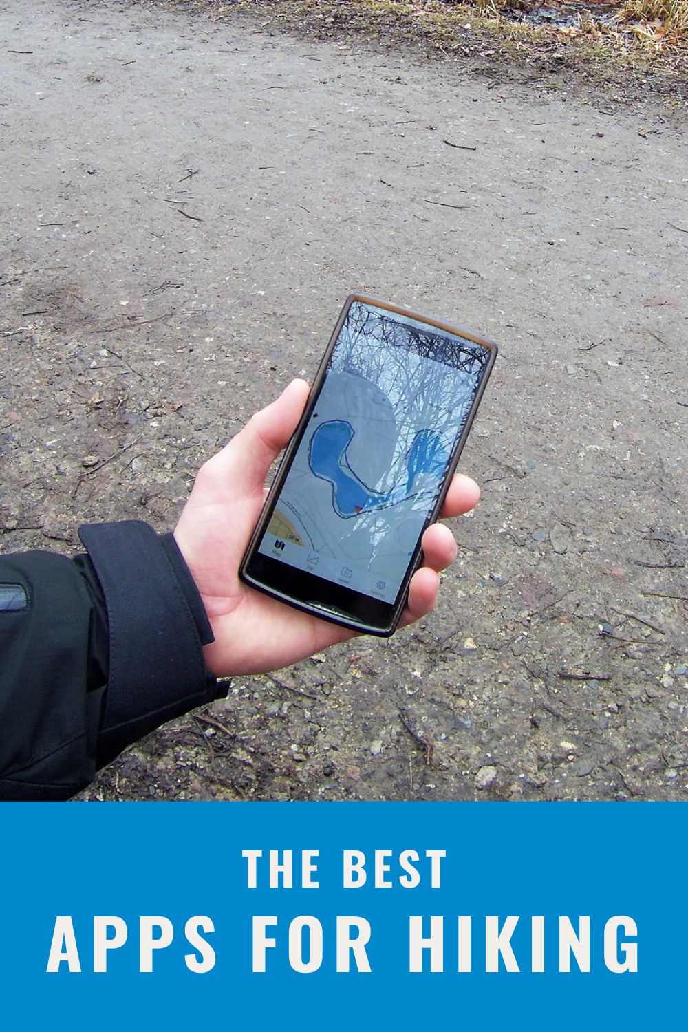
Best Hiking Apps – Tested and Reviewed
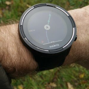
We have mostly been using the Suunto Ambit 2 watch for navigation on our hikes, but we decided to try out the so-called hiking apps. For the last couple of weeks, we have been testing the 8 top-rated hiking apps on Google Play. From those we choose the best five and reviewed them here. We only tested hiking apps that come for free and are available for the Android operating system. However, many of these apps are also available for iOS (see the table below), but since we don’t have any iOS device, we only tested them on an Android device.
What features did we consider as mandatory?
In our opinion every hiking app should provide GPS navigation and GPS tracking.
By GPS navigation we mean that the app can show your current location and direction on a map and supports import of GPS tracks. GPS tracks are very useful for hiking because it is easy to get them online and they make navigation during hikes easier. To learn more about GPS tracks check out our article What are GPS tracks and how to use them for hiking. When it comes to maps, we were not picky, but we did indeed consider offline maps and/or topographic maps as a benefit.
We also thought that a hiking app should provide you with some information about your hikes. For example, duration, total distance, total ascent, total descent, lowest point, highest point etc. Furthermore, it should also show where you hiked on a map.
Note: You might ask yourself why we are so focused on GPS tracks. It is simply because we use them all the time. For example, if we travel to France and want to climb some mountain, we check if there is any GPS track for that mountain available online – and there usually is. This drastically reduces the time we need to plan our trips.
What were we testing?
We were testing features, accuracy, ease of use and battery consumption. We tested the navigation functionality by creating a valid GPX route and importing it to each app. For the testing a OnePlus One Android device was used to ensure that all apps also work on older devices. We tested each app on the same short trail and carefully noted down pros and cons. Note that we only tested free features – for example some apps offer offline maps, but you need to purchase them. In such case, we marked this feature as non-existent.
List of apps
The following eight apps made it into our initial selection: Map My Hike, AllTrails, Komoot, Hiking Project, Gaia GPS, Green Tracks, A-GPS Tracker and AlpineQuest GPS Hiking Lite.
The five best hiking apps were AllTrails, Komoot, Gaia GPS, A-GPS Tracker and Green tracks.
The Hiking Project app did not qualify because it does not support GPS tracks and therefore you cannot plan a route for your hike beforehand. The Map My Hike app didn’t make it either, because it only supports road maps and thus it seems more oriented towards those who like to walk within cities. Lastly, we dismissed the AlpineQuest GPS Hiking Lite because the free version does not support GPS tracking.
Important notice
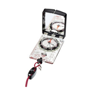
You should never rely solely on your smartphone (regardless of hiking app) because its functionality is limited by battery life and availability of GPS signal. Instead, it is recommended that you always, when you are hiking in unfamiliar terrain, also bring a compass and an appropriate topographic map.
The Best Hiking Apps According to our Test
| Feature/App | Green tracks | Gaia GPS | AllTrails | Komoot | A-GPS Tracker |
|---|---|---|---|---|---|
| Available for | Android | Android, iOS | Android, iOS | Android, iOS | Android |
| Requires Registration | No | Yes | Yes | Yes | No |
| GPS Navigation (import of GPS routes) | Yes | Yes | Yes | Yes | Yes |
| Offline Maps | Yes (many regions and countries - topo maps) | No | No | Limited (one region) | No |
| Topographic Maps | Yes | Yes | Yes | Yes | No |
| Map Types | 11 different maps, including topo and satellite | Gaia Topo, Gaia Road, Satellite | AllTrails Topo, AllTrails Road, Satellite | Topo | Road, Terrain, Satellite |
| GPS Tracking | Yes | Yes | Yes | Yes | Yes |
| Tracking Data - Live | Ascent, Average Speed, Distance, Duration, Max Altitude, Min Altitude, Pace, Elevation Graph | Altitude, Ascent, Average Speed, Distance, Duration, Max Altitude, Min Altitude, Pace, Speed Graph, Elevation Graph | Duration, Distance, Speed, Elevation Graph | Duration, Distance, Current Speed, Average Speed | Duration, Current Elevation, Time |
| Tracking Data After Hike | Ascent, Average Speed, Distance, Duration, Max Altitude, Min Altitude, Pace, Elevation Graph | Average Speed, Distance, Duration, Max Altitude, Min Altitude, Pace, Speed Graph, Elevation Graph | Duration, Distance, Speed, Elevation Graph, Max Speed, Average Speed | Duration, Distance, Average Speed, Ascent, Descent, Max Altitude, Min Altitude | Duration, Ascent/Descent, Min Altitude, Max Altitude |
| Supports export of GPS tracks | Yes | Yes | No | Yes | Yes |
| Preloaded Trails | No | No | Yes | No | No |

Green Tracks Hiking App
1. Green Tracks
Available for: Android
Website: Google Play
During the brief overview of the hiking apps that made it into our initial selection, we never thought that the Green Tracks app would rank on the first place – the app stood out by its graphic design and not in a positive way. However, after carefully testing the app we figured out that it is very easy to use. Furthermore, it is also the only hiking app that comes with an enormous amount of free offline topographic maps. Keep in mind that GSM signal is not always available in remote or mountainous regions and thus offline maps are indeed a very useful feature. The Green Tracks hiking app also offers no less than 11 types of online maps (road, satellite and topographic etc.) and shows a lot of live data about your hike (ascent, distance, elevation graph etc.). To use GPS tracks you need to transfer them to your smartphone storage (via cable, Google Drive, email etc.) and open them with the app. What we didn’t like about this app was that if you touch the map, it stops updating your location until you press the re-center button again. Hopefully, the developers will fix this bug soon.
Pros:
- Offline maps
- Many different maps
- Topographic maps are actually really good
- Easy to use
- Easy to import GPS tracks
Cons:
- Looks like it is from the 90’s
- Bug – updating location
Gaia GPS Hiking App
2. Gaia GPS
Available for: Android and iOS
Website: Gaia GPS
The Gaia GPS hiking app impressed us with live data while we were hiking – no other app in this review shows you so much information about your hike (speed graph, elevation graph, highest point and all other kinds of important information). The app is also very easy to use and comes with a great topographic map. Furthermore, the Gaia GPS app supports satellite map and road map. However, these maps don’t work if you are not connected to the internet (free version) which is indeed a downside. You can easily use GPS tracks with the app – you simply transfer them to your smartphone storage and open them with the app. While you are hiking the app also draws a breadcrumb trail on the map (note: all apps in this selection have this feature). We recommend Gaia GPS hiking app to those who find the design of the Green Tracks app outdated or have an iOS device (the Green Tracks app is not available for iOS). The Gaia GPS app, has the best topographic map of all apps reviewed here.
Pros:
- Good interface
- A lot of data about the hike
- Great topographic map
Cons:
- Offline maps require subscription
AllTrails Hiking App
3. AllTrails
Available for: Android and iOS
Website: AllTrails
The AllTrails hiking app has a good interface and comes with road, satellite and topographic map like the Gaia GPS app mentioned above. However, the AllTrails app provides you with much less information about your hike than the Gaia GPS app and has a less sophisticated topographic map. Besides from that, it is relatively easy to use and even comes with preloaded trails which will unfortunately only work if you are connected to the internet. The app also keeps track of your activities and shows you how much you hiked each month. Getting GPS tracks to the app was quite a hassle – definitely more complicated than with the other hiking apps in this selection. We also didn’t figure out how to export GPS tracks from the app.
Pros:
- User-friendly interface
- Preloaded trails
Cons:
- Hard to import GPS tracks
- Offline maps require subscription
- Can’t export GPS tracks
Komoot Hiking App
4. Komoot
Available for: Android and iOS
Website: Komoot
The Komoot app wins when it comes to graphic design and interface. The app is very easy to use and comes with several very useful features. One such feature is turn-by-turn voice navigation – yes, even on hiking trails! Furthermore, the app also calculates the optimal route to your destination for you; if you tap on a point on the map, the app will create you the optimal route to that point. The Komoot app also keeps track of your activities and allows you to connect with other hikers around the world. A letdown is that the app only comes with a topographic map which can’t be zoomed in adequately. We would thus like to see that more types of maps were available. Besides from that, the Komoot app is a great option for hikers, trekkers and backpackers. It also allows you to easily import a GPS track via the Komoot website.
Pros:
- User-friendly interface
- Turn-by-turn voice navigation
- Easy to import GPS tracks
Cons:
- Only topographic map
- Can’t zoom the map enough
- Offline maps have to be purchased
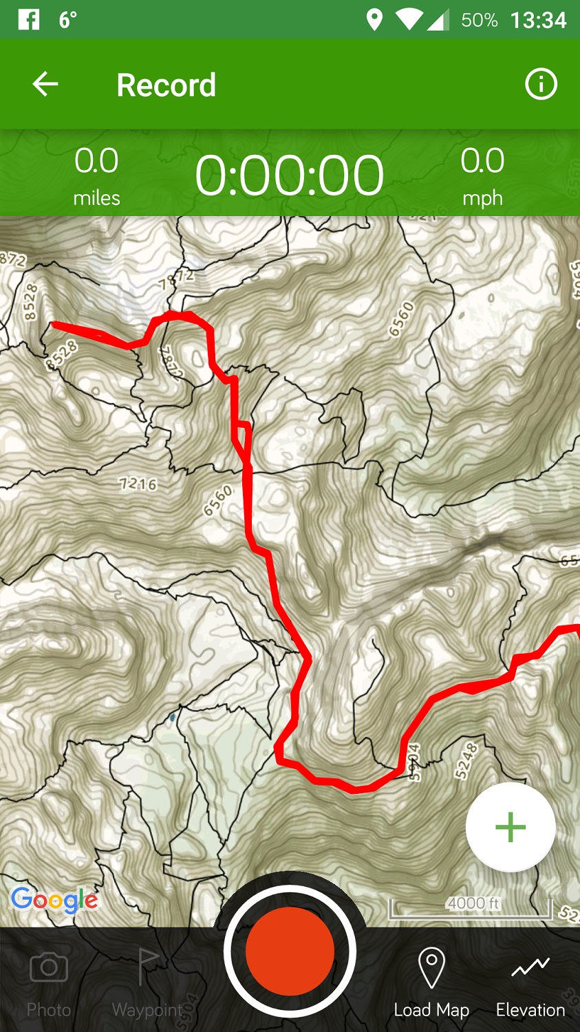
A GPS Tracker Hiking App
5. A-GPS Tracker
Available for: Android
Website: Google Play
The A-GPS Tracker hiking app seemed like a less sophisticated version of the Green Tracks app. The app is thus easy to use and allows you to import GPS tracks without a hassle – you just transfer them to your smartphone and open them with the app. However, the A-GPS Tracker app does unfortunately not support topographic maps and we were also a bit disappointed with the tracking accuracy (see the image on the right). It also shows less information about your hike than the other apps in this review. Nevertheless, it is a good option for those who want a simple and lightweight navigation app for their trips.
Pros:
- Easy to use
- Easy to import GPS tracks
Cons:
- No topographic map
- Inaccurate tracking
- Graphic design
- Only online maps
Battery Consumption
According to the AccuBattery app, all the tested apps, besides from the A-GPS Tracker app, consumed approximately the same amount of energy. The A-GPS Tracker app consumed much less battery but on the other hand the GPS tracking was also quite inaccurate in this hiking app.
Maps Quality
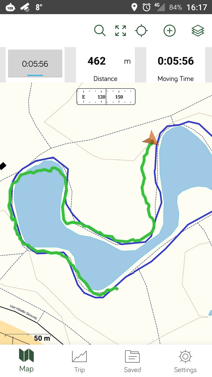
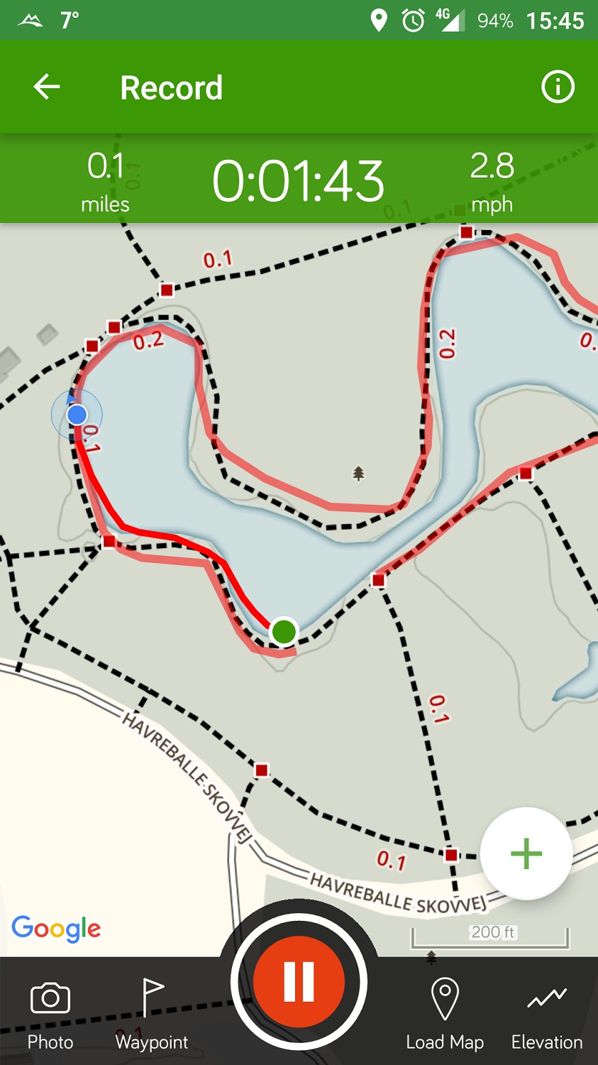
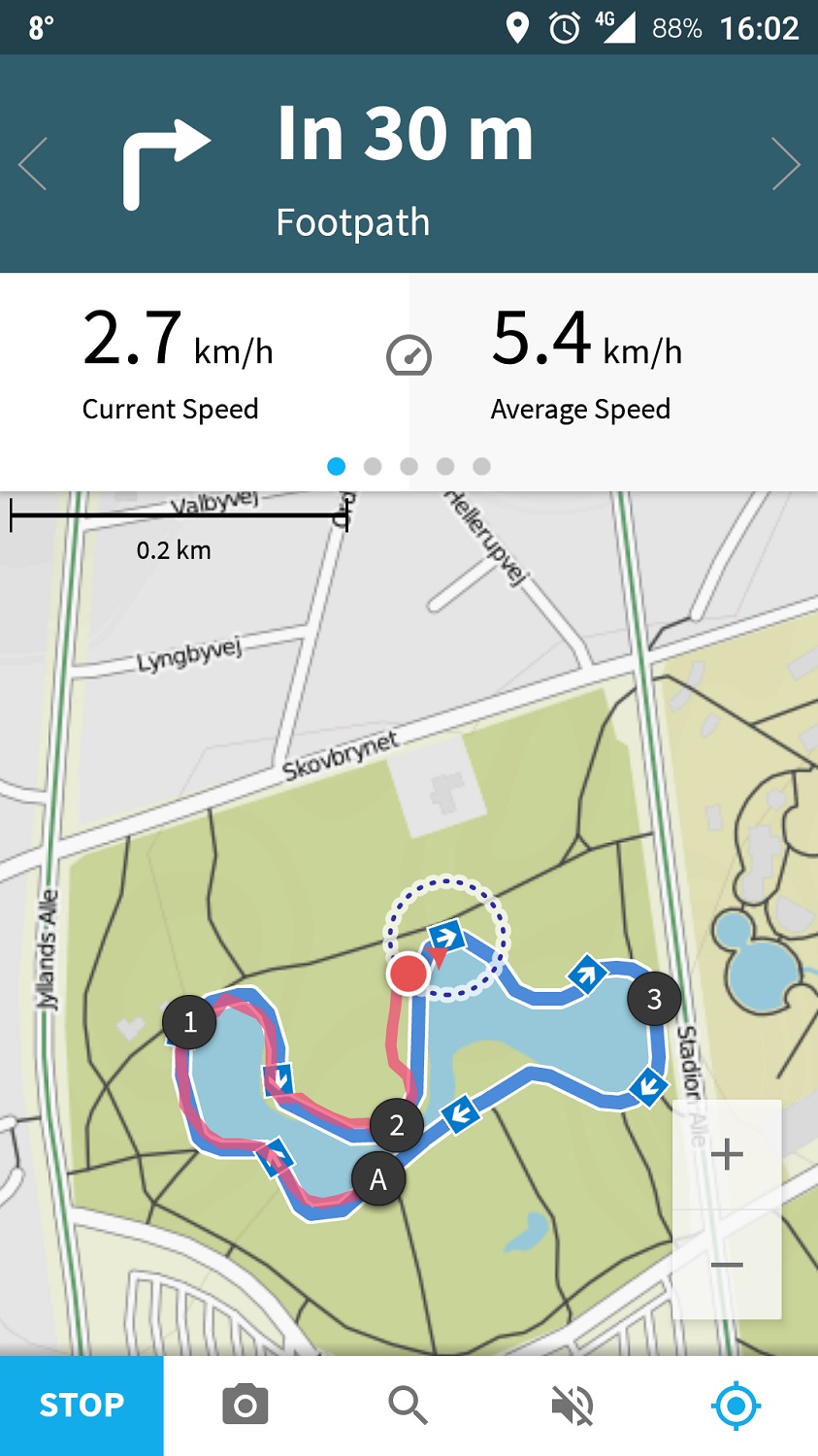
The Gaia GPS and Green Tracks apps have the best topographic maps. The A-GPS Tracker app does not support a topographic map. Only the Green Tracks app has free offline maps. Below we made a screenshot of our GPS track from Triglav hike rendered in each app so that you can assess the quality of maps yourself. We used a topographic map, if the app could provide it.
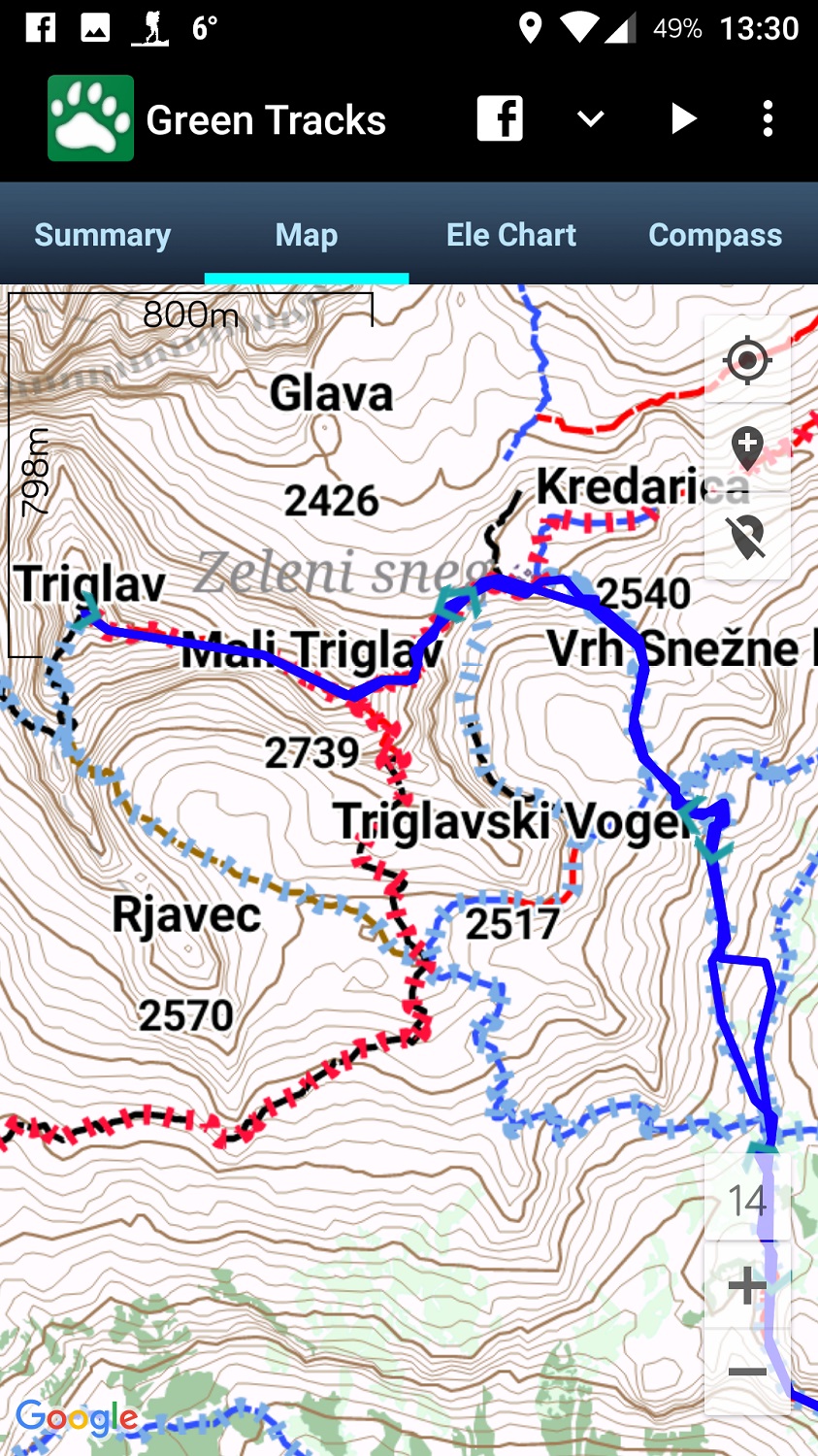
Green Tracks - Maps Quality
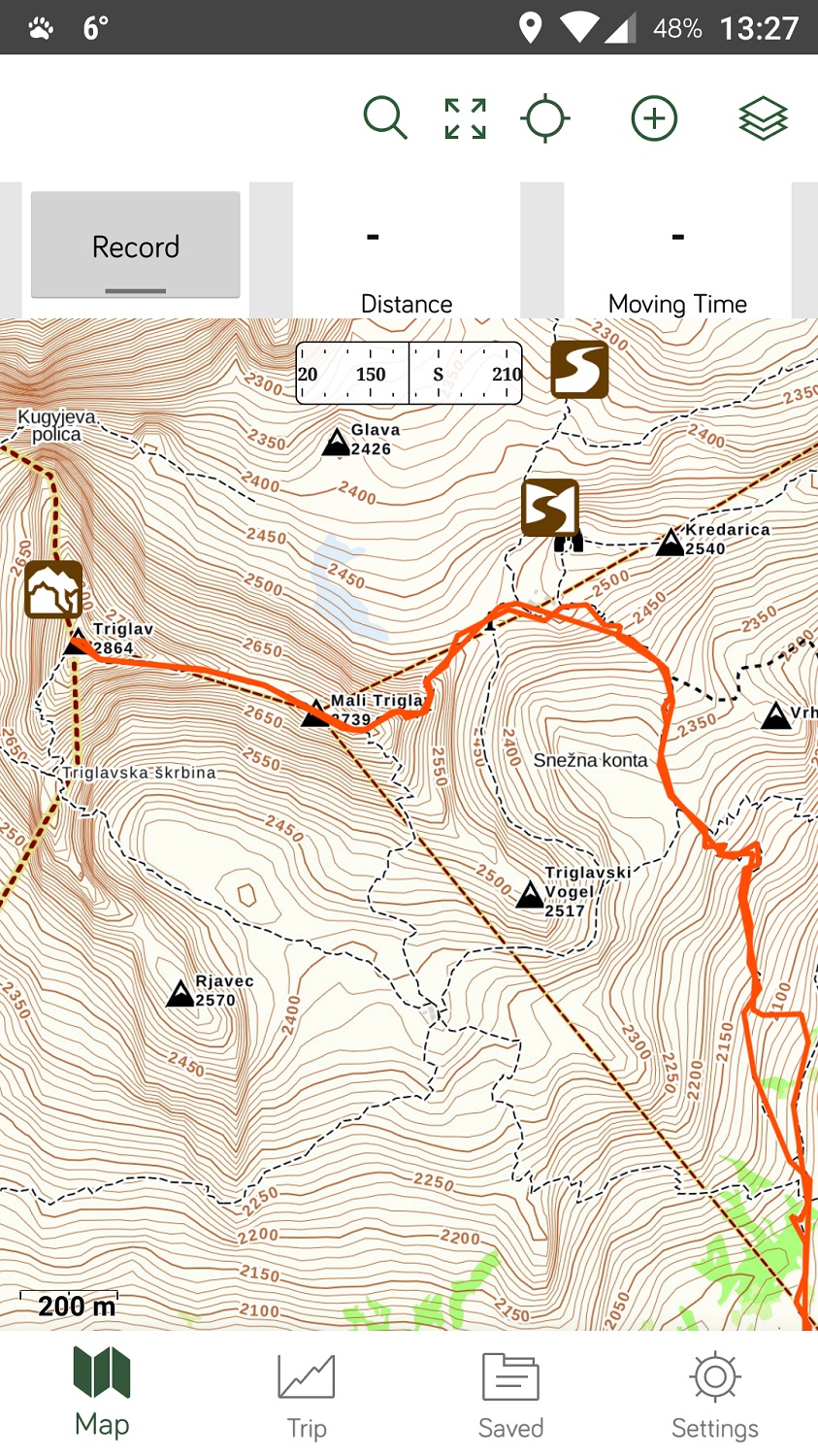
Gaia GPS - Maps Quality
AllTrails - Maps Quality
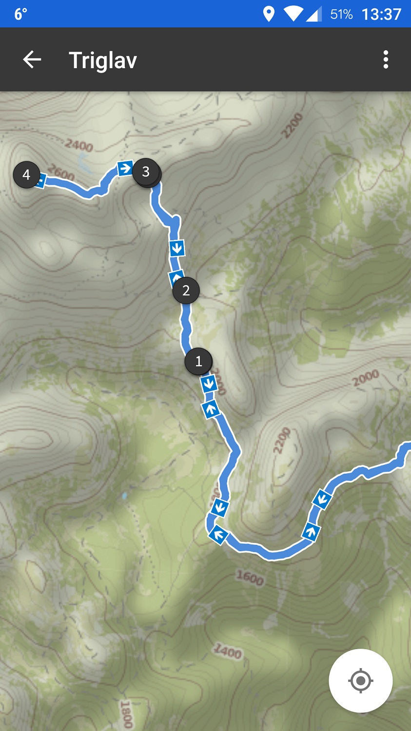
Komoot - Maps Quality
A GPS Tracker - Maps Quality
Conclusion
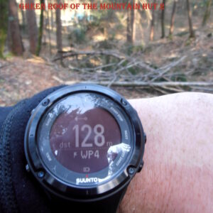
We must admit that these apps are very useful for hiking, but we will probably only use them as a backup on our hiking trips. We will keep using the Suunto Ambit 2 watch for tracking and navigation (in addition to a compass and a map), because it is much easier to use than a smartphone – especially in rainy and cold weather. Also note that smartphones cannot compare to handheld GPS devices or GPS watches when it comes to battery life and durability.
What is your experience with hiking apps? Did we forget any good hiking app? Let us know in the comments below.


Thank you Blaz for this review!!!
Is there any app for phones/tablets able to receive GPS data from the watch (Suunto, Garmin) and handle maps, waypoints and routes?
I mean, just to see bigger and with more details what you can see in the watch….
Thank you!!!
Hi Juan,
Not that I would know. You need to manually export a GPS track and import it to a phone app. However, the new Suunto app keeps routes in sync with the watch, but it doesn’t provide navigation. Well, there is a trick – if you click on edit route in the app, the app starts showing your location as well as the route 🙂 So, theoretically it possible to use it for navigation.
Awesome review! Thanks
I use Locus Pro, very good map material and a lot of options. You can create your own gpx files.
Worth a second look from you.
I’m not familiar with Locus Pro, but I will check it for sure.
Thank you for your article and laying out the apps for navigation that are out there. Juan, most phones and tablets have a GPS in them and can be used for navigation in conjunction with your watch. The maps and tracks/route need to be installed on the device before heading out to prevent battery drain in low or non existent service areas and when using for navigation should be placed in airplane mode.
You missed the best one: MyTrails! Lots of maps and free offline maps too.
Thanks for pointing out this app Carl. I’ll check it out! 🙂
My favourite is ViewRanger (www.viewranger.com) which has free apps for Android and iOS with free, downloadable maps from Open Street Map, Open Cycle Map etc available worldwide. Premium maps available to purchase if you need them. Responsive and helpful support team too.
Thanks for letting me know about this app Evan. I’ll check it out and see how it compares to apps listed here.
Update for Komoot: since a few weeks you can zoom in very very detailed.
What I like very much about Komoot, is the detailed analysis of planned routes: surface, inclination, …
Regarding pricing for Komoot, 30€ for a worldwide forever subscription is more a gesture of respect.
Thanks for the update Hugo. I’ll soon test the apps again to see what’s new 🙂
Congratulations!
The review is very well structured.
I’m looking for an hiking app for my Android smartphone.
I would like to see your review, as well, about the apps: ViewRanger, MyTrails and Locus.
Is it possible?
Hi Carlos,
I added these apps to my list and will test them before I next time update the article 🙂
Do you know any app (or webpage) that contains estimated times? Or even allow you planning tours (by setting start and end of tour and displaying estimated time)?
Hi there,
unfortunately, I don’t know any such app/website. It would be also hard to develop such a tool as the estimated times depend on your speed and physical preparedness.
Have you looked at Topo Maps+ application? I’ve used some of the ones mentioned and have found I like Topo Maps+. More expensive, however they offer lots of great features that work for me. Looking forward to a future report on it.
Have you checked out Oruxmaps?
There’s a free version on their website and a donate version in the Playstore. Maybe not as easy to pick up as some, but there’s so much stuff it can do once you really get in to it.
It will work with many online WMS/REST mapservers to get additional maps, which you can then download for offline use.
Hi Brekel,
thanks for sharing Oruxmaps! I see it has good reviews. I’ll test it before I again update this article.
Blaz
Going GPS-free can be much more enjoyable.
In some cases it can indeed be more enjoyable 🙂 But it depends on the trail, terrain etc.
Ciao Blaz, thanks for the reviews. Very help/useful.
I use Easytrails while hiking, it also has a lot of maps loaded. Unfortunately it’s rather slow in loading maps while using..even if you are online (paid version)
After finishing a trail you can upload the track on other apps like Wikiloc, Koomot, Garmin, Relive. That’s very good.
I use Alltrails to draw routes, it is very good, with a lot of different maps and overlayer to choose. Then I download the track in GPX and upload it to Easytrail to follow (Easytrail is complicated to upload tracks) or upload on Wikiloc which (paid version) is the best app while following the track. The phone vibrates (or you can use the voice) if you get off the track. This future has saved me a couple of times when I was in unknown areas.
Wikiloc is also good to use while hiking, you can see elevation gain and loss..time recorded and in moving time..and if you follow a track you can see how may km remains to finish.
I use Koomot only in Tirol as this is the region I got when I subscribed.
I tried Locus (free version) but I found it complicated.
Lately people keep suggesting ViewRanger, which has a lot of free maps to download.
I can’t wait to read your new review of hiking apps 2021! 🙂
Brii
Hi Brii,
Thank you for sharing this with me. I’m planning to update this review soon and I’ll test the apps you mentioned. Lately, I’ve been regularly using Gaia GPS (on desktop) for planning hiking routes because Suunto is discontinuing Movescount which I had been using before.
Regards,
Blaz
Thanks for review. I’ve been using RIDEWITHGPS for my hikes. I had been using it to create cycling and driving routes. Discovered I could use it for hiking as well. So tried it two ways: 1 to record a hike, 2 to create a route for a hike and then hike that route. The hike leaders were really impressed.
The features I appreciate most are:
– create a route in advance so can advise fellow hikers on distance of hike and show them the trail in advance;
– pre load routes for offline usage during hike no need for data or wifi while hiking
– tracks progress during hike and give distance to finish
– advises when you are off route by showing what direction you are going and the direction you should be going
– voice navigation, so I’m not always looking at the phone;
– phone goes dormant when doing a long stretch so not using up battery life, phone reactivates when close to turn and voice navigation kicks in, can override this manually as needed;
– OSM outdoors map for hiking, plus several other maps;
– using same app and device, can create a scenic drive to and from the trailhead;
– shareable routes because each route has a unique number that I can share with others;
– create a library of routes to share with others;
– when using camera on the phone on which the app is loaded, it will record location of where the photo was taken and file this with the route when saved; would be useful for a tricky intersections, can take photo of this to record for future users.
– plus more features.
There is a free version, a monthly or yearly subscription and a club membership.
Thanks for sharing this Anne. I’ll check out the app! It has good reviews on Google Play 🙂
Hi Blaz,
Have you checked out Hiiker App? Great for long-distance hikes.
Hi there,
Thanks for the suggestion. I will try it out before I update this post 🙂
Blaz
Thank you for the review, I tried a couple of these but they are pro hiker oriented and do not satisfy a rather simple need: create a breadcrumb trail as you wander about, using GPS and an offline map, then use the breadcrumbs to take you back home (preferably using turn-by-turn voice assistance).
It’s for senior lady who has a smartphone and has absolutely no sense of direction, but wishes to take short walks (no longer than about 1 km) in the mountains. Is there such an app?
Hi there,
Most of these apps support breadcrumb trail but it gets trickier with turn-by-turn voice assistance. Nevertheless, I’m pretty sure Komoot supports this. It’s true that these app might be a bit complicated for beginners but I haven’t heard of any simpler app with such features 🙁
Blaz
Hello. A helpful review. Thanks. I’m new to this and my needs are simple I think. I don’t want micro planning of a day trip as it takes the fun out of it. I don’t even really want maps, although it’s OK if they’re on the app, but the deep bush I ride in here in Australia probably isn’t sufficiently mapped in detail anyway. I’m a ” go see ” guy. I need a (Android) smartphone app that lays a trail of breadcrumbs such that I can find my way back again. You mention this for Gaia. Is it also available for any of the others? As an aside I have a good, simple shouldn’t-get-lost system which is to hang strands of orange wool on trees at junctions of bush tracks. It’s fail proof except for one thing, and that is forgetting to do it at even one junction, which happened recently and a 3 hour evening mountain bike ride turned into a 2 day ” oh dear,” culminating in a helicopter rescue. So a reliable backup would be good.
Hi Dave,
I think more or less all apps that are listed above support breadcrumb trails. However, I haven’t used any of them, except Gaia GPS for quite some time. So, I recommend double checking this. For breadcrumb trails I typically use my Suunto 9watch. It has a track back feature which works perfectly. However, no electronic device is a reliable backup due to battery life 🙂
Regards,
Blaz
You might have a look at what is available to us here in the UK from our national mapping agency, Ordnance Survey – https://osmaps.ordnancesurvey.co.uk/
Through an inexpensive subscription, we have access to a wonderful range of services, on a desktop, iPad or phone app. Route plotting (at scales to 1:25,000) with distance, time, elevation data, and easy route editing. Route fly-through on a superb 3D aerial photographic base. Out in the field, all integrated, eg on an iPhone, with accurate GPS location.
Hi Colin,
that’s wonderful. It seems the maps are very good. How do you get them on your phone? Is there an app for it?
Regards,
Blaz
Yes there is an app. Search for os maps to download. Free trial. Great maps for UK, library of routes, for a £20+ sterling annual subs. It breadcrumbs, with stats provided. Can also print maps. If you have downloaded a map for an area, it’s still there to use offline if the phone data signal disappears.
Nice presentation. There are preloaded trails in Komoot, though,
Great overview,
Looking forward to an update.
Another one for the list: mapy.cz with free offline maps.
And a question to the community:
Do you know of any hiking or hiking app, that allows instantaneous voice note taking?
I think it would be a killer feature to allow recording quick trail comments while hiking and exploring that are linked to the current GPS location.
Seems like a popular app with many good reviews. I’ll check it out! 🙂
Just wanted to note that you can import and export GPS tracks in AllTrails. This may be a premium feature as I have subscribed on an annual basis.
Hi Luc,
Thanks for sharing this. It does seem that you can now export GPS tracks in AllTrails app without the premium plan (source). Nevertheless, I have to test the app again to confirm this. Import was possible also before. It was just a bit tricky to to do it in comparison to other apps.
Regards,
Blaz
Hi, thank you, this was helpful.
I will add just one more interesting one as it is more hiking location based game than pure navigation app. It is Hill Hunter GPS. The goal is to visit real hills and peaks, get points for it, compare score with other users and possibly win trophies. It is fun and motivating.
Last year I subscribed and this year I’m trying Gaia. I like how Alltrails seems to make it easier to locate trails. But I do like how easy it is to create a trail/path with Gaia. I need a PC to create one on Alltrails. As you can see there are things I like about both. Still figuring out my preference. If I could create paths on all platforms for Alltrails I’d probably lean more toward Alltrails. Very good app. Worth downloading
Did you look at Sports Tracker? It can be used for a multitude of activities – hiking, backpacking, walking, cross country skiing, etc. It has been my go-to app for years.
Hi Terri,
Yeah, I’m familiar with Sports Tracker. I use a Suunto watch and Suunto App is based on Sports Tracker. All your activities in Suunto app are also visible in Sports Tracker by default. Nevertheless, I’m not a big fan of Sports Tracker. I don’t like the maps (no contour lines) and as far as I remember it doesn’t support importing GPS tracks from PC? Maybe something changed in the last months but I kind of ditched the idea of using Sports Tracker.
Regards,
Blaz
One to check out – Soviet military maps app for android – these maps are about 40 years old and were drawn to a 1:50,000 scale, and are therefore excellent for finding old roads and tracks, but no good if you are looking for a motorway!, they have contours and contour shading, forest areas, etc. The app has plenty of alternative maps including Yandex (which has better photography than Google Earth, at least in this area), Open cycle map etc, and ESRI (digital mapping firm) amongst many others. Since I spend most of my time looking for new routes, it’s really useful, especially for eastern Europe, etc. You don’t have to be able to read Russian as place names are added in Latin script. Has all the normal tracking features of Gaia etc.
I want an app that will show trail distance and elevation gain and loss for planning. With the old PC based Delorme Atlas app one could trace the trail with your finger to get that info.
Hi Mike,
Gaia GPS has this feature. I’m not sure about the Smartphone app but the web version for sure has it.
Regards,
Blaz
Most countries have excellent local apps. For example, Switzerland has the Swisstopo app which is very nice.
Great review thanks!
Can you please check ATLAS app with Altitude monitor capabilities?
Hi Erol,
It seems that the app doesn’t support importing GPX tracks and I find this feature crucial for a hiking app. That is mentioned in “What features did we consider as mandatory?” section above.
Best regards,
Blaz
Thx for this info. But what about Strava, I use it and there are monthly competitions that you can join for free. Do you maybe know if there are any competitions on this 5 apps
Hi Corrie,
Strava is indeed a great app. However, here I mostly focused on apps which provide navigation and come with good maps. I find this crucial for hiking and mountaineering.
Blaz
GreenTracks was by far the best, no bloatware and when I opened the app it didn’t feel like it was a lovechild of Google Maps, Instagram and Facebook. Just no nonsense, down to business navigation and tracking app. It didn’t try to tell me where to go, what to see or ask my opinions.
Sadly, it seems that the Hike & Fiets Kaart option for online maps has been removed. Today I downloaded and tried other 5 top rated apps, including Alltracks and Gaia, and the maps on those are nowhere nearly as accurate, nor are they as visually pleasant.. Half of the more obscure trails are not shown.
Hi Juraj,
That’s also why I liked the GreenTracks app. Try asking the developer about the removed feature. He seems to be very responsive.
Regards,
Blaz
Thanks for your review.
I was a big fan of Viewranger, but it is Outdooractive now (as of march 2022) and I am very disappointed. So I am looking for a new app 🙁
Viewranger was free (even downloading maps), more accurate, better maps, lower battery consumption etc. (see comment by Evan Grant below as well)
The past few weeks I used Outdooractive to track home-work vv on my bicycle, same route every day. Elevation differs, max speed is way off (I could be world champion with those speeds), uphill average speed is higher than downhill (I am sure it is not), and so on…
And, After stopping the recording the time is shown in hours and minutes without seconds.
On a positive note: it shows total time and actual moving time.
One thing to consider next to GPS-accuracy is GPS-update frequency (and recording). Every second, 5, 10 seconds or every 10 meters.
Thanks for sharing your experience with Viewranger/Outdooractive. I’m sorry to hear that that Viewranger’s functionality deteriorated. I hope they’ll fix the issues with future updates.
Regards,
Blaz
Is it possible to reverse the comments? Newest first? 🙂
We will consider making it possible 🙂
Have been using Osmand which I find v good
Two of the other popular Apps are: Strava and OutdoorActive (ex. ViewRanger), both of which I thought you’d include in your review.
Hi Tim,
Strava is a great app for running and cycling but it lacks topographic maps for hiking. OutdoorActive is being considered 🙂
Regards,
Blaz
Can you advise on a route/map planner for beginners please.
Hi Juliette,
I recommend Komoot. It has a very used-friendly interface and is thus perfect for beginners.
Blaz
I use VIDEGRO’s WalkTracker. Including offline maps, no account needed. Follow GPX-track included.
https://play.google.com/store/apps/details?id=net.videgro.walktracker
I use GaiaGPS and was surprised with the assessment as it does not highlight the true capabilities of the App. If it is true that Gaia requires a subscription for their premium service, it is important to mention that the subscription provides access to very high quality maps such IGN and Swissmap for example. I have used the IGN maps doing the GR10 across the Pyrenees and had much better reliability than any other other app especially when outside the US. Note that it is used by many professional guides in the world. Because I use an iPhone, obviously I cannot comment on GreenTracks. Note also, that the zoom capability on Gaia allows you to go as low as 50ft!… It also has a feature that automatically locates you on the map. The best way to use it is to plan your itinerary on the computer and then start the app at the trailhead. This automatically down load the local map, including the overlays of more advanced maps and grids. The use of the record button is registering your track and it becomes very easy to retrace your steps if you get lost. The key to extend the battery is to turn the airplane mode on once your start your journey. BTW, I always use paper maps and compass as I do not rely exclusively upon the Phone as well as a 2-way messaging device. I hope this is helpful.
Thank you for the article. I personally use Relive app for hiking, they have recently added Routes to the app.
Very interesting review, not mentioning two classic navigation apps for android: OruxMaps and Locus map, yet you included Green tracks which does not even have user reviews, or a proper site in the play store. Is it a legit app at all?
I doubt the info here is usefull btw…
Hi there,
The Green Tracks app has more than 6000 reviews on Google Play store (see here). Green tracks is listed here because it comes with many free offline topographic maps. Most other apps require some kind of subscription to use offline maps which is indeed a great shortcoming. If you don’t have signal you can’t use the maps in the app. So, I stand by my decision to include Green Tracks.
Best regards,
Blaz
Great info
Cheers
Both Gaia and AllTrails have off-line mapping available. I use AllTrails all the time like that. You need a subscription to download off-line, but it’s a capability.
Hi Jim,
I mention this in the article. However, the ratings are for free apps.
You can effectively double the limiting battery life of your mobile phone by using an inexpensive back up battery. I’ve just bought one for £13 sterling. However, I still have to use it whilst hiking. When I’ve done this in the UK I’ll post again. Your review was excellent!
Thanks John. I’m looking forward to hear your experience with an extra battery.
Best regards,
Blaz
Mapy.cz app is better IMO. Free and has offline maps, can import tracks etc.