Triglav Trail
About Triglav Trail
After executing six different hiking trips in the Alps, I decided it’s time to climb the highest mountain in the Julian Alps, Triglav with its 2864 meters. The mountain lies in the heart of the Julian Alps and is very popular but fairly technically challenging. However, Triglav offers several approach routes that differ by total distance, ascent and technical complexity. I decided to ascend the mountain from the Pokljuka plateau as the route from here is one of the fastest to the top of Triglav and the plateau is also relatively easy to reach by car. This trail is suitable for physically well-prepared hikers who are not new to scrambling and via ferrata routes as the last part of the trail is very steep and exposed. Many hikers decide to do this hiking trip in two or even three days as the trail goes past two mountain huts on the way to the top. I, however, decided to conduct this hike in only one day – which is not impossible but nonetheless requires that you are physically well-prepared and start early in the morning (8 am at latest) in order to return back to the starting point before the night falls. Reaching the peak requires an ascent of almost 2000 meters over the distance of 11.5 kilometers. When the trail is covered with snow the ascent involves ice climbing and therefore requires additional equipment such as crampons, ice axes and gaiters. Keep in mind that the trail is usually covered with snow all months except late June, July, August and September.
The Pokljuka plateau (the starting point) lies in proximity to the town of Bled which is very popular among tourists due to its lake of glacial origins as well as its cultural heritage. In the summer months you can also swim in the lake as the average water temperature is usually above 20 C.
Triglav Trail Details
Physical Difficulty
Hard
Technical Difficulty
Hard
Duration
11 h 25 min
Distance
23.11 km
(14.36 mi.)
Ascent
1976 m
(6483 ft.)
Descent
1976 m
(6483 ft.)
Highest Point
2864 m
(9396 ft.)
Lowest Point
1327 m
(4354 ft.)
Date of the Hike Date when we did this hike ?
September 2016
Weather On the day when we did this hike ?
Partly cloudy
Temperature On the day when we did this hike ?
15° C
(59° F)
Wind On the day when we did this hike ?
5 km/h
Warning!
This trail is technically very difficult and requires alpine equipment and proven experience with alpine mountaineering.
Triglav GPS Route and Trail Description
*Click on the chart to see the location on the map
GPX route helps you with the navigation on a hike. It can be used with a smartphone, handheld GPS device or a GPS watch.About GPX Route
Reaching the starting point
This trail starts at the Pokljuka karst plateau which lies 23 kilometers away from the famous lake of Bled. It is not impossible to get there by public transport, but it will require an extra day for the hike as you will add 10 kilometers of walking each way if you go by bus to the village Bitnje pri Bohinju (for bus schedules see the Ljubljana Bus Station website). You can also go by bus or train (for train schedules see the Slovenian Railways website) to Bohinjska Bistrica or Bohinjska Bela which are located 12 kilometers and 18 kilometers from the starting point respectively. As the region is beautiful and there are two huts along the Triglav trail for spending the night, it will surely not be a waste of time.
It is, of course, easier to reach such remote destinations off the beaten track by car. Indeed, the Pokljuka plateau is fairly easy to reach by car as it lies in proximity to the Slovenian E61 expressway.
If you are arriving from the north (Villach, Austria) you should drive along the A11 expressway towards south and the Karawankentunnel which separates Austria from Slovenia; from the border the A11 turns into the E61 expressway. Then continue along the E61 highway towards south for approximately 20 kilometers till you reach the Bled exit. Take the Bled exit and continue on the local road towards Bled (west). After driving for only five kilometers you will reach Bled.
Soon after you go past the gas station in the beginning of the town, you will see a directions sign for Pokljuka, following local road 634. You should turn right here and follow the 634 road, a relatively narrow road that ascends gently towards northwest. You will go through several villages (Spodnje Gorje, Zgornje Gorje, Krnica) and after driving on this road for approximately 20 kilometers you will reach a hotel with big parking place (Hotel Center Pokljuka). Next to the hotel there is also a famous biathlon center where a race for Biathlon World Cup takes place every year. Here you should continue straight ahead on a wide dirt track and soon after the road will split into two. Take the right road and after driving on it for approximately 3 kilometers you will reach a parking place where the trail starts. If you are using a GPS device, the coordinates 46.338607, 13.904571 will lead you directly to the parking place. The wide dirt track is well-maintained and therefore doesn’t require a 4X4 vehicle.
If you are coming from any other direction you should drive along the Slovenian E61 highway (which passes the Slovenian capital Ljubljana) towards north until you reach the Bled exit. From here on continue as described above (arriving from north) in order to reach the parking place at the Pokljuka plateau.
Trail
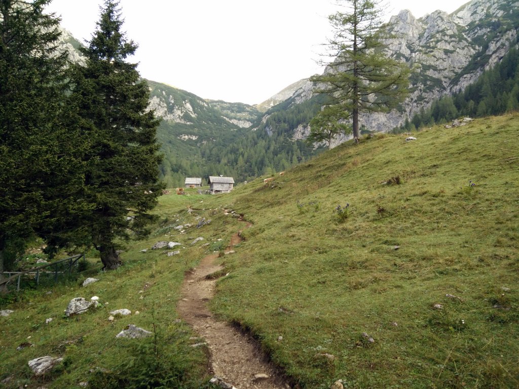
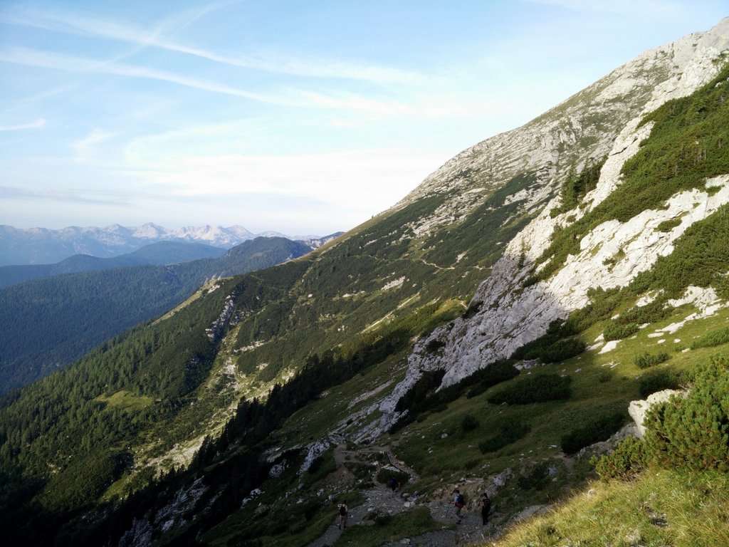
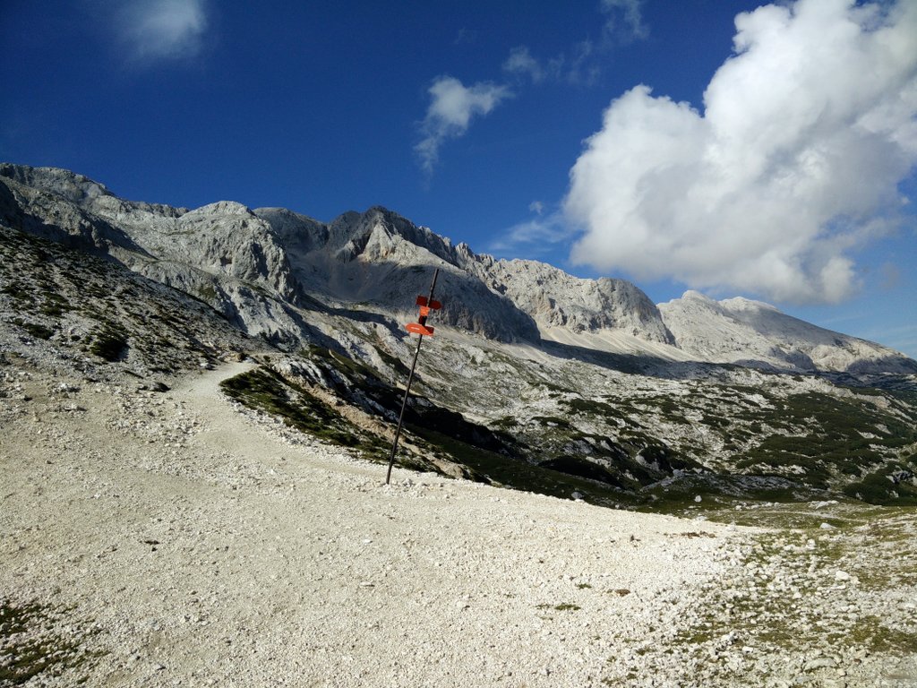
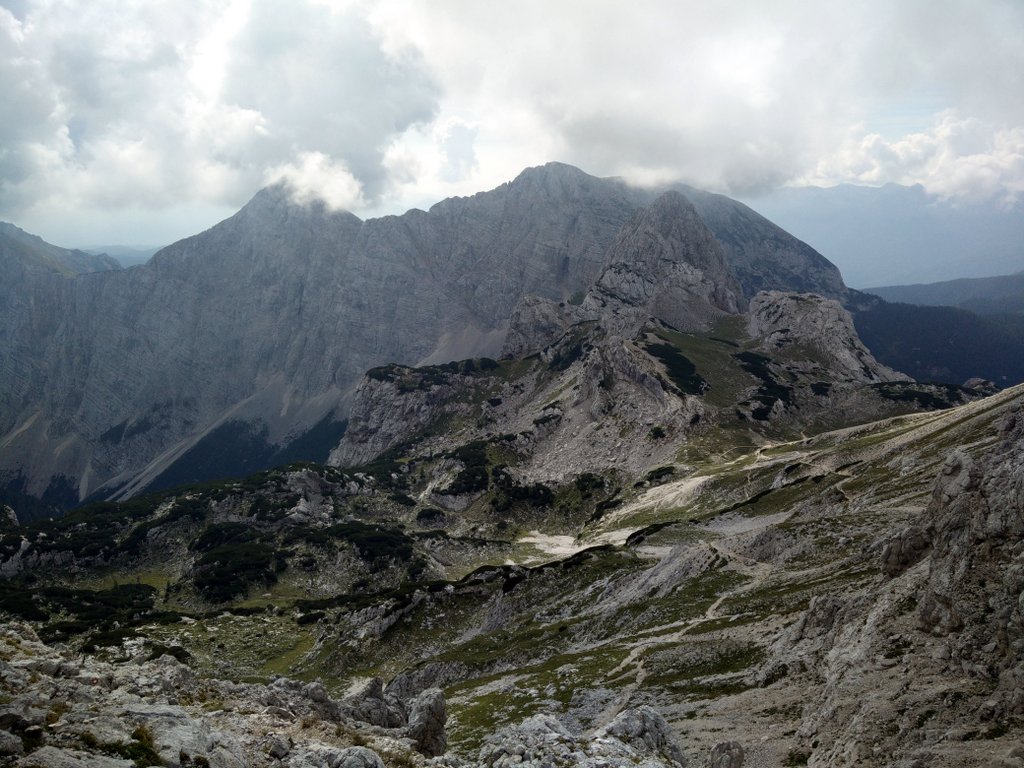
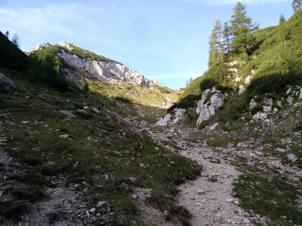
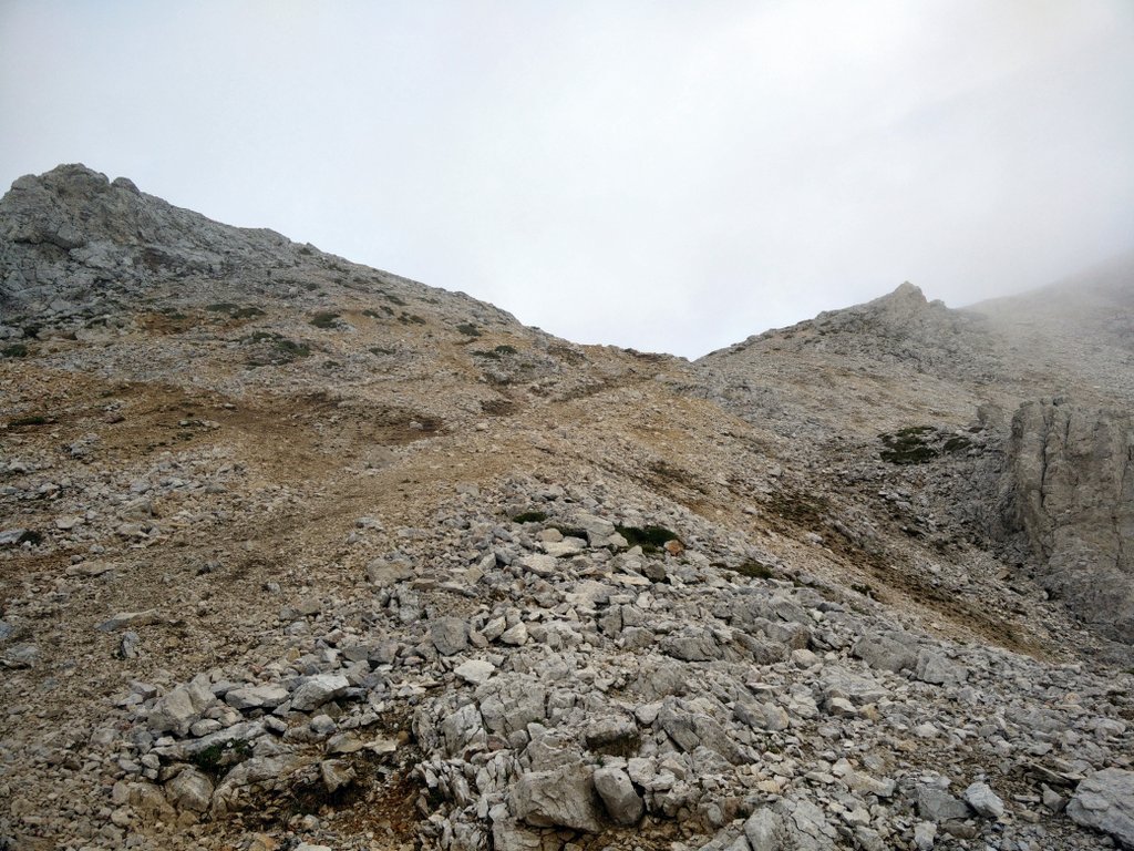
The trail is generally very well-marked with direction signs and painted red and white circles on rocks, trees etc. From the parking lot start walking on the narrow path towards north-east in the direction of Planina Konjscica (there is a directions sign at the parking place). The path ascends gently through dense woods and soon changes its direction towards north-west. After hiking on this path for approximately 1.7 kilometers, you will reach a mountain pasture (Planina Konjscica) where there is a small hut for shepherds. Continue towards north-west on the dirt track on the other side of the hut which will soon narrow and ascend rapidly. After ascending for approximately 700 meters you will reach a small plateau that offers a great view on the slopes of the surrounding mountains Mali Draski Vrh, Veliki Draski Vrh and Tosc which are all more than 2000 meters high.
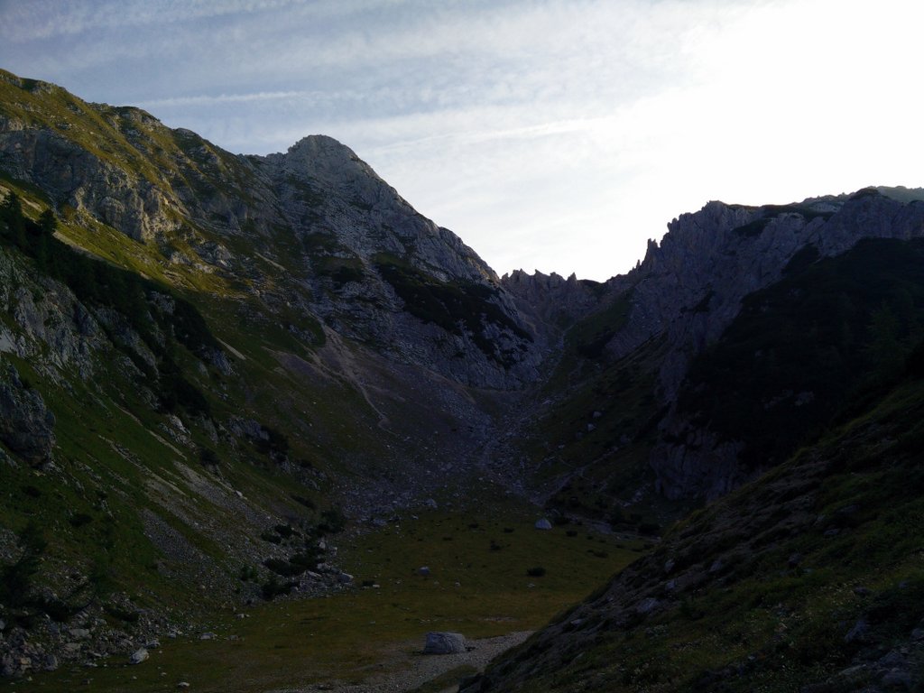
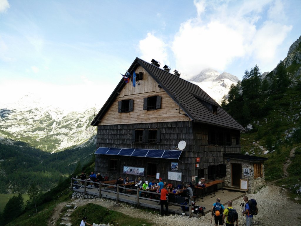
Here the trail changes its direction towards south-west and starts ascending to the ridge called Studorski Preval. When you come to the ridge you will be 1870 meters above sea level. Then the trail descends slightly and is for the next 3 kilometers relatively flat while it follows a line around the steep slopes of mountain Tosc. The trail eventually changes its direction towards north and passes the Vodnikov Dom mountain hut. By now you have hiked for 7 kilometers since the starting point. The Vodnikov Dom mountain hut offers cooked food, drinks and accommodation. Here you can also refill your water bottles for free as the tap water is drinkable. I indeed recommend refilling water bottles here as you will otherwise be slowed down by carrying all the water you need from the starting point to the top and back.
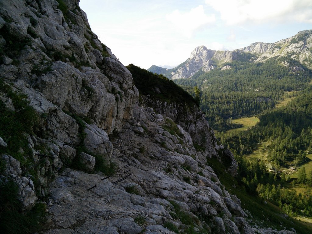
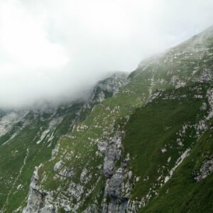
From the mountain hut continue on the narrow path towards north-west. The path soon starts ascending and crosses several exposed areas that are protected with steel cable. You can secure yourself with via ferrata set, but the stretches are so short that it is not really necessary. The terrain here becomes rockier and the vegetation less dense. After ascending for approximately one kilometer you will reach another plateau. Here you should continue towards north and soon you will reach a crossroad with a directions sign. From here two routes lead to the peak – one goes past the Kredarica Mountain Hut while the other goes past the Dom Planika mountain hut. The route that goes past the Kredarica mountain hut is slightly longer and more technically challenging, but the mountain hut there is also more popular among hikers than the smaller Dom Planika mountain hut. I took the Kredarica option because I wanted to spend some time at the mountain hut there on the way back, but if you would like to avoid the crowds I recommend that you take route past the Dom Planika mountain hut.
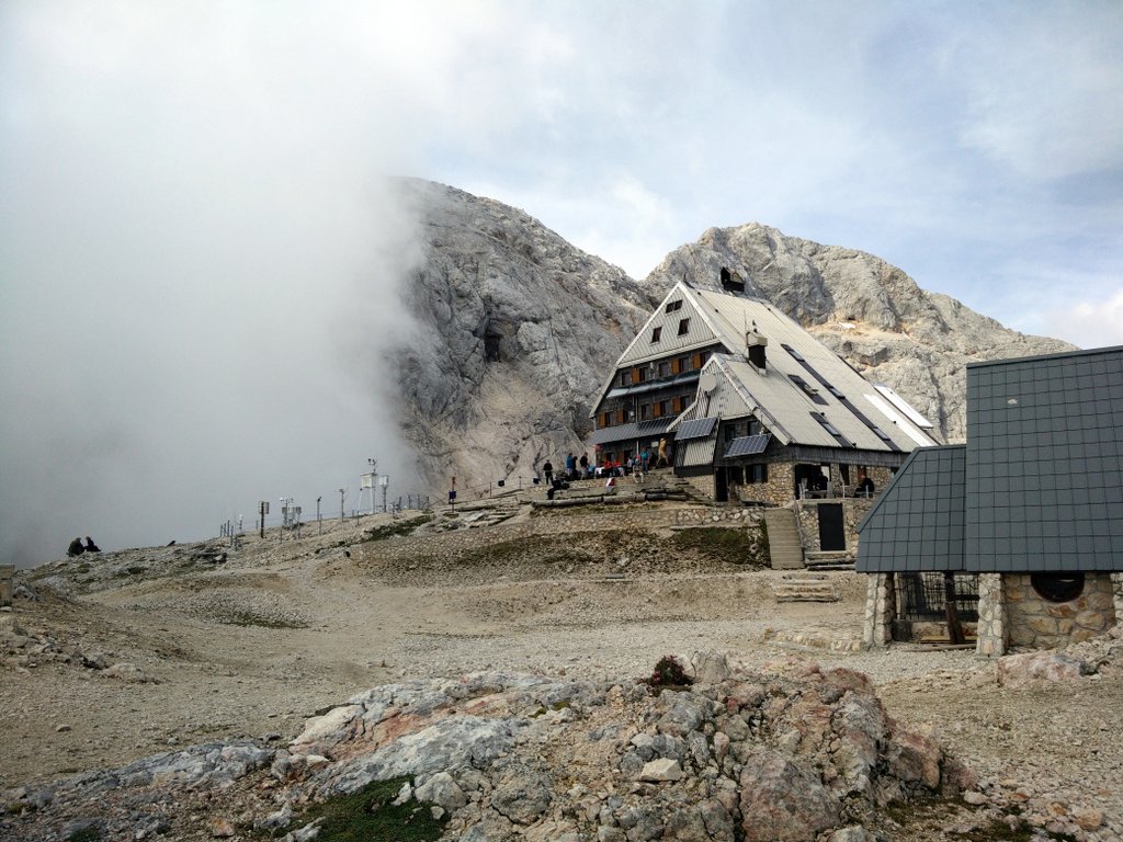
So, at the crossroads I took the Kredarica route in the direction of north where the path starts ascending rapidly and crosses a few fairly exposed areas. Soon you will see the mountain hut ahead of you and after hiking on this path for approximately two kilometers you will reach it. The Kredarica Mountain Hut provides accommodation, drinks and cooked meals. It is a fairly big mountain hut and can accommodate up to 340 persons. A beer there will cost you 4 € while a 1.5-liter water bottle costs 5 € – the water in the pipes is no longer drinkable. From the mountain hut you will also get a nice view on the peak – if it’s not covered with clouds.
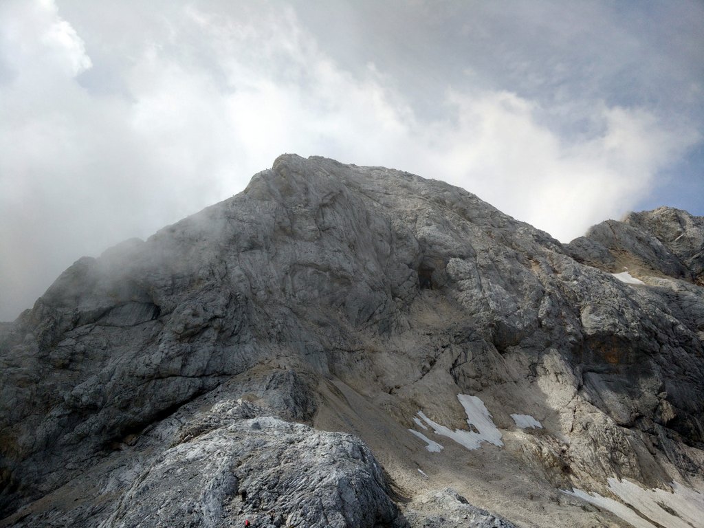
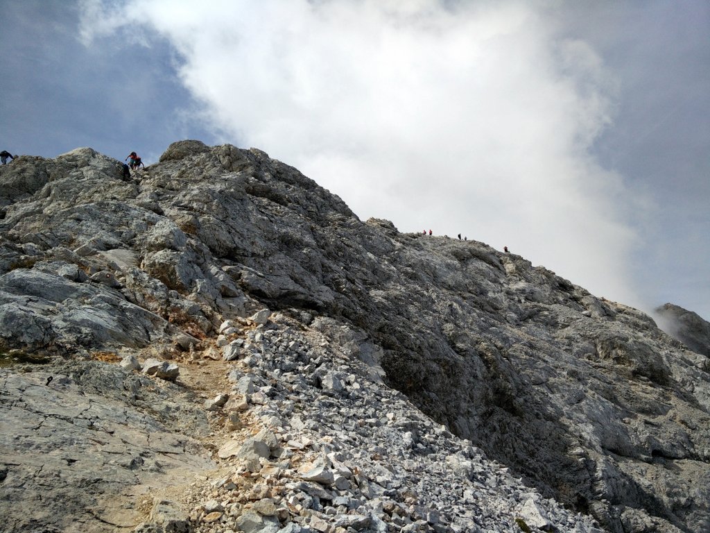
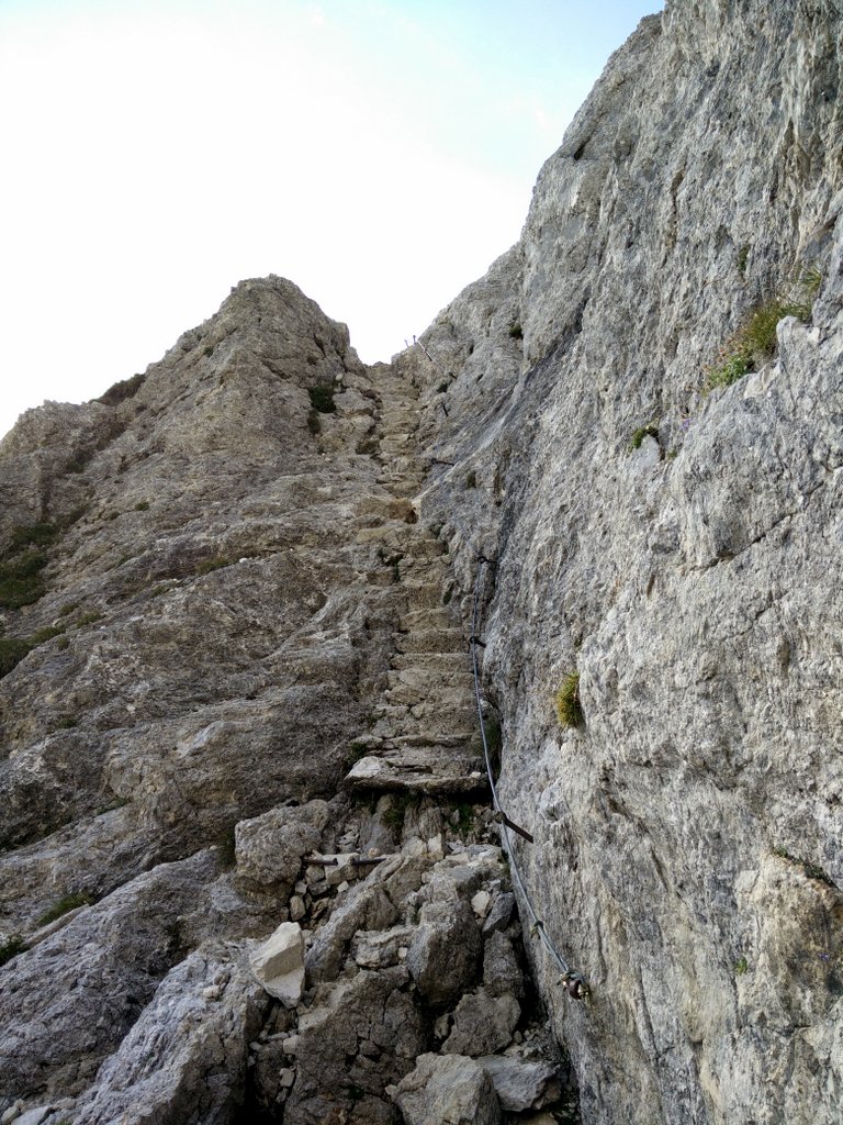
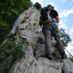
Continue in the direction of west and soon you will come to the foot of the steep slopes of Mali Triglav (literally Little Triglav). Here the most technically challenging part of the trail begins as you need to climb to the top of Mali Triglav. The path is equipped with a steel cable for via ferrata use and will lead you almost vertically to the top of the mountain (ascent of 150 meters). However, via ferrata sets couldn’t be used effectively at the time when I was doing the ascent as there were too many hikers going up and down. Those who were using via ferrata sets had a lot of hassle with attaching and detaching themselves every time they encountered somebody. Instead I would recommend that you merely hold on to the cable with your hands as the slope offers plenty of places for foothold, so that you should feel secure nonetheless. One advisable safety precaution is, however, to wear a climbing helmet here as the flow of so many hikers also entailed falling stones.
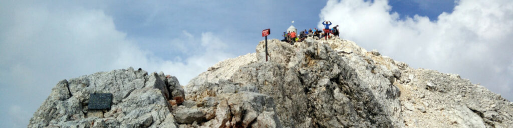
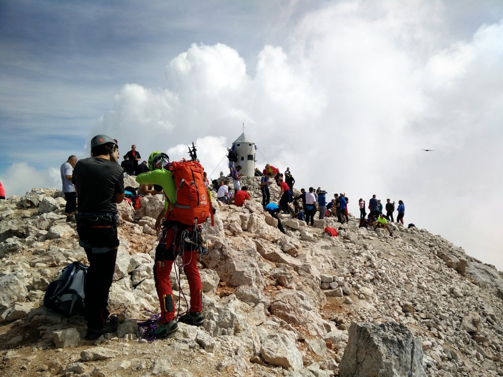
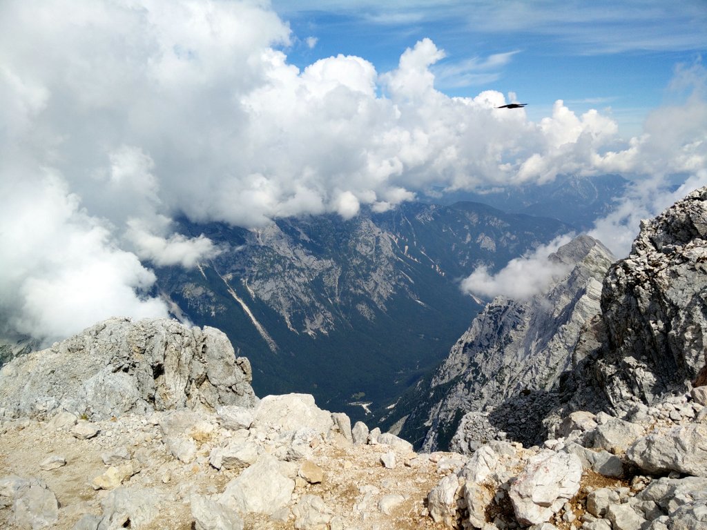
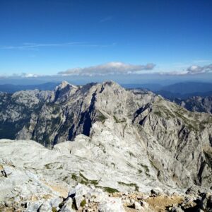
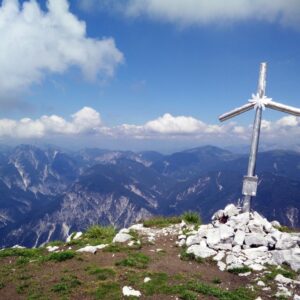
When you reach the peak of Mali Triglav you should continue towards north-west on a narrow ridge (with a steel cable) until you come to the foot of the steep slope of Triglav. Here another technically challenging stretch begins as the path again ascends almost vertically to the peak (ascent of 60 meters). After ascending for 10 minutes or so, you will reach the top of the mountain. On the top you will be rewarded with a great view on the numerous surrounding peaks. There is also a small shelter (Aljazev Stolp) on the top which was built in 1895 by local mountaineers and renovated several times since then. You will see people photographing the little shelter intensely as it especially among Slovenes is a widely known landmark and the symbol of Triglav. Triglav literally means “Three heads” due to its three top peaks and in Slovenian folklore you have to climb the mountain at least once in your life to be a proper Slovene.
Getting back to the starting point
For the way back I used more or less the same path as for the climb. I stopped at the Kredarica Mountain Hut for an hour or so and enjoyed the fresh mountain air. Hikers from all around the world are hanging out here, having a good time.
Triglav Trail – Planina Konjscica
Triglav Trail -Plateau after Planina Konjscica
Triglav Trail – Path towards Vodnikov Dom
Triglav Trail – Vodnikov Dom Hut
Triglav Trail – Crossroad on the second plateau
Triglav Trail – View from the trail
Triglav Trail – Kredarica Mountain Hut
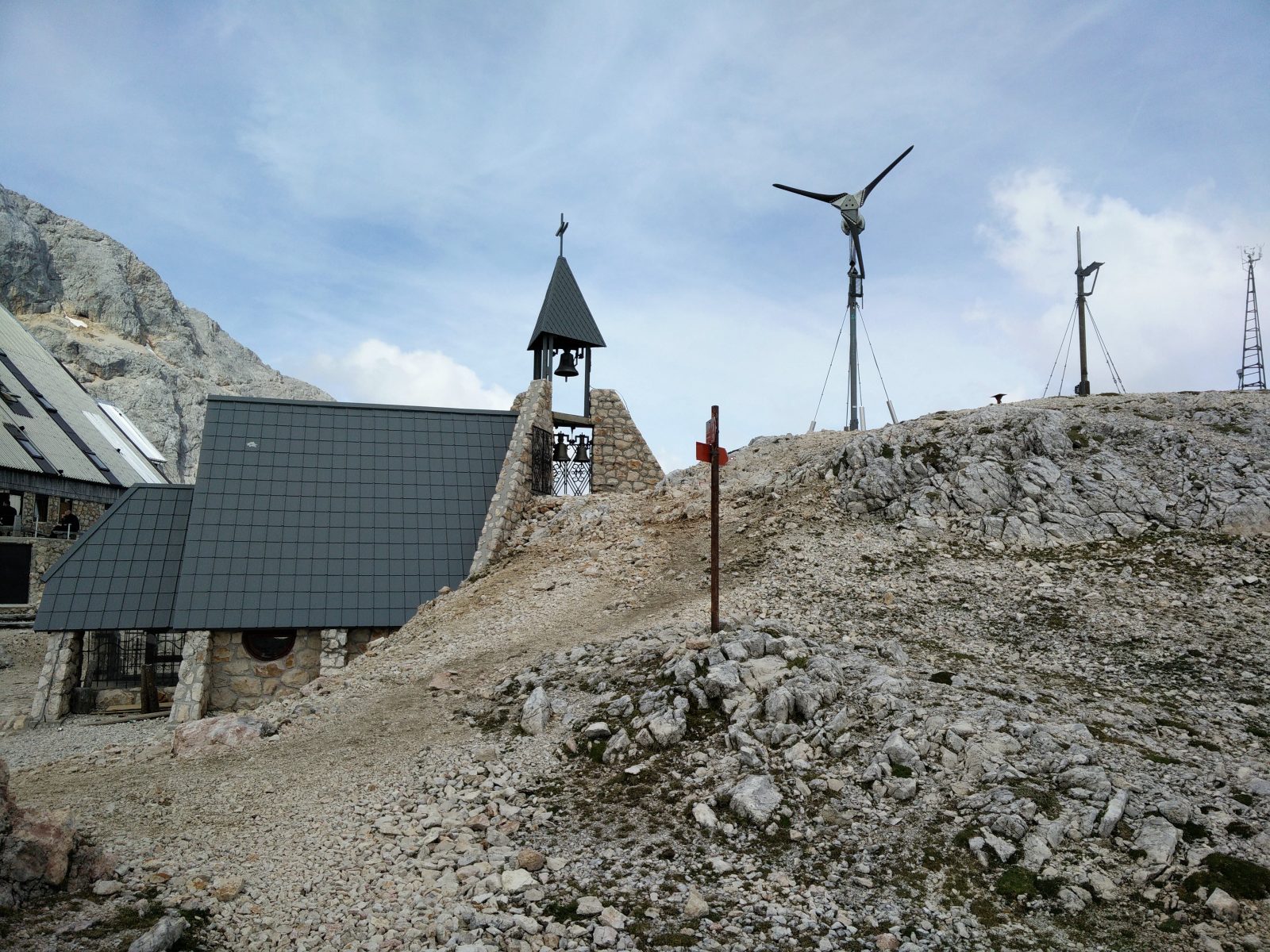
Triglav Trail – Chapel next to the mountain hut
Triglav Trail – Technically challenging stretch
Triglav Trail – Approaching Mali Triglav
Triglav Trail – Mountain Shelter on the top
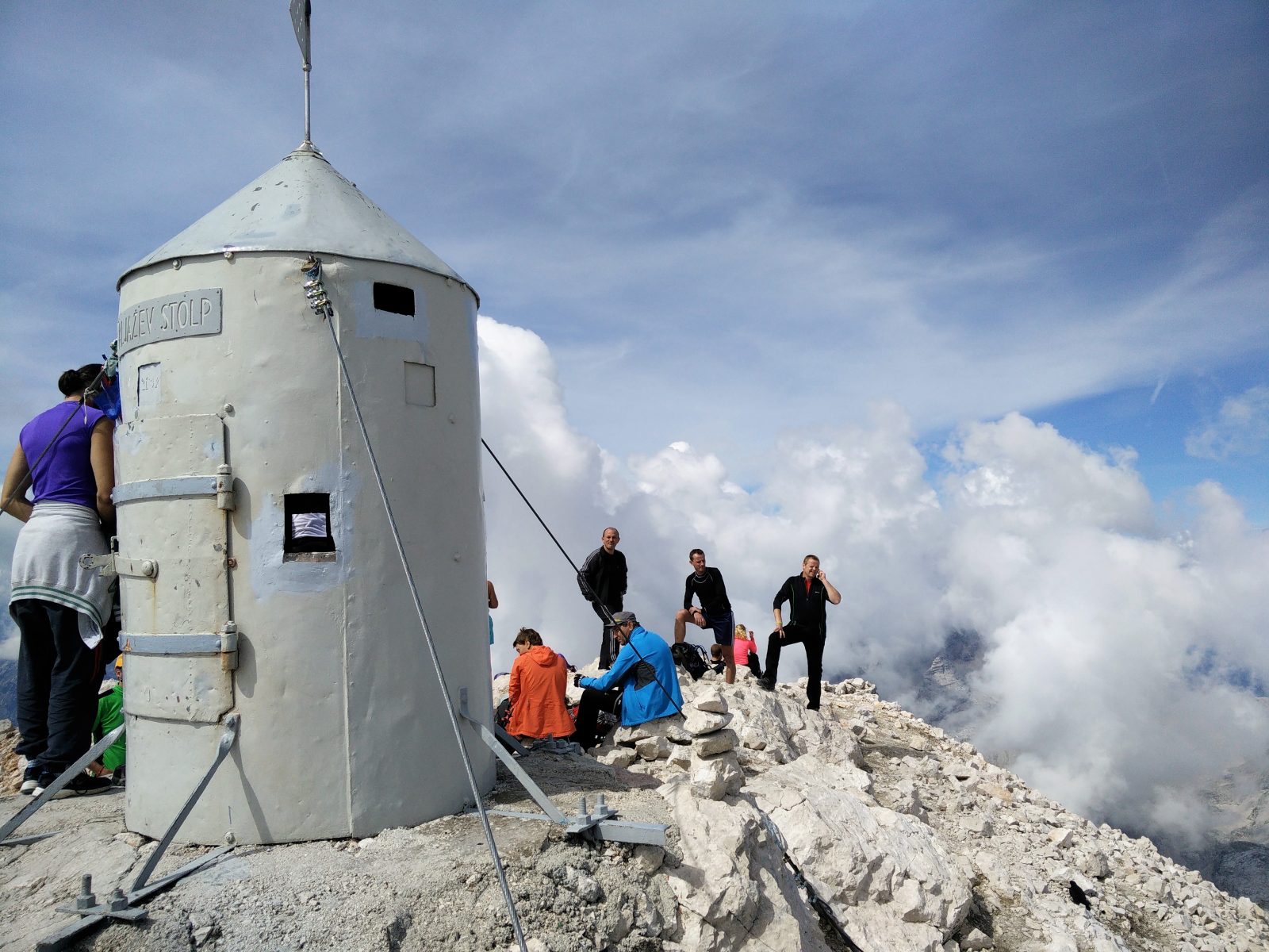
Triglav Trail – Shelter on the top
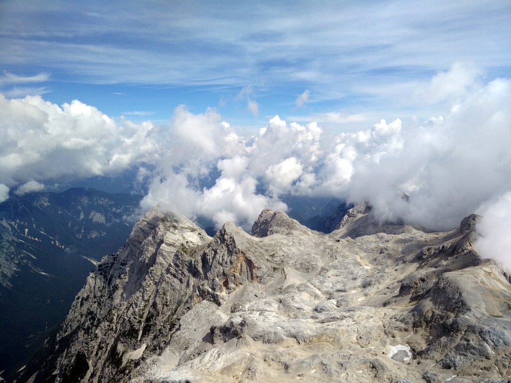
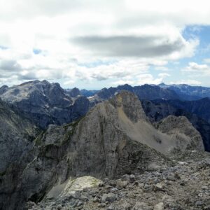
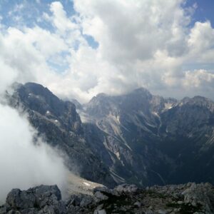
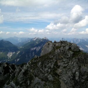
Triglav Trail – View from the top
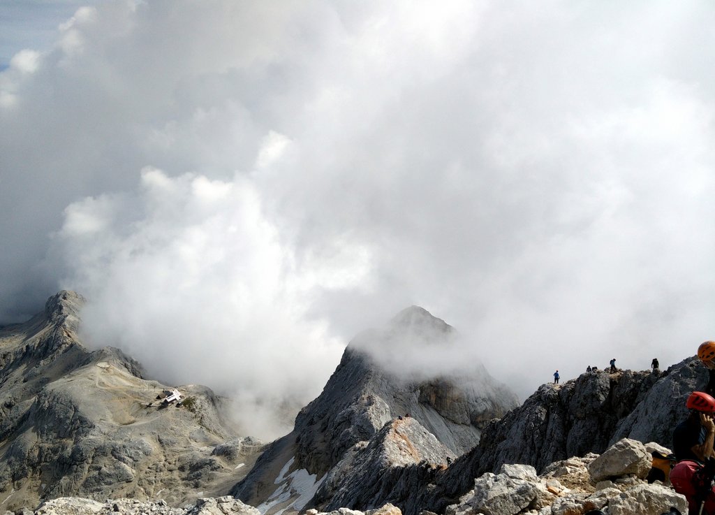
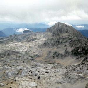
Triglav Trail – Kredarica is seen from the top
Equipment
As I knew that the hike is physically very demanding, I wanted to go as lightweight as possible. During the hike I was wearing the Icebreaker Tech T Lite Merino wool t-shirt, Montane Terra Pack pants, Salewa Mountain Trainer Mid hiking boots, Woolx Merino Boxers and socks made of Coolmax fibers. In my Osprey Talon 44 backpack I was carrying a rain jacket, fleece jacket, hat, via ferrata gloves, climbing helmet, food, 3 liters of water and some accessories.
On both the way up and down I filled the hydration bladder at the Vodnikov Dom mountain hut. Additionally, I purchased 0.5 liter water bottle at the Kredarica Mountain Hut. All in all I needed approximately 5 liters of water for this demanding hike.
I was wearing the climbing helmet from the Kredarica Mountain Hut onwards due to the danger of falling rocks. Besides wearing a helmet, you might want to bring a via ferrata set if you feel too insecure on steep exposed places without.
Keep in mind that if you are doing this hike in any other season than summer you will definitely also need crampons, ice axes and gaiters as the trail will require ice climbing.
Equipment under scrutiny
Icebreaker Tech T Lite T-shirt
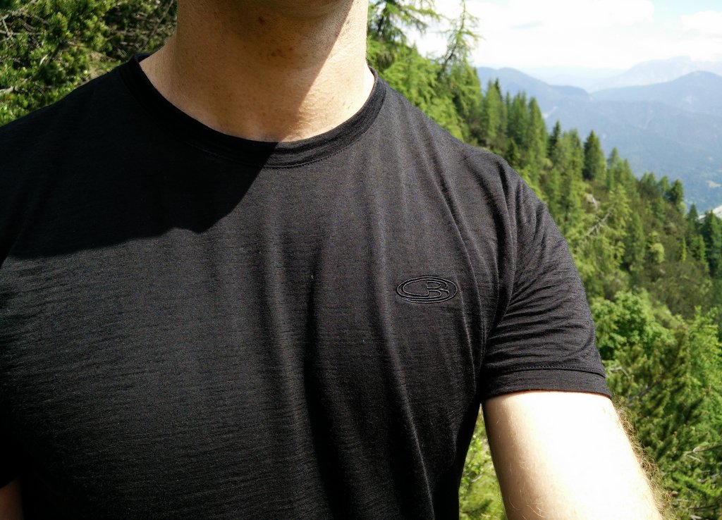
Icebreaker Tech T Lite – On the trail
The Icebreaker Tech T Lite T-shirt keeps on impressing me with its outstanding performance. The base layer offers great breathability and moisture-wicking properties. As it is made of a very thin and porous fabric it is also perfect for hiking on warm days. However, the best thing about this base layer is its antimicrobial performance due the high content of Merino wool (87%). So far I couldn’t detect any signs of odor no matter how long I’ve been wearing it. You can read the full review of the Icebreaker Tech T Lite t-shirt here.

Also available at:
Conclusion and photo gallery
The Triglav trail is best for experienced and physically well-prepared hikers and mountaineers who are comfortable with via ferrata routes and scrambling. If you want to avoid the crowds Triglav might not be your best option as the mountain is indeed very popular – especially in the month of August. Instead I would recommend the Skuta trail. However, if you do decide to climb Triglav you will be doing a dynamic and challenging trail that rewards you with a great view on the surrounding peaks and offers many opportunities to hang out with fellow hikers. Before going you should of course check the weather conditions as doing this hike in bad weather (thunder storms, avalanches) could be hazardous or even fatal.
Triglav Trail - Approaching Studorski Preval
Triglav Trail - Trail after Vodnikov Dom
Triglav Trail - Stairs after Vodnikov Dom
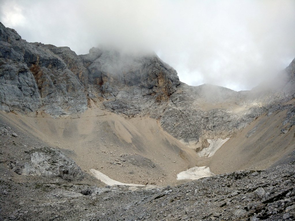
Triglav Trail - There was still some snow
Triglav Trail - Approaching Kredarica
Triglav Trail - View on the valley beneath
If you have any questions about this hike, please drop me a line in the comments below.
Triglav Trail Terrain Video


Thank you so much for such a detailed description. My husband and I hiked to Triglav and back today. Your post really helped us with getting there, being prepared, and not getting lost.
You are very welcome 🙂 I hope you had a nice ascent to this amazing mountain!
Thanks for a really good post, this will be very helpful. Can you give an idea of how long it took you to complete the route? Thanks
Hi Keith,
it took me over 11 hours to complete the route. It’s a long one and it was very crowded from Kredarica mountain hut to the top 🙂