Thorbjorn
About Thorbjorn Trail
In August I decided to spend a weekend in Grindavik and of course I also checked for mountains to climb nearby. I came across Thorbjorn which is placed between Grindavik and Blue Lagoon – a well known Icelandic spa. The mountain is only 200 meters high but after checking the map I figured out that it offers a great view on Grindavik and the Atlantic Ocean. Furthermore, I saw that there are several hiking trails in this area and therefore I planned a nice circle tour which starts in Grindavik and goes over Thorbjorn to Blue Lagoon and then returns back to Grindavik around the mountain. This hike is very easy and therefore suitable for everybody who wants to spend a day in the nature while observing the astonishing Icelandic landscape. As you can come to the starting point by bus from both the airport and the capital, we have put the Thorbjorn trail on our selection of Hiking Trails in Iceland Reachable by Public Transport.
Thorbjorn Hiking Trail Details
Physical Difficulty
Easy
Technical Difficulty
Easy
Duration
4 h 27 min
Distance
13.05 km
(8.11 mi.)
Ascent
278 m
(912 ft.)
Descent
278 m
(912 ft.)
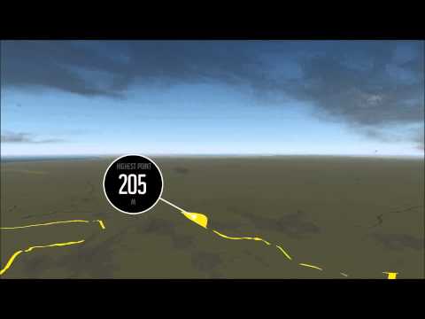
Highest Point
205 m
(673 ft.)
Lowest Point
19 m
(62 ft.)
Date of the Hike Date when we did this hike ?
August 2015
Weather On the day when we did this hike ?
Mostly Cloudy
Temperature On the day when we did this hike ?
16° C
(61° F)
Wind On the day when we did this hike ?
20 km/h
Thorbjorn GPS Route and Trail Description
*Click on the chart to see the location on the map
GPX route helps you with the navigation on a hike. It can be used with a smartphone, handheld GPS device or a GPS watch.About GPX Route
Reaching the starting point
This hike starts in Grindavik which can be easily reached by public transport from both the capital and the Keflavik airport. First take bus 55 from the Klambratun bus stop towards Grindavíkurafleggjari. If you are not planning to leave from Klambratun Park, check Straeto’s website to find other bus stations where bus 55 stops. The bus drive will take you around 44 minutes. At the Grindavíkurafleggjari bus stop, take bus 88 towards Grindavík Adalbraut. Note that bus 88 runs very infrequently, so be sure to choose a departure with 55 that fits with it. After driving approximately 10 minutes on bus 88 you will reach Grindavík Adalbraut. In the proximity to the bus stop there is a Netto supermarket as well as a Vinbudin – an Icelandic liquor store. Just in case you want to buy something for the hike.
The above attached GPS route starts approximately 700 meters northwest from the Adalbraut bus stop.
Trail
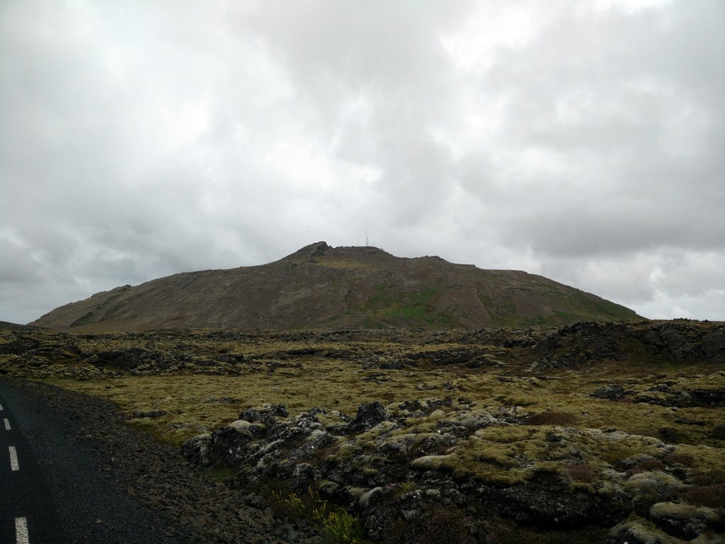
From the bus stop walk towards north on Grindavikurvegur Street for approximately 600 meters. Then go towards northwest until you reach Nesvegur Street; here the attached GPS route starts. Cross the Nesvegur Street and continue on a paved road which leads towards the Blue Lagoon but only follow it for 500 meters. Then you’ll see a wide dirt track on the right side of the road which runs towards Thorbjorn. After approximately 800 meters the wide dirt track splits into two. I decided to continue on the right path and ascend the mountain from the western side.
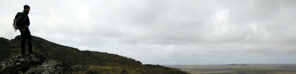
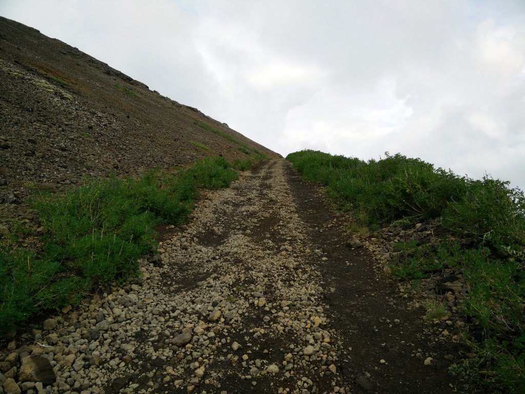
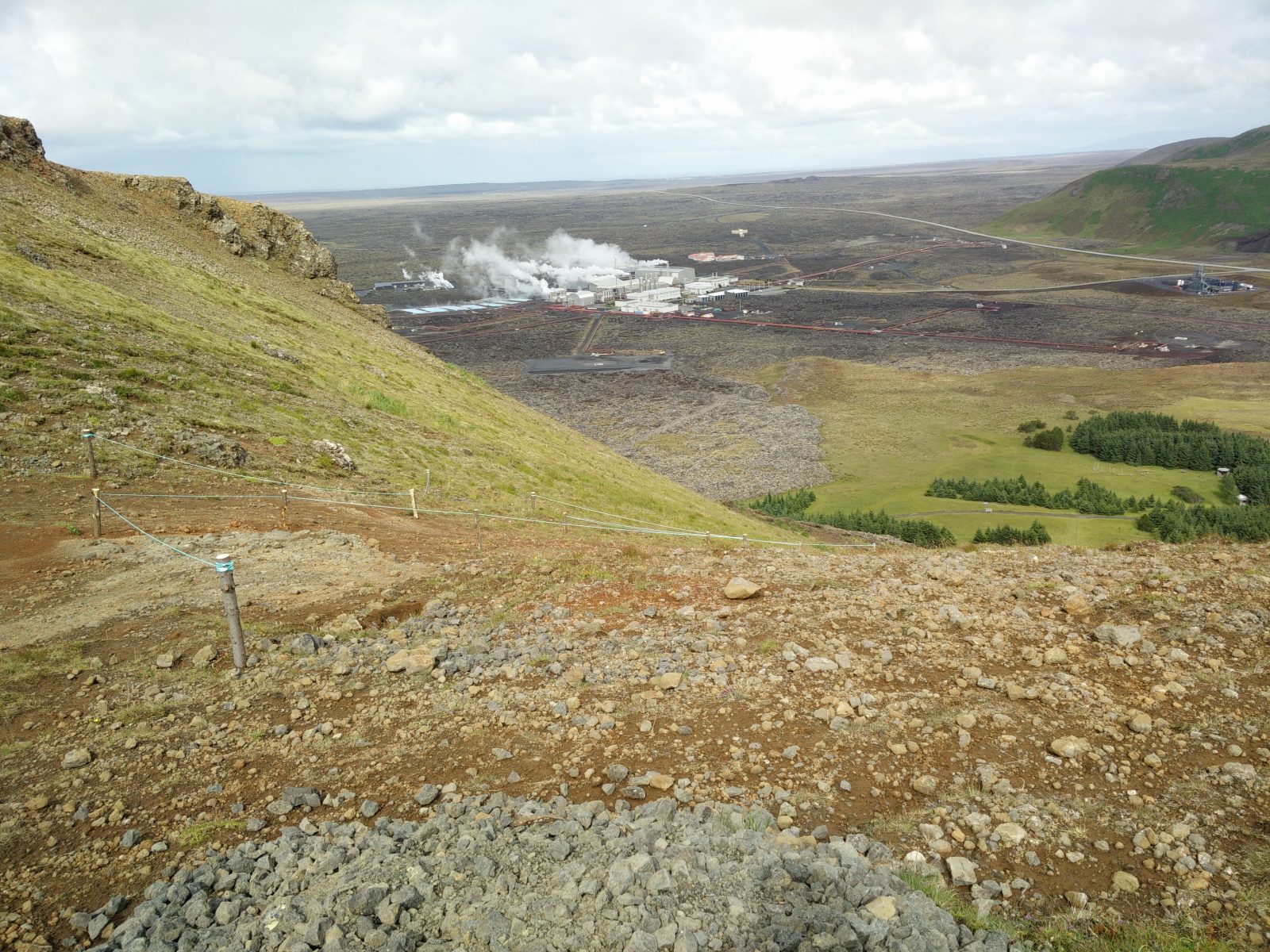
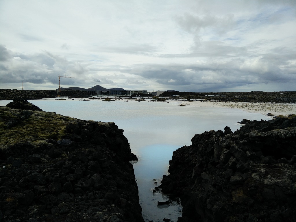
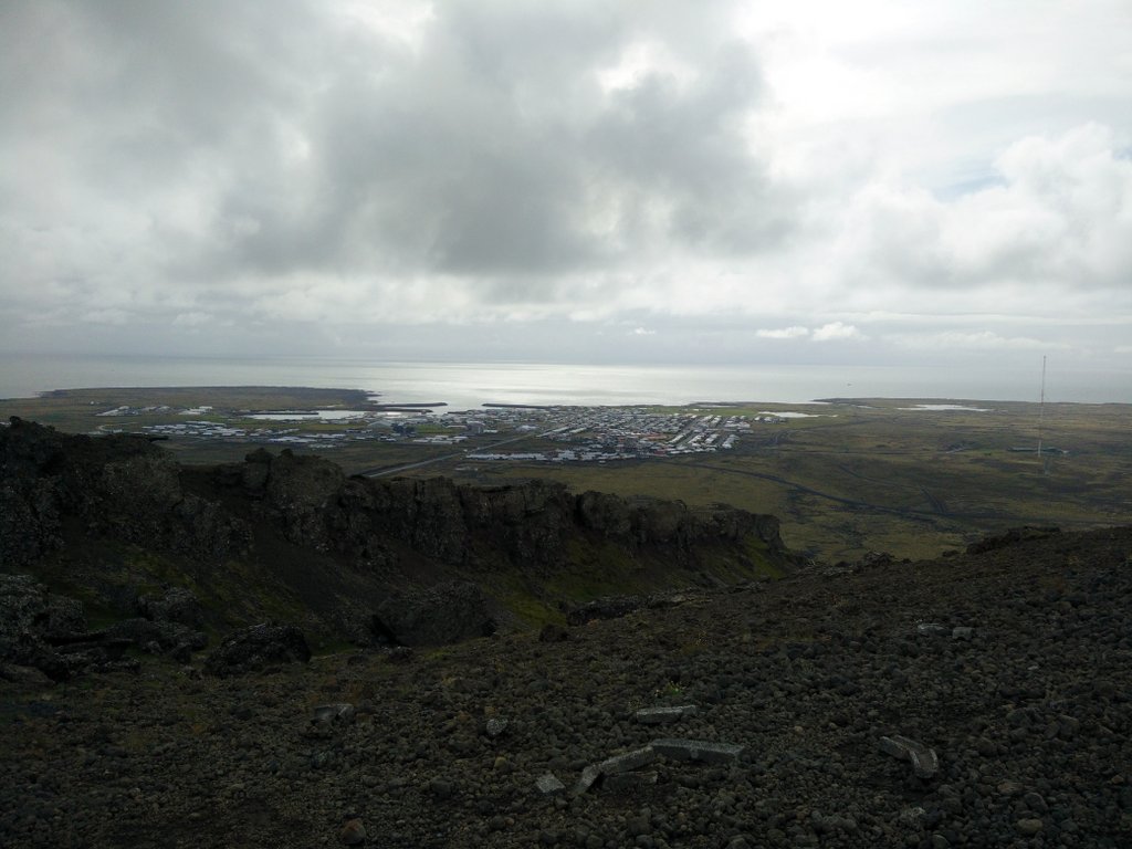
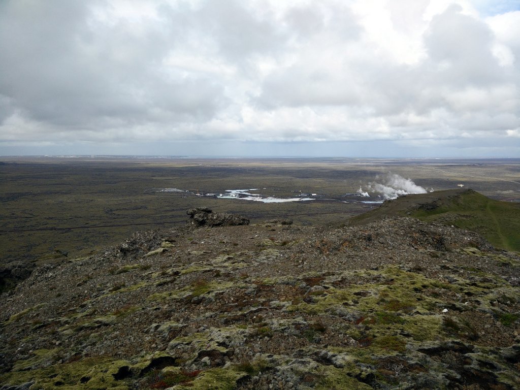
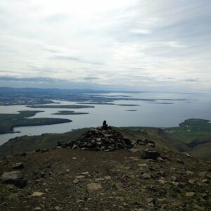
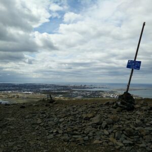
The climb is quite steep but the path is not difficult and I believe everybody can climb this small mountain. After walking altogether 4 kilometers you will reach the top of Thorbjorn where you’ll see several small buildings and a radio tower. These buildings were used by the U.S. Navy which had a radar station there in the 1990s, but they are abandoned now. From there you will also have a great view on Grindavik and Atlantic Ocean. Besides the amazing view of the varied Icelandic landscape, alternating between lava fields and green hills, you will be able to see the famous Blue Lagoon or rather its less flattering location.The spa is placed next to a huge geothermal power station, but in between there have been put huge piles of rocks so that the visitors can’t see the massive industrial complex which feeds the lagoon with the characteristically blue waste water that tourists pay high prices to swim in…
Getting back to the starting point
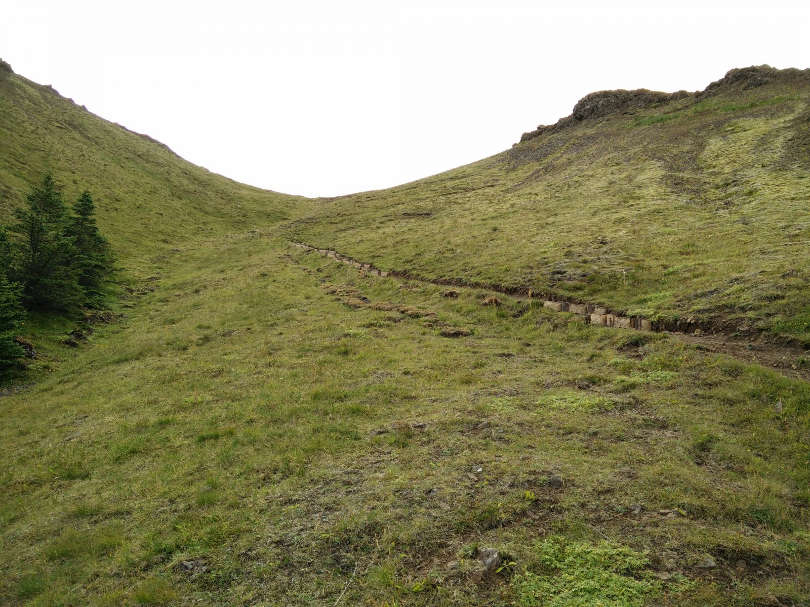
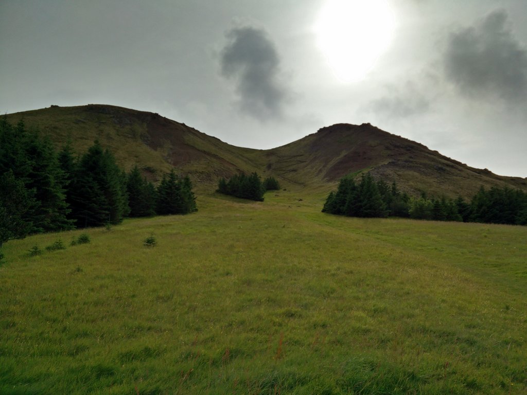
I descended the mountain from the northern side where a completely new path with wooden stepping logs have been made – and was being expanded at the time of my hike. The path is pretty steep so be careful to avoid slips and falls. Whereas the mountain was mostly rocky and bare while ascending, the northern side was more lush and green. At the foot of the mountain there is a small pine forest and a playground next to the path; an ideal place to take a pause for lunch – not least because it is relatively sheltered from the ever-present Icelandic wind. There is even a hammock for those who want to take a nap in the nature. The little forest is said to house wild rabbits – both are a rarity on Iceland!
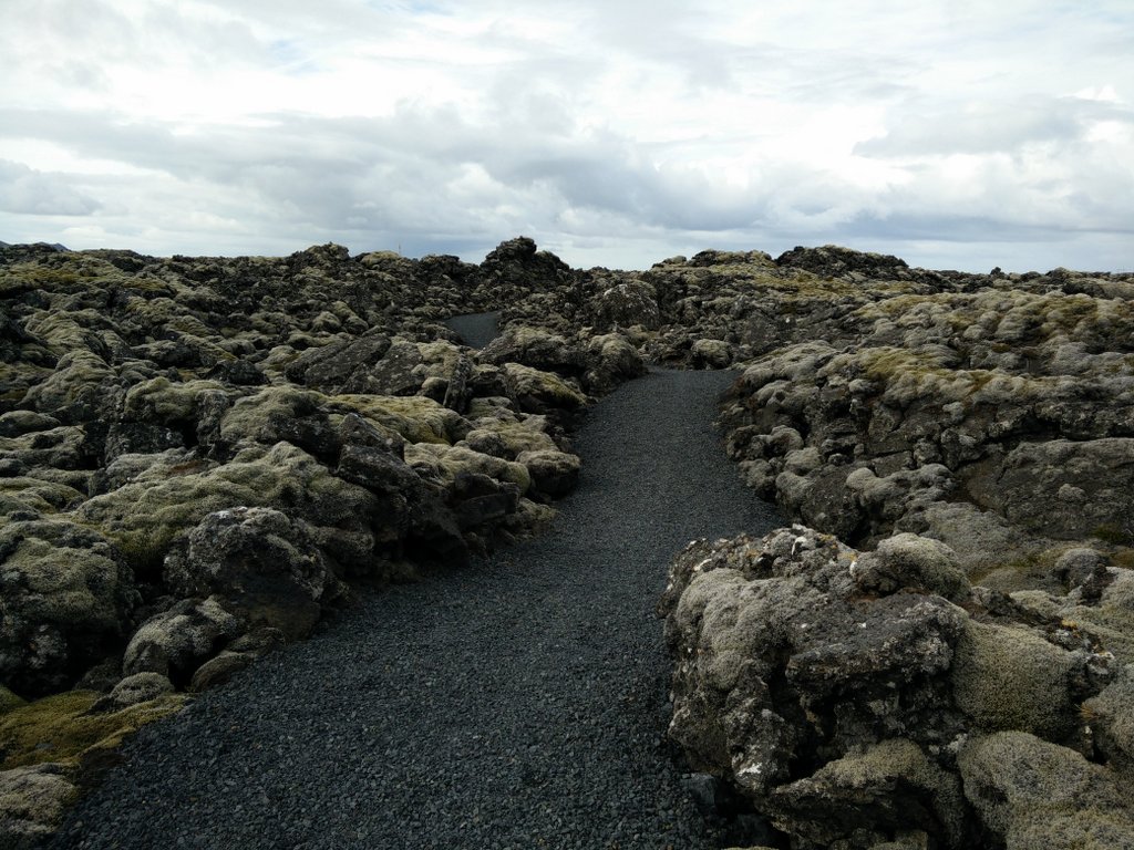
After a lunch break I continued on the path towards west. The path soon splits into two – the left path is leading around the mountain and the right path is running towards Blue Lagoon. I took the right path which is paved with gravel and runs over an amazing lava field. After approximately one kilometer, I reached the Blue Lagoon and walked around it. Then I continued on a path towards west until I reached the main road which connects Grindavik with the Blue Lagoon. For the next 2 kilometers I hiked on this road which was free of heavy traffic and surrounded by lava fields with several outstanding lava structures. Finally a wide dirt track began from the left side of the road and I decided to continue on it. I soon came to the crossroads where I took the right path in the beginning of the hike. After that I just continued south until I finally reached Grindavik.
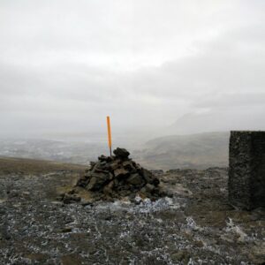
Thorbjorn – Start
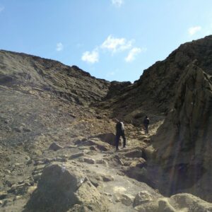
Thorbjorn – Climb
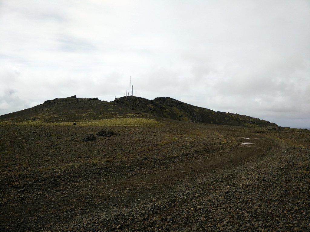
Thorbjorn – Top
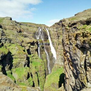
Thorbjorn Trail – A not so charming view on the Blue Lagoon
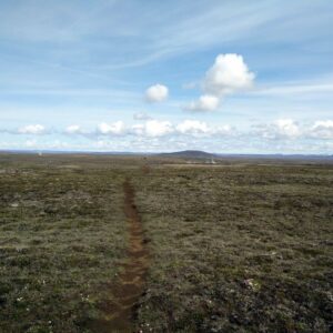
Thorbjorn Trail – Path
Thorbjorn – Descend
Blue Lagoon
Equipment
Because the weather forecast showed possibility of rain, I wanted to be decently equipped for the hike. I was wearing an Under Armour t-shirt, Woolx Blizzard Top, windproof Schoeller AB400 pants, Woolx Merino Hat and Salewa Mountain Trainer hiking boots. In the backpack I was carrying thermal underwear, windstopper jacket, food and water. When I was approaching the top of the mountain I had to put on my Windstopper jacket because the wind became pretty strong.
Equipment under scrutiny
Woolx Merino Wool Daily Boxers
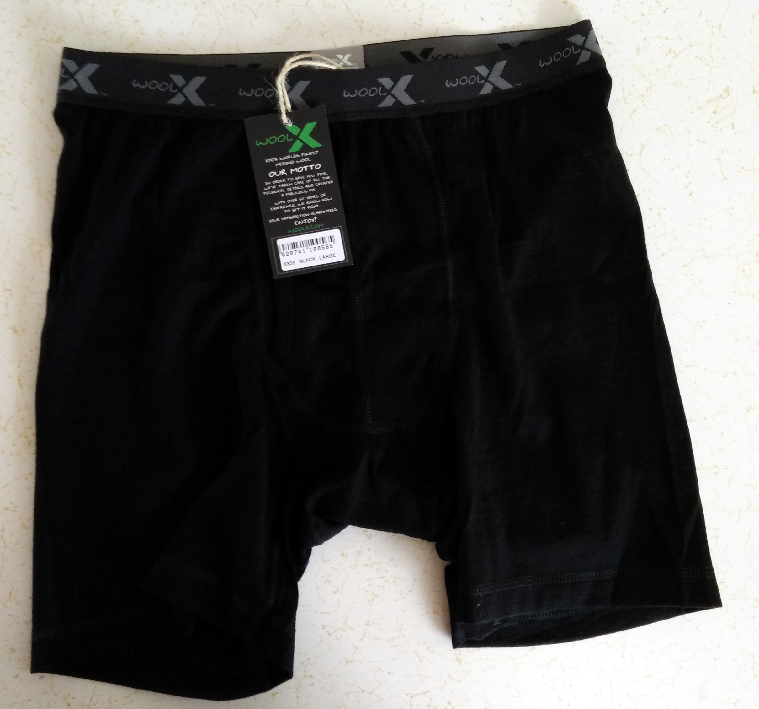
Woolx Merino Boxer Briefs
These extremely comfortable boxers were perfect for this hike. They are made out of soft 100% 17.5 micron Merino wool which assures superb temperature regulation and anti-odor properties. I haven’t noticed any rubbing, chaffing or other discomfort during the hike. I would recommend them to everybody who wants top quality underwear for the most demanding trails as well as for easy walks. You can read the full review of the Woolx Merino boxer shorts here.

Conclusion and photo gallery
The Thorbjorn trail is best for those who want to explore the area around Grindavik and Blue Lagoon while climbing a small mountain that offers a great view on the Reykjanes peninsula. I would recommend you to wear good hiking boots because the climb to the mountain as well as the descend is quite steep. When packing your gear, keep in mind that weather in Iceland can change very quickly. Rather pack too much than too little.
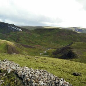
Thorbjorn - View
Thorbjorn - Blue Lagoon
Thorbjorn - Lava Field
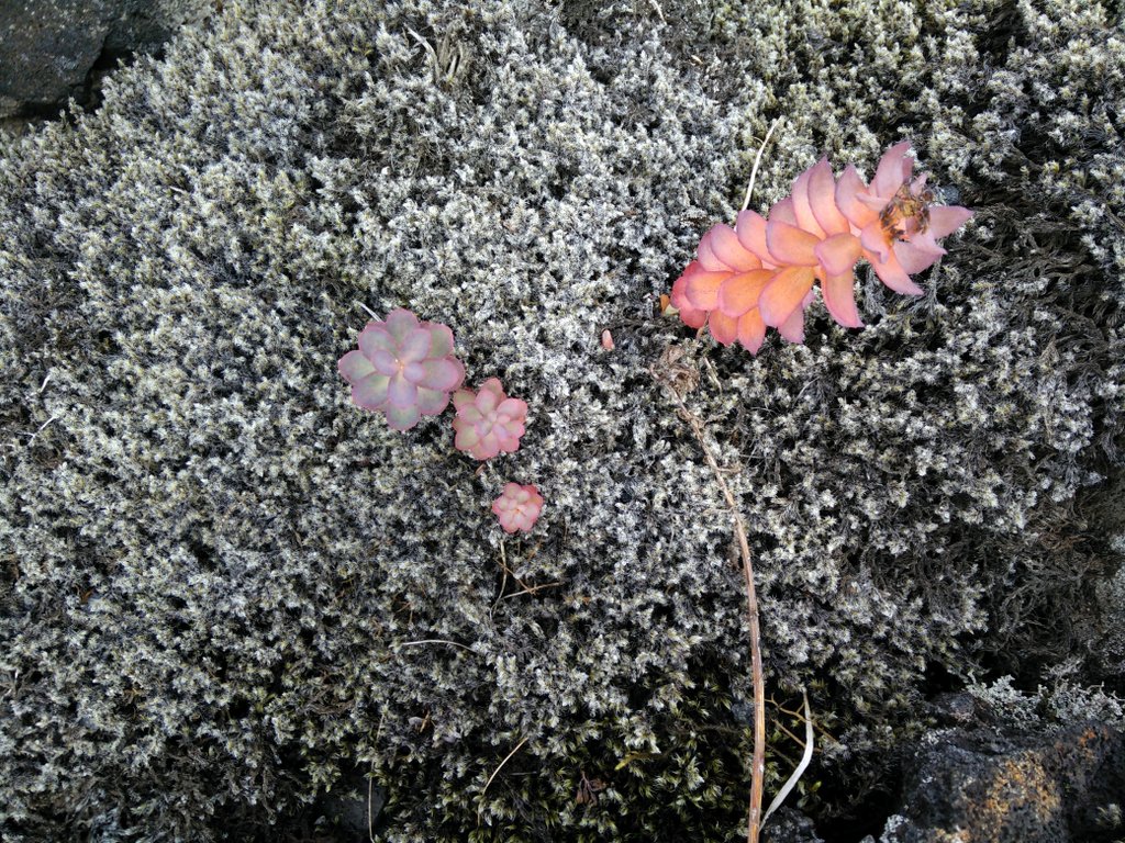
Thorbjorn - Moss
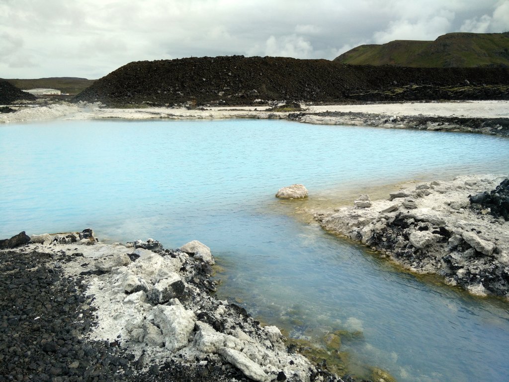
Thorbjorn - Blue Lagoon Pools
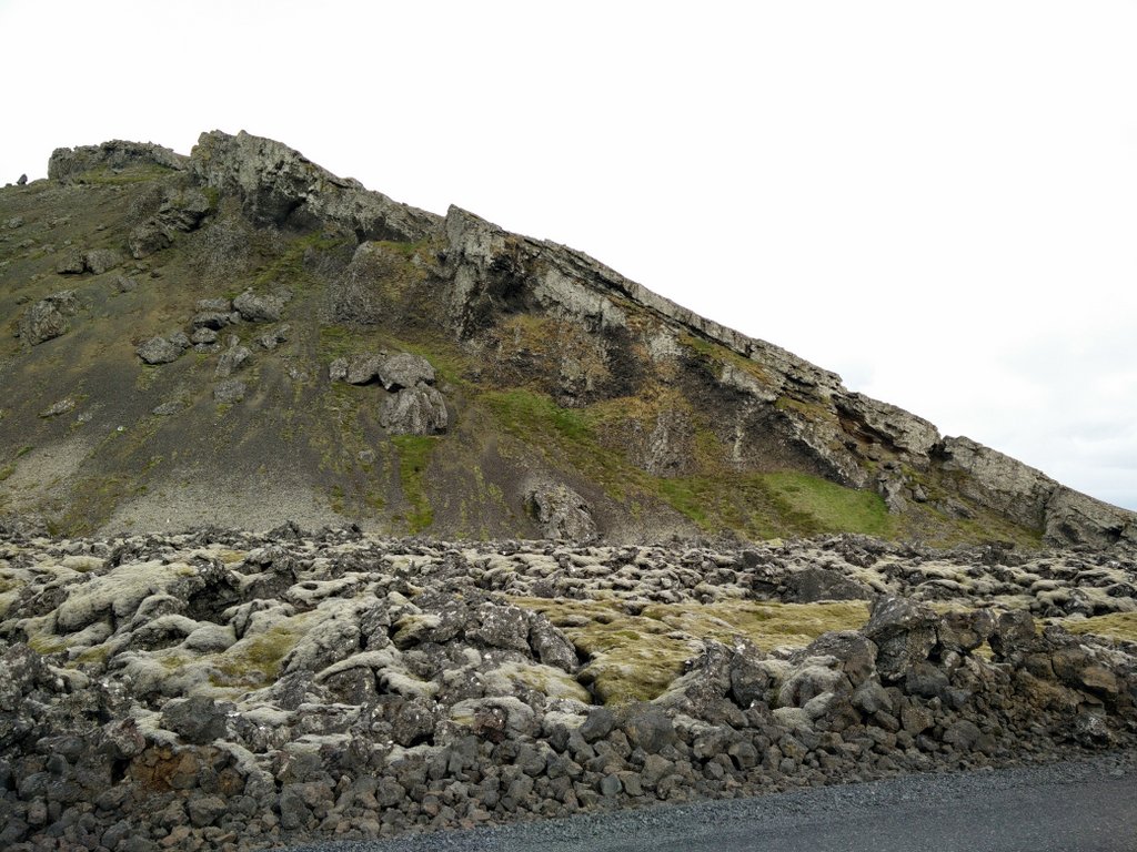
Thorbjorn - Landscape
If you have any questions about this hike, please drop me a line in the comments below.
Thorbjorn Trail Terrain Video


how do I drive from Bue Lagoon to this hiking point and is there parking there
Hi there!
If you’ll visit Blue Lagoon, you can start the hike right there. The trail goes past the entrance to the Blue Lagoon 🙂 You can download our GPS track above for free and use it for navigation with your smartphone.
Regards
Thank you for such an informative post! The weather looked nice on your day out. I know your post is marked January, but what month did you do the hike?
We are planning on doing this hike in mid-March and expect there might be a little more snow. Altogether unpredictable weather though, so we’re bringing the same stuff we wear to hike in the Canadian Rocky Mountains in the winter….nice difference is it won’t be -20°C!
Oops, disregard my question about when….. I just found the hike month was August, when clicking deeper into the Trail Details above!
I Cee,
I wish you a nice hike around the Blue Lagoon! In mid-March there will probably still be snow and ice some places, so be careful.
Regards,
Blaz