About the Logar Valley Hiking Trail
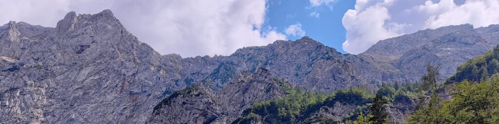
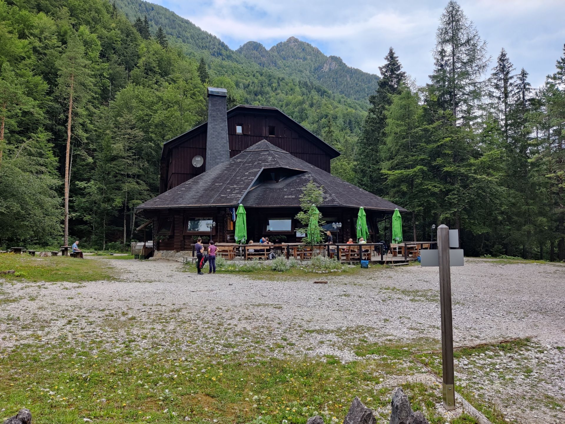
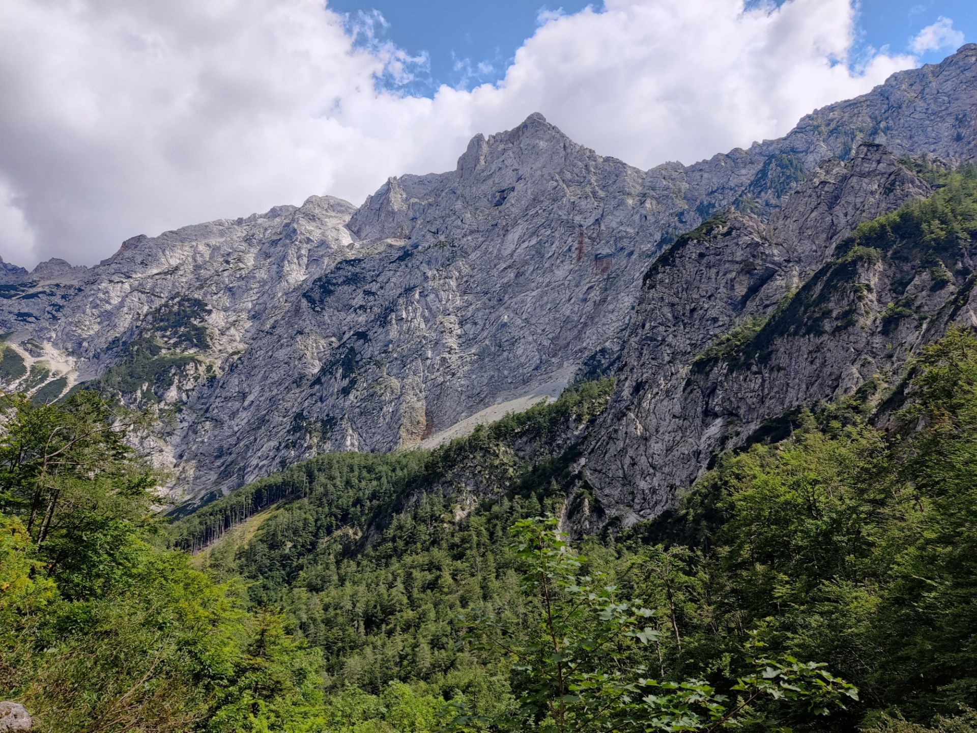
The Logar Valley (Logarska Dolina) is a picturesque Slovenian alpine valley surrounded by the Kamnik-Savinja Alps. It offers a relatively flat and easy trail called Pot po Logarski Dolini, which runs southwest through the nine kilometers long valley and ends at the Rinka waterfall at the end of the valley, while offering spectacular views on the towering peaks surrounding the valley. The adventurous mountaineer can continue onwards from the waterfall and undertake steeper excursions to peaks such as Skuta (2532 m), Mrzla Gora (2203 m) and Turska Gora (2251 m). As we had our daughter to carry in the summer heat, we opted to stay in the valley and started our hike to the waterfall from the mountain hut called Dom Planincev, which is conveniently placed next to the asphalted road that runs through the valley, about four kilometers away from the waterfall.
Logar Valley Hiking Trail Details
Physical Difficulty
Easy
Technical Difficulty
Easy
Duration
2 h 54 min
Distance
8.5 km
(5.28 mi.)
Ascent
304 m
(997 ft.)
Descent
297 m
(974 ft.)
Highest Point
1120 m
(3675 ft.)
Lowest Point
845 m
(2772 ft.)
Date of the Hike Date when we did this hike ?
August 2022
Weather On the day when we did this hike ?
Partly cloudy
Temperature On the day when we did this hike ?
25° C
(77° F)
Wind On the day when we did this hike ?
5 km/h
Logar Valley Hiking Trail GPS Route and Trail Description
*Click on the chart to see the location on the map
GPX route helps you with the navigation on a hike. It can be used with a smartphone, handheld GPS device or a GPS watch.About GPX Route
Reaching the starting point
You can only access the Logar valley by vehicle in one place; on the country road aptly named Logarska Dolina. It is a sideway to the regional road 428 which runs from the Austrian border passing Pavličevo sedlo in the west to the village of Radmirje further southeast. Be sure to drive along road 428 when approaching the Logar valley as Google Maps might offer you “alternative” routes on more or less passable forest dirt roads; you should all the time be driving on asphalt! If you are approaching from the northwest, you will be driving downhill most of the time; when you reach the bottom of the valley, you only have a few hundred meters before you should turn right and into the Logar valley. If you are approaching from the east, you will be driving through the valley for quite some time. The road towards the Logar valley will come up on your left about four kilometers after you have driven through the village called Solcava.
Once you have turned into the valley, you have the pay the entrance fee for the vehicle type you are driving at a small wooden hut. It was 7 euros for a car at the time of our visit; you can see a full list of current prices here. The entrance fee is only for motorized vehicles and used to maintain the road and amenities, so it is for free if you are entering by foot or bike. We then drove for about four kilometers on the asphalted road till we reached the mountain hut called Dom Planincev and parked there. You can, however, shorten or lengthen your hike by parking closer or further away from the Rinka waterfall as the Pot po Logarski Dolini starts soon after the entrance fee hut and crosses over the asphalted road multiple times. Just be sure to park on the actual parking lots, and not for example in the side of the road somewhere random.
You can park as close as on the parking lot just 10 minutes hike away from the Rinka waterfall next to the mountain hut called Dom Planincev v Logarski Dolini. Here you will also find the bus stop called “Logarska Dolina Slap”, which is the last stop for the very rare bus route here. The other bus stops in the valley are “Logarska Dolina Hotel”, next to the four-star Hotel Plesnik (about two kilometers from our starting point at Dom Planincev, so you have a six kilometers hike to the Rinka waterfall) and “Logarska Dolina Sestre”, just outside the entrance to the valley. From there it’s a nine kilometers hike to the Rinka waterfall. However, we don’t really recommend going to the Logar valley by public transport as it will take a lot of time (two hours from the city of Celje) and you have very limited departures (1-2 each way) for a limited season (30th of April – 31st of October).
If you insist on going by public transport, you can check the schedule for a given date by going to the respective bus company’s website Nomago.si (turn on google translate if needed), and choose “Celje AP” as the place of entry and one of the valley’s bus stops mentioned above as your destination. Select the needed date and then press the button “Prikazi vozni red”/”Show time table”. If it fails to find departures at first, then press the button called “Prikazi splosni vozni red”/”Show general time table”. You can then click on the individual departures to see what your departure options are, depending on the season and the day of the week (Monday to Friday, or Saturday-Sunday plus bank holidays). Simply switch entry point and destination to find your return. The ticket price from Celje to the last stop in the valley is 7.5 euros each way.
Trail
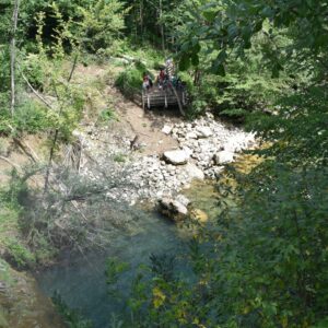
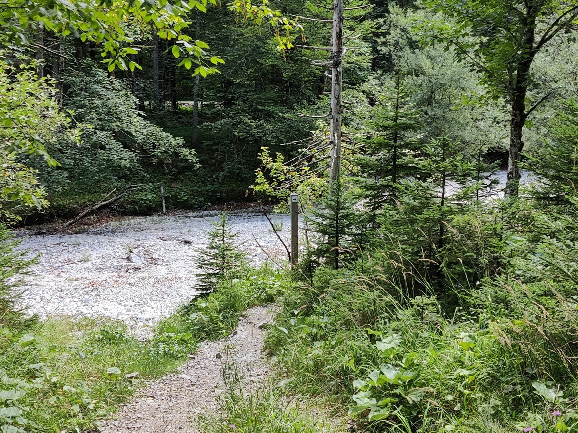
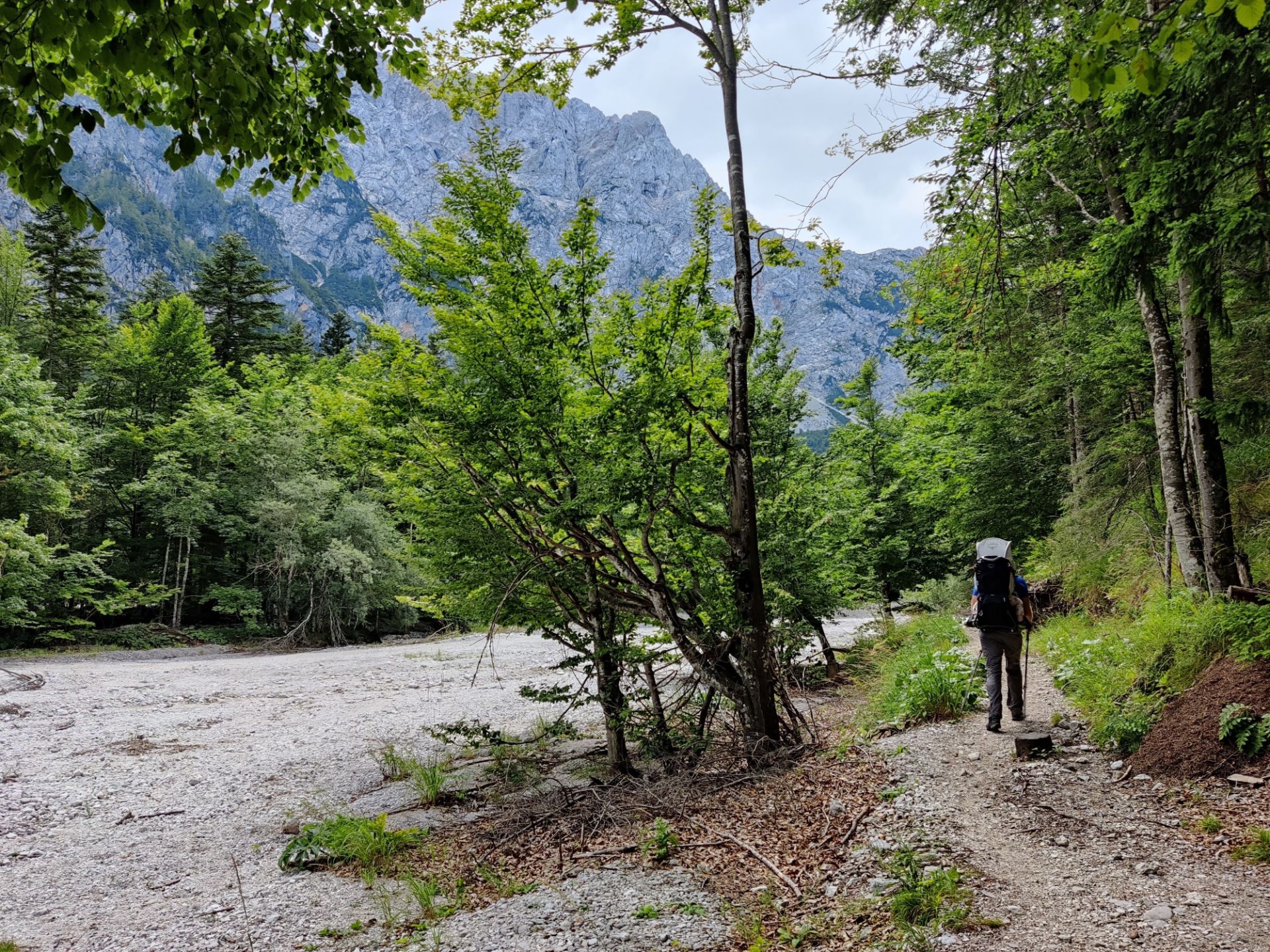
We started our hike from the parking place at the Dom Planincev mountain hut, approximately in the middle of the official Pot po Logarski Dolini trail. We started out by getting a good cup of coffee and an even better apple strudel from the mountain hut, which offer both food and accommodation and then headed out on the path, which is just north of the mountain hut. From there the wide dirt path runs southwest, past a large enclosure, and divides into two after less than 500 meters of walking. You take the narrower left one, which is also marked with a sign. The path narrows further as you walk on and turns more rocky. After approximately walking for one kilometer, you will reach the banks of the river Savinja, which at the time of our visit was completely dried out due to the extraordinary drought in the summer of 2022.
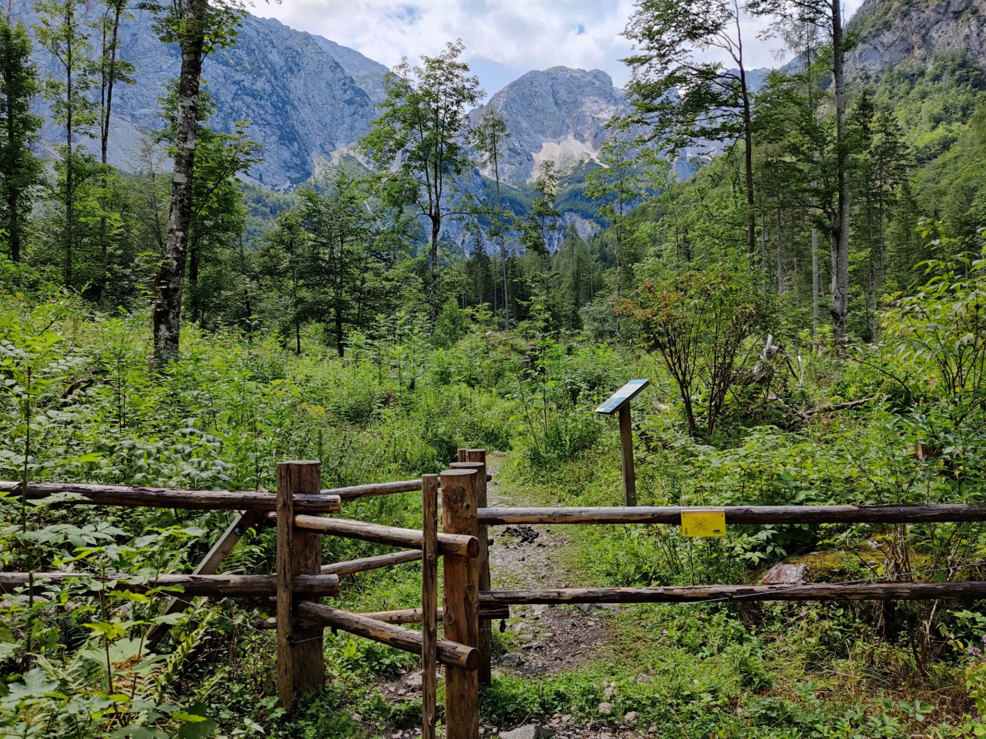
Upon following the river for a few hundred meters, the path crosses the asphalted road and continues up a wide gravel road that leads up to the mountain hut called Logarski Kot, which offers food and accommodation. About 20 meters from the building, you should, however, leave the wide gravel road and turn right (towards west) to follow the narrowing path towards a wooden fence with a small gateway built into it. Inside the enclosure we only encountered three donkeys, who minded their own business, but be sure to keep any dogs or wild kids close when you enter. You only walk for a few hundred meters through the enclosure, then you will again come to a gateway and leave the farm animals behind.
Shortly after, the path meets the paved road again, and now you have to follow the asphalted road for about 50 meters southwest till you see another of the trail signs showing you the continuation of the forest path along the riverbed past a large gravel parking lot. After a few hundred meters the forest path intersects with the paved road once again, but here the path continues immediately on the other side. At this point you have walked 2.5 kilometers from the starting point. After another 500 meters of walking, you come to a concrete retaining wall and a small wooden bridge crossing over the river bed. When you have crossed the bridge, you will again come to the paved road and towards southwest you will see the last parking area before the Rinka waterfall. You follow the road past the parking area and up to the small wooden huts respectively serving as a coffee bar and a gift shop with local products.
The footpath up to the Rinka waterfall starts just across from the coffee bar, and is marked with a big sign so you can’t miss it. From here, the path meanders ever more steeply upwards for almost a kilometer till you reach the waterfall. You can both go to the bottom of it as well as scramble up to the Orlovo Gnezdo (Eagles Nest’) Bar, which is built on a summit next to the Rinka waterfall. Here you can buy coffee and cold refreshments, but as it was packed when we were visiting, we just took in the amazing view of the waterfall and the surrounding mountains, and then made our way down to the coffee bar at the parking lot just in time before the heavens opened and rain started pouring down.
Getting back to the starting point
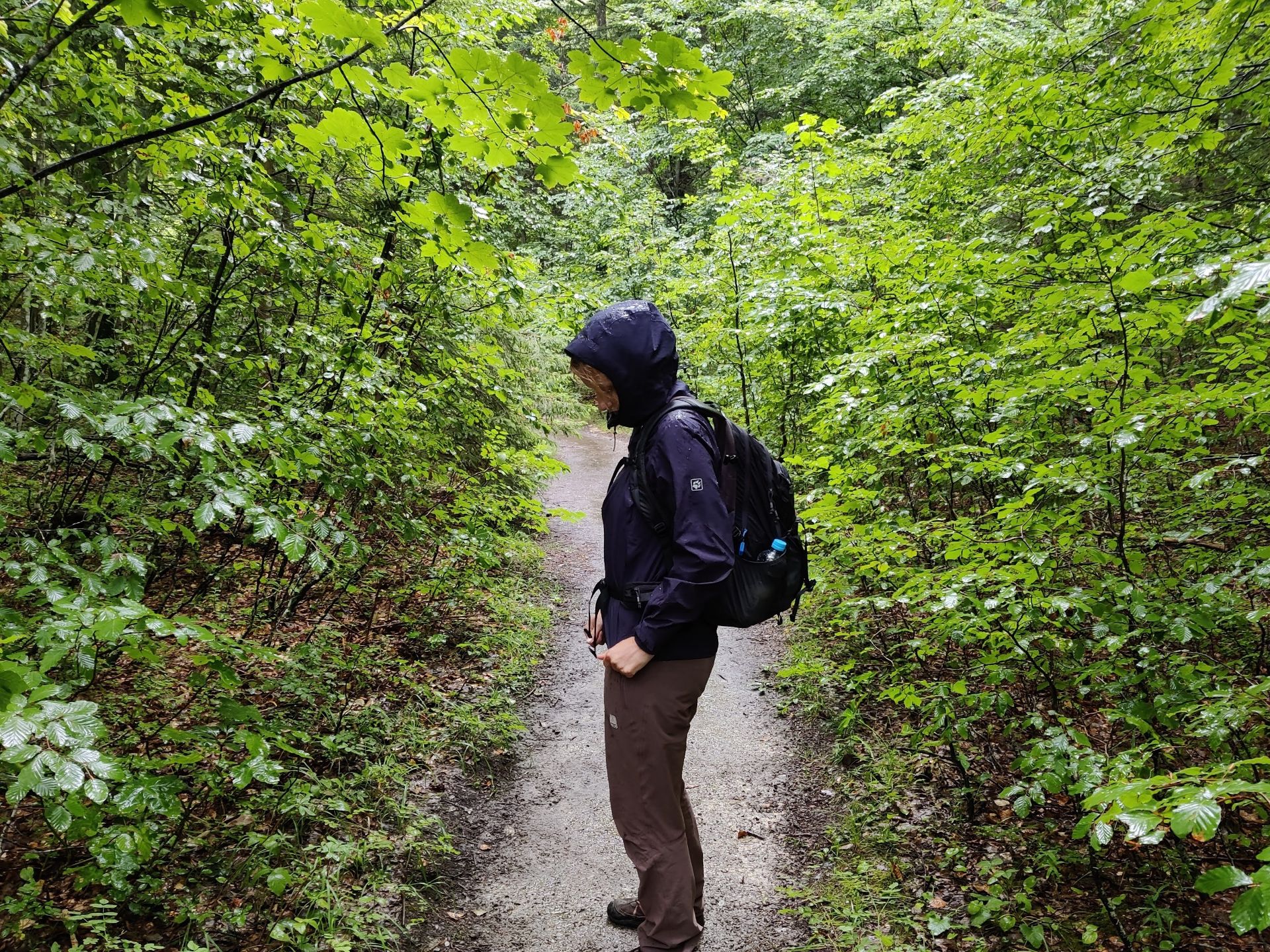
We took the same way back as we came since the Pot po Logarski Dolini is an out-and-back trail. The only alternative would be to simply follow the asphalted road back to Dom Planincev. Getting back to the starting point on the same route was still a different visual experience, though, as the woods were extra lush and glistening from the rain fall.
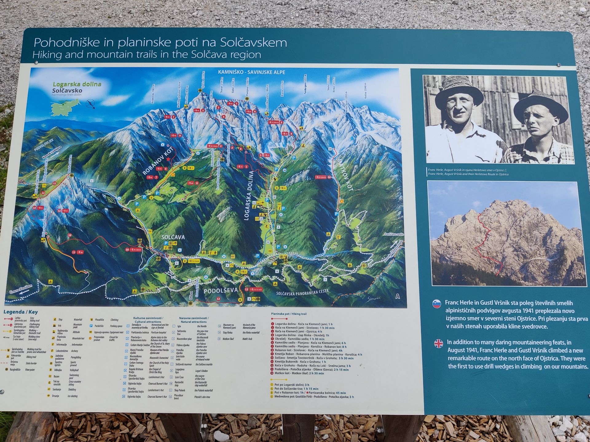
Logar Valley – hiking trails and summits in and around the valley
The Logar Valley Hiking Trail is very well-marked so you won’t have troubles with navigation
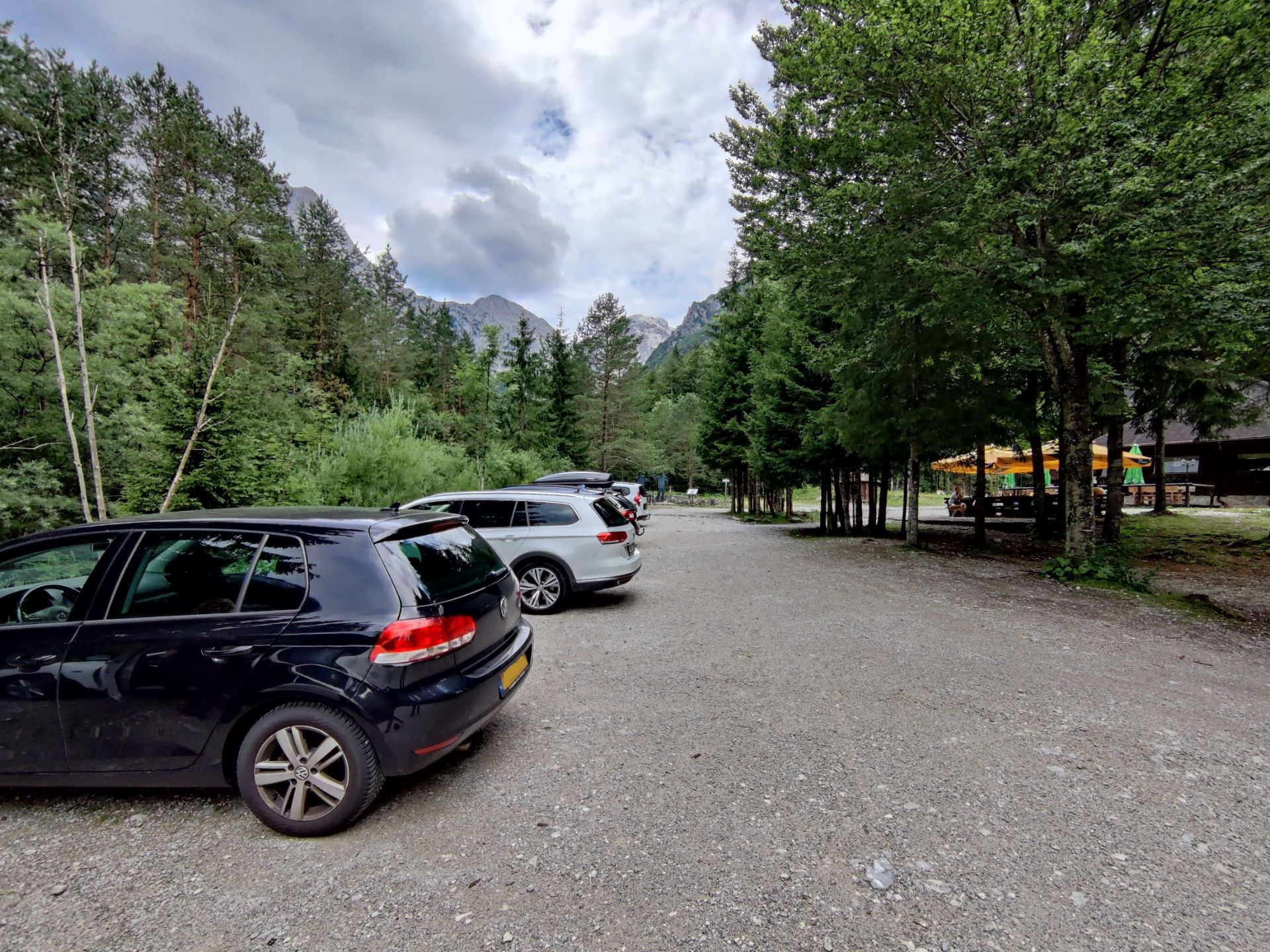
Logar Valley Hiking Trail- you can park your car free of charge at the Dom Planincev parking lot or any other public parking lot in the valley
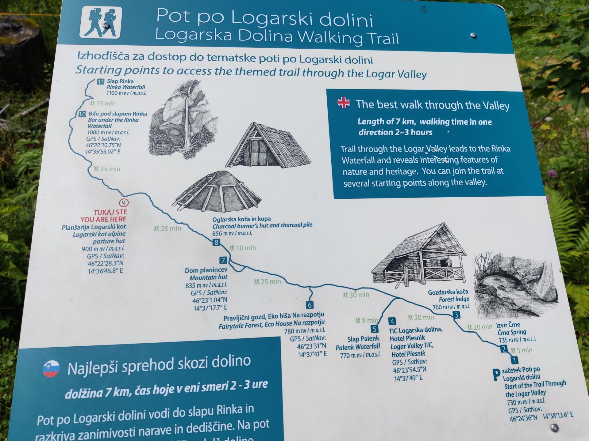
Logar Valley – overview of the official marked hiking trail called Pot po Logarski Dolini
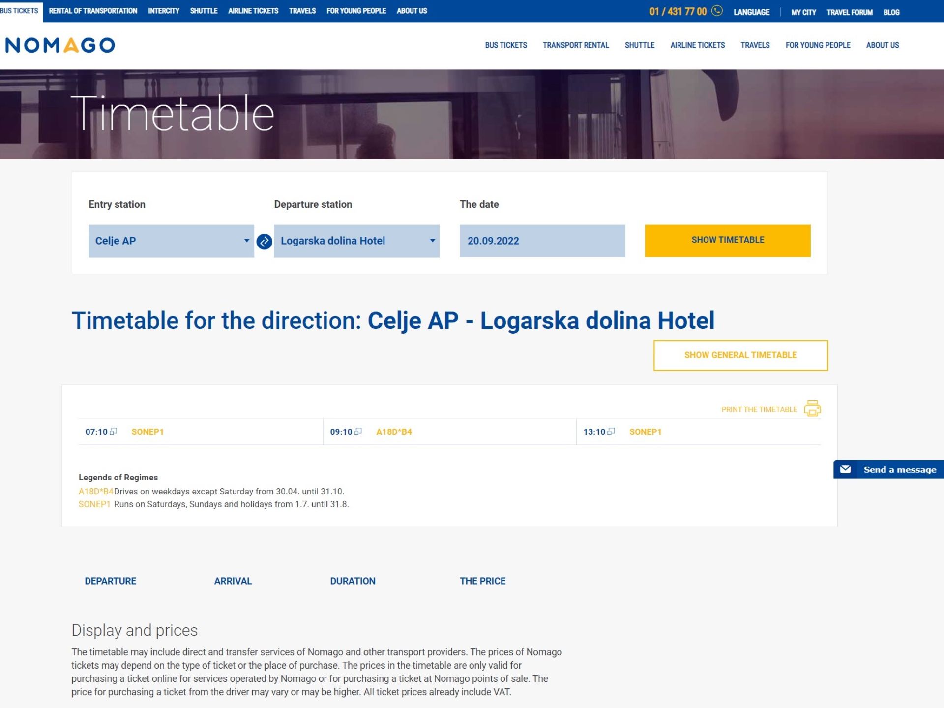
Screenshot of bus departures from Celje to the Logar valley on Nomago.si (Google Translate enabled)
Logar Valley Hiking Trail- the path runs behind the Dom Planincev mountain hut
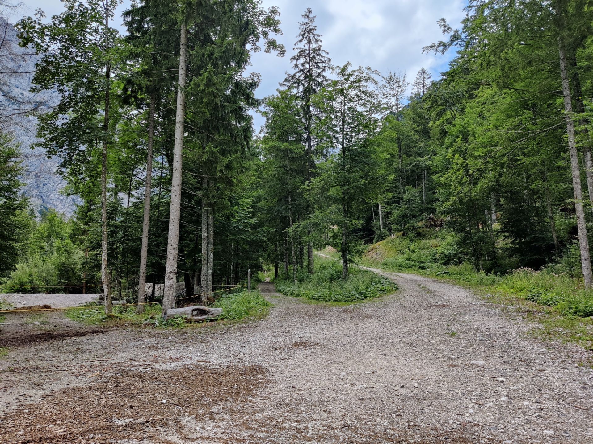
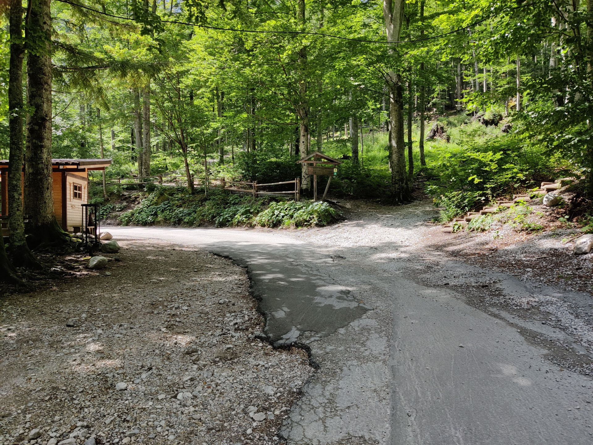
Logar Valley Hiking Trail – the dirt road splits into two.
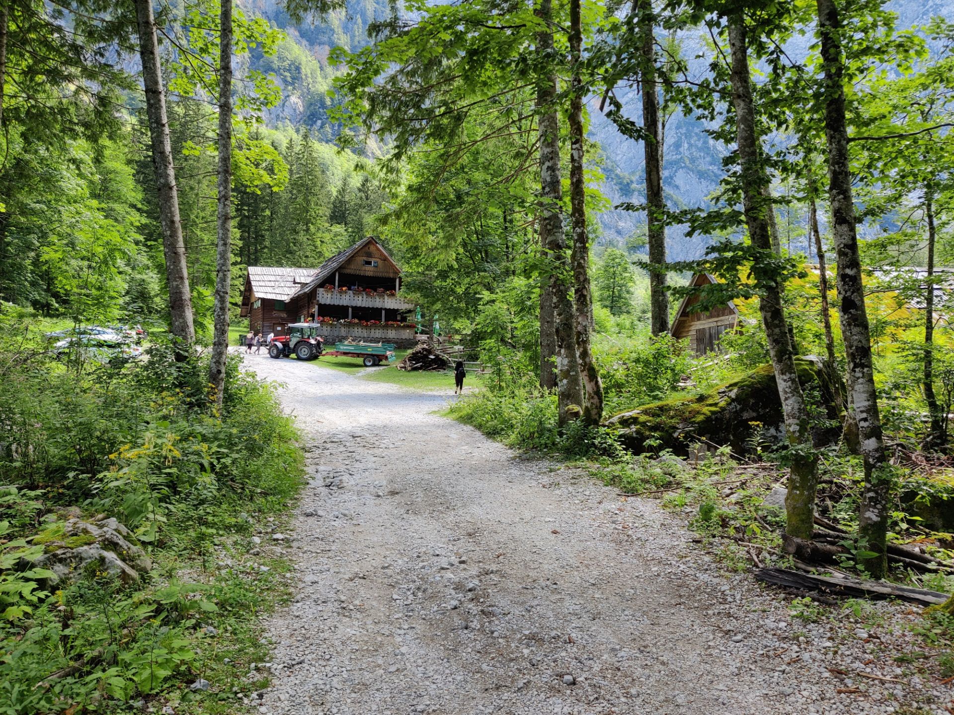
Logar Valley Hiking Trail – the path turns right just before the mountain hut Plansarija Logarski Kot.
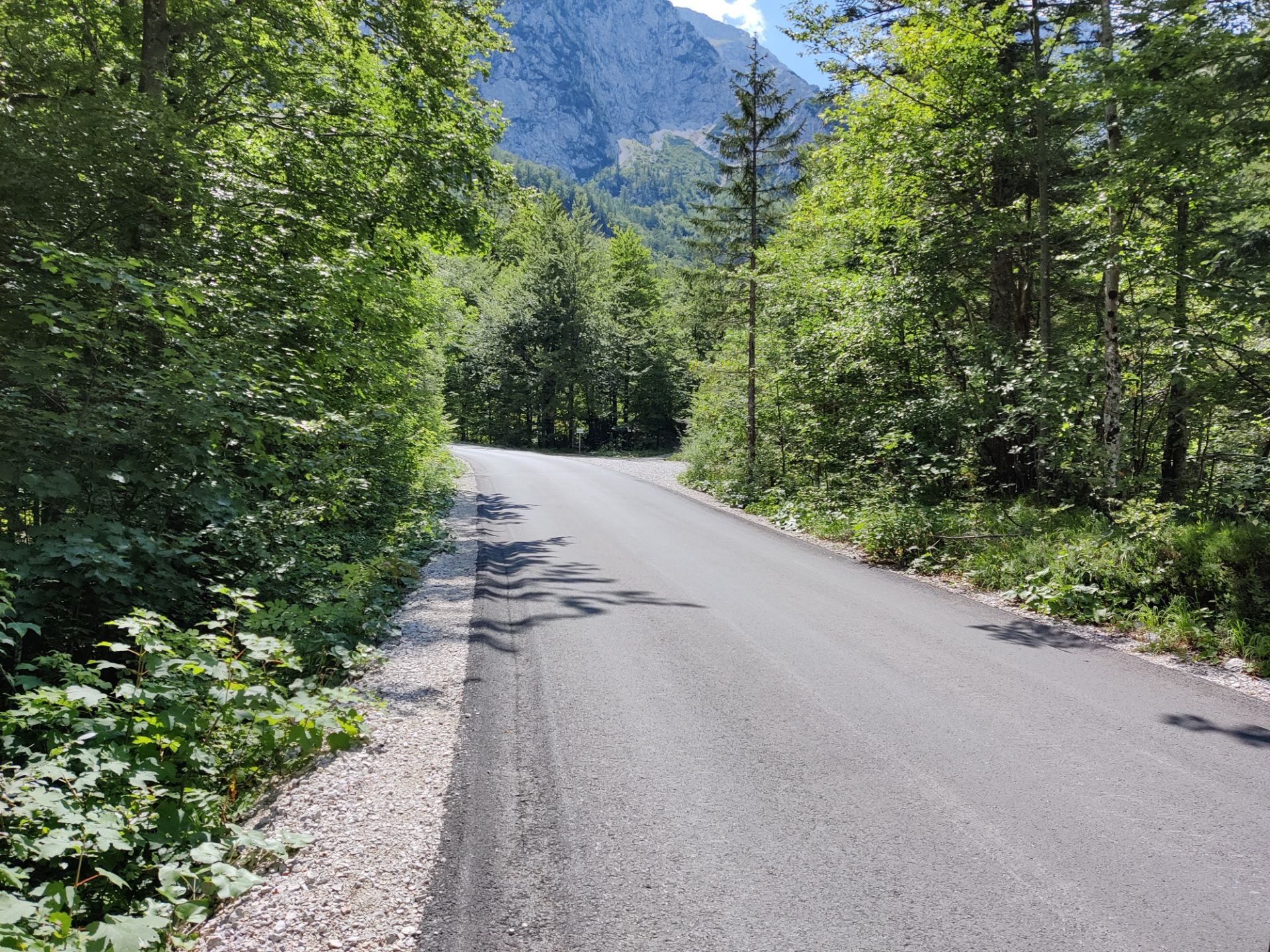
Logar Valley Hiking Trail – here you have to walk 50 meters on the paved road until the next sign for the footpath down the road.
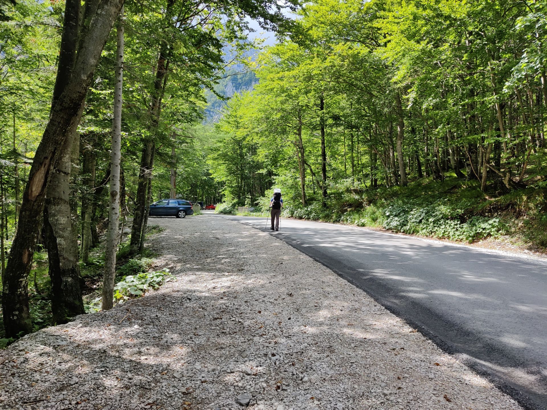
Logar Valley Hiking Trail – after crossing the wooden bridge, you come to the last parking place before the Rinka waterfall.
Logar Valley Hiking Trail – the big sign marks the footpath up to the Rinka waterfall.
Equipment
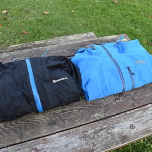
For this hike I was wearing the Lasting Merino base layer, CimAlp hiking pants, lightweight hiking boots and Tifosi Swoon sunglasses while the weather was still sunny. When it started raining, I fortunately had my Jack Wolfskin rain jacket in my Camelbak Rim Runner 22 daypack along with water and some snacks.
Equipment under scrutiny
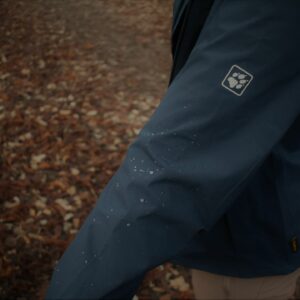
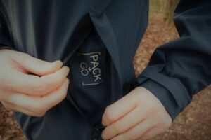
Jack Wolfskin JWP Rain Jacket
Jack Wolfskin JWP rain jacket came into use for the way back through the Logar valley
The Jack Wolfskin JWP rain shell packs into its own pocket, which means that it is easy to store until you need it. And I definitely needed it for making our way back to the starting point as it started raining just as we had made our way down from the Rinka waterfall. The Jack Wolfskin jacket is light, breathable and withstands heavy rain also for longer periods as it has a hydrostatic head of 20.000 mm. You can read the full review here.
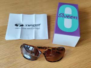
Tifosi Swoon Polarized Sunglasses
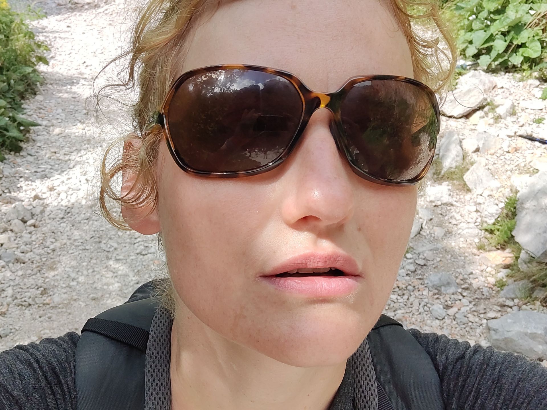
The polarized lenses of the Tifosi Swoon sunglasses were ideal for the high altitude in the Logar Valley
Shortly after we began the hike, the sun started poking out from the clouds and I was thus happy to have brought the Tifosi Swoon sunglasses with me . They are lightweight, comfortable and wrap around your face in order to protect your eyes from sunlight at all angles. The category 3 lenses were just right for this relatively high altitude and the fact that they are polarized made the viewing experience all the more comfortable. You can read the full review of the Tifosi Swoon polarized sunglasses here.
Where to buy?
Conclusion and photo gallery
The trail through the Logar valley is very easy and suitable for all, yet it offers some amazing views on the mountains surrounding the valley. As a minimum you should wear good walking shoes, and if you are intent on scrambling up to the bar overlooking the Rinka waterfall, you will thank yourself for wearing proper hiking boots. Although we came in the high season for hiking the valley (beginning of August), the trail was far from crowded. It was only at the actual water fall that we encountered larger groups. As for refreshments, there are plenty of possibilities along the way; we for example finished the day by having dinner in the mountain hut at our starting point. You also have multiple options for staying the night in the Logar valley, which we would have loved, if we had more time.
Logar Valley Hiking Trail - the Savinja river was almost completely dried out at the time of our hike
Logar Valley Hiking Trail - gateway to the donkey enclosure
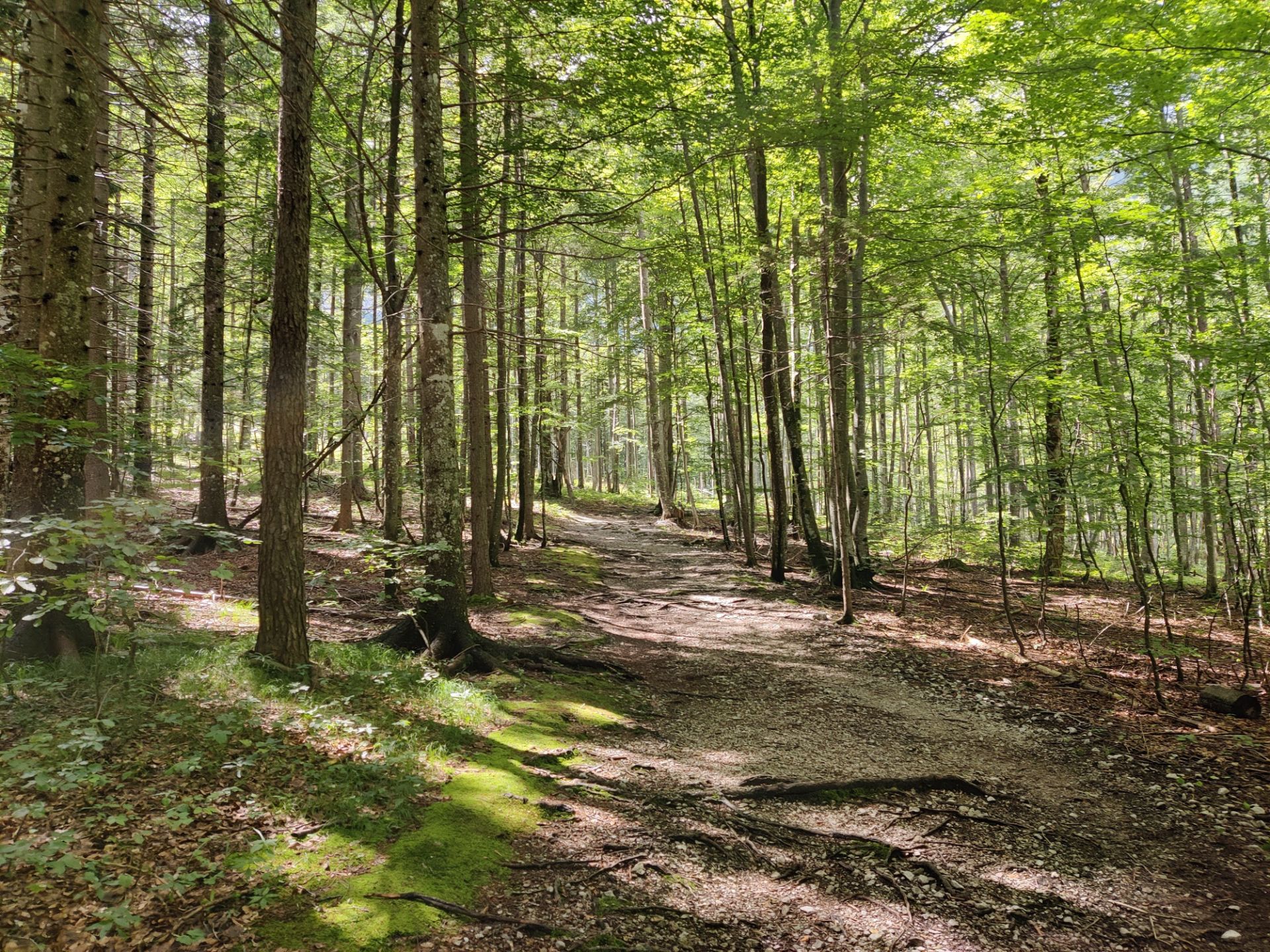
Logar Valley Hiking Trail - the forest looked magical in places
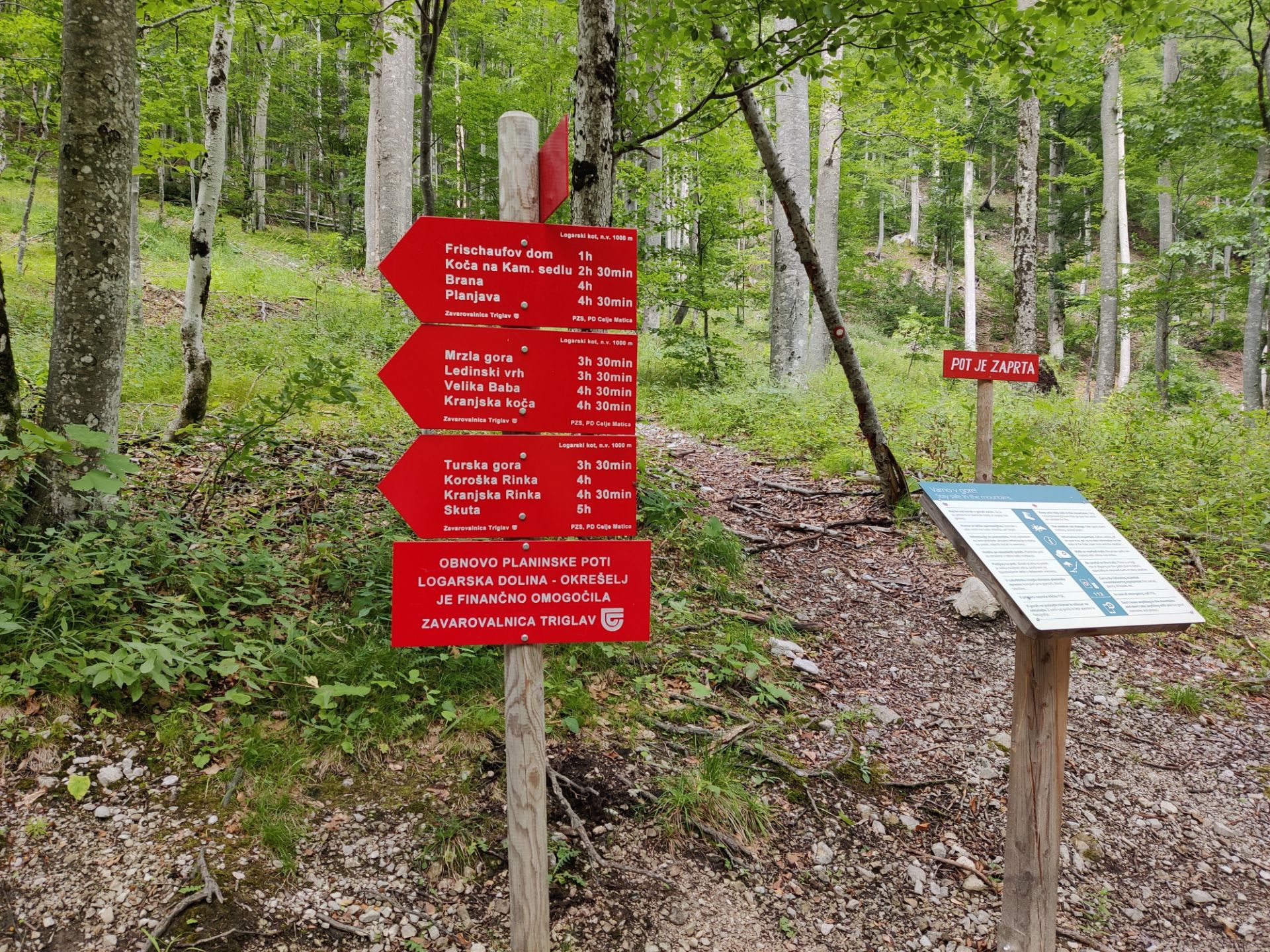
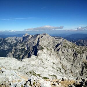
Logar Valley Hiking Trail - there are routes to many more summits in the area
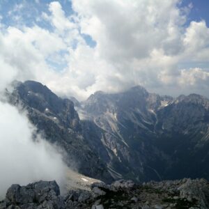
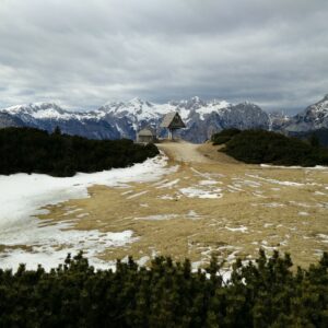
Logar Valley Hiking Trail - view on the mountains from the Orlovo Gnezdo bar
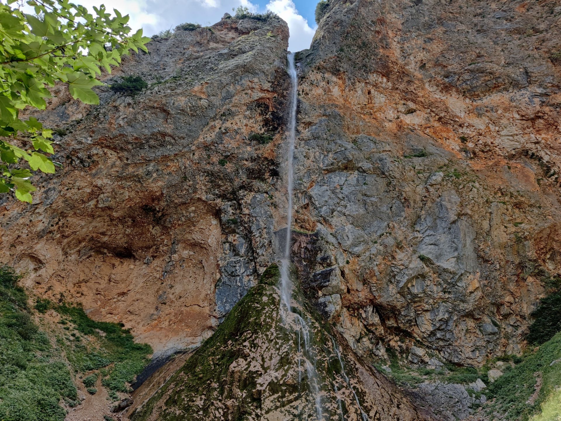
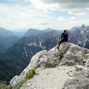
Logar Valley Hiking Trail - the top of the Rinka waterfall
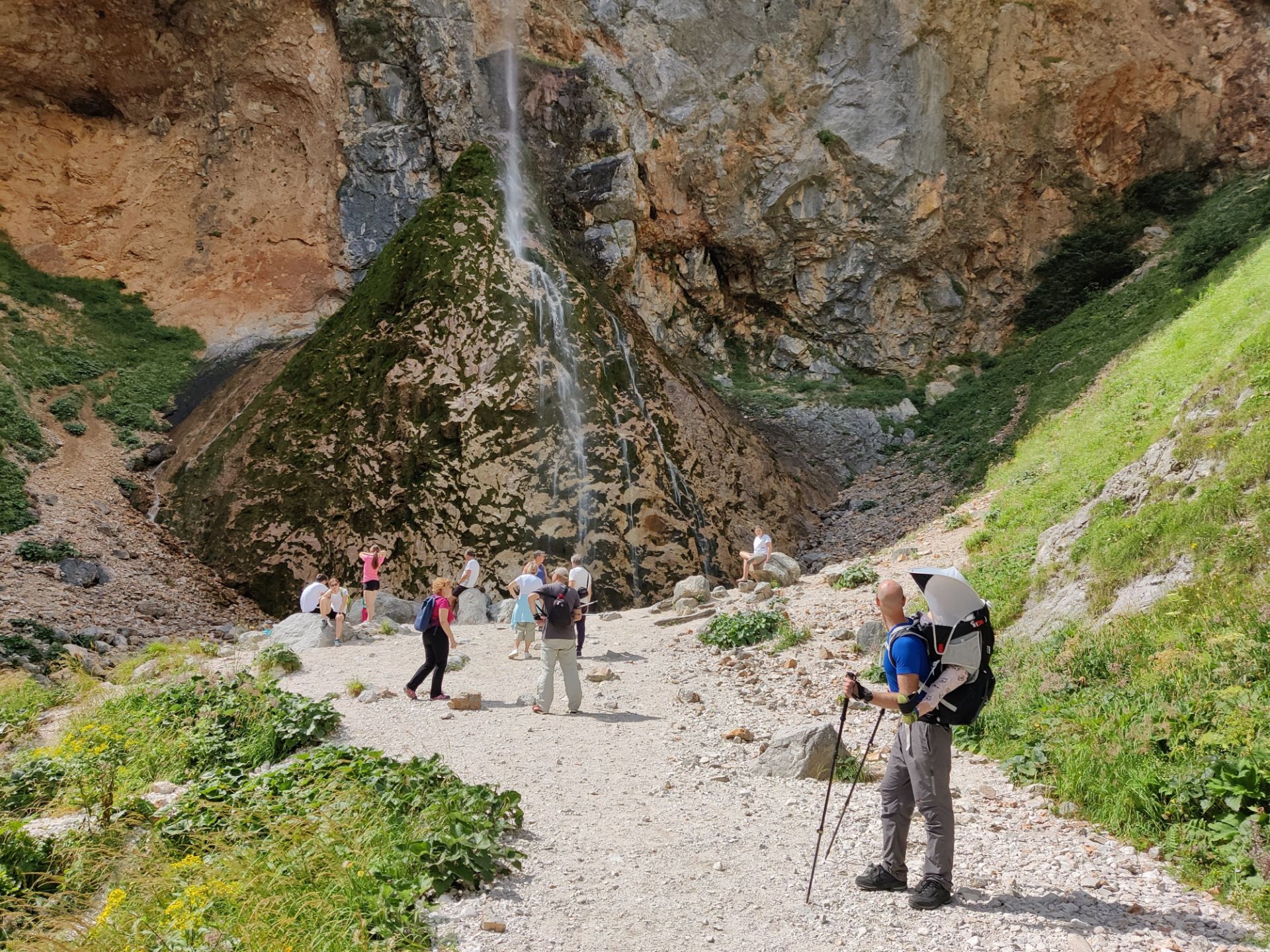
Logar Valley Hiking Trail - you can go all the way to the bottom of the waterfall and get a cooling shower!
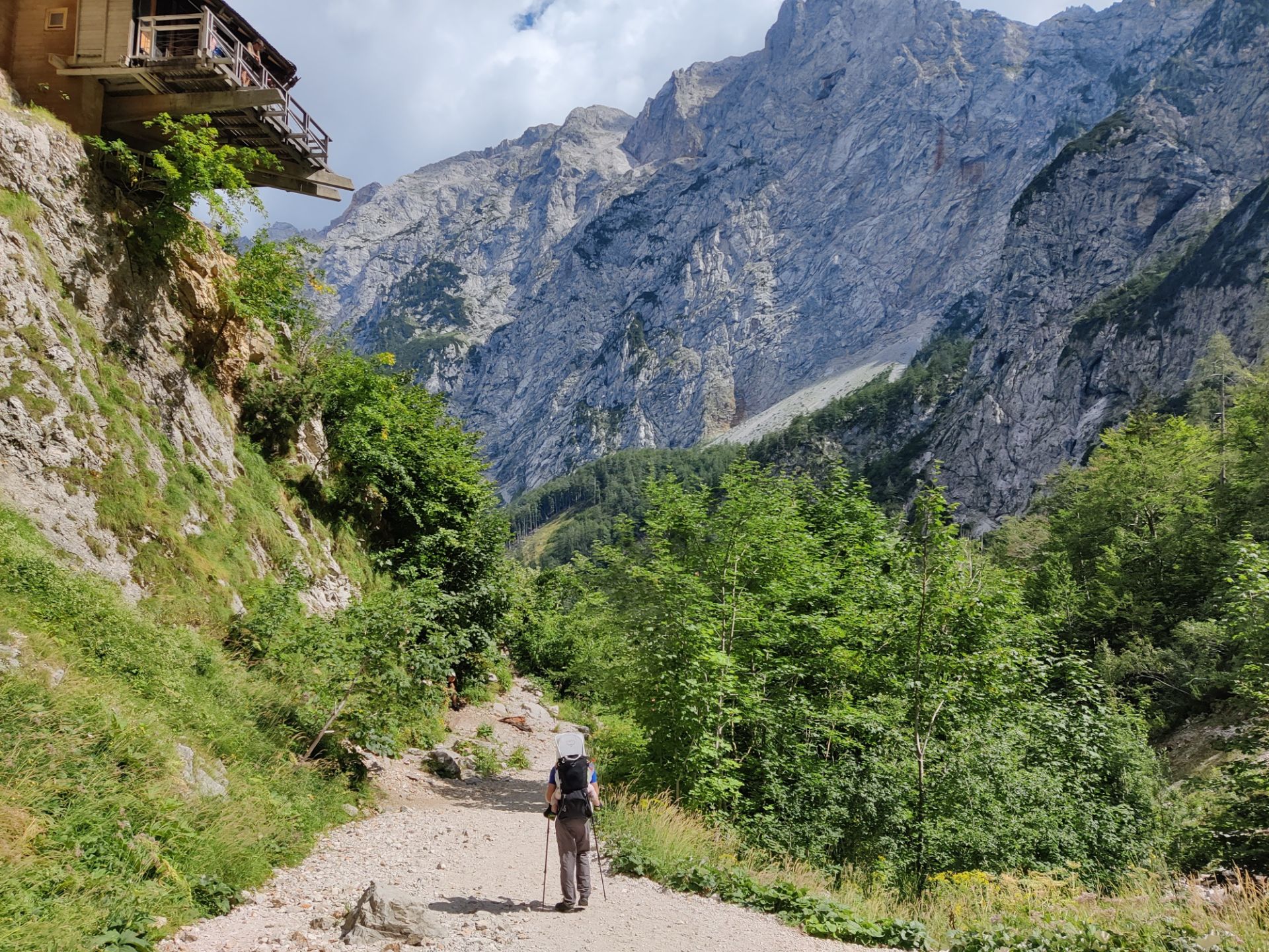
Logar Valley Hiking Trail - heading back downhill
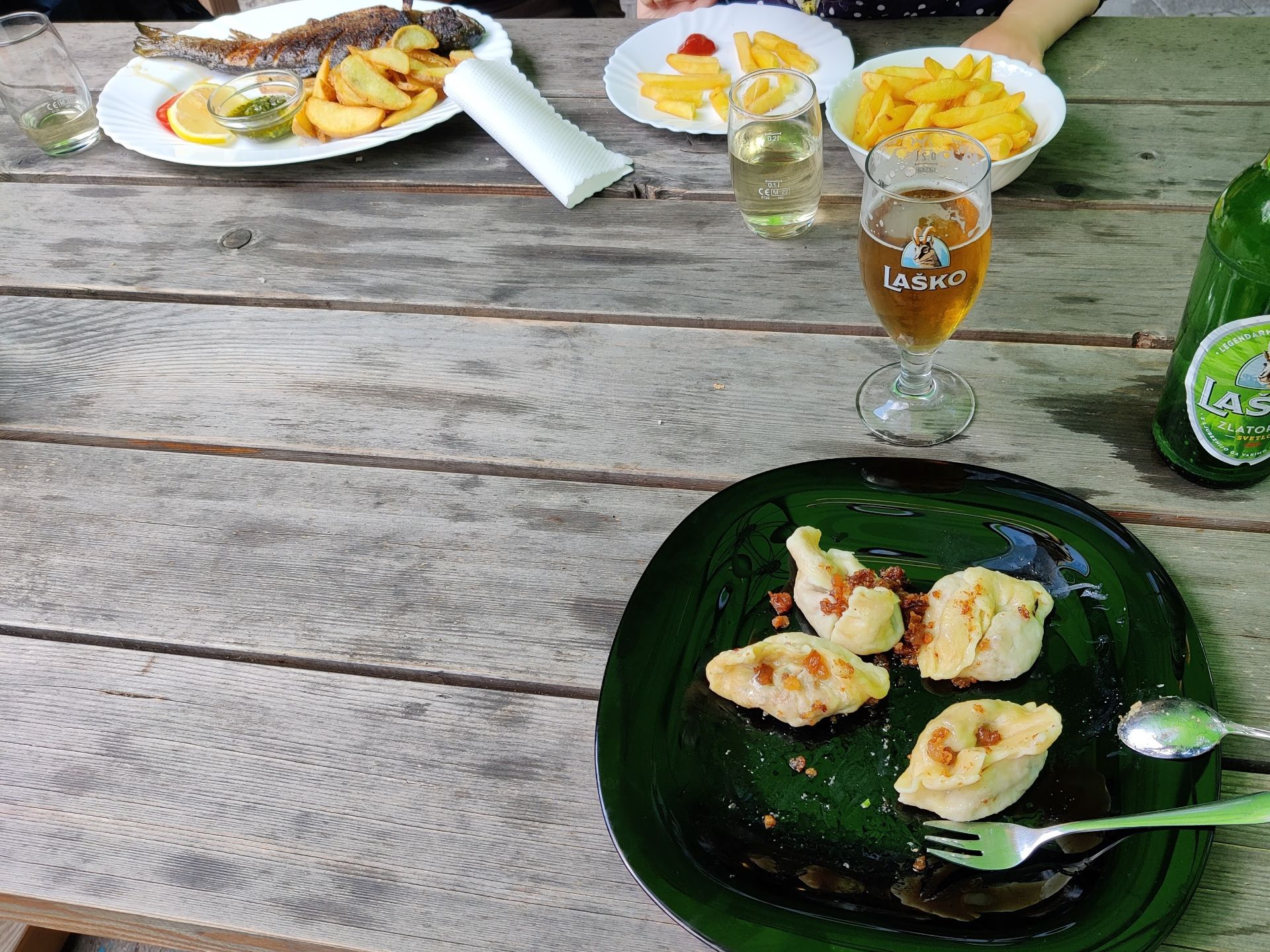
Logar Valley Hiking Trail - enjoying local dishes for dinner at Dom Planincev
If you have any questions about this hike, please drop us a line in the comments below.