Glymur Waterfall
About Glymur Waterfall Hiking Trail
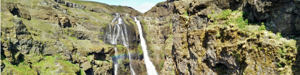
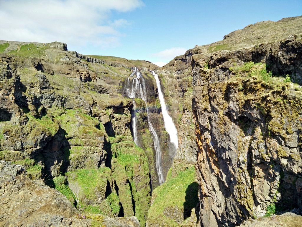
Glymur waterfall is the second highest waterfall in Iceland and therefore very popular among tourists. It is, however, a bit further away from nicely paved roads than the waterfalls at Seljalandsfoss or Skogafoss for example, but on the other hand this seems to weed out some of the tourist crowd. From the nearest parking place you will have an approximately 5 kilometers long hike going through a very alternating landscape. The bad news is that this parking place cannot be reached by public transport; you will have to rent a car which can get quite pricy in Iceland – at least 15.000 ISK (100 €, 117 $) per day depending on season and availability. You could also try to book a tour with a tourist agency, but this will be almost as expensive as renting a car for a whole day. I hiked the Glymur trail as a part of my Hiking Iceland adventure.
Glymur Waterfall Trail Details
Physical Difficulty
Medium
Technical Difficulty
Medium
Duration
2 h 10 min
Distance
4.96 km
(3.08 mi.)
Ascent
363 m
(1191 ft.)
Descent
363 m
(1191 ft.)
Highest Point
294 m
(965 ft.)
Lowest Point
66 m
(217 ft.)
Date of the Hike Date when we did this hike ?
July 2015
Weather On the day when we did this hike ?
Partly cloudy
Temperature On the day when we did this hike ?
14° C
(57° F)
Wind On the day when we did this hike ?
15 km/h
Warning!
This trail has a few steep sections and requires good footwear, steady footing and no fear of heights.
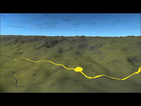
Glymur Waterfall GPS Route and Trail Description
*Click on the chart to see the location on the map
GPX route helps you with the navigation on a hike. It can be used with a smartphone, handheld GPS device or a GPS watch.About GPX Route
Reaching the starting point
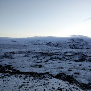
If you are starting your journey in Reykjavik you should drive towards Mosfellsbaer and then take road number 1 towards Akranes/Borgarnes. Before Hvalfjordur underwater tunnel turn right and continue on road 47. Many tourists travelling north or around Iceland on the ring road decide to go through this underwater tunnel (which costs 1.000 ISK for one car) to save time but believe me, it’s not worth it. The area around Hvalfjordur is extremely nice with several little waterfalls just by the road and thus the additional 60 kilometers (compared to the tunnel, if you are going to Akranes) feels like an absolute joyride. And the best thing about prolonging your journey is that you get to see the Glymur waterfall. When you reach the innermost point of the bay, you will see signs directing you east towards Glymur. From there on a wide gravel road (suitable for all cars) leads to the parking place from where the above attached GPS route starts.
Trail
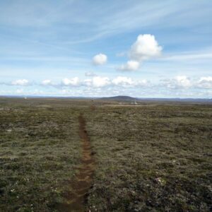
This hiking trail is very clearly marked and you are sure to meet other people on the trail. Therefore, I believe you won’t have any problems with the navigation. Some parts of the trail are very steep and exposed. I would advise you to wear good hiking boots with decent grip to avoid slips and falls. Also keep in mind that if you are afraid of height, this hike probably isn’t what you want.
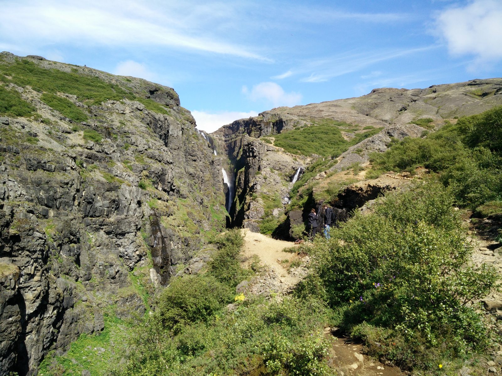
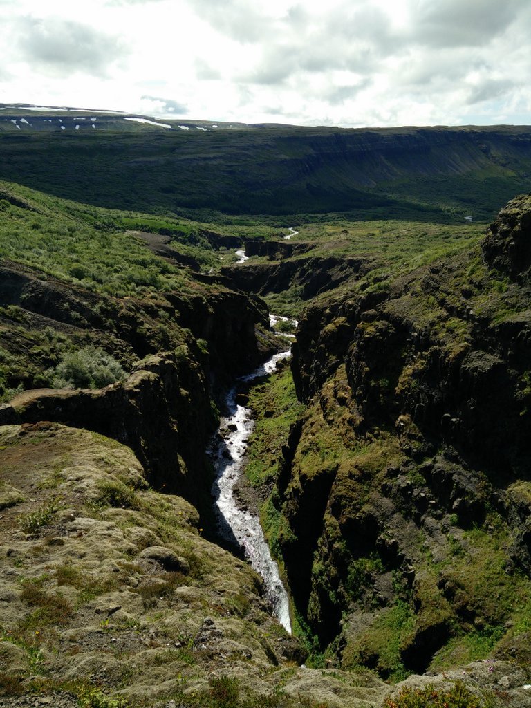
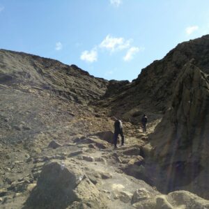
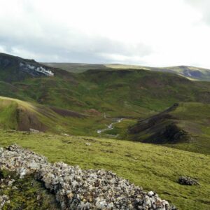
From the parking place walk through the gate and continue on the path leading east. The path is marked with yellow sticks and climbs steadily for approximately one kilometer. Then it descends through a small cave (a natural double arch) down to a river. There you have to cross the river over a wooden pole. A steel cable runs over the river and should be used as a handhold as the river is forceful, but not deep. The river runs from the waterfall which falls deep into narrow gorge. After you have crossed the river, the path gets steeper and technically more difficult as you will have to climb the side of the gorge to get a good view of the waterfall. On some exposed areas a thick rope runs along the path for additional security. After scrambling approximately 2 kilometers you will get a view of the waterfall.
The view gets better as you climb further but only till 2.5 kilometer from the starting point; here I turned around and headed back. However, plenty of people climb onwards and make a circle tour by climbing to the top of the mountain and crossing the river (which turns into the waterfall) up there and then descend from the western side (which doesn’t offer a view on the waterfall) down to the parking place. If you have time to spend several hours in the area, this circle tour will unquestionably offer a more challenging hike, but if you just want to see the waterfall from its best angles you can head back after 2.5 kilometer.
Getting back to the starting point
For the way back I used the same path as for the climb.
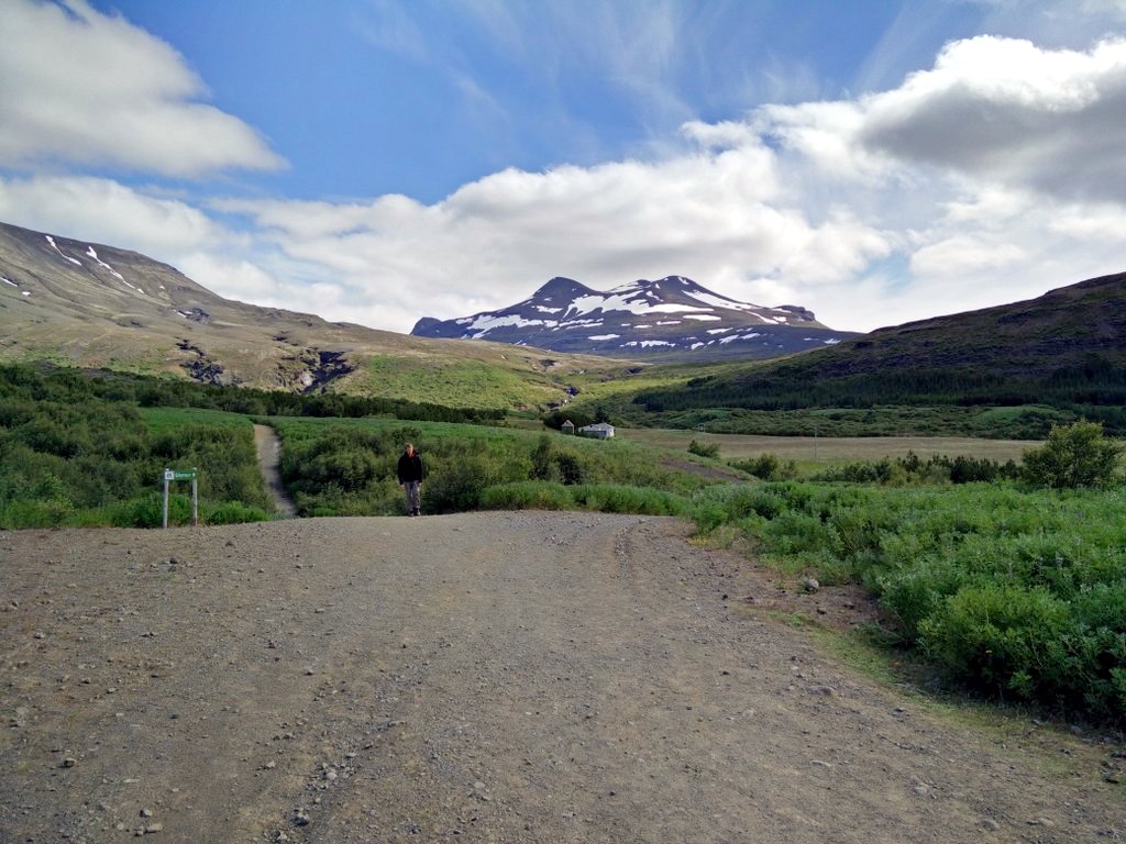
Glymur Trail Starting Point
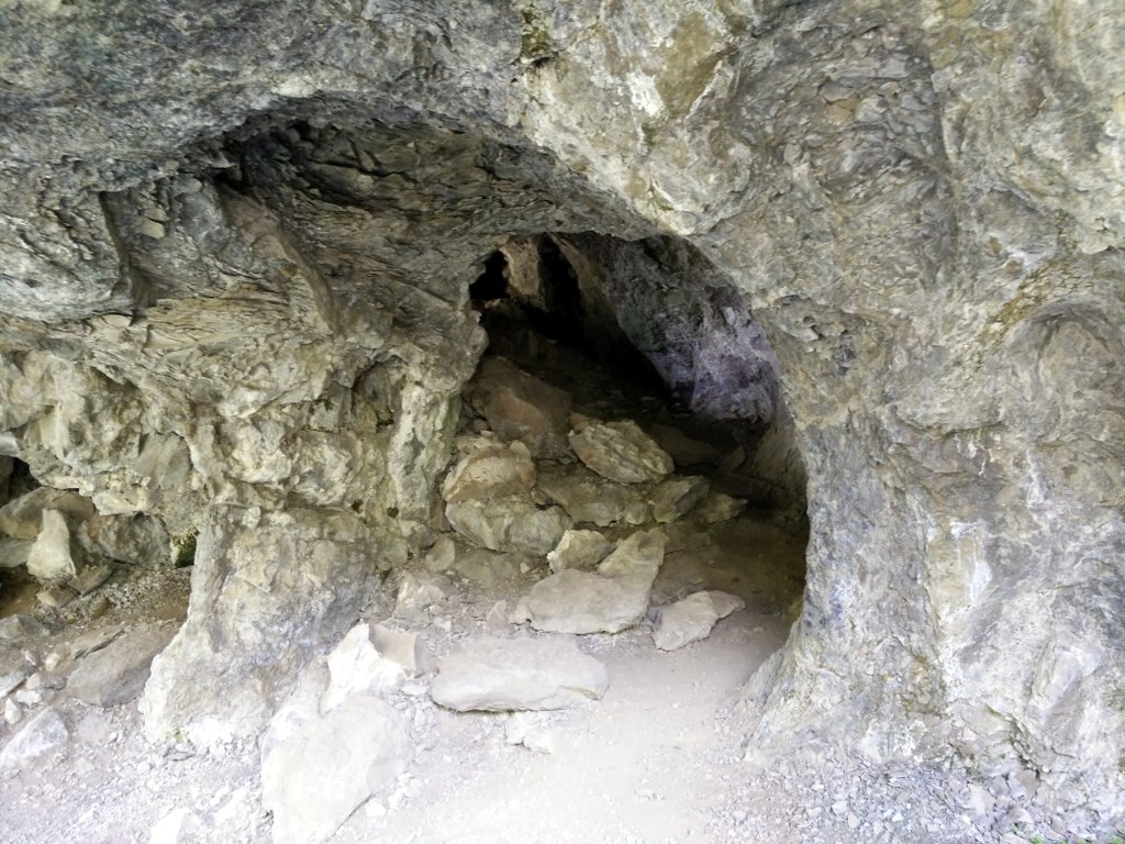
Glymur Trail Cave
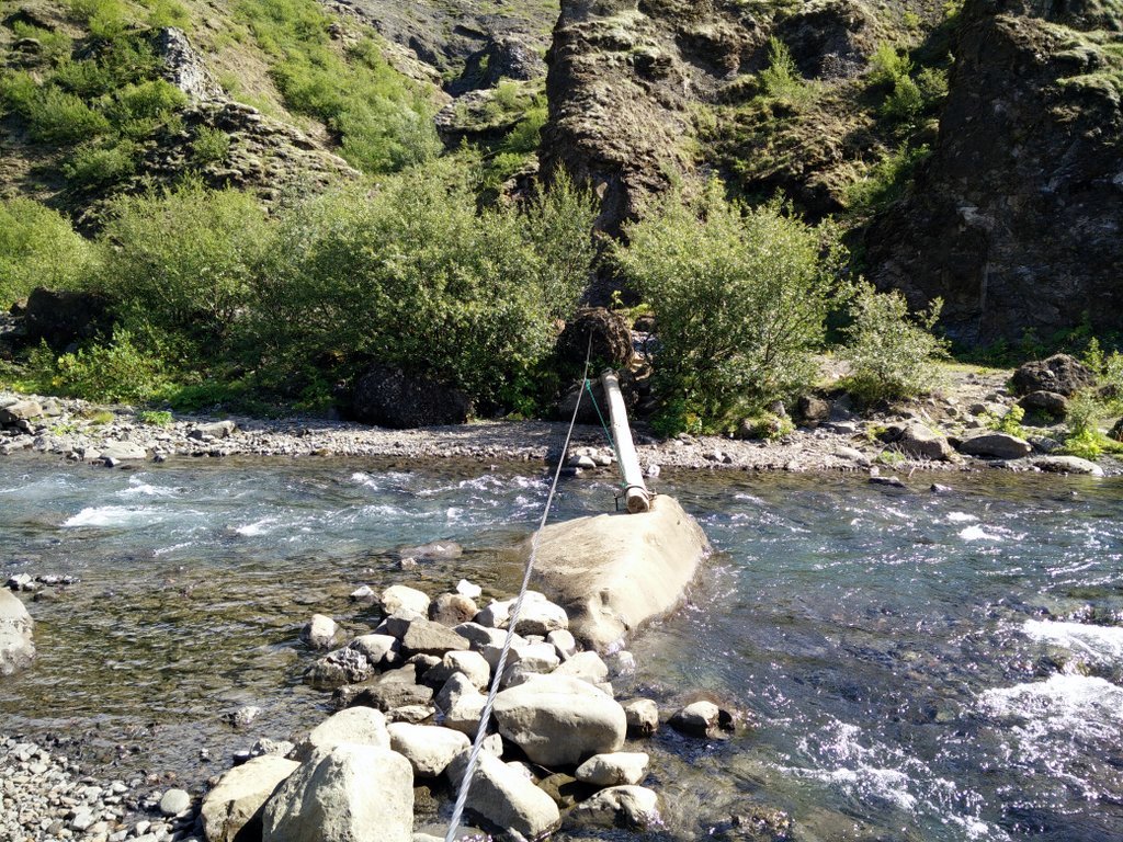
Glymur Trail Wooden Pole
Glymur Waterfall Trail – Going up
Glymur Waterfall from Trail
Equipment
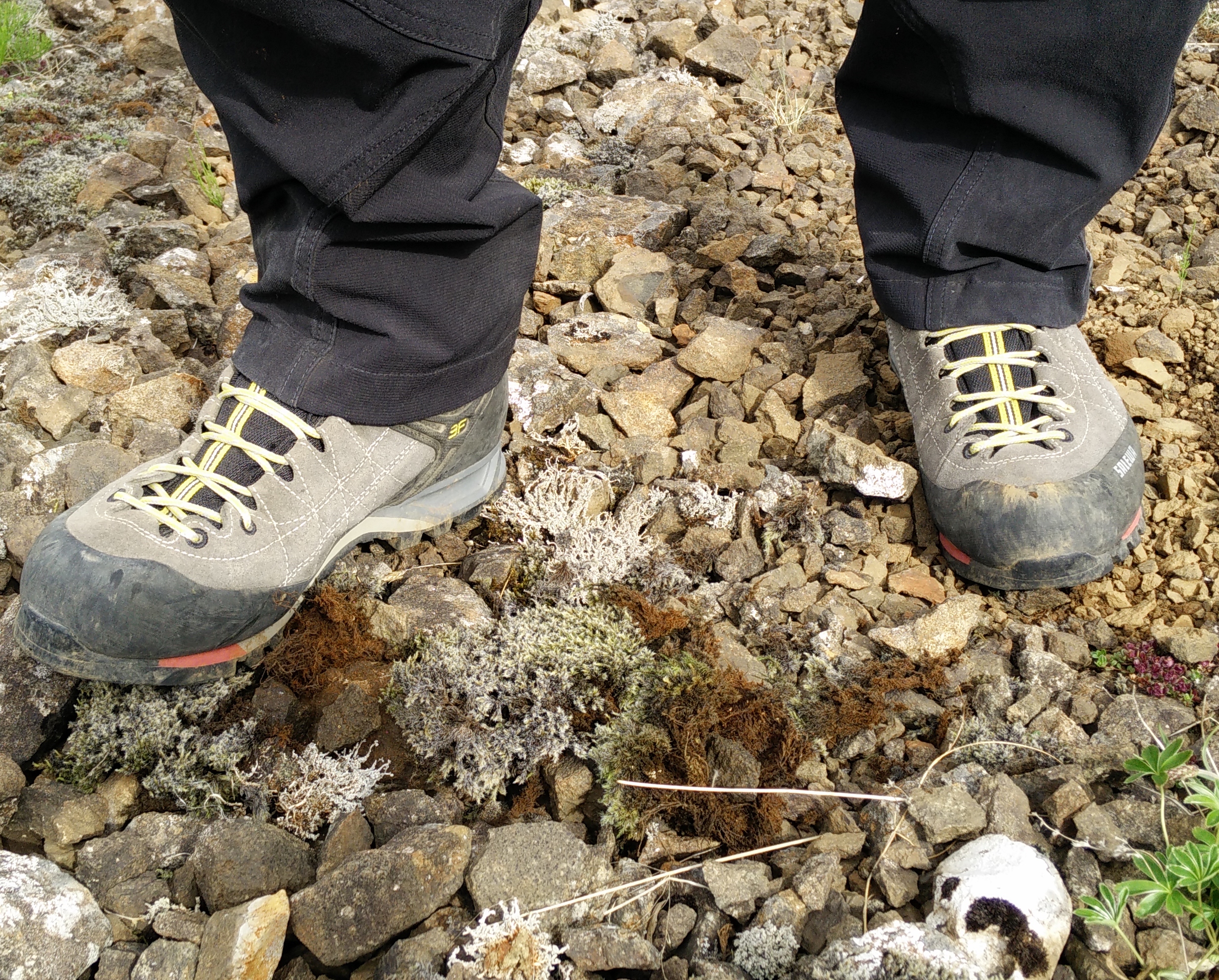
As I arrived to the starting point by car, the weather was nice and the estimated duration of the hike short I didn’t carry much equipment with me. I even decided to go without a backpack. I was wearing a t-shirt made of polyester, Woolx Blizzard Top, simple hiking pants and mid-length Salewa Mountain Trainer hiking boots. I also took a bottle of water with me which I was carrying in my hand. However, I would recommend you bringing a backpack with additional clothing and water. The weather can change quickly in Iceland and you probably don’t want to carry a water bottle in your hands since you’ll need them on exposed areas to hold a rope for additional security. You can, however, fill and refill water bottles in the river you will cross as well as the small streams you will pass on your climb onwards as the water is clean and tasty.
Equipment under scrutiny
Salewa Mountain Trainer Mid Hiking Boots
Salewa Mountain Trainer Mid
The Salewa Mountain Trainer Mid hiking boots were perfect for this hike. The boot is equipped with a relatively stiff sole and therefore offers great performance in rocky terrain. I was also really amazed over the provided grip while climbing the trail. Additionally the boots were very comfortable and didn’t cause any pain or discomfort. I would recommend these boots to every hiker who wants a reliable and comfortable boots for technically complex trails. You can read the full review of the Salewa Mountain Trainer Mid hiking boots here.
Note: Salewa has since released an updated version of this boot and the links are for the new version.

Conclusion and photo gallery
Because you need a car to reach the starting point, I would recommend the Glymur trail to those who are travelling around Iceland and want to diversify the trip with a beautiful and not too demanding hike. But please keep in mind that you need hiking boots to safely execute this hike, even if you choose the short version like me. While hiking I saw many tourists struggling in footwear that was far from appropriate for this hike. To their luck, it was a dry and sunny day, but the trail would be more slippery and tricky with just a hint of rain. And you know what they say about the (alternating) weather in Iceland: “Don’t like it? Just wait five minutes”.
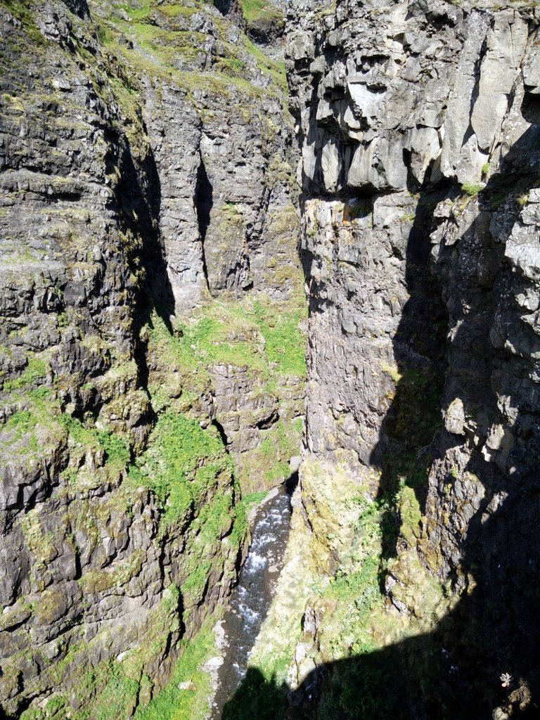
Glymur View Down
Glymur Valley View
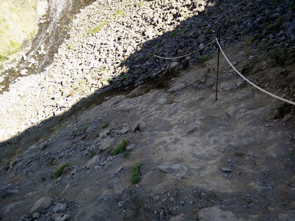
Glymur Trail Exposed Areas
If you have any questions about this hike, please drop me a line in the comments below.
Glymur Waterfall Trail Terrain Video


This was super helpful thanks!
I just went on this hike July 9, 2018. The water level in the river was much higher. I had to walk through fast moving, ankle deep water for 10-12 feet before reaching the log that lays across the river. I recommend taking water shoes on this hike no matter what.
I did cross the river at the top of the falls and take the other side down. That side of the trail is NOT so well marked and at times you are bushwhacking down the mountain.
All this said, Glymur Waterfall was our favorite hike in Iceland! Absolutely gorgeous!
I’m sorry to hear that the water level was so high. However, I do believe that such a high water level is more an exception than a rule. Thanks for sharing your experience about the trail on the other side.
Hi!
Thanks for a great post 🙂 Is there a toilet at the starting point of this hike?
Hi Nanna,
the are unfortunately no toilets at the starting point or along the trail.